This page is not an official page of the app or its developer, but an independent editorial publication created for informational and commentary purposes. Unless expressly stated otherwise, neither the app nor its developer is affiliated with, endorsed by, sponsored by, authorized by, or otherwise officially connected with MWM, Apple, Google Play, the app publisher, or the app's developer, and nothing on this page implies that the app was developed using MWM's services. Any trademarks, logos, screenshots, and other content remain the property of their respective owners.

NexAtlas
The essential EFB for pilots demanding precision. Navigate with updated AIRAC charts, automated VNAV, and real-time weather, perfectly tailored for cross-border and regional missions.
Downloads
35K+User Rating
Total Ratings
100Publisher
Category
NavigationLocales
1Latest Version
1.26.9Size
73.1 MBFirst Released
Jan 7, 2022Advanced Navigation for the Modern Aviator
Master your Brazilian and cross-border operations with an Electronic Flight Bag (EFB) that blends intuitive design with professional-grade aeronautical data for unmatched safety.
Smart Route Planning
Create complex routes directly on the map with integrated ROTAER, NOTAMs, and AIRAC data, reducing your pre-flight workload to minutes.
Performance & VNAV
Maximize efficiency with automatic TOC/TOD points and precise fuel consumption calculations based on your aircraft's specific performance profile.
The following screenshots and description are sourced directly from the app's official store listing and are the property of the app developer.
App Store
Screenshots
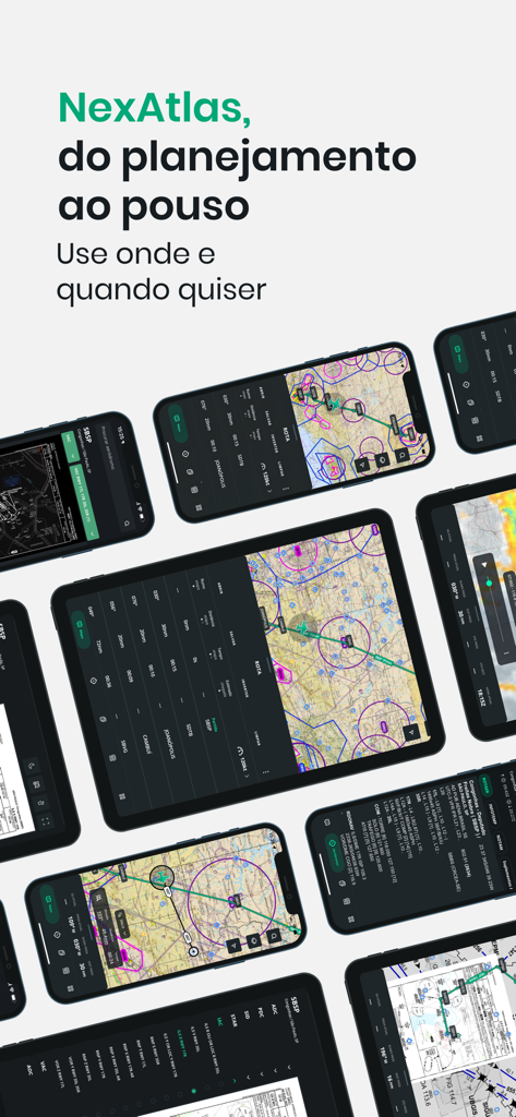
NexAtlas app on tablets and phones showing aeronautical charts and flight planning features
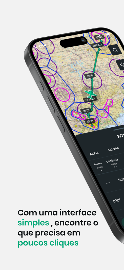
Smartphone screen displaying NexAtlas aeronautical navigation map and flight route
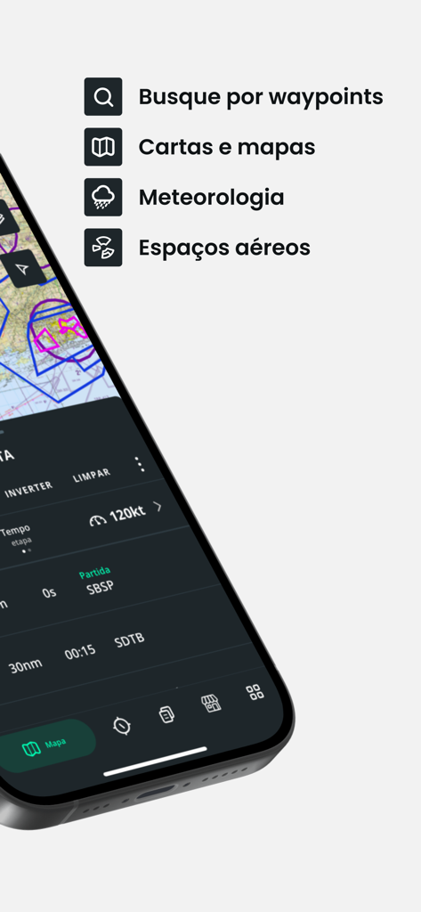
NexAtlas mobile app interface displaying flight planning map and navigation tools for pilots
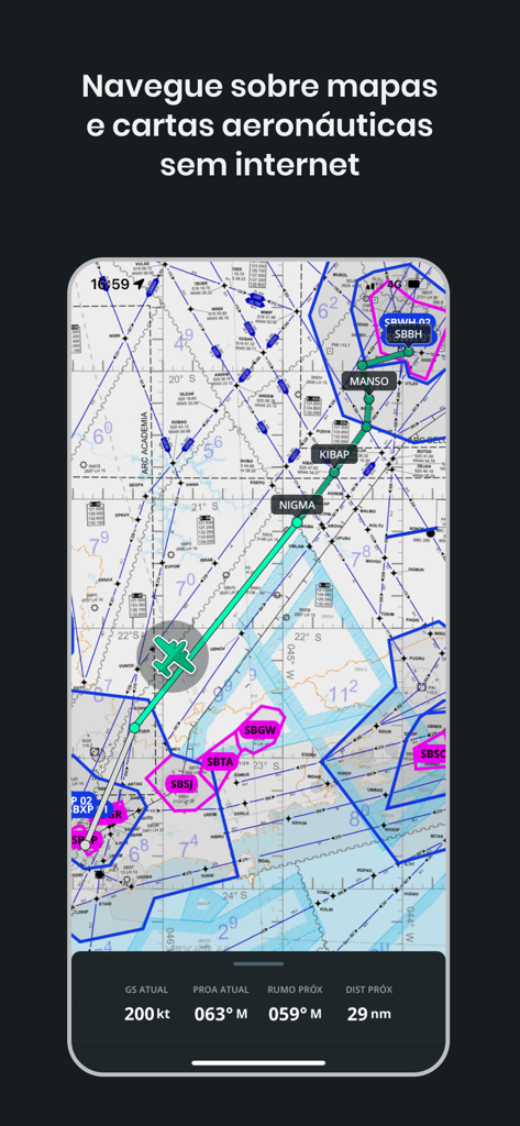
NexAtlas mobile app interface showing an aeronautical chart with a flight route and real-time navigation data
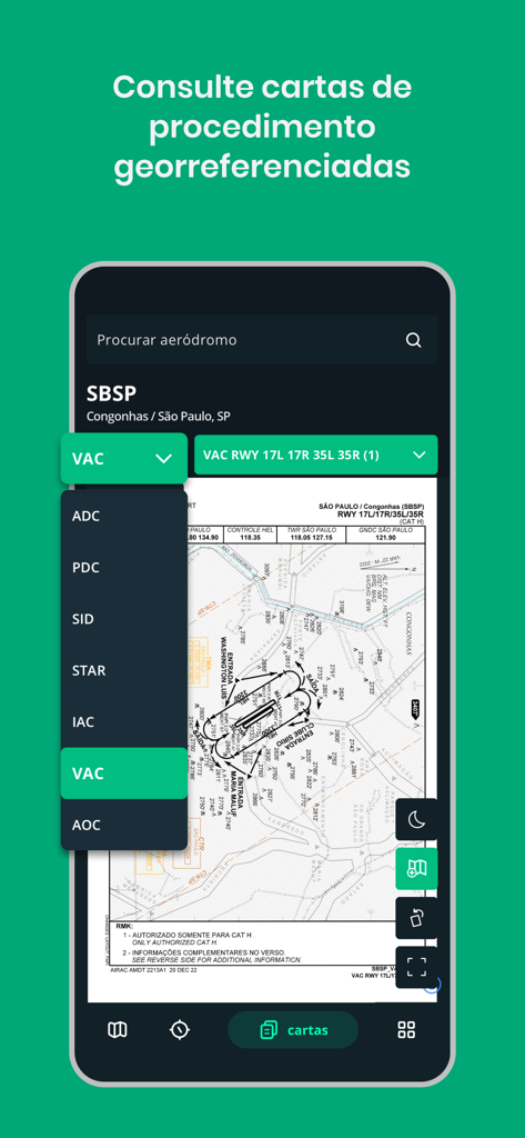
NexAtlas mobile app interface displaying a georeferenced procedure chart for SBSP airport navigation
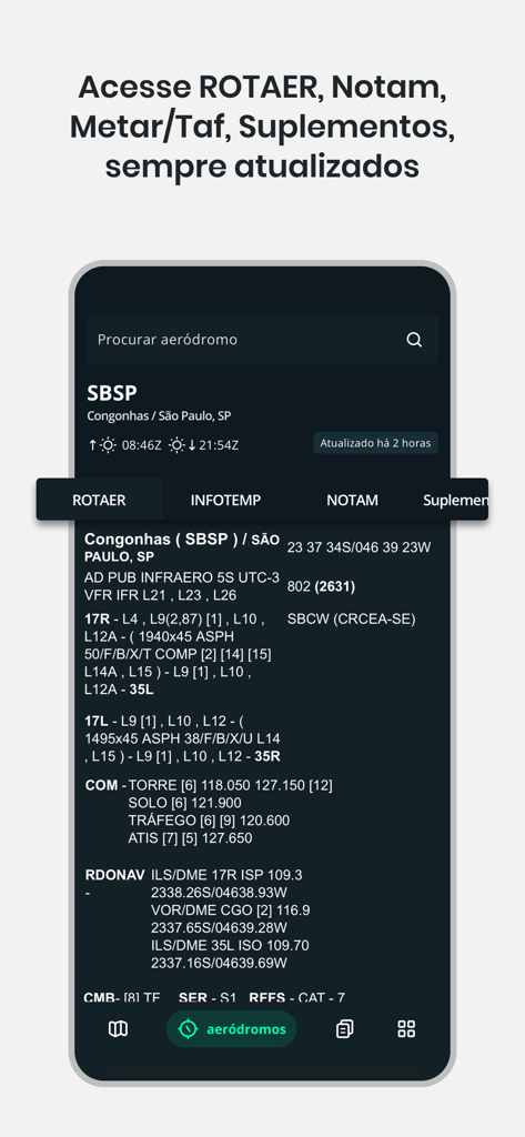
NexAtlas app screen displaying ROTAER and NOTAM information for Congonhas airport
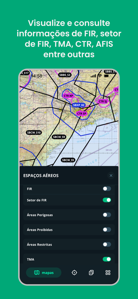
NexAtlas aviation app showing aeronautical airspace layers like FIR and TMA on a navigation map
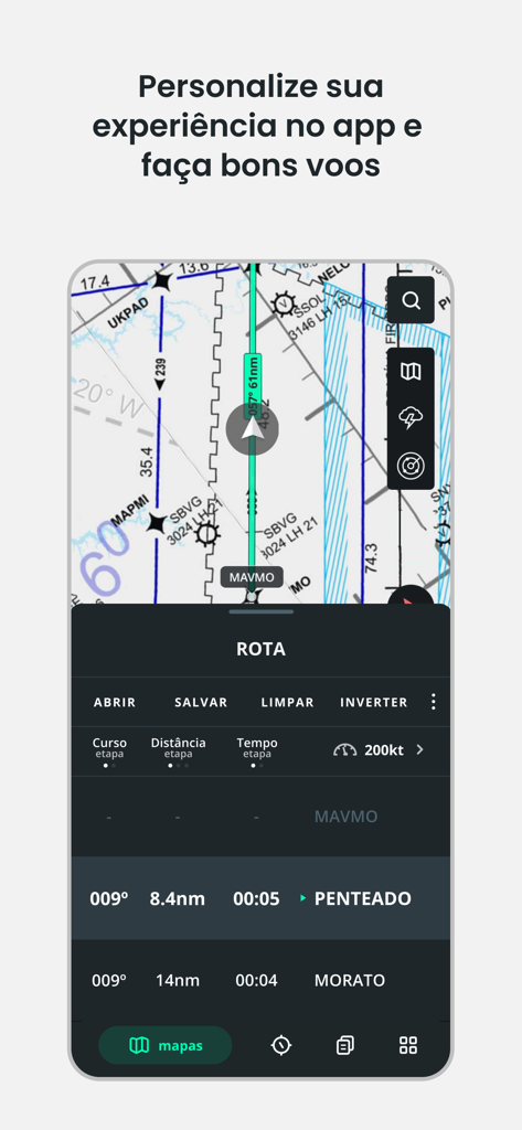
NexAtlas app interface displaying a digital aeronautical chart with a flight route and navigation data panel
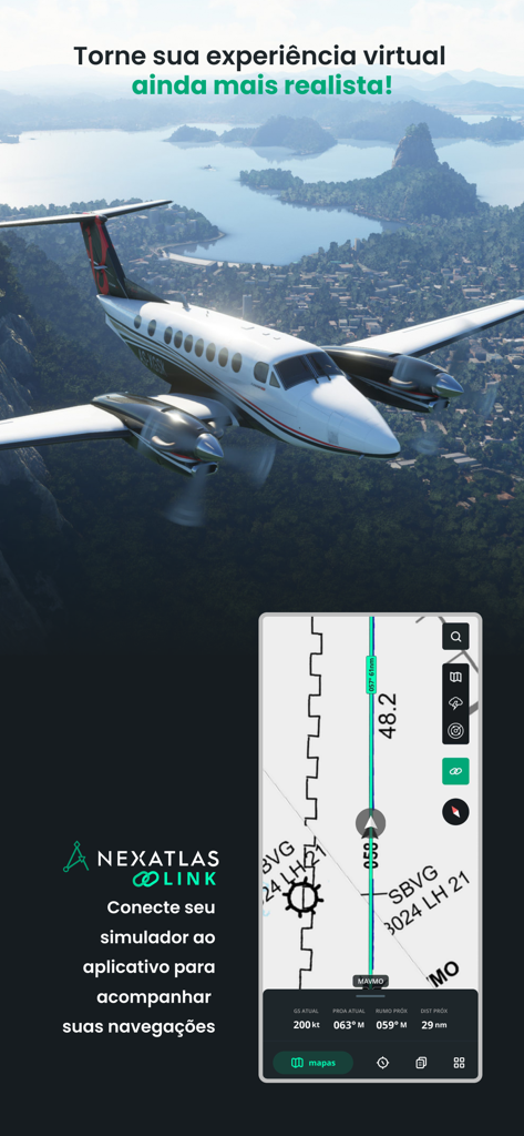
NexAtlas Link app interface showing real-time flight navigation map for simulators

A mobile screenshot of the NexAtlas app showing a personalized customer support chat for pilots.
Description
Download
More Like This
Top-ranked apps in the same category

Google Maps
Google LLC

Waze Navigation & Live Traffic
waze

AMap Global
AutoNavi Information Technology Co. Ltd.

百度地图-路线规划,出行必备
Beijing Baidu Netcom Science & Technology Co.,Ltd

Moovit: Bus & Transit Tracker
Moovit App Global LTD

Transit • Subway & Bus Times
9280-0366 Quebec inc.

ParkMobile: Park. Pay. Go.
Parkmobile USA, Inc

腾讯地图-路线规划,导航地铁打车出行
Shenzhen Tencent Computer Systems Company Limited

Île-de-France Mobilités
Ile de France Mobilites
This page is not an official page of the app or its developer, but an independent editorial publication created for informational and commentary purposes. Unless expressly stated otherwise, neither the app nor its developer is affiliated with, endorsed by, sponsored by, authorized by, or otherwise officially connected with MWM, Apple, Google Play, the app publisher, or the app's developer, and nothing on this page implies that the app was developed using MWM's services. Any trademarks, logos, screenshots, and other content remain the property of their respective owners.