This page is not an official page of the app or its developer, but an independent editorial publication created for informational and commentary purposes. Unless expressly stated otherwise, neither the app nor its developer is affiliated with, endorsed by, sponsored by, authorized by, or otherwise officially connected with MWM, Apple, Google Play, the app publisher, or the app's developer, and nothing on this page implies that the app was developed using MWM's services. Any trademarks, logos, screenshots, and other content remain the property of their respective owners.

Northumberland Maps Offline
The essential companion for trekking Hadrian’s Wall and the National Park. Navigate the wilderness with professional-grade Ordnance Survey maps—no cellular signal or roaming data required.
Downloads
8K+User Rating
Total Ratings
0Publisher
Category
NavigationLocales
1Latest Version
2.1.1Size
612.2 MBFirst Released
May 9, 2015Navigate Like a Local Expert
Professional Ordnance Survey mapping tailored for the high-intent explorer. Discover Hadrian’s Wall and the Northumbrian moors with the world’s most detailed offline cartography.
Zero Signal? No Problem.
Eliminate international roaming charges and stay safe in remote 'dead zones.' Our high-resolution maps are stored entirely on your device for total offline independence.
Ordnance Survey Accuracy
Experience the UK’s gold standard of mapping. View intricate contour lines, specific footpaths, and historic landmarks at the professional 1:25,000 Explorer scale.
The following screenshots and description are sourced directly from the app's official store listing and are the property of the app developer.
App Store
Screenshots
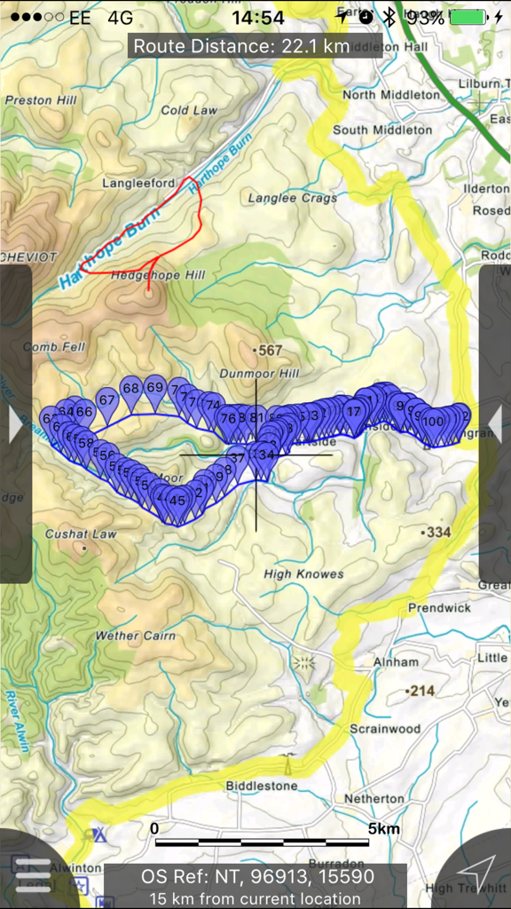
Detailed topographic hiking map with a tracked route and waypoints in Northumberland
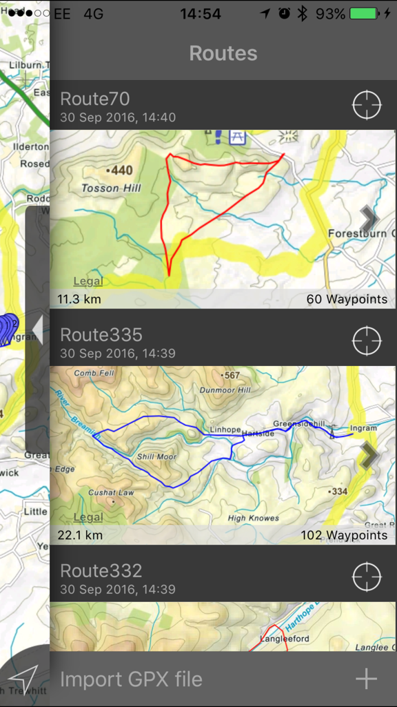
A list of saved hiking routes in the Northumberland Maps Offline app showing distances and topographical maps
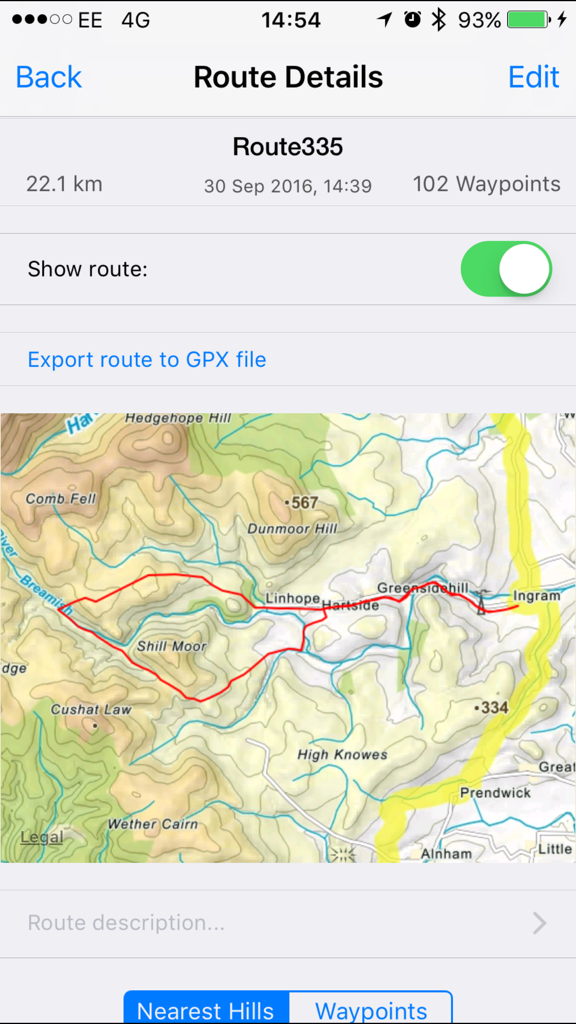
Detailed hiking route on a topographic map within the Northumberland Maps app
Offline topographic map search interface for hills in Northumberland
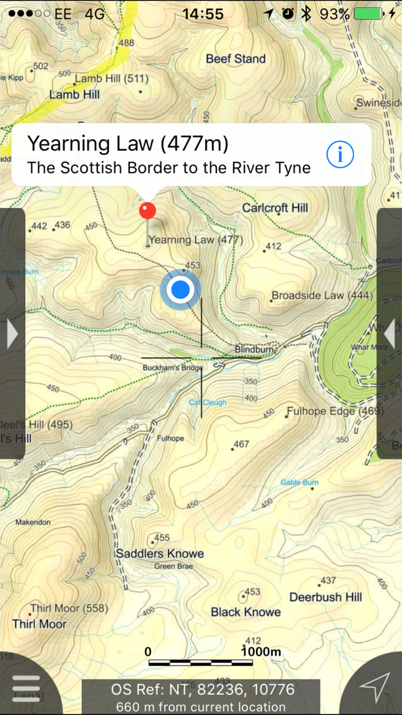
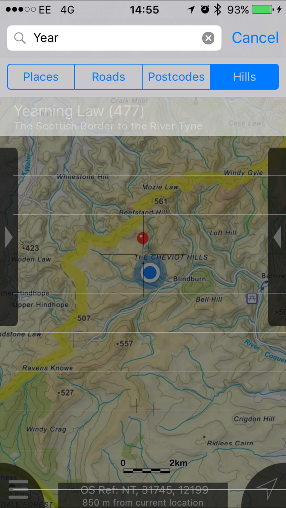
Topographic map of Northumberland showing Yearning Law with elevation contours and hiking trails
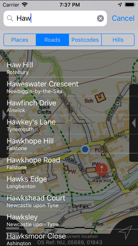
Offline search results for roads and hills in Northumberland Maps app
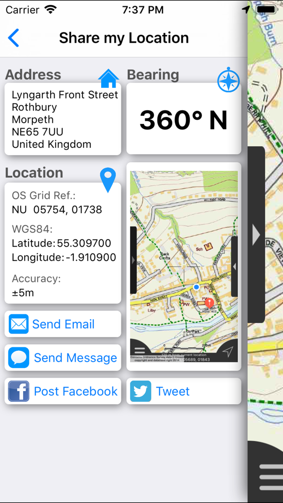
Share my location interface showing address GPS coordinates and map view.
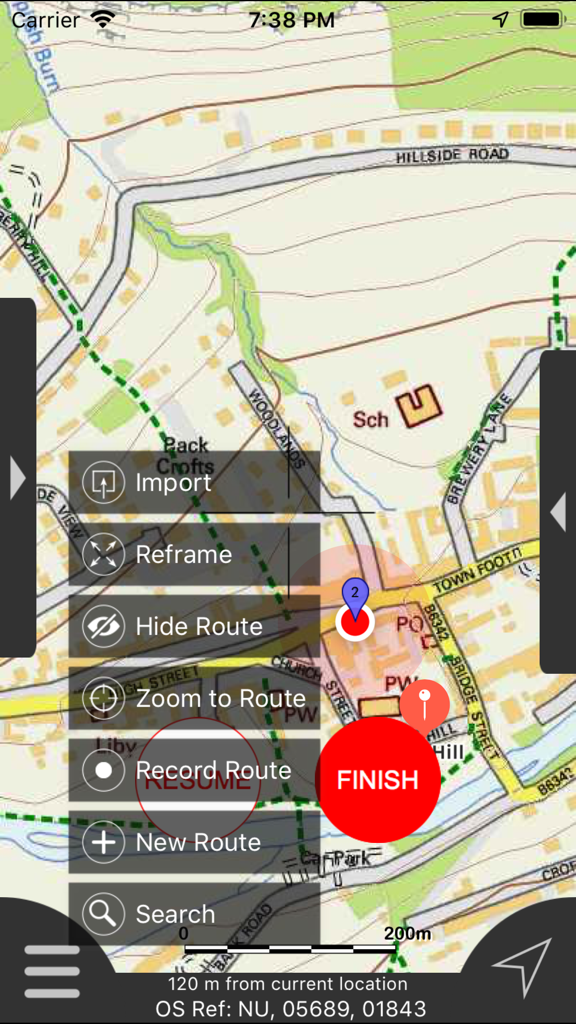
Northumberland Maps Offline app interface showing a detailed map and route management menu
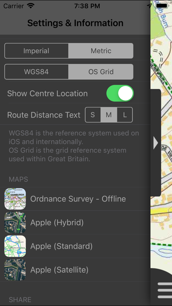
Settings and information screen of the Northumberland Maps Offline app displaying unit and coordinate system options.
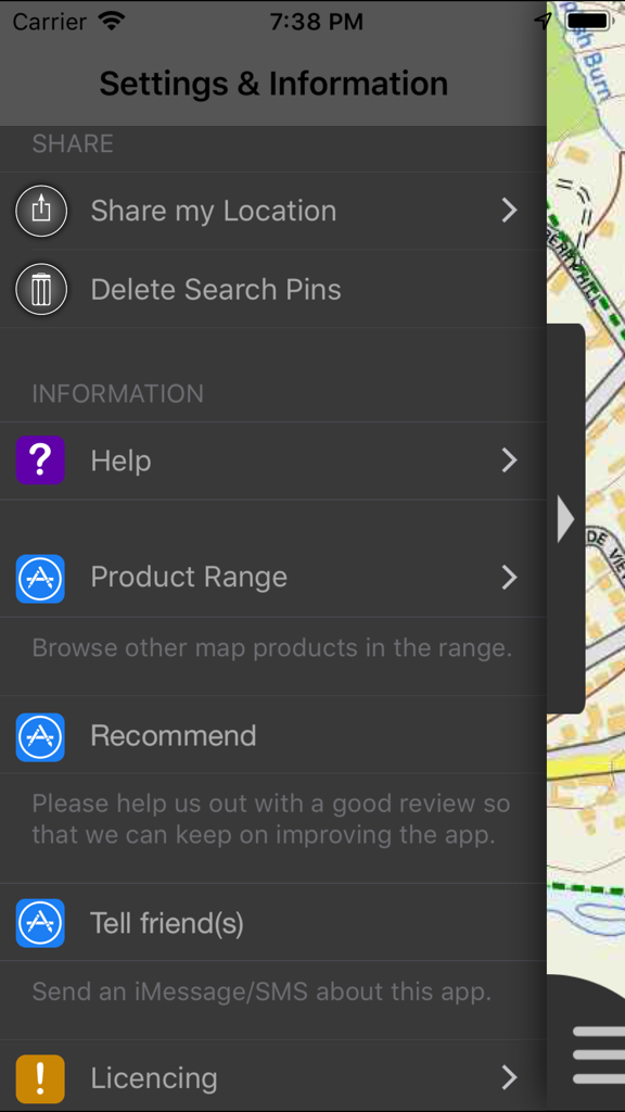
Settings and information menu screen for the Northumberland Maps Offline app showing various navigation and sharing options.
Description
Download
More Like This
Top-ranked apps in the same category

Google Maps
Google LLC

Waze Navigation & Live Traffic
waze

AMap Global
AutoNavi Information Technology Co. Ltd.

百度地图-路线规划,出行必备
Beijing Baidu Netcom Science & Technology Co.,Ltd

Moovit: Bus & Transit Tracker
Moovit App Global LTD

Transit • Subway & Bus Times
9280-0366 Quebec inc.

ParkMobile: Park. Pay. Go.
Parkmobile USA, Inc

腾讯地图-路线规划,导航地铁打车出行
Shenzhen Tencent Computer Systems Company Limited

Île-de-France Mobilités
Ile de France Mobilites
This page is not an official page of the app or its developer, but an independent editorial publication created for informational and commentary purposes. Unless expressly stated otherwise, neither the app nor its developer is affiliated with, endorsed by, sponsored by, authorized by, or otherwise officially connected with MWM, Apple, Google Play, the app publisher, or the app's developer, and nothing on this page implies that the app was developed using MWM's services. Any trademarks, logos, screenshots, and other content remain the property of their respective owners.