This page is not an official page of the app or its developer, but an independent editorial publication created for informational and commentary purposes. Unless expressly stated otherwise, neither the app nor its developer is affiliated with, endorsed by, sponsored by, authorized by, or otherwise officially connected with MWM, Apple, Google Play, the app publisher, or the app's developer, and nothing on this page implies that the app was developed using MWM's services. Any trademarks, logos, screenshots, and other content remain the property of their respective owners.

Nufarm
Empower your decision-making with high-resolution satellite imagery, precision zoning, and field-level insights designed to reduce input costs and boost yields—online or off.
Downloads
0User Rating
Total Ratings
0Publisher
Category
NavigationLocales
1Latest Version
1.0Size
20.6 MBFirst Released
Jun 2, 2025Maximize Every Acre with Precision Intelligence
From high-resolution satellite imagery to variable-rate prescription maps, Nufarm integrates all your field data into one powerful platform to reduce input costs and boost your bottom line.
Smart Zoning & Variable Rate Maps
Create precise prescription maps in minutes to apply inputs only where they are needed, slashing fertilizer and seed costs across your entire operation.
High-Definition Satellite Scouting
Monitor crop health with 10x higher resolution imagery and 2-day revisit rates to spot pest or nutrient stress before it impacts your final yield.
The following screenshots and description are sourced directly from the app's official store listing and are the property of the app developer.
App Store
Screenshots
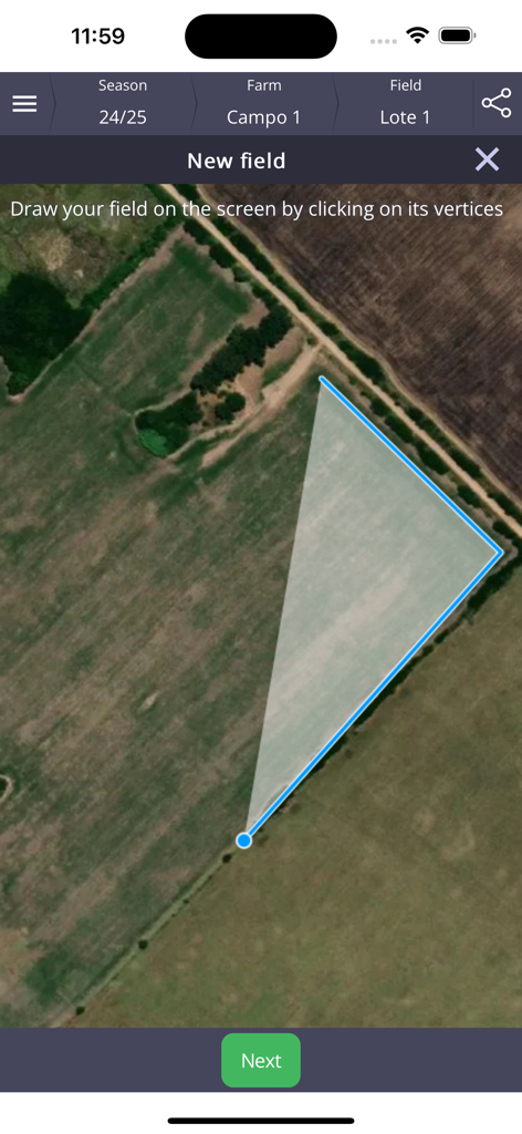
Nufarm app interface for drawing field boundaries on a satellite map
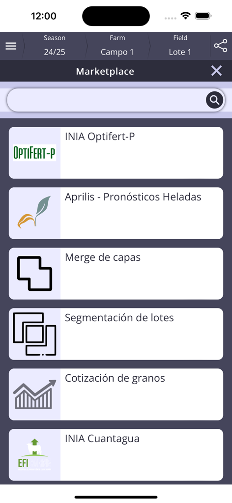
Nufarm app marketplace screen displaying various agricultural extensions and data tools
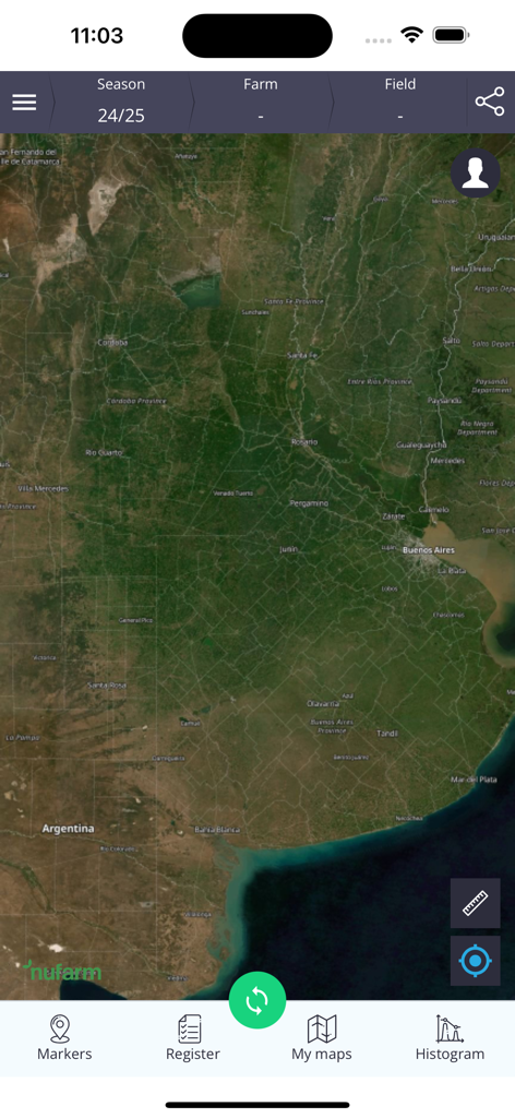
Satellite map view of fields in the Nufarm digital agriculture app showing navigation and scouting tools
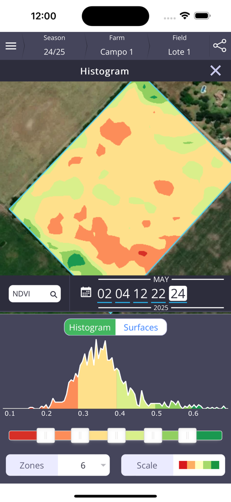
Nufarm app showing a vegetation index histogram and color-coded field map for precision farming data analysis.
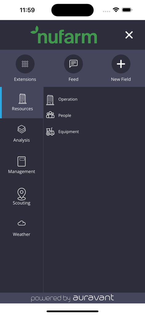
Nufarm app side menu showing options for resources analysis and scouting
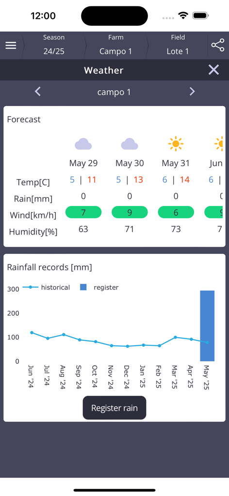
Nufarm app weather dashboard showing agricultural forecast and rainfall data
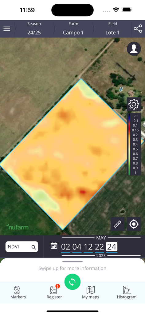
Nufarm app showing an NDVI vegetation index heatmap of a farm field for precision agriculture
Description
Download
More Like This
Top-ranked apps in the same category

Google Maps
Google LLC

AMap Global
AutoNavi Information Technology Co. Ltd.

Waze Navigation & Live Traffic
waze

百度地图-路线规划,出行必备
Beijing Baidu Netcom Science & Technology Co.,Ltd

Moovit: Bus & Transit Tracker
Moovit App Global LTD

腾讯地图-路线规划,导航地铁打车出行
Shenzhen Tencent Computer Systems Company Limited

ParkMobile: Park. Pay. Go.
Parkmobile USA, Inc

Transit • Subway & Bus Times
9280-0366 Quebec inc.

NAVER Maps, Navigation
NAVER Corp.
This page is not an official page of the app or its developer, but an independent editorial publication created for informational and commentary purposes. Unless expressly stated otherwise, neither the app nor its developer is affiliated with, endorsed by, sponsored by, authorized by, or otherwise officially connected with MWM, Apple, Google Play, the app publisher, or the app's developer, and nothing on this page implies that the app was developed using MWM's services. Any trademarks, logos, screenshots, and other content remain the property of their respective owners.