This page is not an official page of the app or its developer, but an independent editorial publication created for informational and commentary purposes. Unless expressly stated otherwise, neither the app nor its developer is affiliated with, endorsed by, sponsored by, authorized by, or otherwise officially connected with MWM, Apple, Google Play, the app publisher, or the app's developer, and nothing on this page implies that the app was developed using MWM's services. Any trademarks, logos, screenshots, and other content remain the property of their respective owners.

OpenSeaMap
Access free worldwide maritime data, harbor info, and weather layers. Navigate your next coastal adventure with powerful offline maps built for the recreational boating community.
Downloads
222K+User Rating
Total Ratings
300Publisher
Category
NavigationLocales
3Latest Version
4.2Size
13.2 MBFirst Released
Jan 25, 2012Smarter Nautical Navigation Without the Subscription
Join the global open-source community and access free, detailed sea charts designed for secondary helm displays and coastal exploration.
Total Offline Reliability
Cache up to 1 million map tiles to your device so you can navigate with confidence even when cellular signals fade miles offshore.
No-Cost Nautical Intelligence
Ditch expensive annual fees with a worldwide chart that includes weather data and harbor information powered by the OpenStreetMap project.
The following screenshots and description are sourced directly from the app's official store listing and are the property of the app developer.
App Store
Screenshots
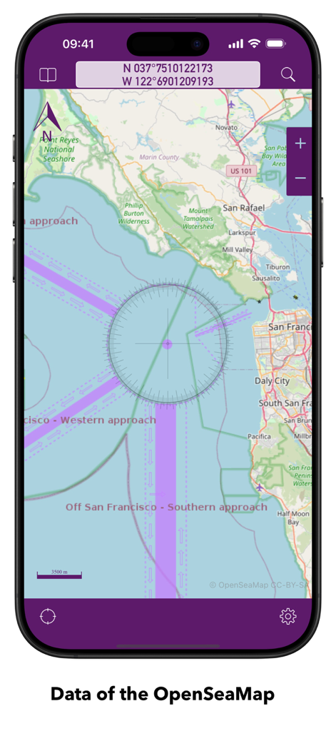
OpenSeaMap app displaying a nautical chart of San Francisco Bay with coordinates and navigation markings
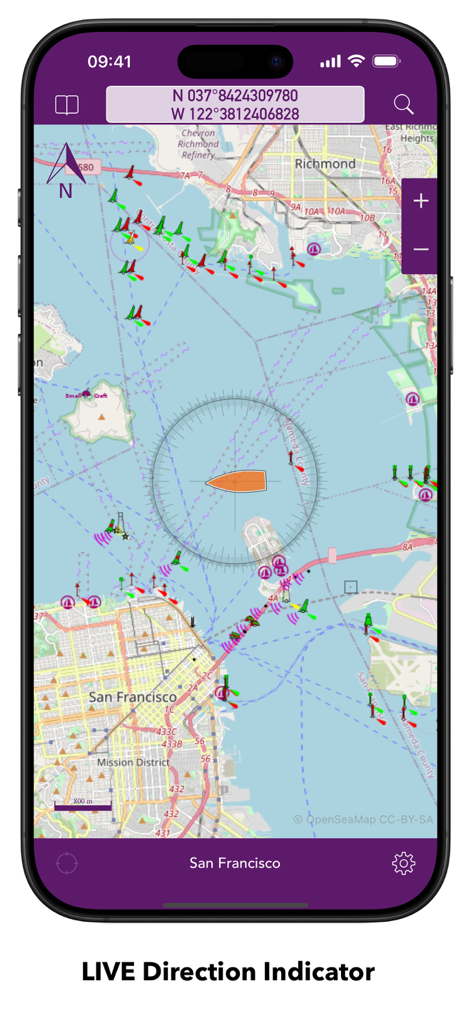
OpenSeaMap app displaying a nautical chart of San Francisco with a live direction indicator and maritime navigation markers
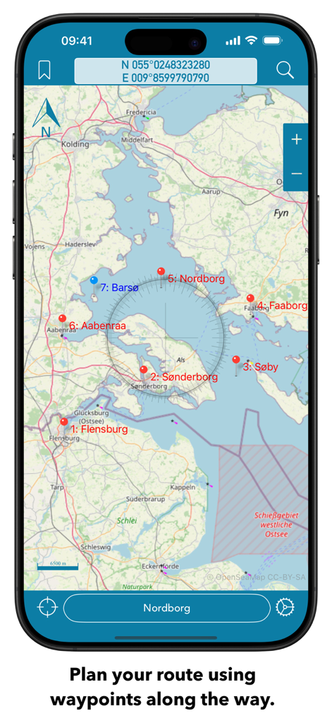
OpenSeaMap nautical chart interface on a smartphone showing route planning with multiple waypoints and a compass overlay.
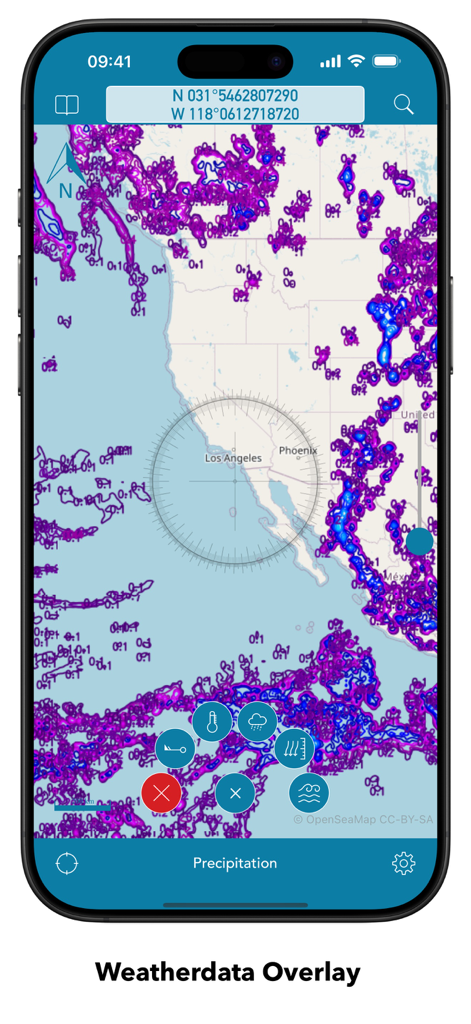
OpenSeaMap mobile interface displaying a precipitation weather data overlay on a nautical chart
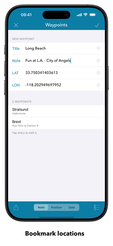
OpenSeaMap mobile app waypoints screen showing bookmarked nautical locations and coordinate entry
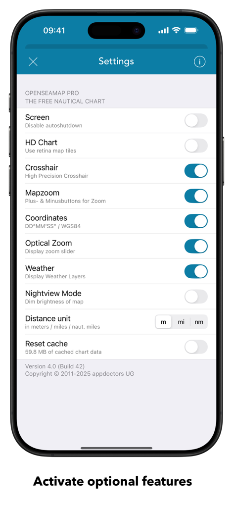
OpenSeaMap settings screen showing nautical chart and navigation configuration options
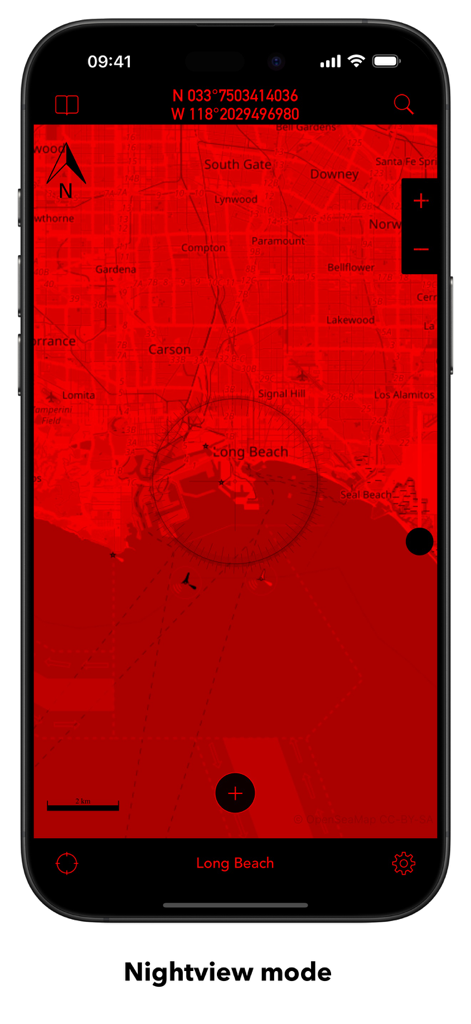
OpenSeaMap mobile app interface showing a red nightview mode map of Long Beach
Description
Download
More Like This
Apps with similar features and user experience

PredictWind — Marine Forecasts
PredictWind Limited

Navily
The Navigation Family

Argo - Boating Navigation
Argo Navigation, LLC

SEAiq Pilot
Sakhalin, LLC

Maptrails
Pasi Salenius

KartenWerft NavGo 2.0
KartenWerft GmbH

MarineTraffic - Ship Tracking
MARINETRAFFIC APPLICATIONS LTD

Wavve Boating: Marine Boat GPS
Wavve Boating Inc

Savvy Navvy Boating Navigation
SAVVY NAVVY LTD
This page is not an official page of the app or its developer, but an independent editorial publication created for informational and commentary purposes. Unless expressly stated otherwise, neither the app nor its developer is affiliated with, endorsed by, sponsored by, authorized by, or otherwise officially connected with MWM, Apple, Google Play, the app publisher, or the app's developer, and nothing on this page implies that the app was developed using MWM's services. Any trademarks, logos, screenshots, and other content remain the property of their respective owners.