This page is not an official page of the app or its developer, but an independent editorial publication created for informational and commentary purposes. Unless expressly stated otherwise, neither the app nor its developer is affiliated with, endorsed by, sponsored by, authorized by, or otherwise officially connected with MWM, Apple, Google Play, the app publisher, or the app's developer, and nothing on this page implies that the app was developed using MWM's services. Any trademarks, logos, screenshots, and other content remain the property of their respective owners.

国土マップR
Access 160+ official GSI map layers with total offline support. Layer terrain data, check instant elevation, and navigate Japan’s wilderness with government-grade reliability.
Downloads
238K+User Rating
Total Ratings
5K+Publisher
Category
NavigationLocales
2Latest Version
1.0.5Size
21.3 MBFirst Released
Dec 7, 2017Professional-Grade Mapping for Precision Explorers
Access over 160 official GSI map layers with specialized tools designed for military personnel, adventurers, and researchers navigating Japan.
160+ Official Data Layers
Navigate with high-precision topographical maps, volcanic surveys, and disaster-risk data verified by the Geospatial Information Authority of Japan.
Rugged Offline Support
Navigate the Japanese Alps or remote areas without data roaming. Automatic 200MB caching ensures your maps work perfectly in airplane mode.
The following screenshots and description are sourced directly from the app's official store listing and are the property of the app developer.
App Store
Screenshots
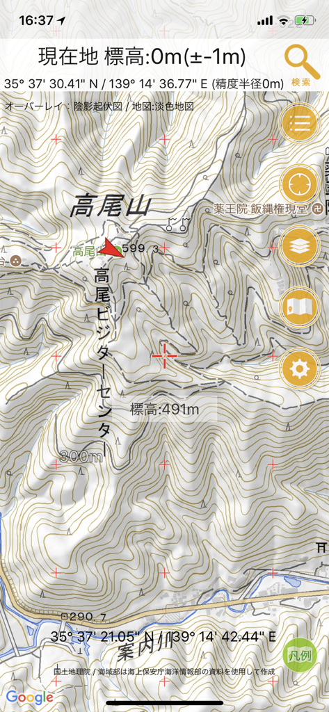
Kokudo Map R app displaying a detailed topographic map of Mount Takao with elevation data and GPS coordinates
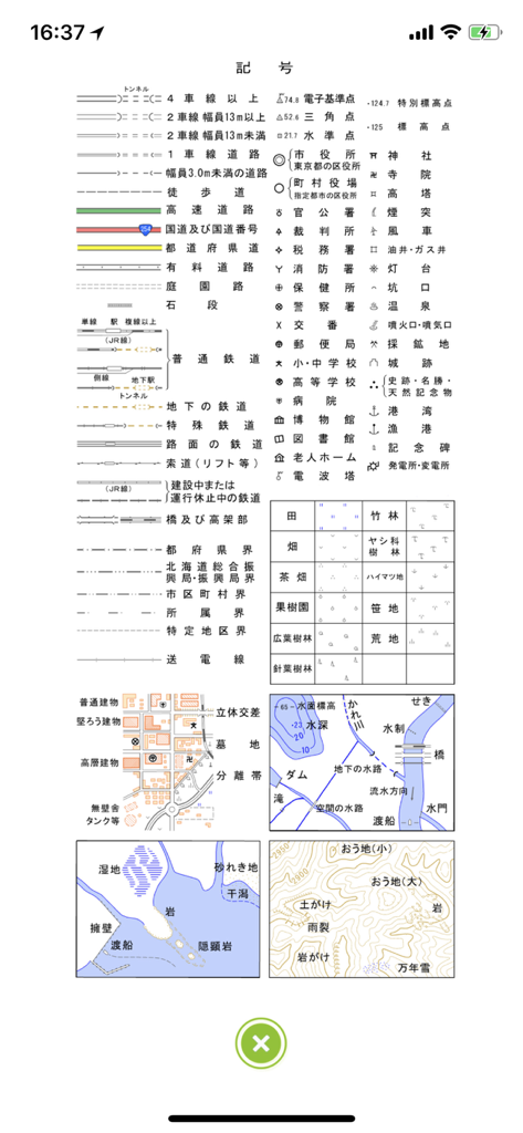
A comprehensive legend of Japanese map symbols and topographical markers including roads railways and land use types
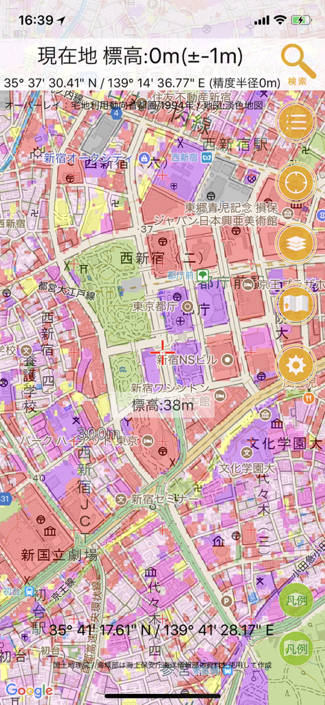
Topographical map of Tokyo on Kokudo Map R app with elevation and land use overlays
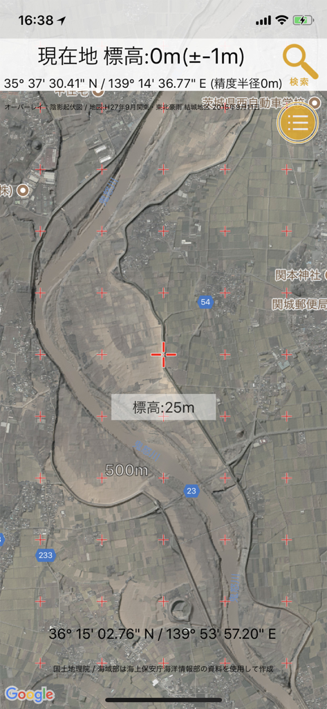
Kokudo Map R navigation app interface displaying a satellite view of Japan with real-time elevation and coordinate data

Smartphone screen displaying a list of map layers with transparency sliders for the Kokudo Map R app.
Description
Download
More Like This
Top-ranked apps in the same category

Google Maps
Google LLC

Waze Navigation & Live Traffic
waze

AMap Global
AutoNavi Information Technology Co. Ltd.

百度地图-路线规划,出行必备
Beijing Baidu Netcom Science & Technology Co.,Ltd

Moovit: Bus & Transit Tracker
Moovit App Global LTD

Transit • Subway & Bus Times
9280-0366 Quebec inc.

ParkMobile: Park. Pay. Go.
Parkmobile USA, Inc

腾讯地图-路线规划,导航地铁打车出行
Shenzhen Tencent Computer Systems Company Limited

Île-de-France Mobilités
Ile de France Mobilites
This page is not an official page of the app or its developer, but an independent editorial publication created for informational and commentary purposes. Unless expressly stated otherwise, neither the app nor its developer is affiliated with, endorsed by, sponsored by, authorized by, or otherwise officially connected with MWM, Apple, Google Play, the app publisher, or the app's developer, and nothing on this page implies that the app was developed using MWM's services. Any trademarks, logos, screenshots, and other content remain the property of their respective owners.