This page is not an official page of the app or its developer, but an independent editorial publication created for informational and commentary purposes. Unless expressly stated otherwise, neither the app nor its developer is affiliated with, endorsed by, sponsored by, authorized by, or otherwise officially connected with MWM, Apple, Google Play, the app publisher, or the app's developer, and nothing on this page implies that the app was developed using MWM's services. Any trademarks, logos, screenshots, and other content remain the property of their respective owners.

Radar Map
Explore the world in real-time. Monitor aircraft, ships, and weather balloons with professional-grade ADS-B and AIS data on one powerful interactive map.
Downloads
0User Rating
Total Ratings
0Publisher
Category
NavigationLocales
1Latest Version
1.0Size
56.3 MBFirst Released
Mar 18, 2026Master the Skies and Seas in Real-Time
Get a professional-grade radar experience that combines global flight paths, maritime vessel traffic, and meteorological balloon data into one powerful interactive map.
Live Global Aviation Tracking
Follow any flight worldwide with real-time altitude, speed, and ADS-B data. Color-coded layers provide an instant 3D perspective of the airspace above you.
Real-Time Maritime Intelligence
Monitor cargo ships, tankers, and private vessels using AIS data. Track route histories, vessel types, and navigation headings across the world’s oceans and waterways.
The following screenshots and description are sourced directly from the app's official store listing and are the property of the app developer.
App Store
Screenshots
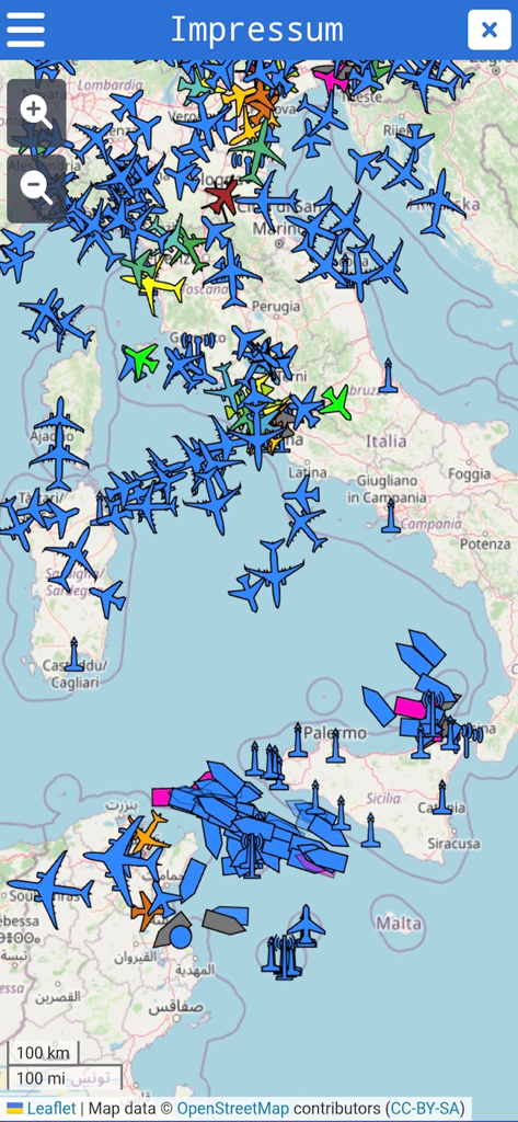
Real-time radar map displaying live aircraft and ship tracking across Italy and the Mediterranean Sea.
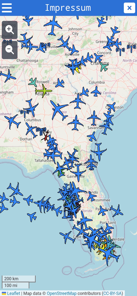
Real time radar map showing color coded aircraft positions and flight activity over the southeastern United States
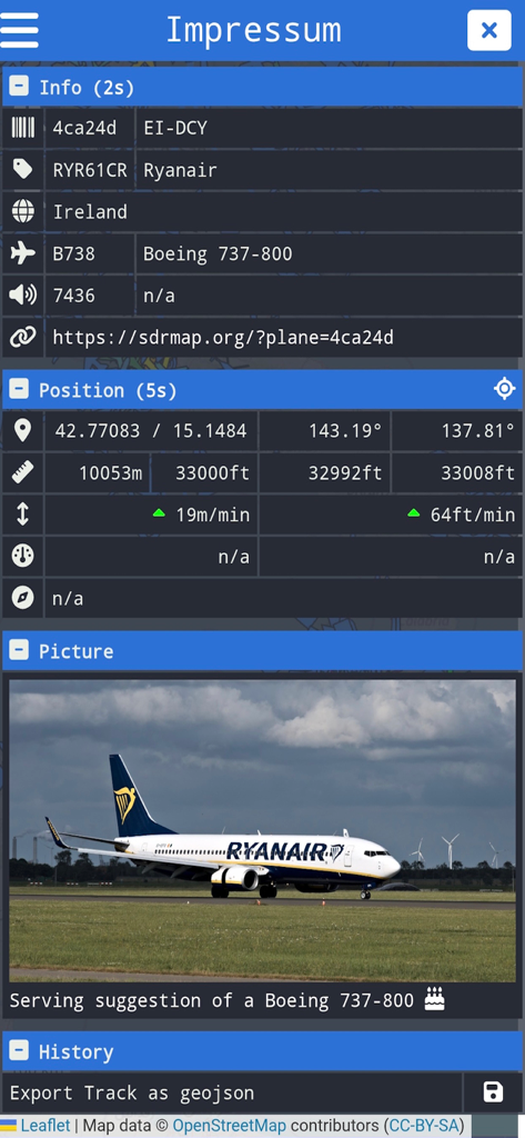
A detailed aircraft information screen in the Radar Map app showing flight data and a photo of a Ryanair Boeing 737
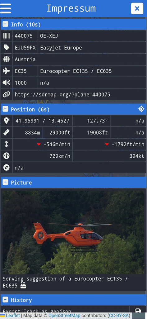
Detailed aircraft information panel in the Radar Map app displaying flight position and a Eurocopter helicopter image
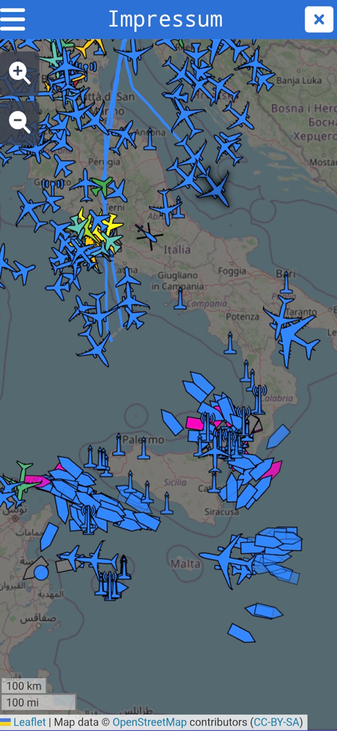
Radar Map displaying live aircraft and ship traffic across Italy and the Mediterranean Sea.
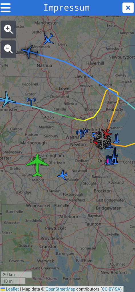
A live radar map showing color-coded aircraft and flight paths over the Boston area.
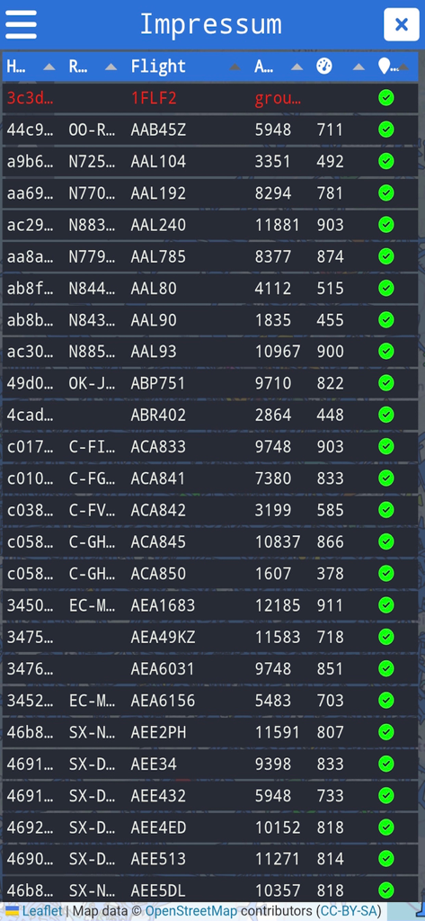
A list of live aircraft flights with tracking information including flight numbers and altitude
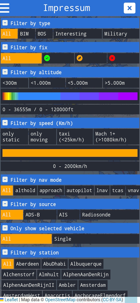
Advanced filtering options in Radar Map app for live aircraft and ship tracking
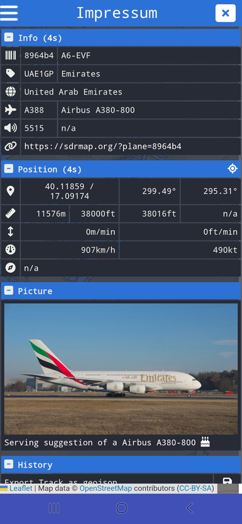
Detailed aircraft tracking screen in the Radar Map app showing technical flight data and a photo of an Emirates Airbus A380.
Description
Download
More Like This
Top-ranked apps in the same category

Google Maps
Google LLC

AMap Global
AutoNavi Information Technology Co. Ltd.

Waze Navigation & Live Traffic
waze

百度地图-路线规划,出行必备
Beijing Baidu Netcom Science & Technology Co.,Ltd

Moovit: Bus & Transit Tracker
Moovit App Global LTD

腾讯地图-路线规划,导航地铁打车出行
Shenzhen Tencent Computer Systems Company Limited

Transit • Subway & Bus Times
9280-0366 Quebec inc.

ParkMobile: Park. Pay. Go.
Parkmobile USA, Inc

MapXplorer: Map Radar Navigate
GOLDLAB APPLICATIONS YAZILIM VE BILISIM ANONIM SIRKETI
This page is not an official page of the app or its developer, but an independent editorial publication created for informational and commentary purposes. Unless expressly stated otherwise, neither the app nor its developer is affiliated with, endorsed by, sponsored by, authorized by, or otherwise officially connected with MWM, Apple, Google Play, the app publisher, or the app's developer, and nothing on this page implies that the app was developed using MWM's services. Any trademarks, logos, screenshots, and other content remain the property of their respective owners.