This page is not an official page of the app or its developer, but an independent editorial publication created for informational and commentary purposes. Unless expressly stated otherwise, neither the app nor its developer is affiliated with, endorsed by, sponsored by, authorized by, or otherwise officially connected with MWM, Apple, Google Play, the app publisher, or the app's developer, and nothing on this page implies that the app was developed using MWM's services. Any trademarks, logos, screenshots, and other content remain the property of their respective owners.

Realsee 3D virtual tour
Transform physical spaces into immersive 3D walkthroughs with your smartphone. The all-in-one solution for real estate, architecture, and construction professionals to capture, edit, and share high-resolution spatial data.
Downloads
10K+User Rating
Total Ratings
0Publisher
Category
LifestyleLocales
6Latest Version
3.59.1Size
603.6 MBFirst Released
Aug 4, 2022Elevate Your Business with Professional 3D Digital Twins
Capture, create, and share immersive virtual tours in minutes. Whether you are a realtor or an architect, Realsee provides the tools to showcase spaces with unmatched precision.
Smartphone-Ready 3D Capture
No expensive equipment needed. Use your smartphone or a 360 camera to generate high-fidelity VR walkthroughs instantly on-site.
Precision CAD & BIM Exports
Streamline your technical workflow with downloadable floor plans, point clouds (E57), and OBJ models ready for AutoCAD and Revit.
The following screenshots and description are sourced directly from the app's official store listing and are the property of the app developer.
App Store
Screenshots
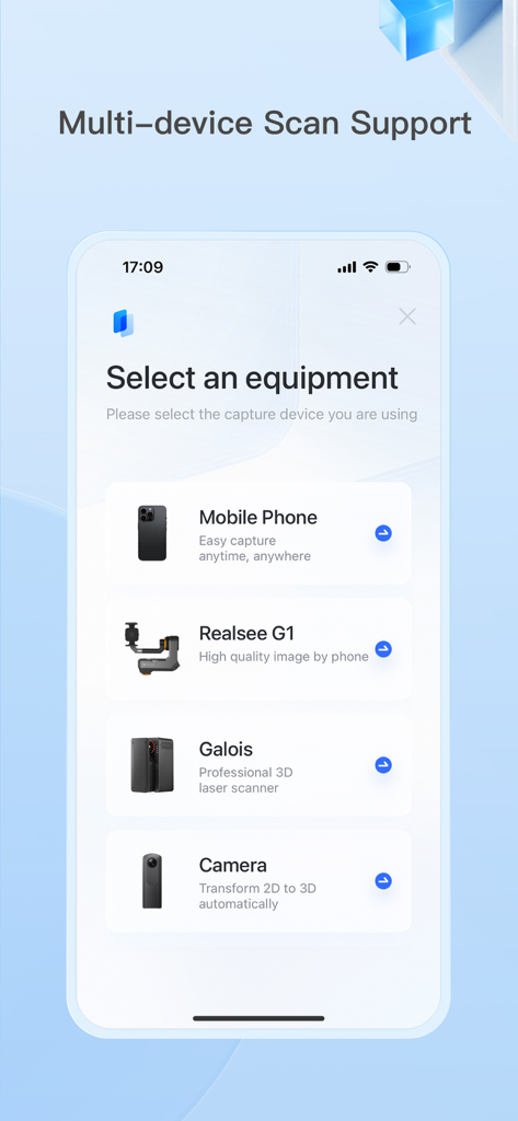
Mobile app interface showing options to select scanning equipment including mobile phone, Realsee G1, Galois laser scanner, and 3D cameras.
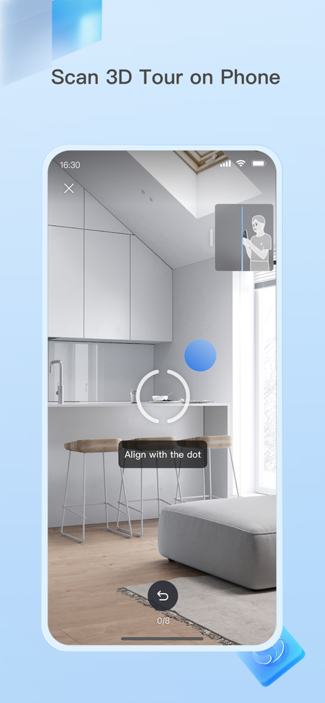
Smartphone interface of the Realsee app showing the 3D scanning process of a room with instructions to align with a dot
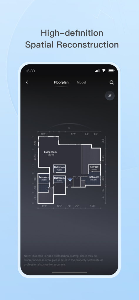
The Realsee app interface displaying a detailed floorplan with room labels and precise measurements for spatial reconstruction.
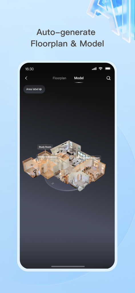
A smartphone screen displaying an auto-generated 3D house model and floorplan with labeled rooms like study and master bedroom
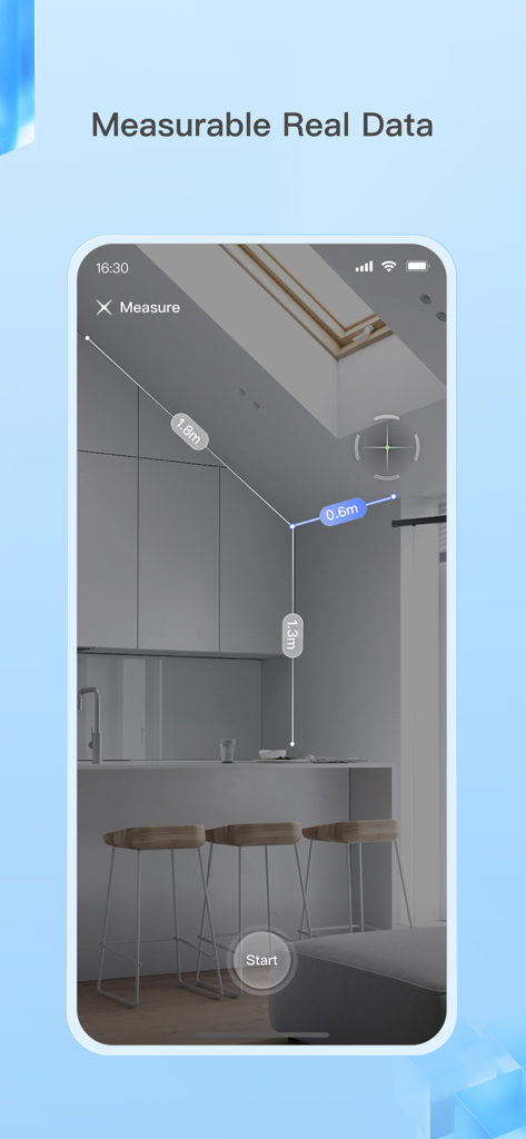
A smartphone interface showing the Realsee app measuring dimensions of a kitchen interior in a 3D virtual tour
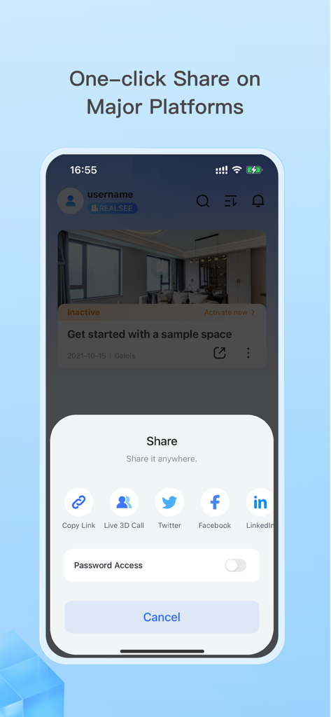
Mobile app interface showing one-click sharing options for a 3D virtual tour to LinkedIn Facebook and Twitter
Description
Download
More Like This
Top-ranked apps in the same category

Pinterest, Inc.

Alipay - Simplify Your Life
Alipay (Hangzhou) Technology Co., Ltd.

美团-美好生活小帮手
Sankuai Technology Co., Ltd.

Dianping: Discover Good Places
Hanhai Information Technology (Shanghai) Co.Ltd

Lemon8 - Lifestyle Community
TIKTOK PTE. LTD.

Xiaomi Home
Beijing Xiaomi Co., Ltd

Tinder Dating App: Date & Chat
Tinder LLC

VNeTraffic
GLOBAL TECHNOLOGY - TELECOMMUNICATIONS CORPORATION

SmartThings
Samsung Electronics Co., Ltd.
This page is not an official page of the app or its developer, but an independent editorial publication created for informational and commentary purposes. Unless expressly stated otherwise, neither the app nor its developer is affiliated with, endorsed by, sponsored by, authorized by, or otherwise officially connected with MWM, Apple, Google Play, the app publisher, or the app's developer, and nothing on this page implies that the app was developed using MWM's services. Any trademarks, logos, screenshots, and other content remain the property of their respective owners.