This page is not an official page of the app or its developer, but an independent editorial publication created for informational and commentary purposes. Unless expressly stated otherwise, neither the app nor its developer is affiliated with, endorsed by, sponsored by, authorized by, or otherwise officially connected with MWM, Apple, Google Play, the app publisher, or the app's developer, and nothing on this page implies that the app was developed using MWM's services. Any trademarks, logos, screenshots, and other content remain the property of their respective owners.

Sea Maps
Navigate with confidence using high-resolution bathymetry, real-time AIS vessel tracking, and advanced weather overlays. Whether you are chasing the catch of a lifetime or cruising the coast, get the professional-grade data you need to stay safe on the water.
Downloads
100+User Rating
Total Ratings
0Publisher
Category
NavigationLocales
62Latest Version
1.03Size
690.8 MBFirst Released
Nov 6, 2025Navigate with Professional Precision
From high-resolution bathymetry to real-time weather overlays, get the advanced tools you need to master the water and ensure every voyage is a safe one.
Precision Fishing Data
Locate the perfect catch using Sea Surface Temperature (SST) heat maps and real-time ocean current animations designed for serious anglers.
Real-Time AIS & Navigation
Track nearby vessels and navigate complex coastal waters with confidence using detailed ship information and professional-grade depth contours.
The following screenshots and description are sourced directly from the app's official store listing and are the property of the app developer.
App Store
Screenshots
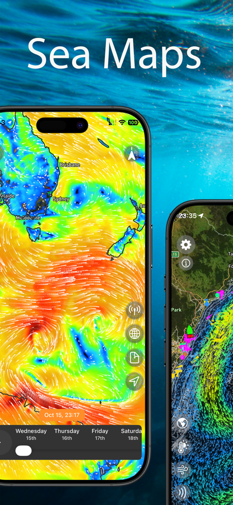
Sea Maps app interface showing animated wind patterns and AIS vessel tracking on smartphone screens.
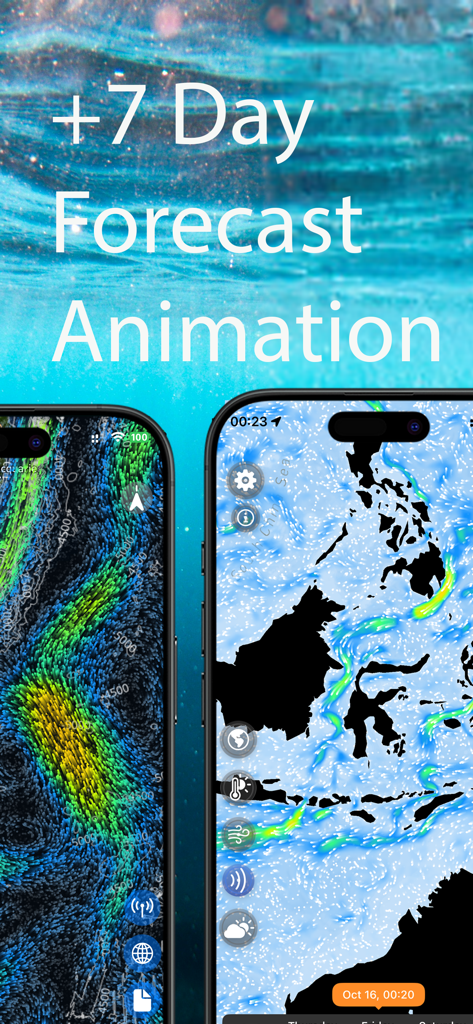
Sea Maps app interface showing a 7-day marine forecast with animated wind and ocean currents.
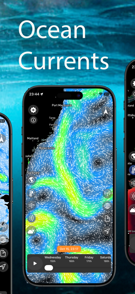
Animated ocean current flow visualization on the Sea Maps marine navigation app
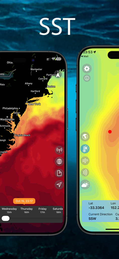
Mobile app screens of Sea Maps showing sea surface temperature SST heat maps and marine navigation data
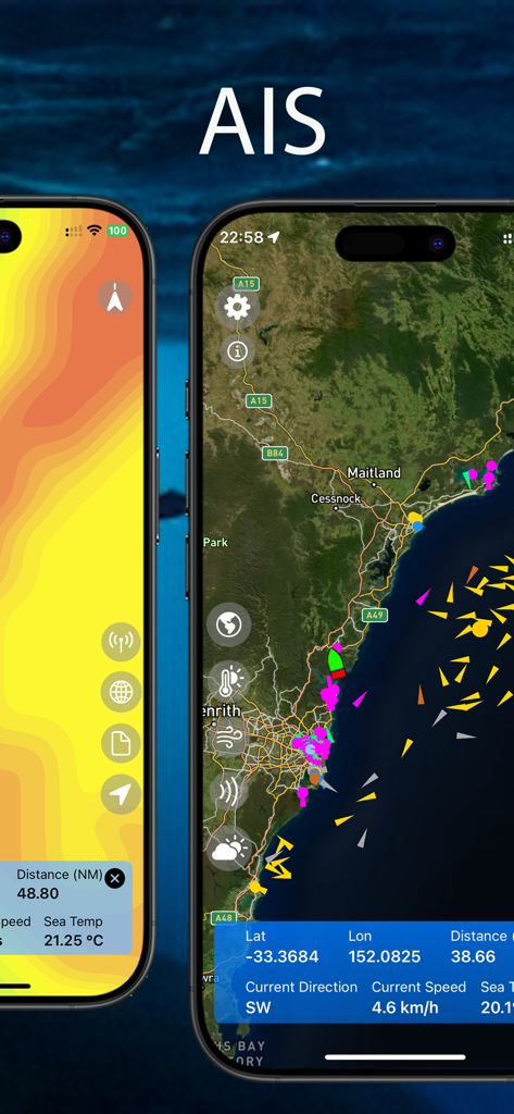
Sea Maps app interface displaying real time AIS vessel tracking and coastal navigation data
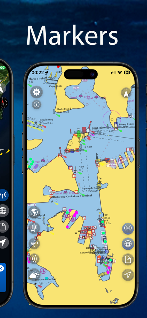
Sea Maps app interface displaying a nautical chart with marine navigation markers and buoys.
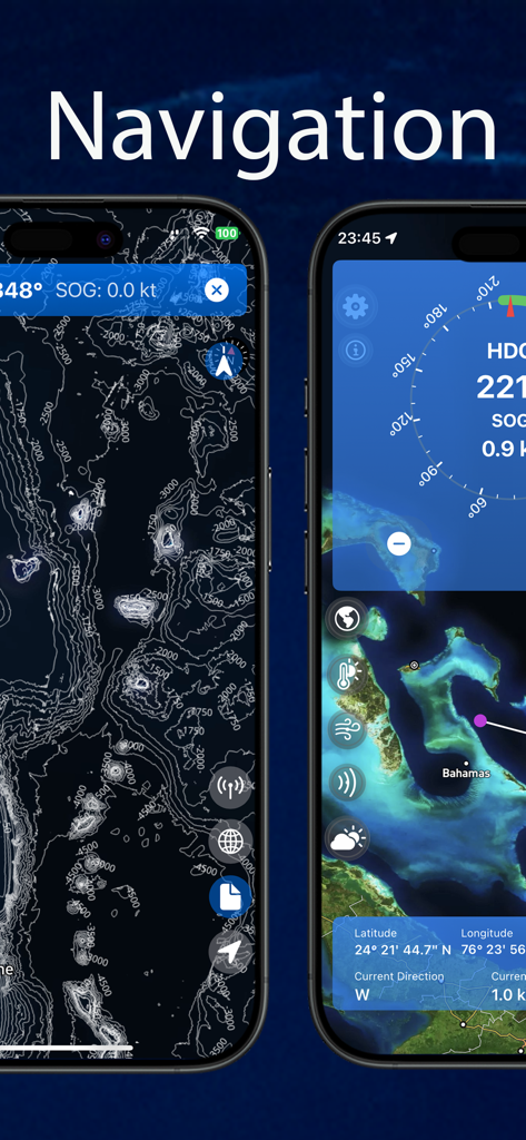
Sea Maps app navigation screens showing ocean depth contours and satellite charts
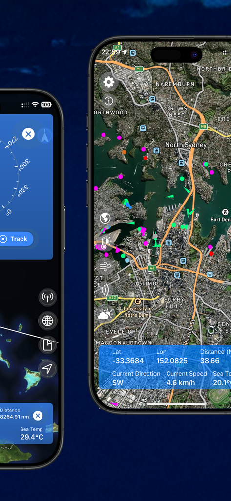
Marine navigation app interface showing satellite maps with AIS vessel tracking and real-time ocean data
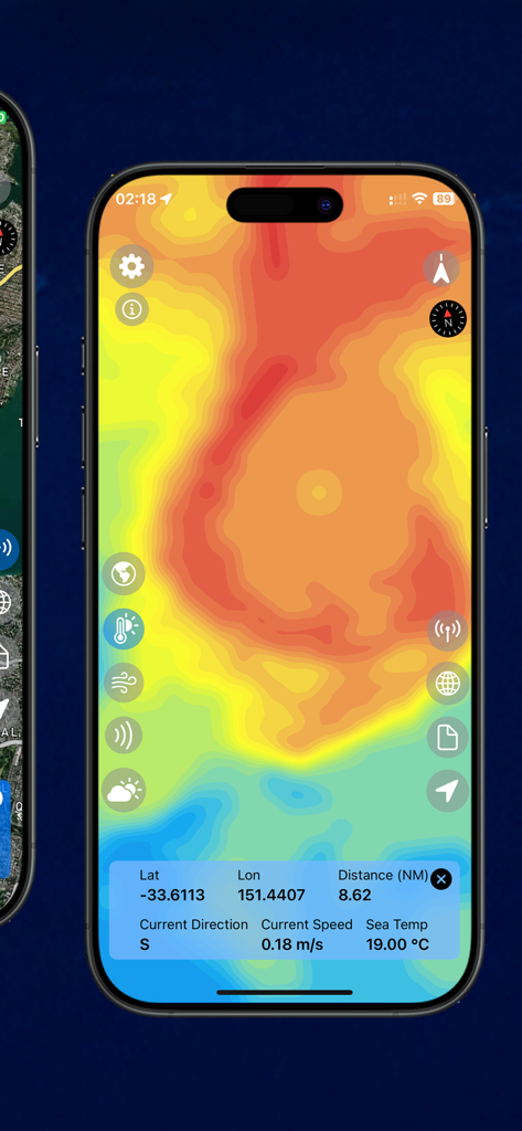
Sea Maps app screen displaying a sea surface temperature heat map with GPS coordinates and marine data.
Description
Download
More Like This
Top-ranked apps in the same category

Google Maps
Google LLC

AMap Global
AutoNavi Information Technology Co. Ltd.

Waze Navigation & Live Traffic
waze

百度地图-路线规划,出行必备
Beijing Baidu Netcom Science & Technology Co.,Ltd

Moovit: Bus & Transit Tracker
Moovit App Global LTD

Transit • Subway & Bus Times
9280-0366 Quebec inc.

ParkMobile: Park. Pay. Go.
Parkmobile USA, Inc

腾讯地图-路线规划,导航地铁打车出行
Shenzhen Tencent Computer Systems Company Limited

MapXplorer: Map Radar Navigate
GOLDLAB APPLICATIONS YAZILIM VE BILISIM ANONIM SIRKETI
This page is not an official page of the app or its developer, but an independent editorial publication created for informational and commentary purposes. Unless expressly stated otherwise, neither the app nor its developer is affiliated with, endorsed by, sponsored by, authorized by, or otherwise officially connected with MWM, Apple, Google Play, the app publisher, or the app's developer, and nothing on this page implies that the app was developed using MWM's services. Any trademarks, logos, screenshots, and other content remain the property of their respective owners.