This page is not an official page of the app or its developer, but an independent editorial publication created for informational and commentary purposes. Unless expressly stated otherwise, neither the app nor its developer is affiliated with, endorsed by, sponsored by, authorized by, or otherwise officially connected with MWM, Apple, Google Play, the app publisher, or the app's developer, and nothing on this page implies that the app was developed using MWM's services. Any trademarks, logos, screenshots, and other content remain the property of their respective owners.

Singapore MRT Map Route(Pro)
The ultimate ad-free companion for business travelers and tourists. Get the fastest routes, travel time estimates, and the latest bilingual map data in just one second.
Downloads
84K+User Rating
Total Ratings
500Publisher
Category
NavigationLocales
1Latest Version
2.9.7Size
181.2 MBFirst Released
Nov 2, 2011Precision Navigation for the Global Traveler
Maximize your time in Singapore with an ad-free, pro-grade toolkit designed to provide the fastest routes across the entire MRT network.
One-Second Route Optimization
Calculate the most efficient path between any two stations instantly. Perfect for high-stakes business meetings and tight travel schedules.
Up-to-the-Minute System Maps
Navigate with confidence using the latest updates, including full support for the new Thomson-East Coast Line (TEL) and all major interchange connections.
The following screenshots and description are sourced directly from the app's official store listing and are the property of the app developer.
App Store
Screenshots
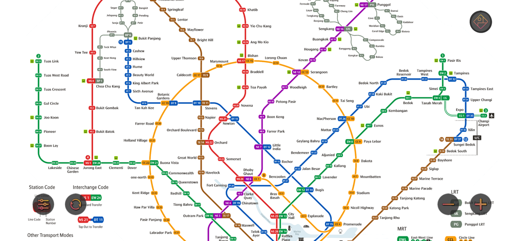
Full digital layout of the Singapore MRT and LRT subway map showing transit lines and station connections
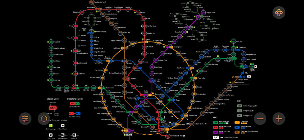
Detailed color-coded map of the Singapore MRT and LRT transit system.
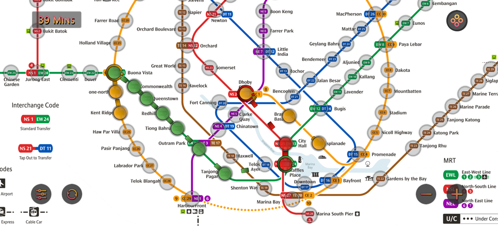
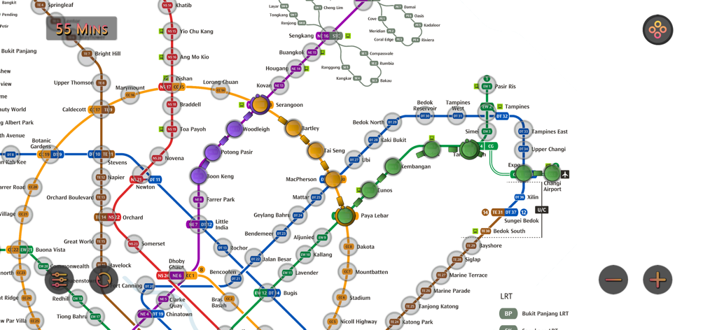
A detailed subway map of Singapore featuring various MRT lines and a route travel time estimate.
Detailed Singapore MRT subway map with route path and travel time indicator
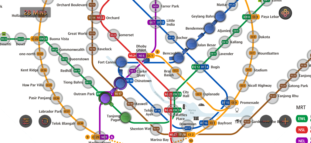
Detailed Singapore MRT subway map interface showing route calculation and travel time estimates
Description
Download
More Like This
Top-ranked apps in the same category

Google Maps
Google LLC

Waze Navigation & Live Traffic
waze

AMap Global
AutoNavi Information Technology Co. Ltd.

百度地图-路线规划,出行必备
Beijing Baidu Netcom Science & Technology Co.,Ltd

Moovit: Bus & Transit Tracker
Moovit App Global LTD

Transit • Subway & Bus Times
9280-0366 Quebec inc.

ParkMobile: Park. Pay. Go.
Parkmobile USA, Inc

腾讯地图-路线规划,导航地铁打车出行
Shenzhen Tencent Computer Systems Company Limited

Île-de-France Mobilités
Ile de France Mobilites
This page is not an official page of the app or its developer, but an independent editorial publication created for informational and commentary purposes. Unless expressly stated otherwise, neither the app nor its developer is affiliated with, endorsed by, sponsored by, authorized by, or otherwise officially connected with MWM, Apple, Google Play, the app publisher, or the app's developer, and nothing on this page implies that the app was developed using MWM's services. Any trademarks, logos, screenshots, and other content remain the property of their respective owners.