This page is not an official page of the app or its developer, but an independent editorial publication created for informational and commentary purposes. Unless expressly stated otherwise, neither the app nor its developer is affiliated with, endorsed by, sponsored by, authorized by, or otherwise officially connected with MWM, Apple, Google Play, the app publisher, or the app's developer, and nothing on this page implies that the app was developed using MWM's services. Any trademarks, logos, screenshots, and other content remain the property of their respective owners.

SkyGuard for Drones
Navigate complex airspace with ease. Our smart algorithms cross-check your flight path against local laws and FAA regulations, ensuring a worry-free journey every time you take to the skies.
Downloads
0User Rating
Total Ratings
0Publisher
Category
NavigationLocales
1Latest Version
1.5Size
81.3 MBFirst Released
May 9, 2024Master the Skies with Absolute Confidence
SkyGuard simplifies complex drone regulations, turning legal jargon into actionable insights so you can focus on capturing the perfect shot without the fear of fines.
Automated Legal Guardrails
Skip the legal jargon. Our smart algorithms cross-check your flight path against local and national laws to keep you safe from accidental violations and costly penalties.
Precision Flight Planning
Visualize your mission with an intuitive interface that automatically identifies No-Fly Zones and provides personalized height and weather suggestions for every takeoff.
The following screenshots and description are sourced directly from the app's official store listing and are the property of the app developer.
App Store
Screenshots
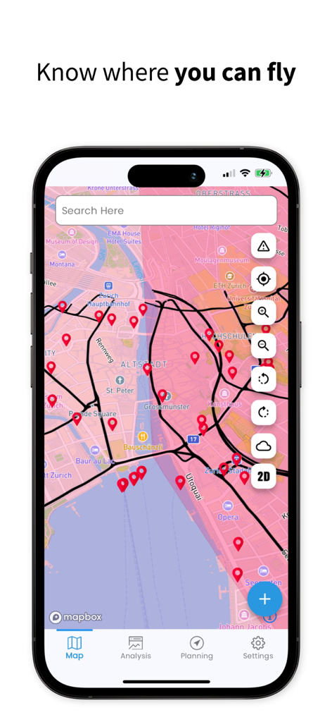
SkyGuard for Drones app showing an interactive map with drone flight paths and airspace restriction markers
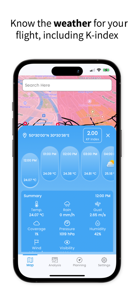
Weather forecast and KP Index dashboard within the SkyGuard for Drones app
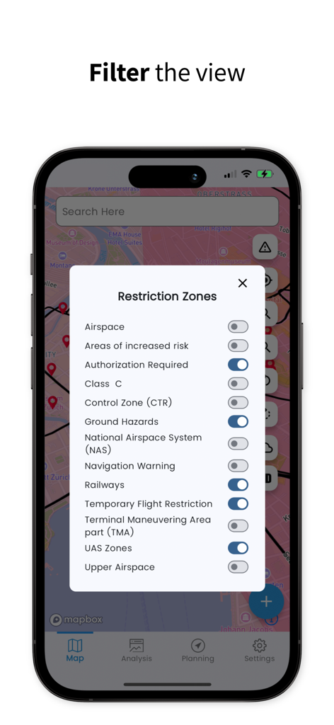
SkyGuard app screen showing a list of toggle filters for drone restriction zones like TFRs and UAS zones over a map.
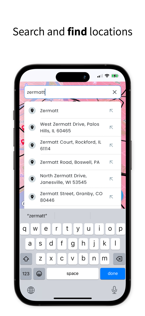
SkyGuard for Drones app screenshot showing the search and find locations feature on a map.
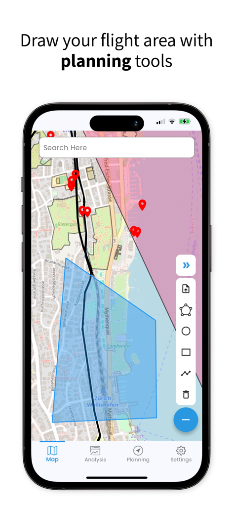
SkyGuard app interface showing a map with a blue polygon representing a planned drone flight area and various drawing tools.
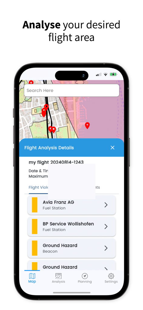
SkyGuard app interface showing flight analysis details with ground hazards and map markers
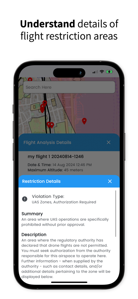
SkyGuard app interface showing detailed drone flight restrictions and UAS zone violation information on a map.
Description
Download
More Like This
Top-ranked apps in the same category

Google Maps
Google LLC

AMap Global
AutoNavi Information Technology Co. Ltd.

Waze Navigation & Live Traffic
waze

百度地图-路线规划,出行必备
Beijing Baidu Netcom Science & Technology Co.,Ltd

Moovit: Bus & Transit Tracker
Moovit App Global LTD

Transit • Subway & Bus Times
9280-0366 Quebec inc.

ParkMobile: Park. Pay. Go.
Parkmobile USA, Inc

MapXplorer: Map Radar Navigate
GOLDLAB APPLICATIONS YAZILIM VE BILISIM ANONIM SIRKETI

全能导航-精准卫星实况导航
子豪 李
This page is not an official page of the app or its developer, but an independent editorial publication created for informational and commentary purposes. Unless expressly stated otherwise, neither the app nor its developer is affiliated with, endorsed by, sponsored by, authorized by, or otherwise officially connected with MWM, Apple, Google Play, the app publisher, or the app's developer, and nothing on this page implies that the app was developed using MWM's services. Any trademarks, logos, screenshots, and other content remain the property of their respective owners.