This page is not an official page of the app or its developer, but an independent editorial publication created for informational and commentary purposes. Unless expressly stated otherwise, neither the app nor its developer is affiliated with, endorsed by, sponsored by, authorized by, or otherwise officially connected with MWM, Apple, Google Play, the app publisher, or the app's developer, and nothing on this page implies that the app was developed using MWM's services. Any trademarks, logos, screenshots, and other content remain the property of their respective owners.

SpotItFly
The ultimate all-in-one toolkit for drone pilots. Explore community-sourced locations, navigate airspace regulations, and get precise weather forecasts to plan your next cinematic flight.
Downloads
200User Rating
Total Ratings
0Publisher
Category
NavigationLocales
2Latest Version
2.0.0Size
31.0 MBFirst Released
Nov 6, 2025Master Every Flight with Precision
Stop jumping between apps. SpotItFly combines airspace safety, hyper-local weather, and a community of creators into one powerful drone toolkit.
Discover & Navigate Safely
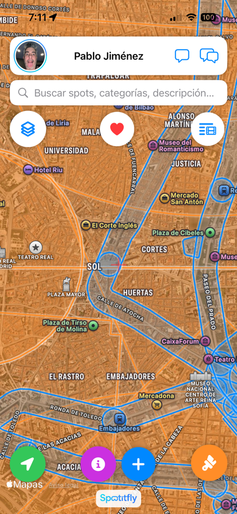
Find community-sourced flight spots with real-time airspace layers like CTR/TMA and urban zones to ensure you always fly legally and confidently.
Hyper-Local Flight Conditions
Plan ahead with 15-day hourly forecasts specifically for pilots. Track wind speeds and rain probability to protect your gear and nail the perfect cinematic shot.
The following screenshots and description are sourced directly from the app's official store listing and are the property of the app developer.
App Store
Screenshots
SpotItFly app interface showing a drone flight map with restricted airspace zones
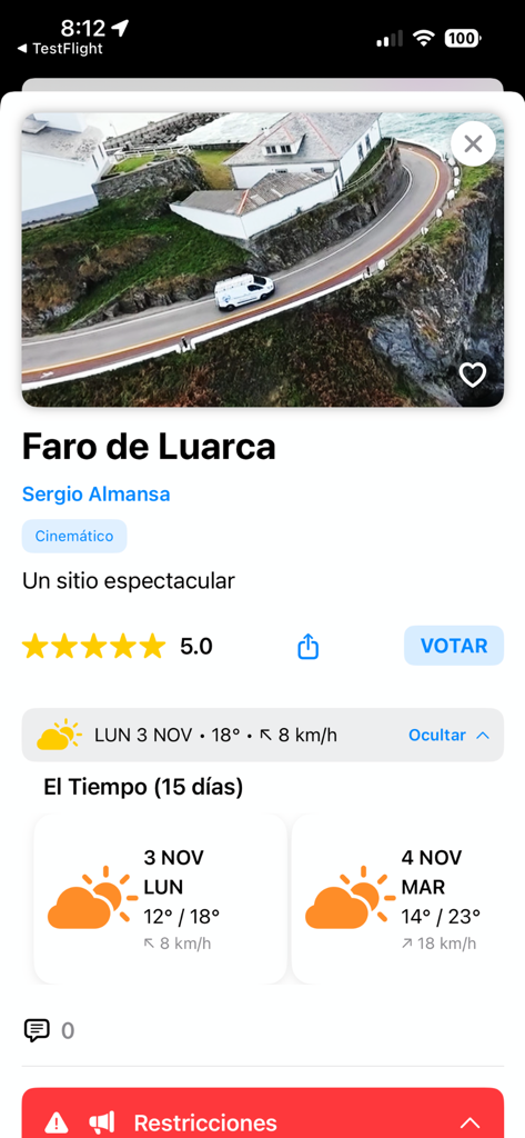
Drone flight spot details for Faro de Luarca on the SpotItFly app showing weather forecast and flight restrictions
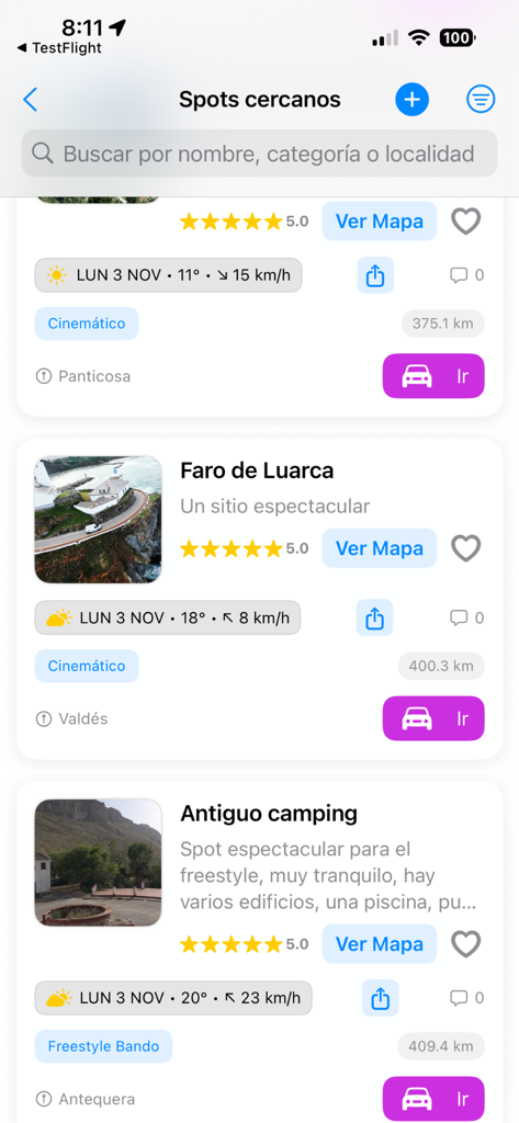
SpotItFly app interface showing a list of nearby drone flying spots with community photos, weather data, and ratings.
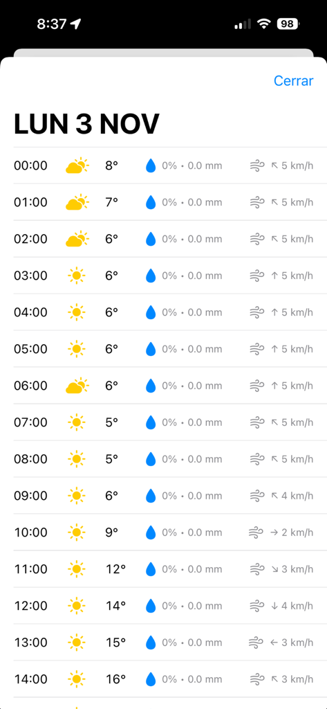
Hourly weather forecast in SpotItFly app showing wind speed and temperature for drone pilots
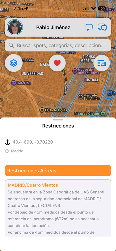
SpotItFly app interface showing a map of Madrid with drone flight restrictions and safety zones
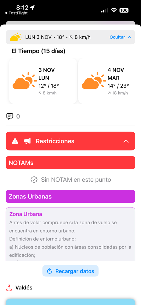
Mobile app interface showing drone flight weather forecast and airspace restrictions including urban zones and NOTAMs
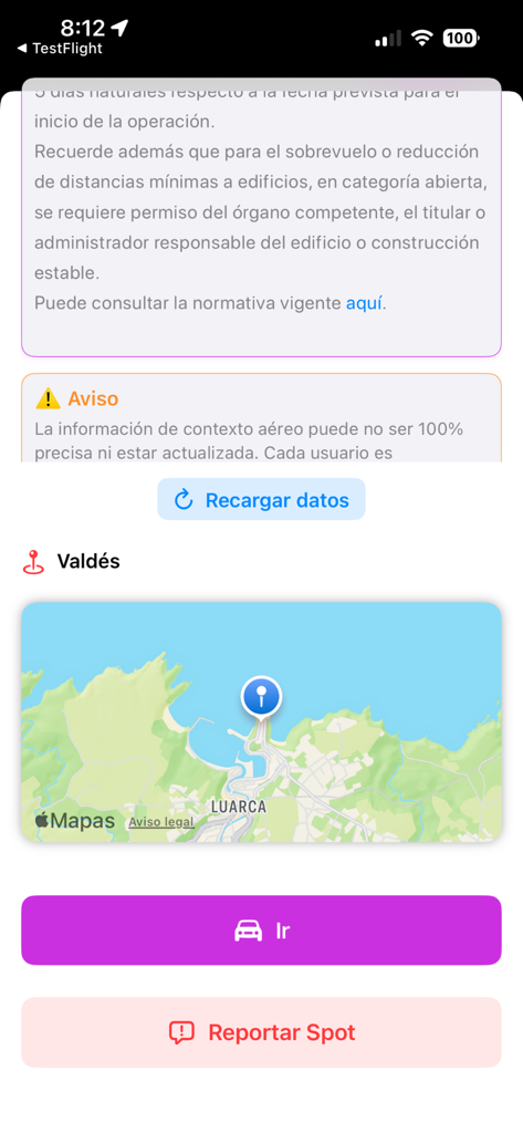
SpotItFly app screen displaying a drone flight location map for Valdes with a navigation button
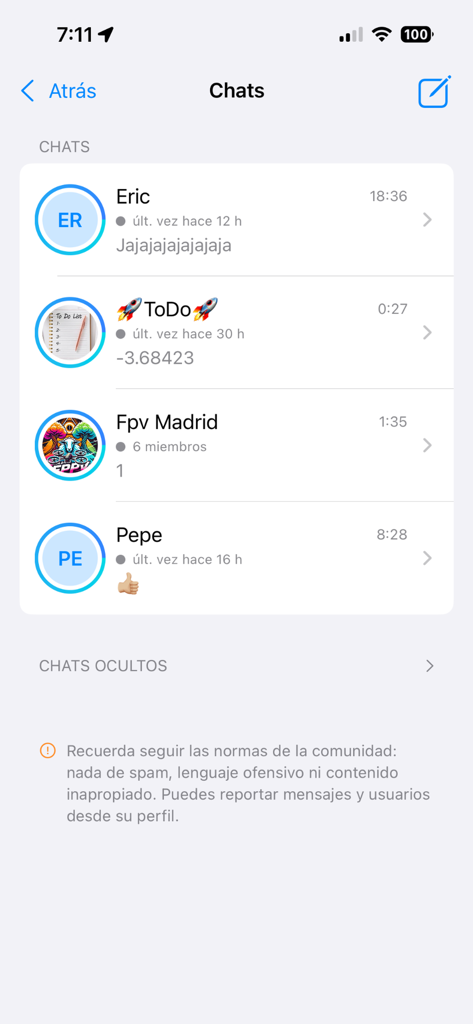
Interface of the SpotItFly app showing a list of active community chats and messages between drone pilots
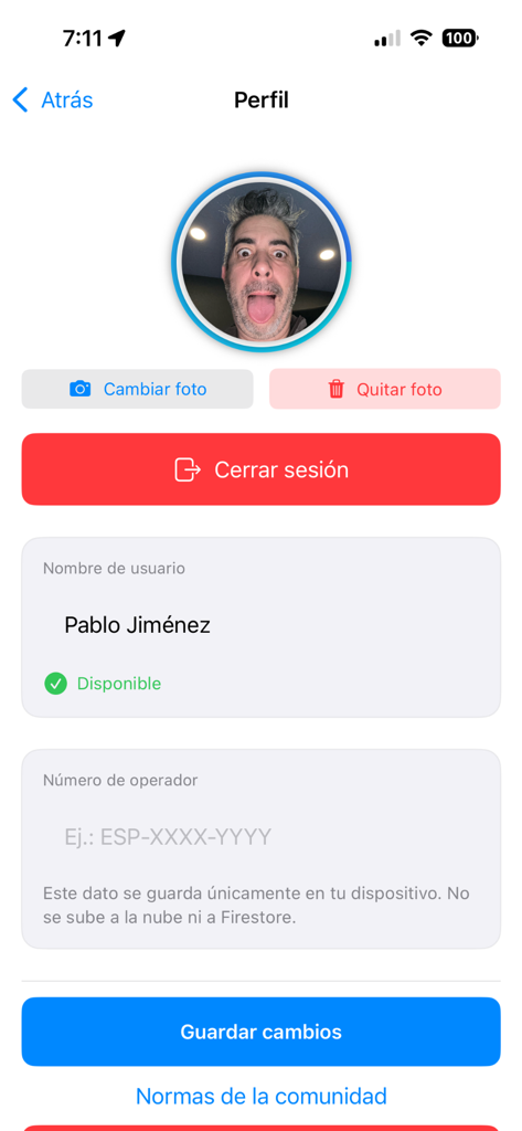
User profile and account settings page in the SpotItFly mobile app for drone pilots
Description
Download
More Like This
Top-ranked apps in the same category

Google Maps
Google LLC

AMap Global
AutoNavi Information Technology Co. Ltd.

Waze Navigation & Live Traffic
waze

百度地图-路线规划,出行必备
Beijing Baidu Netcom Science & Technology Co.,Ltd

Moovit: Bus & Transit Tracker
Moovit App Global LTD

Transit • Subway & Bus Times
9280-0366 Quebec inc.

ParkMobile: Park. Pay. Go.
Parkmobile USA, Inc

腾讯地图-路线规划,导航地铁打车出行
Shenzhen Tencent Computer Systems Company Limited

MapXplorer: Map Radar Navigate
GOLDLAB APPLICATIONS YAZILIM VE BILISIM ANONIM SIRKETI
This page is not an official page of the app or its developer, but an independent editorial publication created for informational and commentary purposes. Unless expressly stated otherwise, neither the app nor its developer is affiliated with, endorsed by, sponsored by, authorized by, or otherwise officially connected with MWM, Apple, Google Play, the app publisher, or the app's developer, and nothing on this page implies that the app was developed using MWM's services. Any trademarks, logos, screenshots, and other content remain the property of their respective owners.