This page is not an official page of the app or its developer, but an independent editorial publication created for informational and commentary purposes. Unless expressly stated otherwise, neither the app nor its developer is affiliated with, endorsed by, sponsored by, authorized by, or otherwise officially connected with MWM, Apple, Google Play, the app publisher, or the app's developer, and nothing on this page implies that the app was developed using MWM's services. Any trademarks, logos, screenshots, and other content remain the property of their respective owners.

Stroomatlas Noordzee
Navigate the complex currents of the North Sea, Wadden Sea, and Zeeland with 91 official HP33 charts licensed from the Royal Netherlands Navy—fully offline and optimized for your iPad and iPhone.
Downloads
29K+User Rating
Total Ratings
0Publisher
Category
NavigationLocales
1Latest Version
2.2Size
67.8 MBFirst Released
Jan 12, 2020Navigate with Military-Grade Precision
Master the world's most complex currents with the definitive tidal guide for the North Sea, featuring official hydrographic data for the serious offshore sailor.
Official HP33 Charts
Access all 91 current maps licensed directly from the Royal Netherlands Navy, providing the gold standard of accuracy for professional maritime navigation.
100% Offline Reliability
Essential for blue-water passages, every chart and tidal curve is available without a data connection, ensuring you are never without critical safety information.
The following screenshots and description are sourced directly from the app's official store listing and are the property of the app developer.
App Store
Screenshots
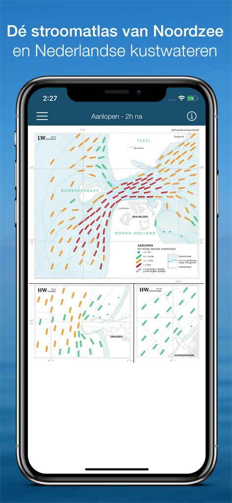
Smartphone screen displaying a detailed tidal current atlas of the North Sea with colored flow indicators
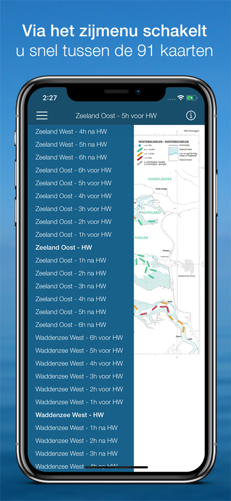
A smartphone screen showing the navigation menu for selecting nautical current maps in the Stroomatlas Noordzee app
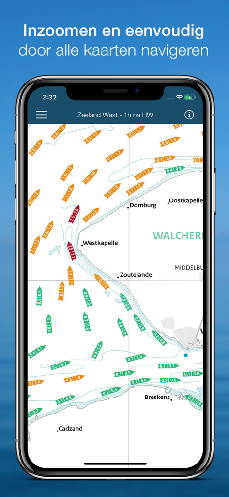
Stroomatlas Noordzee app screenshot showing a detailed nautical chart with tidal current arrows for the Dutch coastline
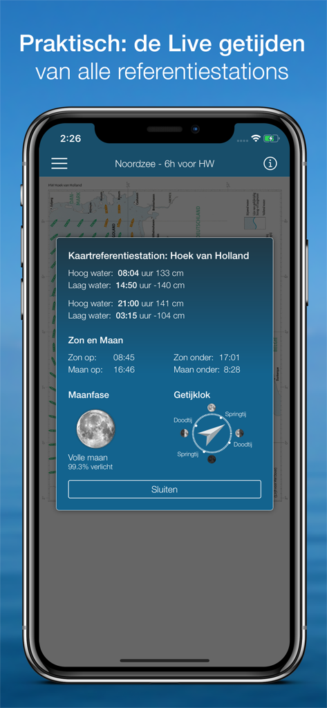
Mobile app interface displaying live tidal data moon phases and tide clock for Hoek van Holland
Description
Download
More Like This
Top-ranked apps in the same category

Google Maps
Google LLC

Waze Navigation & Live Traffic
waze

AMap Global
AutoNavi Information Technology Co. Ltd.

百度地图-路线规划,出行必备
Beijing Baidu Netcom Science & Technology Co.,Ltd

Moovit: Bus & Transit Tracker
Moovit App Global LTD

Transit • Subway & Bus Times
9280-0366 Quebec inc.

ParkMobile: Park. Pay. Go.
Parkmobile USA, Inc

腾讯地图-路线规划,导航地铁打车出行
Shenzhen Tencent Computer Systems Company Limited

Île-de-France Mobilités
Ile de France Mobilites
This page is not an official page of the app or its developer, but an independent editorial publication created for informational and commentary purposes. Unless expressly stated otherwise, neither the app nor its developer is affiliated with, endorsed by, sponsored by, authorized by, or otherwise officially connected with MWM, Apple, Google Play, the app publisher, or the app's developer, and nothing on this page implies that the app was developed using MWM's services. Any trademarks, logos, screenshots, and other content remain the property of their respective owners.