This page is not an official page of the app or its developer, but an independent editorial publication created for informational and commentary purposes. Unless expressly stated otherwise, neither the app nor its developer is affiliated with, endorsed by, sponsored by, authorized by, or otherwise officially connected with MWM, Apple, Google Play, the app publisher, or the app's developer, and nothing on this page implies that the app was developed using MWM's services. Any trademarks, logos, screenshots, and other content remain the property of their respective owners.

Topography Lite
The essential tool for engineers and architects to calculate land areas, convert coordinates, and seamlessly export DXF and KML files for AutoCAD and Google Earth.
Downloads
263K+User Rating
Total Ratings
0Publisher
Category
NavigationLocales
1Latest Version
5.0Size
4.8 MBFirst Released
Aug 24, 2013Professional Field Work, Simplified
Bridge the gap between the field and the office with powerful tools designed for civil engineers, architects, and surveyors.
Instant Surface Area Calculation
Calculate polygon areas in square meters with precision by walking the site with your GPS or selecting boundary points directly on the map.
Seamless CAD & GIS Exports
Skip the manual data entry. Export your measurements instantly as DXF, KML, or TXT files to open in AutoCAD, Google Earth, or professional GIS platforms.
The following screenshots and description are sourced directly from the app's official store listing and are the property of the app developer.
App Store
Screenshots
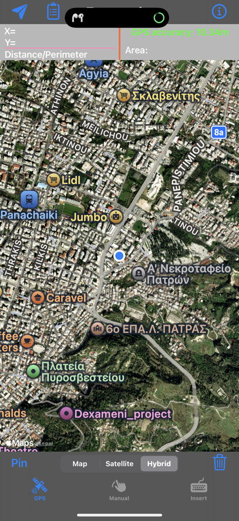
Interface of the Topography Lite app featuring a satellite map view for land surveying and area calculation
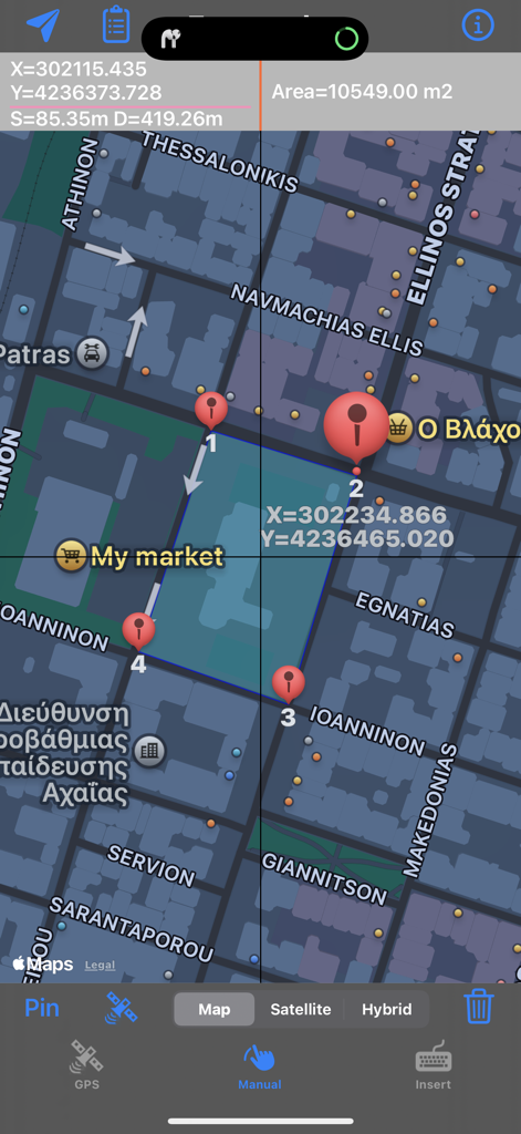
Topography Lite app showing a polygon land area measurement on a map with coordinates
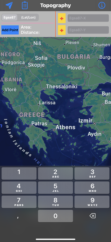
Topography Lite app screen showing map navigation and coordinate entry fields
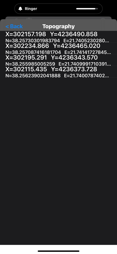
Topography Lite app screen showing a list of GPS survey coordinates with X and Y values
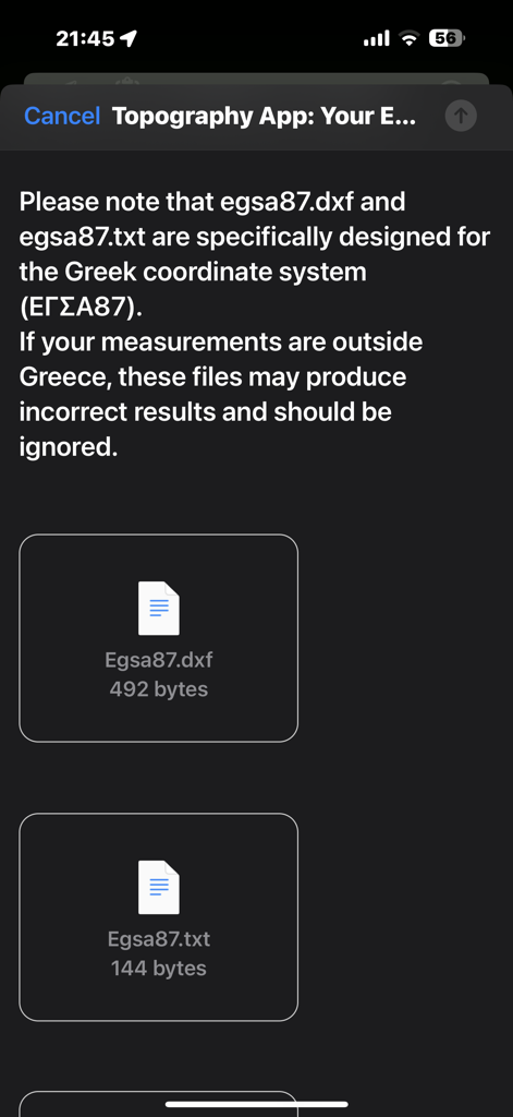
Export screen of Topography Lite app for Greek coordinate system files
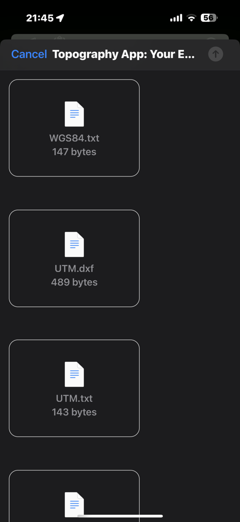
List of exportable survey data files in DXF and TXT formats within the Topography Lite app
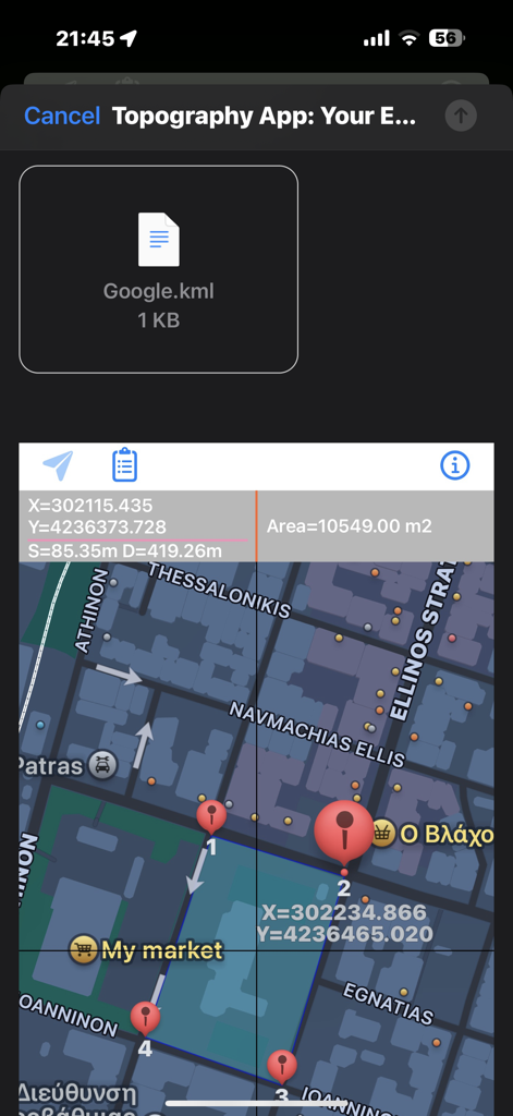
Map interface of Topography Lite app showing area measurement and KML file export
Description
Download
More Like This
Top-ranked apps in the same category

Google Maps
Google LLC

Waze Navigation & Live Traffic
waze

AMap Global
AutoNavi Information Technology Co. Ltd.

百度地图-路线规划,出行必备
Beijing Baidu Netcom Science & Technology Co.,Ltd

Moovit: Bus & Transit Tracker
Moovit App Global LTD

Transit • Subway & Bus Times
9280-0366 Quebec inc.

ParkMobile: Park. Pay. Go.
Parkmobile USA, Inc

腾讯地图-路线规划,导航地铁打车出行
Shenzhen Tencent Computer Systems Company Limited

Île-de-France Mobilités
Ile de France Mobilites
This page is not an official page of the app or its developer, but an independent editorial publication created for informational and commentary purposes. Unless expressly stated otherwise, neither the app nor its developer is affiliated with, endorsed by, sponsored by, authorized by, or otherwise officially connected with MWM, Apple, Google Play, the app publisher, or the app's developer, and nothing on this page implies that the app was developed using MWM's services. Any trademarks, logos, screenshots, and other content remain the property of their respective owners.