This page is not an official page of the app or its developer, but an independent editorial publication created for informational and commentary purposes. Unless expressly stated otherwise, neither the app nor its developer is affiliated with, endorsed by, sponsored by, authorized by, or otherwise officially connected with MWM, Apple, Google Play, the app publisher, or the app's developer, and nothing on this page implies that the app was developed using MWM's services. Any trademarks, logos, screenshots, and other content remain the property of their respective owners.

TouchTrails – Route Planner
The most intuitive route planner for hikers, cyclists, and explorers. Trace custom trails with your finger, analyze elevation profiles, and navigate the backcountry with confidence—even without cell service.
Downloads
1K+User Rating
Total Ratings
0Publisher
Category
NavigationLocales
6Latest Version
2.18.9Size
150.6 MBFirst Released
Sep 4, 2025Master Your Path with Ease
Stop following the pack and start designing your own journey. TouchTrails combines professional-grade GPS precision with a tactile interface built for the modern explorer.
Trace Your Vision
Instantly create custom routes by drawing with your finger. Get real-time elevation profiles and mileage stats as you sketch your next weekend escape.
Navigate the Dead Zones
Download offline maps and use turn-by-turn voice guidance to explore National Parks and remote wilderness with total confidence, even without cell service.
The following screenshots and description are sourced directly from the app's official store listing and are the property of the app developer.
App Store
Screenshots
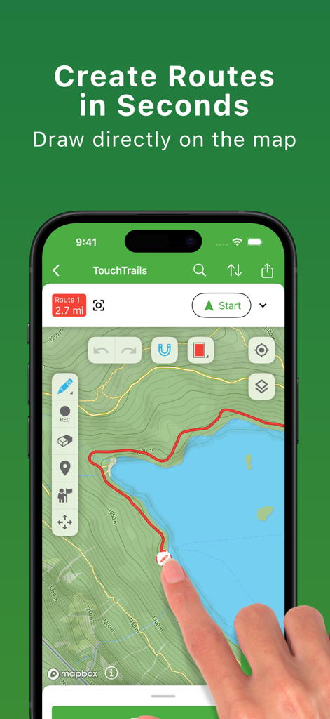
A hand drawing a custom route on a topographic map within the TouchTrails mobile app interface.
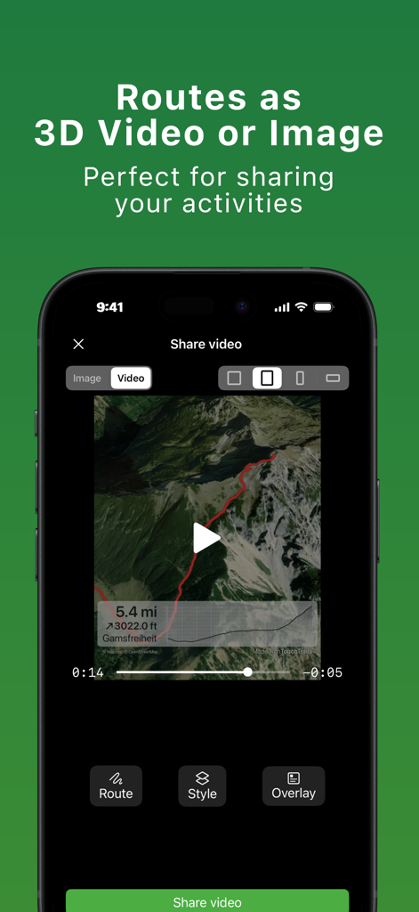
TouchTrails app interface showing a 3D route video of a mountain trail ready for sharing
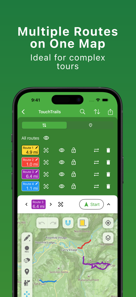
TouchTrails app screen showing multiple routes on one map for complex tours
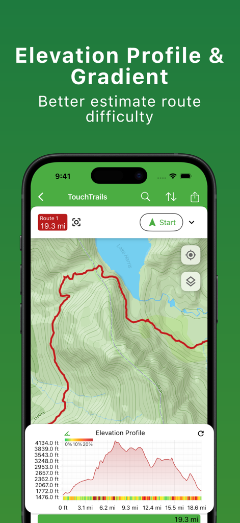
Elevation profile and gradient chart in the TouchTrails route planner app
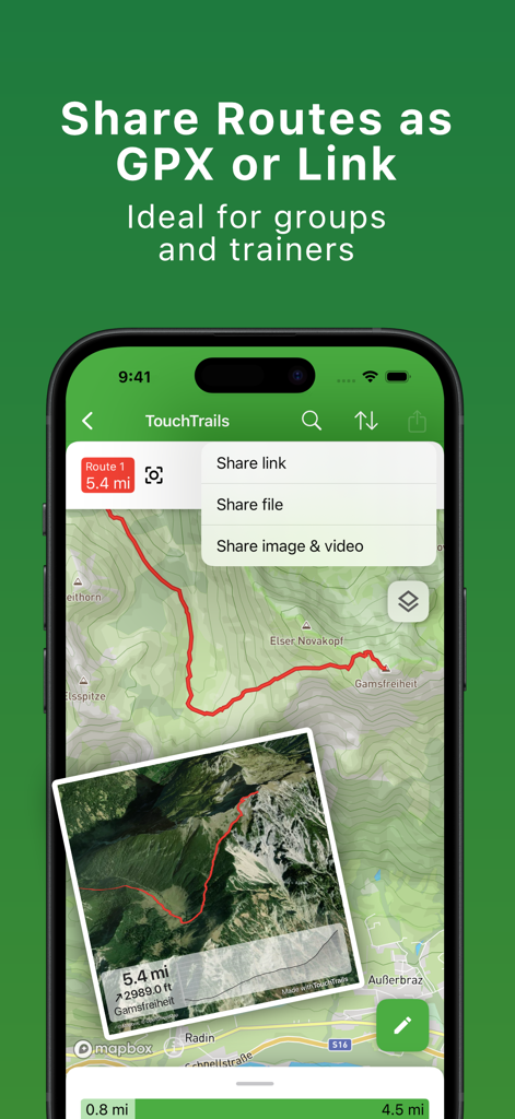
TouchTrails mobile app screen showing options to share outdoor routes as GPX files or links
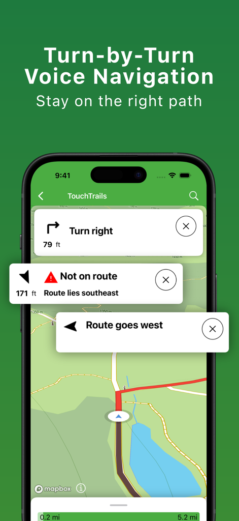
TouchTrails app showing turn by turn voice navigation and off route alerts on a map
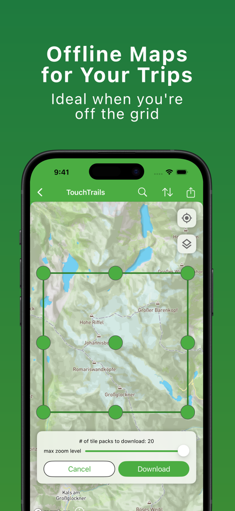
Interface of the TouchTrails app showing a map area selection for downloading offline maps
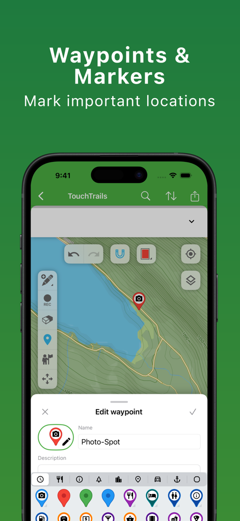
TouchTrails app interface for adding and editing custom waypoints and markers on a topographic map
Description
Download
More Like This
Top-ranked apps in the same category

Google Maps
Google LLC

AMap Global
AutoNavi Information Technology Co. Ltd.

Waze Navigation & Live Traffic
waze

百度地图-路线规划,出行必备
Beijing Baidu Netcom Science & Technology Co.,Ltd

Moovit: Bus & Transit Tracker
Moovit App Global LTD

腾讯地图-路线规划,导航地铁打车出行
Shenzhen Tencent Computer Systems Company Limited

Transit • Subway & Bus Times
9280-0366 Quebec inc.

ParkMobile: Park. Pay. Go.
Parkmobile USA, Inc

MapXplorer: Map Radar Navigate
GOLDLAB APPLICATIONS YAZILIM VE BILISIM ANONIM SIRKETI
This page is not an official page of the app or its developer, but an independent editorial publication created for informational and commentary purposes. Unless expressly stated otherwise, neither the app nor its developer is affiliated with, endorsed by, sponsored by, authorized by, or otherwise officially connected with MWM, Apple, Google Play, the app publisher, or the app's developer, and nothing on this page implies that the app was developed using MWM's services. Any trademarks, logos, screenshots, and other content remain the property of their respective owners.