This page is not an official page of the app or its developer, but an independent editorial publication created for informational and commentary purposes. Unless expressly stated otherwise, neither the app nor its developer is affiliated with, endorsed by, sponsored by, authorized by, or otherwise officially connected with MWM, Apple, Google Play, the app publisher, or the app's developer, and nothing on this page implies that the app was developed using MWM's services. Any trademarks, logos, screenshots, and other content remain the property of their respective owners.

TrailSmart: Great Trails
Plan with precision and navigate with confidence using detailed offline maps, elevation profiles, and a curated guide to accommodations. No internet required, no ads—just you and the journey.
Downloads
1K+User Rating
Total Ratings
0Publisher
Category
TravelLocales
4Latest Version
3.70Size
82.4 MBFirst Released
Mar 10, 2017Navigate Your Next Great Adventure
TrailSmart is the ultimate digital companion for the world's most iconic long-distance treks, providing expert-curated insights and total offline independence for the meticulous traveler.
Total Offline Independence
Navigate with confidence even in remote dead zones. Access all maps, guides, and trail data 100% offline to avoid roaming charges and stay safe without a signal.
Intelligent Wayfinding
Follow the yellow arrow. Our smart compass dynamically updates based on your location and chosen route, while live elevation profiles help you pace your day perfectly.
The following screenshots and description are sourced directly from the app's official store listing and are the property of the app developer.
App Store
Screenshots
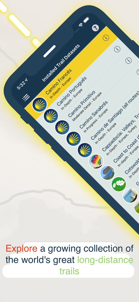
TrailSmart app screen showing a list of installed long-distance trail datasets including Camino de Santiago.
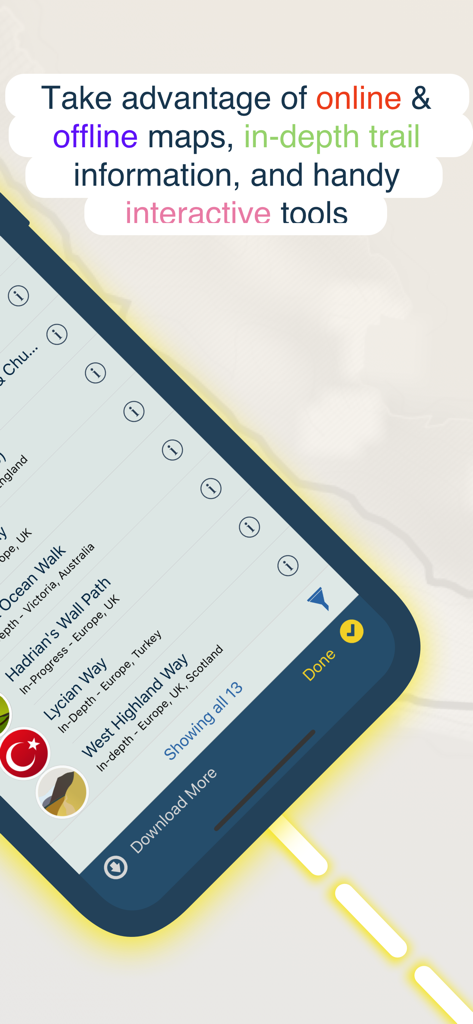
A mobile app interface for TrailSmart showing a list of global hiking trails and offline map features.
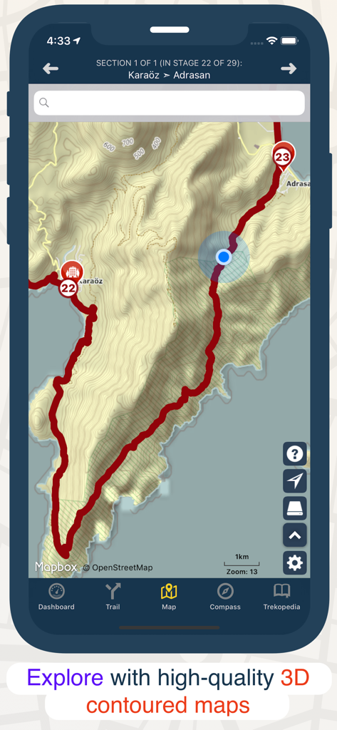
Smartphone screen showing the TrailSmart app with a 3D contoured hiking map and trail route
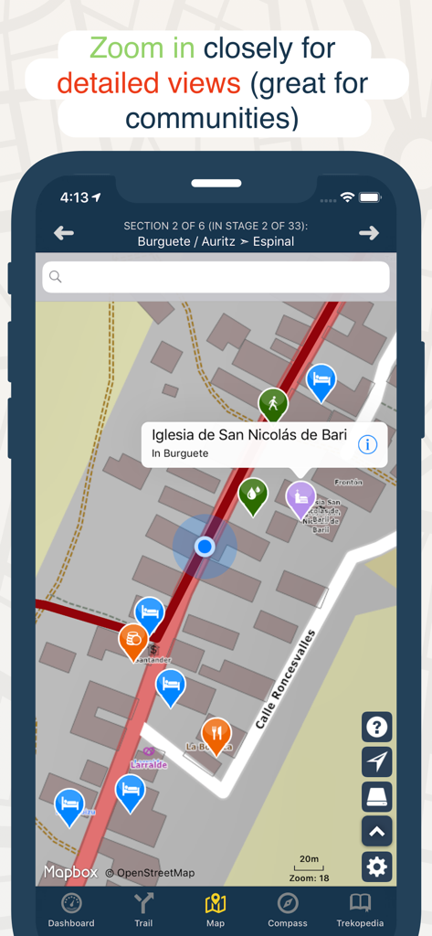
A zoomed-in map view in the TrailSmart app showing icons for accommodation, dining, and landmarks along a hiking trail.
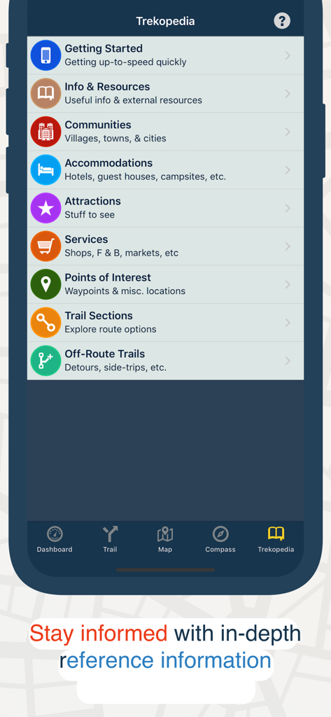
TrailSmart app Trekopedia screen displaying reference categories for hiking trails including accommodations and points of interest.
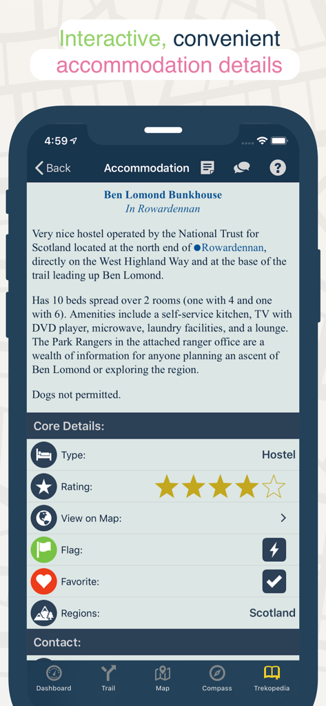
Smartphone screen showing detailed information for a hostel on a long distance hiking trail including ratings and amenities.
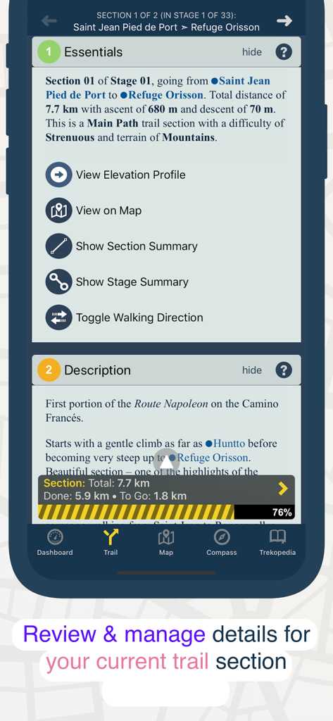
Detailed view of a trail section in the TrailSmart app showing distance elevation and description
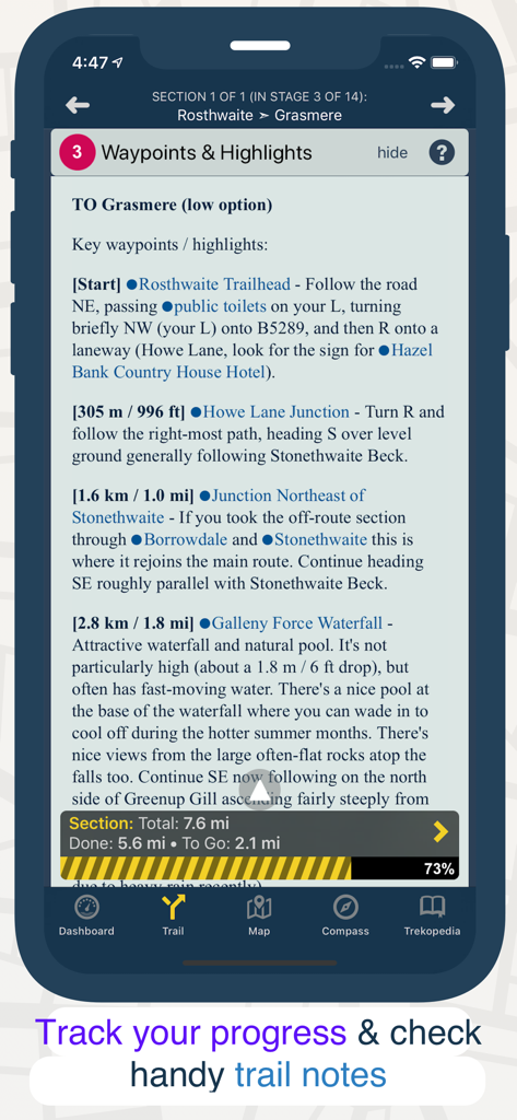
TrailSmart app interface displaying detailed hiking waypoints and a section progress tracker.
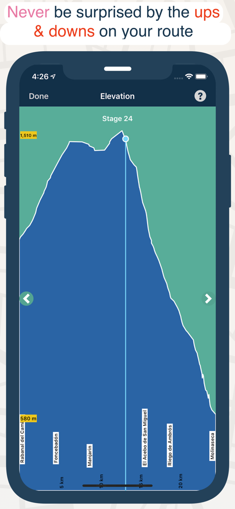
A mobile app screenshot showing a detailed elevation profile chart for a hiking trail stage with altitude and distance markers.
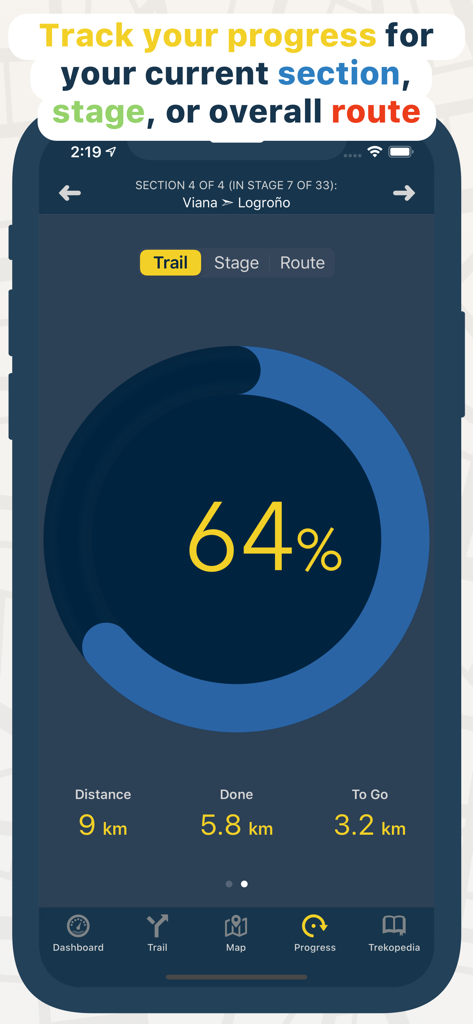
Progress tracking screen in the TrailSmart app showing distance completed and percentage for a hiking trail section.
Description
Download
More Like This
Apps with similar features and user experience


This page is not an official page of the app or its developer, but an independent editorial publication created for informational and commentary purposes. Unless expressly stated otherwise, neither the app nor its developer is affiliated with, endorsed by, sponsored by, authorized by, or otherwise officially connected with MWM, Apple, Google Play, the app publisher, or the app's developer, and nothing on this page implies that the app was developed using MWM's services. Any trademarks, logos, screenshots, and other content remain the property of their respective owners.