This page is not an official page of the app or its developer, but an independent editorial publication created for informational and commentary purposes. Unless expressly stated otherwise, neither the app nor its developer is affiliated with, endorsed by, sponsored by, authorized by, or otherwise officially connected with MWM, Apple, Google Play, the app publisher, or the app's developer, and nothing on this page implies that the app was developed using MWM's services. Any trademarks, logos, screenshots, and other content remain the property of their respective owners.

UTM Geo Map Y2Tech
Transform your device into a professional-grade handheld GPS. Capture high-accuracy UTM/MGRS coordinates, generate contours, and perform field stake-outs with offline spatial analysis tools built for engineers and geologists.
Downloads
5K+User Rating
Total Ratings
0Publisher
Category
NavigationLocales
6Latest Version
1.0.11Size
21.3 MBFirst Released
Oct 28, 2025Professional GIS & Surveying Power in Your Pocket
Equip your team with a professional-grade toolkit for high-precision coordinate tracking, spatial analysis, and field mapping—designed to replace expensive handheld GPS units.
Pro-Grade Offline Precision
Capture UTM, MGRS, and MSL elevation data with sub-meter precision even in remote, off-grid locations without cell service.
Advanced Spatial Analysis
Perform complex GIS operations like Buffering, Overlays, and Stake Outs directly in the field. Calculate area and distance with professional accuracy.
Frequently Asked Questions
Everything you need to know about UTM Geo Map Y2Tech
What is UTM Geo Map Y2Tech?
UTM Geo Map Y2Tech is a free, simple application for land surveying, topography, bathymetry, and GIS. It offers tools for coordinates, spatial analysis, and measurements, suitable for various engineering and geological disciplines.
Is UTM Geo Map Y2Tech a free application?
Yes, UTM Geo Map Y2Tech is a free application. It provides extensive features for land surveying and GIS. Some specific modules, like MSL elevation, Contours, and Elevation Profile, are premium features requiring purchase.
Can I use UTM Geo Map Y2Tech without an internet connection?
Yes, UTM Geo Map Y2Tech includes an Offline GPS module. This allows users to obtain latitude longitude, UTM, MGRS coordinates, and elevation data without requiring an internet connection.
What types of coordinates can UTM Geo Map Y2Tech obtain?
UTM Geo Map Y2Tech obtains Latitude Longitude, UTM, MGRS, and other Coordinate Reference Systems using EPSG Codes. It also provides MSL elevation (premium) and allows plotting points with comprehensive data.
How does UTM Geo Map Y2Tech perform area and distance measurements?
UTM Geo Map Y2Tech measures area and distance with various units, registers lines/polygons, and automatically creates polygons. It supports spatial editing features like Snap Nearest and can store unlimited data.
Does UTM Geo Map Y2Tech support spatial analysis like buffering and overlay?
Yes, UTM Geo Map Y2Tech includes a simple GIS module for spatial analysis. It performs buffering and overlays with options like Union, Intersection, Difference, and Symmetrical Difference, including negative buffers for polygons.
How can I generate contour lines in UTM Geo Map Y2Tech?
UTM Geo Map Y2Tech features a premium Contours module. This module generates contours based on the desired number of contour lines, elevation, or specified contour interval. An internet connection is required.
Can UTM Geo Map Y2Tech convert coordinate formats?
Yes, UTM Geo Map Y2Tech features a Coordinates Converter module. It converts coordinates manually between Latitude Longitude, UTM, and MGRS. The module also supports geocoding, converting addresses to coordinates.
What export formats does UTM Geo Map Y2Tech support for saved points?
UTM Geo Map Y2Tech supports exporting saved points to CSV or KML files. This functionality is available for points plotted via Map Coordinates and data stored through the Offline GPS module.
How does UTM Geo Map Y2Tech assist with finding a location in the field?
UTM Geo Map Y2Tech offers a "Find Point" module. This module helps users locate specific coordinates in the field using the device's built-in GPS and compass for stake-out operations.
The following screenshots and description are sourced directly from the app's official store listing and are the property of the app developer.
App Store
Screenshots
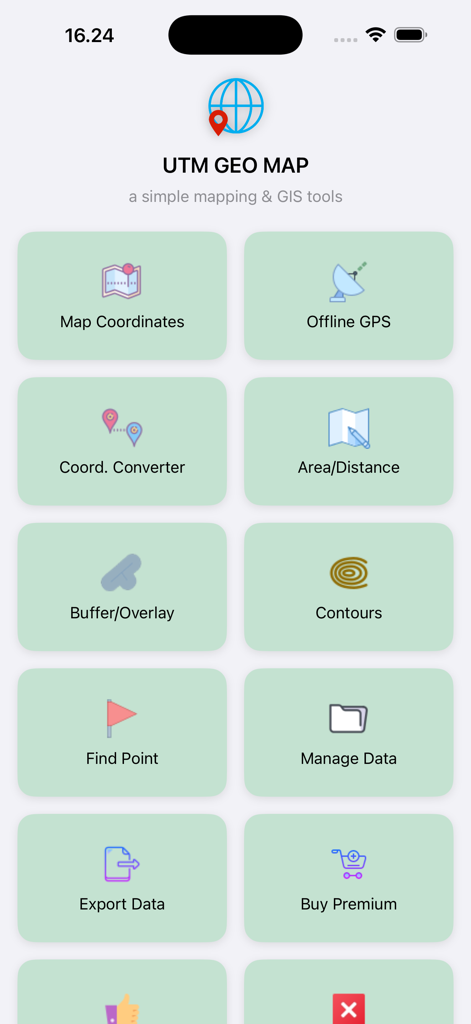
Main menu of the UTM Geo Map app showing professional GIS and land surveying tool modules
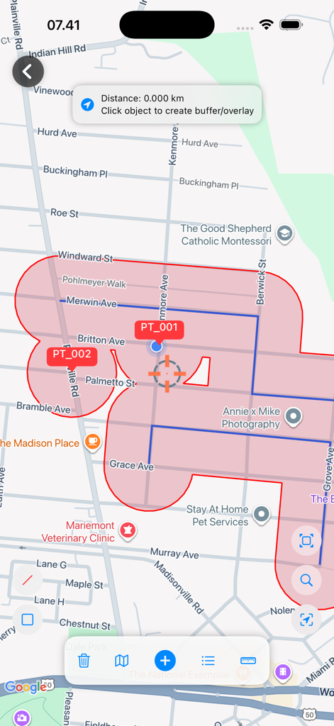
Mobile GIS interface showing a red buffer zone and spatial analysis on a street map
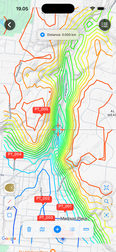
UTM Geo Map interface showing topographical contour lines and survey points
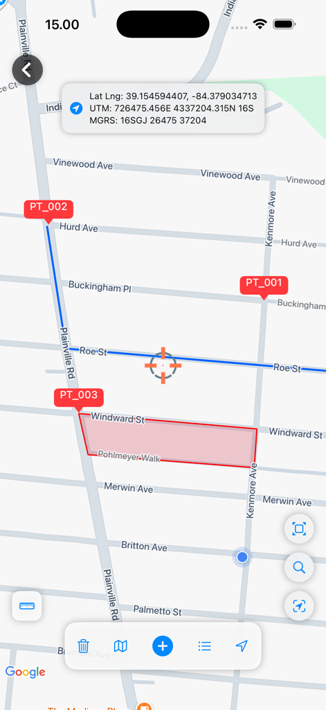
UTM Geo Map interface displaying land surveying markers and area polygon with UTM and MGRS coordinates
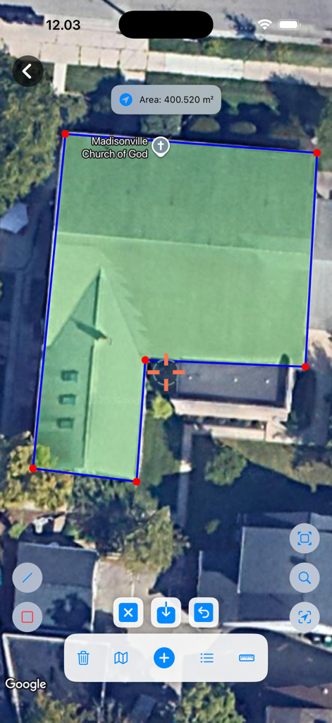
Satellite view of the UTM Geo Map app showing a polygon area measurement of a building
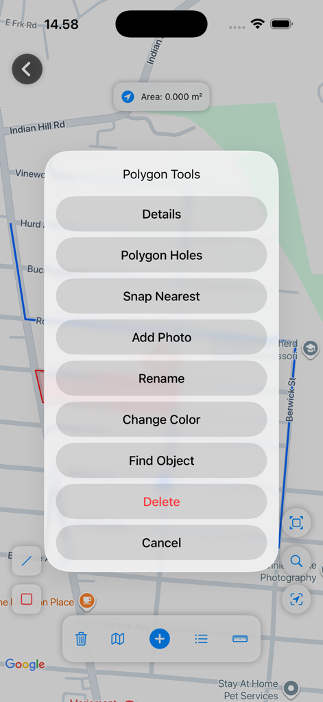
Polygon Tools menu in UTM Geo Map app interface with mapping options
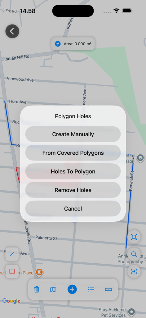
Polygon holes menu options in the UTM Geo Map surveying application
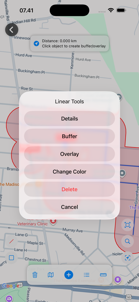
UTM Geo Map interface showing linear GIS tools like buffer and overlay on a street map.
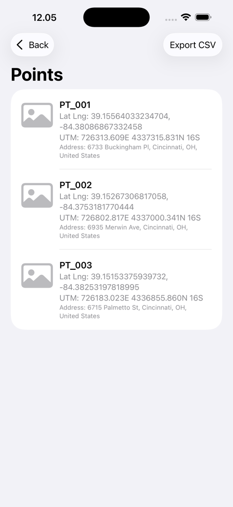
A list of registered geographic points showing UTM and latitude longitude coordinates

Navigation screen showing target coordinates and distance for professional stake out tasks
Description
Download
More Like This
Top-ranked apps in the same category

Google Maps
Google LLC

Waze Navigation & Live Traffic
waze

AMap Global
AutoNavi Information Technology Co. Ltd.

百度地图-路线规划,出行必备
Beijing Baidu Netcom Science & Technology Co.,Ltd

Moovit: Bus & Transit Tracker
Moovit App Global LTD

Transit • Subway & Bus Times
9280-0366 Quebec inc.

ParkMobile: Park. Pay. Go.
Parkmobile USA, Inc

腾讯地图-路线规划,导航地铁打车出行
Shenzhen Tencent Computer Systems Company Limited

Île-de-France Mobilités
Ile de France Mobilites
This page is not an official page of the app or its developer, but an independent editorial publication created for informational and commentary purposes. Unless expressly stated otherwise, neither the app nor its developer is affiliated with, endorsed by, sponsored by, authorized by, or otherwise officially connected with MWM, Apple, Google Play, the app publisher, or the app's developer, and nothing on this page implies that the app was developed using MWM's services. Any trademarks, logos, screenshots, and other content remain the property of their respective owners.