This page is not an official page of the app or its developer, but an independent editorial publication created for informational and commentary purposes. Unless expressly stated otherwise, neither the app nor its developer is affiliated with, endorsed by, sponsored by, authorized by, or otherwise officially connected with MWM, Apple, Google Play, the app publisher, or the app's developer, and nothing on this page implies that the app was developed using MWM's services. Any trademarks, logos, screenshots, and other content remain the property of their respective owners.

WinGPS Marine Plus
Navigate with confidence using expert route planning, real-time AIS tracking, and detailed waterway data tailored for serious mariners, coastal cruisers, and Great Loop adventurers.
Downloads
12K+User Rating
Total Ratings
0Publisher
Category
NavigationLocales
3Latest Version
1.39Size
59.6 MBFirst Released
Dec 11, 2020Professional-Grade Navigation for the Modern Captain
From open-sea voyages to complex inland waterways, WinGPS Marine Plus delivers the precision, safety features, and real-time data required for expert vessel management.
Real-Time AIS Awareness
Navigate busy coastal channels and shipping lanes safely by plotting nearby AIS objects directly onto your high-definition nautical charts.
Vessel-Specific Routing
Generate optimized passages tailored to your boat's dimensions, accounting for bridge clearances, lock schedules, and inland waterway data.
The following screenshots and description are sourced directly from the app's official store listing and are the property of the app developer.
App Store
Screenshots
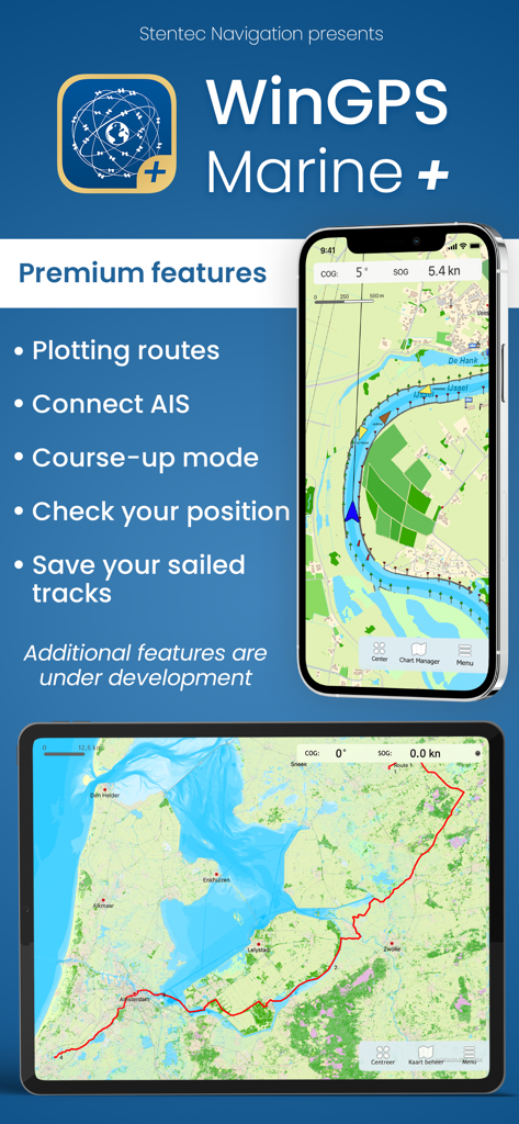
WinGPS Marine Plus app interface showing nautical charts and navigation features on mobile devices
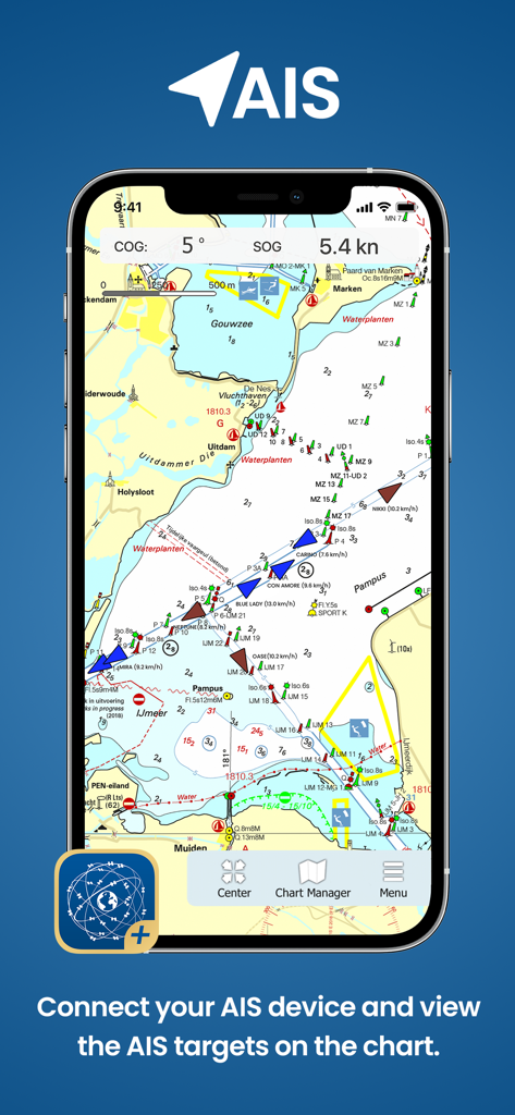
WinGPS Marine Plus app showing AIS vessel tracking on a nautical chart
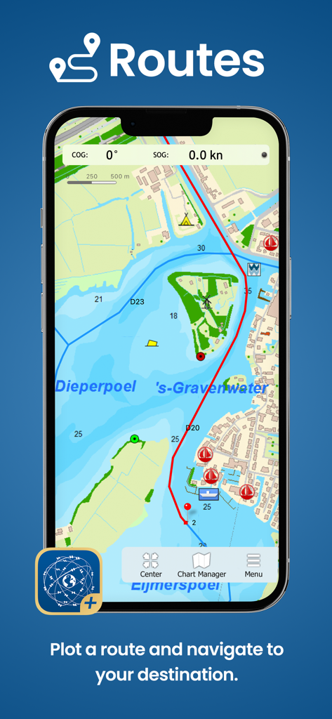
Smartphone screen showing the WinGPS Marine Plus app plotting a nautical route on a maritime chart.
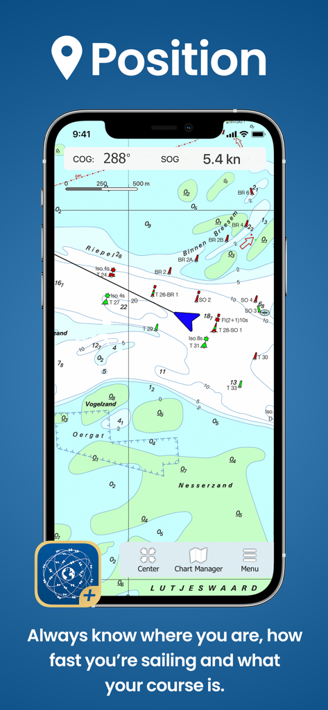
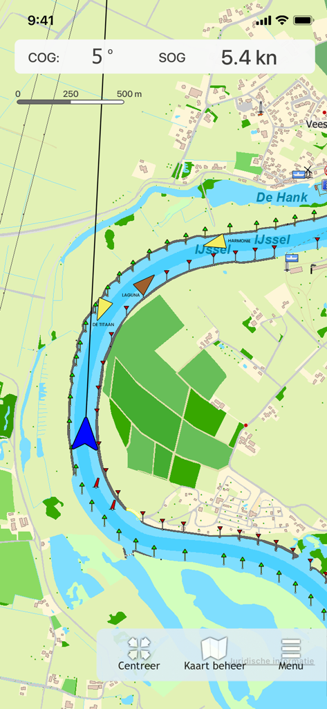
WinGPS Marine Plus app interface showing nautical chart with current vessel position and speed.
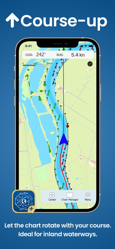
WinGPS Marine Plus app displaying course up chart rotation for inland navigation
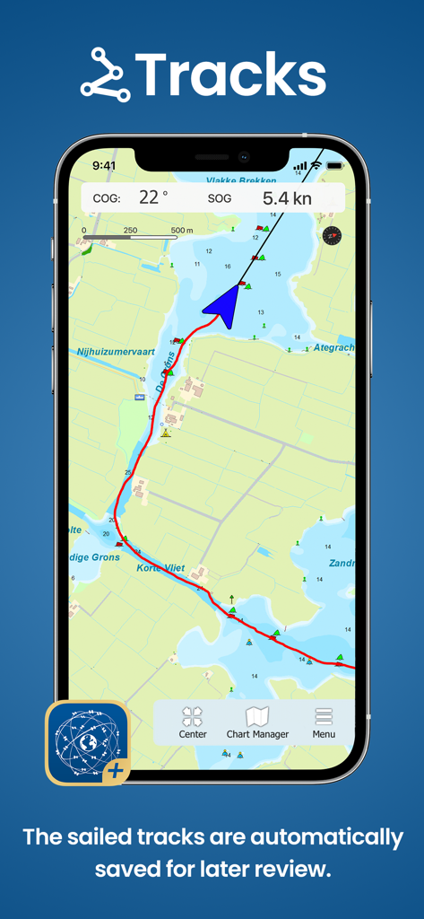
WinGPS Marine Plus app interface displaying a saved nautical track on a chart
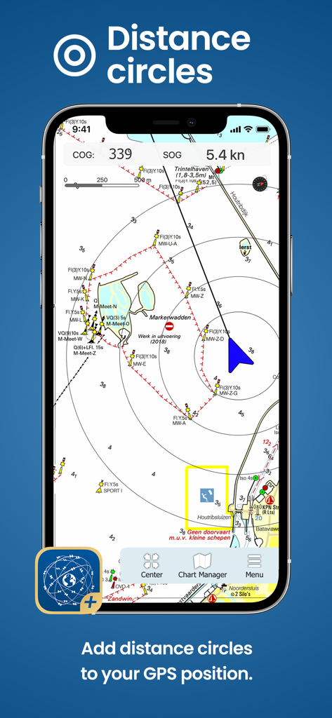
WinGPS Marine Plus app showing distance circles around the boat position on a digital nautical chart
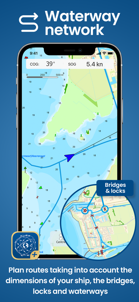
Smartphone showing WinGPS Marine Plus app with nautical chart and waterway network details
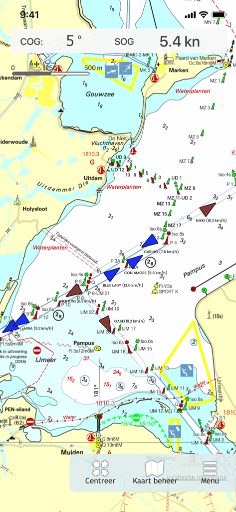
WinGPS Marine Plus navigation map showing AIS vessel tracking and nautical markers on a river.
WinGPS Marine Plus app showing a maritime navigation chart with real-time AIS ship tracking and nautical data
Description
Download
More Like This
Top-ranked apps in the same category

Google Maps
Google LLC

Waze Navigation & Live Traffic
waze

AMap Global
AutoNavi Information Technology Co. Ltd.

百度地图-路线规划,出行必备
Beijing Baidu Netcom Science & Technology Co.,Ltd

Moovit: Bus & Transit Tracker
Moovit App Global LTD

Transit • Subway & Bus Times
9280-0366 Quebec inc.

ParkMobile: Park. Pay. Go.
Parkmobile USA, Inc

腾讯地图-路线规划,导航地铁打车出行
Shenzhen Tencent Computer Systems Company Limited

Île-de-France Mobilités
Ile de France Mobilites
This page is not an official page of the app or its developer, but an independent editorial publication created for informational and commentary purposes. Unless expressly stated otherwise, neither the app nor its developer is affiliated with, endorsed by, sponsored by, authorized by, or otherwise officially connected with MWM, Apple, Google Play, the app publisher, or the app's developer, and nothing on this page implies that the app was developed using MWM's services. Any trademarks, logos, screenshots, and other content remain the property of their respective owners.