This page is not an official page of the app or its developer, but an independent editorial publication created for informational and commentary purposes. Unless expressly stated otherwise, neither the app nor its developer is affiliated with, endorsed by, sponsored by, authorized by, or otherwise officially connected with MWM, Apple, Google Play, the app publisher, or the app's developer, and nothing on this page implies that the app was developed using MWM's services. Any trademarks, logos, screenshots, and other content remain the property of their respective owners.

World atlas & map MxGeo Pro
Master the world with professional-grade geopolitical data, historical maps, and expert quizzes. Designed for lifelong learners and professionals who value depth, accuracy, and total offline access.
Downloads
116K+User Rating
Total Ratings
400Publisher
Category
EducationLocales
11Latest Version
9.6.1Size
258.9 MBFirst Released
Jul 13, 2016Your Ultimate Global Reference
A professional-grade atlas designed for those who value accuracy, depth, and the power of knowledge, whether for study, work, or curiosity.
Explore Time and Space
Dive into high-resolution political maps or travel back in history with specialized layers from 1900, 1930, and 1960.
Data-Driven Insights
Analyze the world through statistical lens with choropleth maps covering GDP, population trends, and HDI for over 260 territories.
The following screenshots and description are sourced directly from the app's official store listing and are the property of the app developer.
App Store
Screenshots
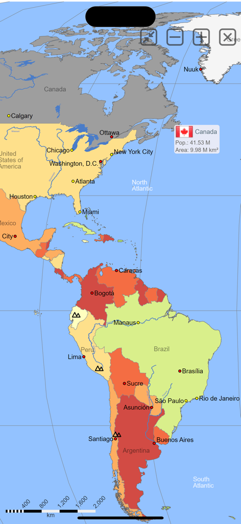
Digital world map from MxGeo Pro app showing North and South America with city labels and country data
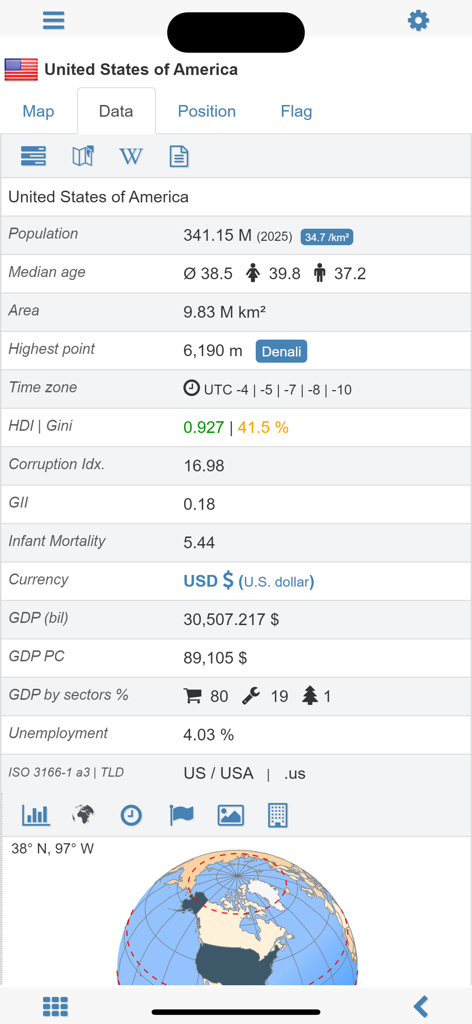
A detailed statistical overview of the United States including population, GDP, and HDI within the World Atlas MxGeo Pro app.
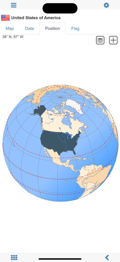
Digital globe view highlighting the geographic location of the United States in the MxGeo Pro world atlas app.
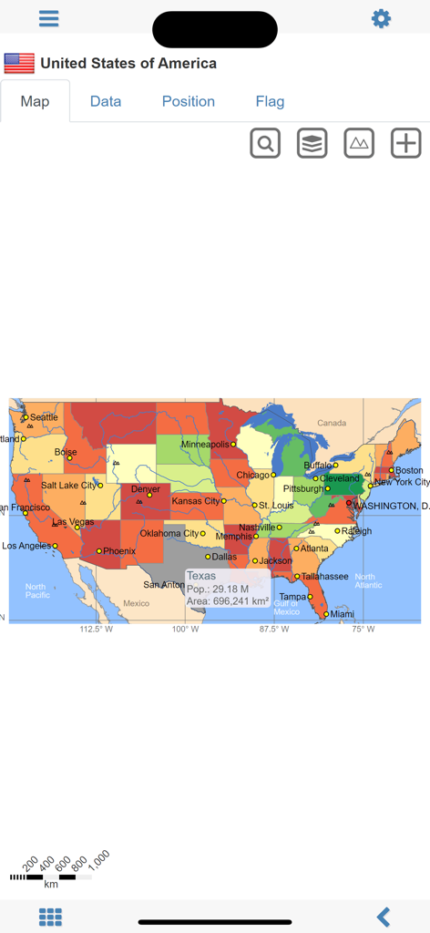
A choropleth map of the United States with population and area data for Texas in the MxGeo Pro app
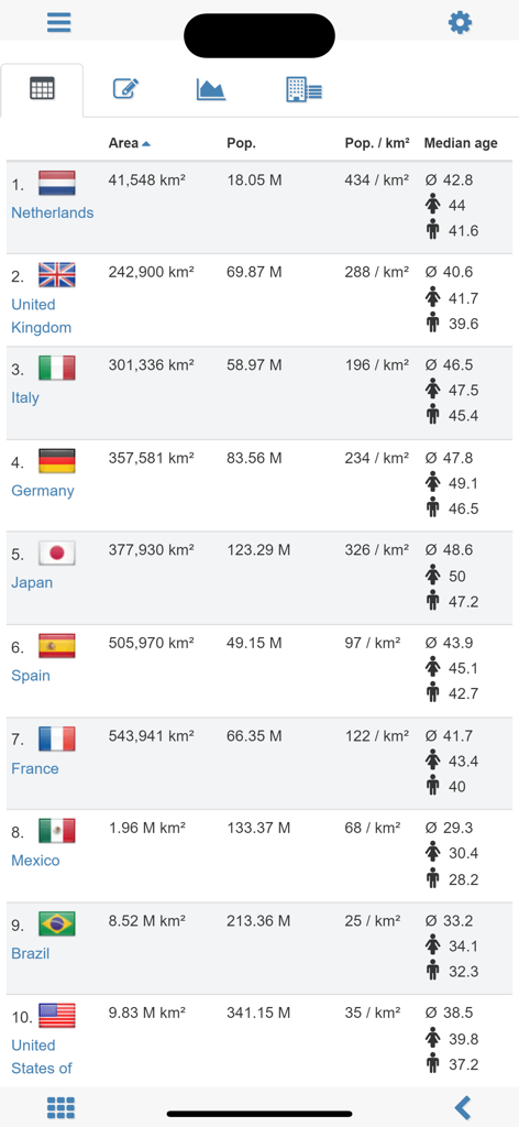
A data table in the World atlas MxGeo Pro app showing country statistics like area population and median age
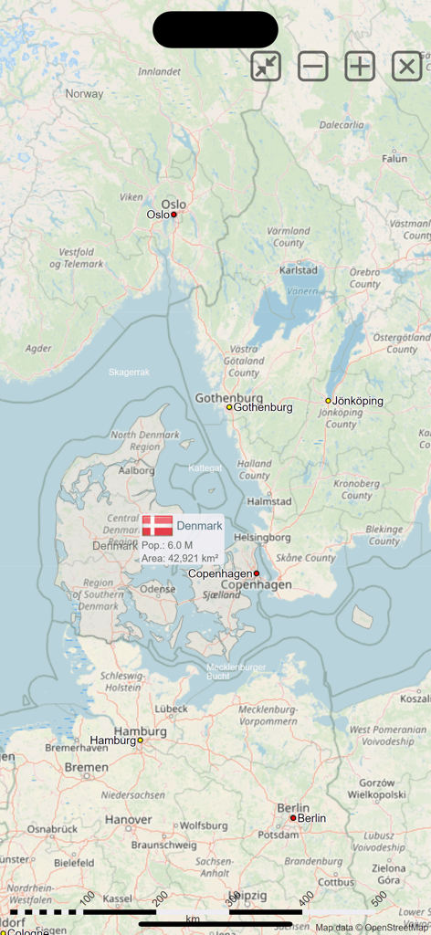
A detailed map of Northern Europe in the MxGeo Pro app featuring a popup with population and area data for Denmark
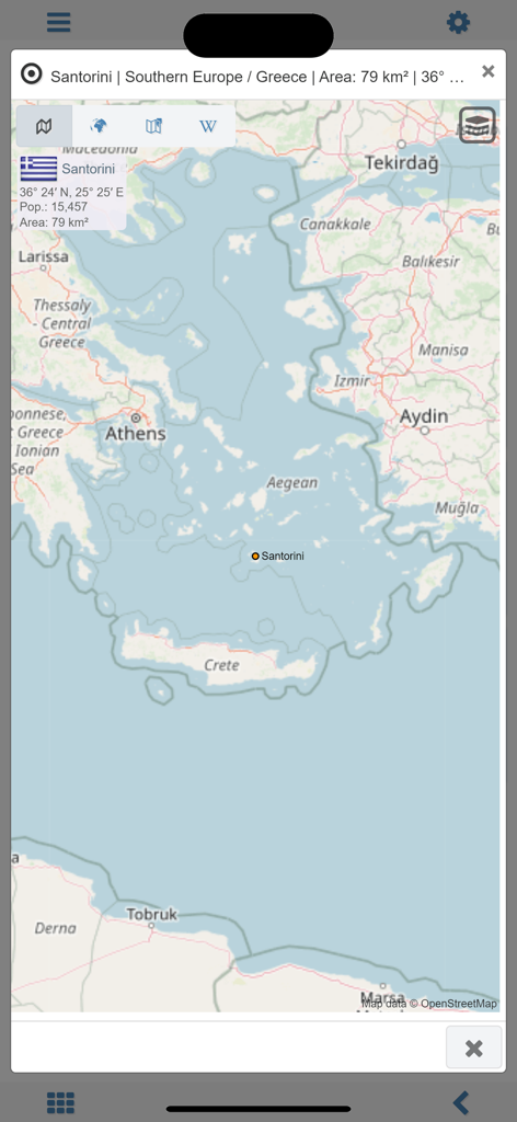
A detailed geographical map of Santorini Greece showing population and area statistics in the World atlas and map MxGeo Pro app
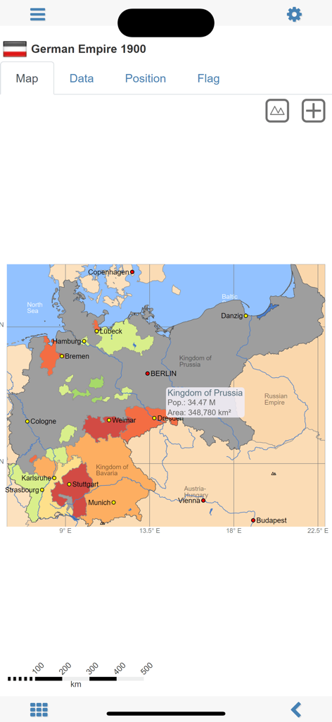
Historical map of the German Empire in 1900 from the MxGeo Pro app showing regional borders and population data
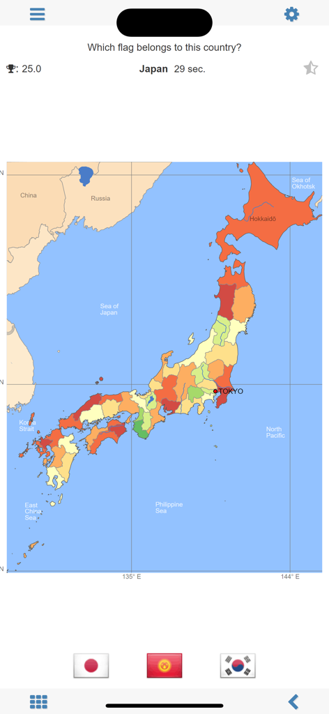
Geography quiz interface in the World atlas and map MxGeo Pro app asking to identify the flag of Japan with three multiple-choice options.
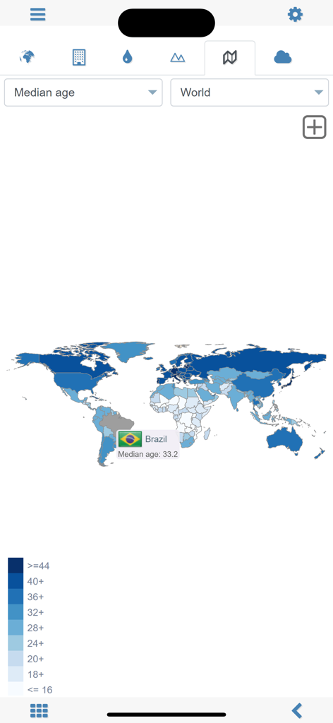
World choropleth map showing median age statistics with Brazil highlighted in the MxGeo Pro app
Description
Download
More Like This
Top-ranked apps in the same category

Duolingo - Language Lessons
Duolingo, Inc

Speak & Learn English: Learna
DEEP FLOW SOFTWARE SERVICES - FZCO

驾考宝典-科一科四驾驶证考试驾考通
Wuhan Jiakaobaodian Information Service Co., Ltd.

Toca Boca World
Toca Boca AB

Google Classroom
Google LLC

作业帮-中小学家长作业检查和辅导工具
Guangzhou Polar Future Culture Technology Co., Ltd

学信网
Student Information Consultation Service Co., Ltd.

Gauth: AI Study Companion
GAUTHTECH PTE. LTD.

ArtWorkout: Learn How to Draw
Aleksandr Ulitin
This page is not an official page of the app or its developer, but an independent editorial publication created for informational and commentary purposes. Unless expressly stated otherwise, neither the app nor its developer is affiliated with, endorsed by, sponsored by, authorized by, or otherwise officially connected with MWM, Apple, Google Play, the app publisher, or the app's developer, and nothing on this page implies that the app was developed using MWM's services. Any trademarks, logos, screenshots, and other content remain the property of their respective owners.