This page is not an official page of the app or its developer, but an independent editorial publication created for informational and commentary purposes. Unless expressly stated otherwise, neither the app nor its developer is affiliated with, endorsed by, sponsored by, authorized by, or otherwise officially connected with MWM, Apple, Google Play, the app publisher, or the app's developer, and nothing on this page implies that the app was developed using MWM's services. Any trademarks, logos, screenshots, and other content remain the property of their respective owners.

World atlas & world map MxGeo
Master world geography with interactive political maps, in-depth statistical data, and engaging quizzes. Explore over 260 countries in a premium, ad-free environment designed for lifelong learners and curious minds alike.
Downloads
175K+User Rating
Total Ratings
100Publisher
Category
EducationLocales
11Latest Version
9.5.5Size
123.4 MBFirst Released
Jul 15, 2016Master World Geography & Global Data
The comprehensive digital almanac designed for curious minds, students, and travelers seeking accurate global insights.
Deep Statistical Insights
Access comprehensive data including HDI, population growth, and economic stats for over 260 countries and territories.
Interactive Trivia Challenges
Master flags, capitals, and borders through gamified quizzes designed for students and lifelong learners alike.
The following screenshots and description are sourced directly from the app's official store listing and are the property of the app developer.
App Store
Screenshots
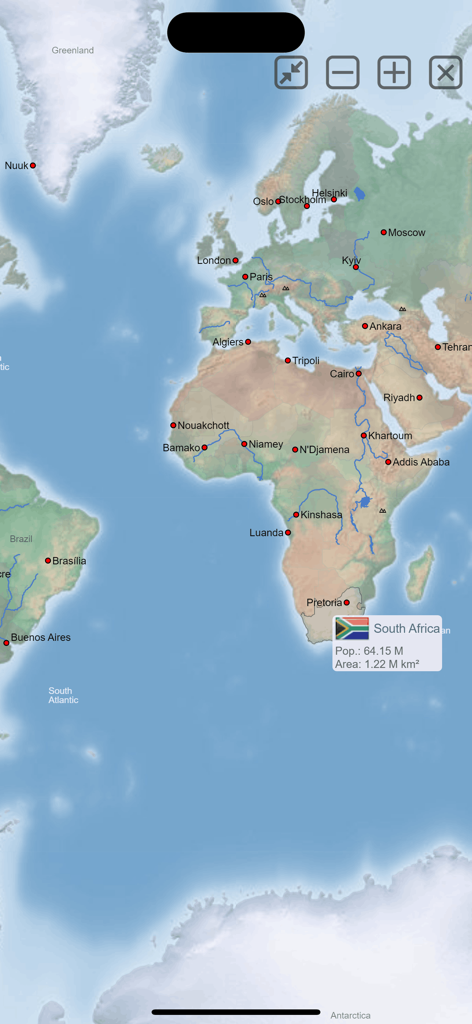
MxGeo world atlas app map interface showing statistics for South Africa
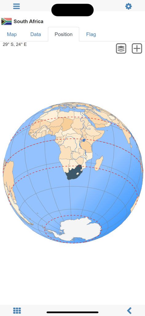
Screenshot of the World Atlas MxGeo app showing the position of South Africa on a 3D globe
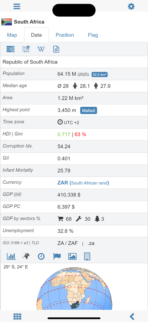
Detailed demographic and economic statistics for South Africa in the MxGeo app
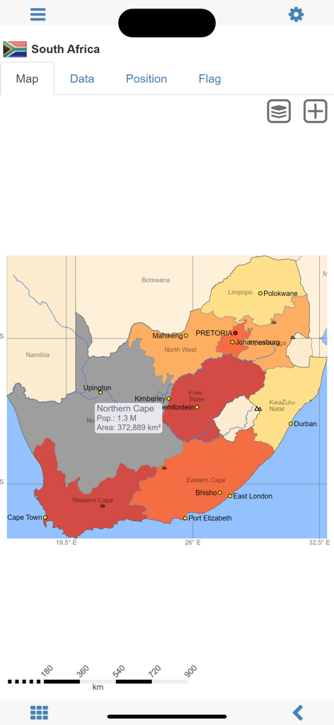
Detailed political map of South Africa showing regional population and area data in the World atlas MxGeo app.
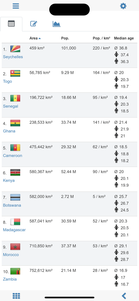
A comparison table in the World Atlas MxGeo app showing statistical data like area, population, and median age for African countries.
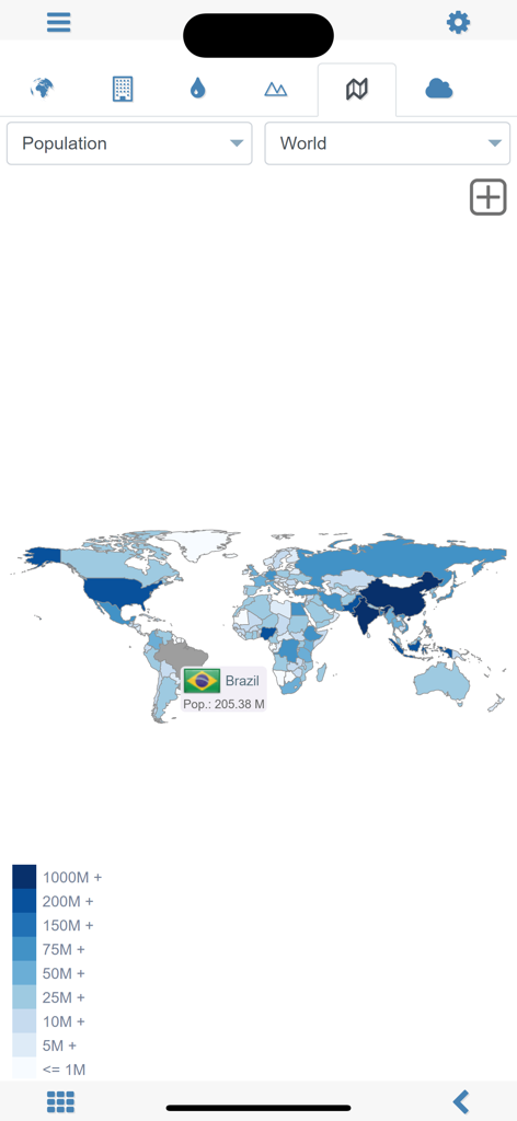
A world map displaying population statistics with Brazil selected in the MxGeo app
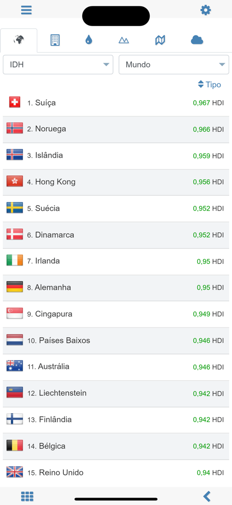
Ranking of top countries by Human Development Index in the World Atlas app
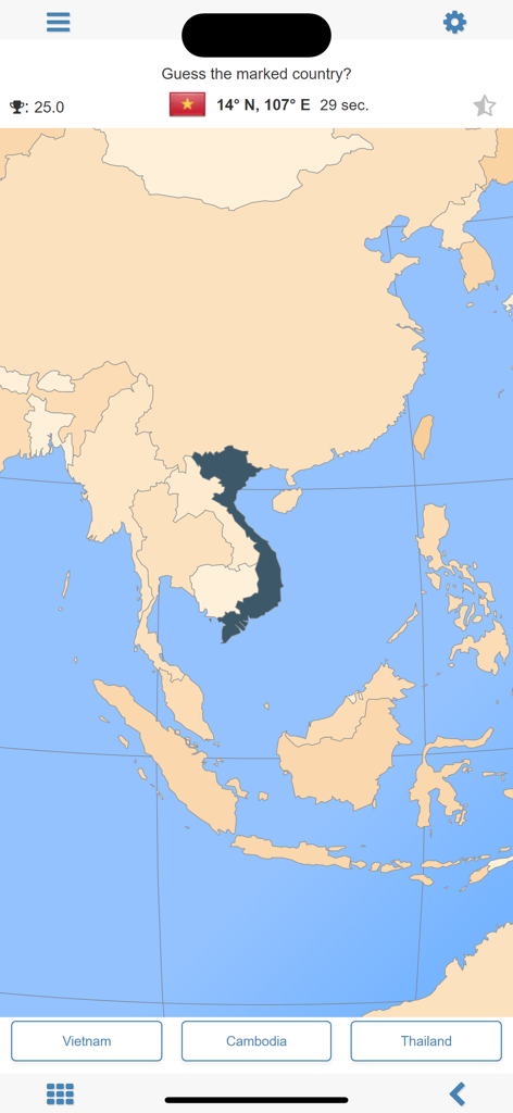
MxGeo geography quiz screen showing a map of Southeast Asia with Vietnam highlighted.
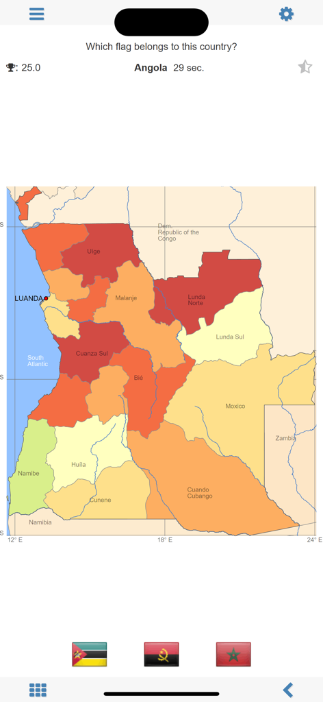
MxGeo app geography quiz screen asking to identify the flag of Angola with a map showing its provinces
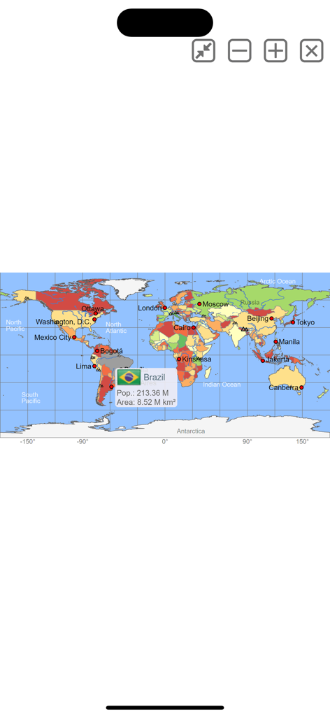
Interactive world map showing population and area data for Brazil
Description
Download
More Like This
Top-ranked apps in the same category

Duolingo - Language Lessons
Duolingo, Inc

Speak & Learn English: Learna
DEEP FLOW SOFTWARE SERVICES - FZCO

驾考宝典-科一科四驾驶证考试驾考通
Wuhan Jiakaobaodian Information Service Co., Ltd.

Toca Boca World
Toca Boca AB

Google Classroom
Google LLC

作业帮-中小学家长作业检查和辅导工具
Guangzhou Polar Future Culture Technology Co., Ltd

学信网
Student Information Consultation Service Co., Ltd.

Gauth: AI Study Companion
GAUTHTECH PTE. LTD.

ArtWorkout: Learn How to Draw
Aleksandr Ulitin
This page is not an official page of the app or its developer, but an independent editorial publication created for informational and commentary purposes. Unless expressly stated otherwise, neither the app nor its developer is affiliated with, endorsed by, sponsored by, authorized by, or otherwise officially connected with MWM, Apple, Google Play, the app publisher, or the app's developer, and nothing on this page implies that the app was developed using MWM's services. Any trademarks, logos, screenshots, and other content remain the property of their respective owners.