This page is not an official page of the app or its developer, but an independent editorial publication created for informational and commentary purposes. Unless expressly stated otherwise, neither the app nor its developer is affiliated with, endorsed by, sponsored by, authorized by, or otherwise officially connected with MWM, Apple, Google Play, the app publisher, or the app's developer, and nothing on this page implies that the app was developed using MWM's services. Any trademarks, logos, screenshots, and other content remain the property of their respective owners.

GeoKit: Geology Toolkit
Streamline your field research with high-precision strike and dip measurements, GPS-tagged mapping, and seamless GIS data export—built for professionals who need reliability in the most remote, offline locations.
Downloads
0User Rating
Total Ratings
0Publisher
Category
EducationLocales
1Latest Version
1.4Size
67.3 MBFirst Released
Jun 15, 2025Professional Field Tools in Your Pocket
Replace bulky hardware with high-precision digital tools. GeoKit streamlines your data collection, from measuring strike and dip to exporting GIS-ready files—all without needing a cell signal.
Precision Strike & Dip
Measure geological orientations instantly using your phone's internal sensors. Get professional-grade readings for slope angles and outcrops without the $500 price tag of a traditional compass.
Seamless GIS Integration
Export field notes, GPS-tagged photos, and markers directly to KML, GeoJSON, or CSV. Transition from the outcrop to QGIS or ArcGIS in seconds with zero manual data entry.
The following screenshots and description are sourced directly from the app's official store listing and are the property of the app developer.
App Store
Screenshots
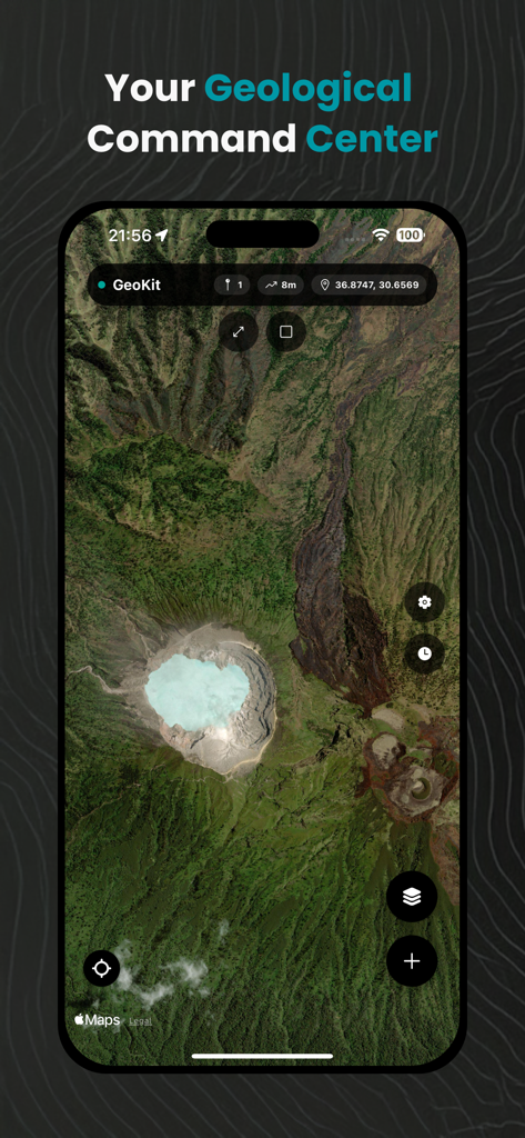
GeoKit app satellite map interface showing geological terrain and location coordinates
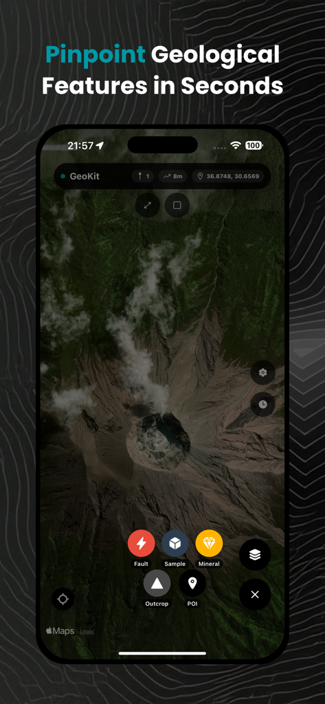
GeoKit app interface showing a satellite map with geological markers for fault, sample, mineral, and outcrop mapping.
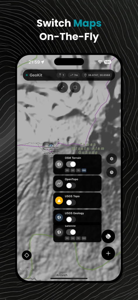
GeoKit app interface showing various geological and topographic map layers for field mapping
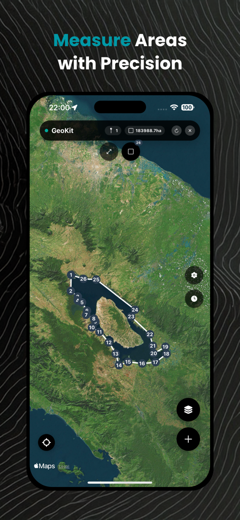
GeoKit app interface showing a satellite map with a large lake area measured using precise digital markers.
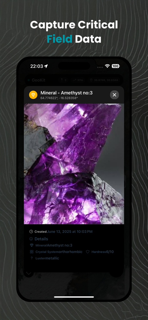
GeoKit app interface showing a field record for an amethyst mineral with photo and geological details
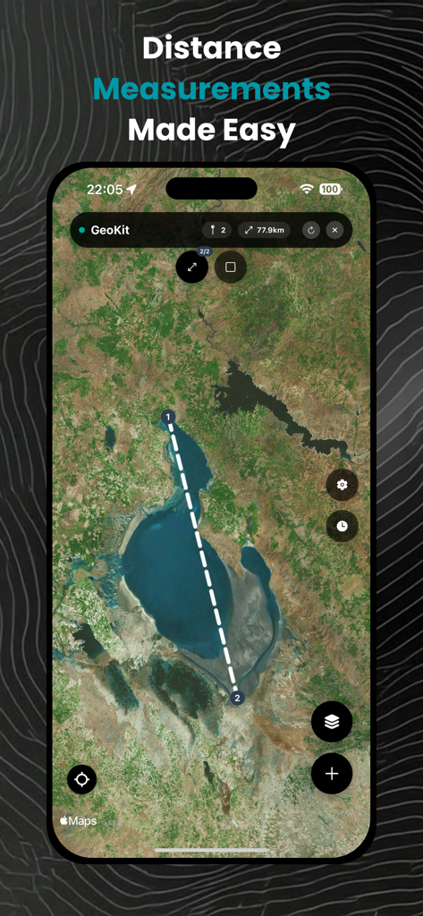
Satellite map showing a 77.9 km distance measurement between two points in the GeoKit app interface
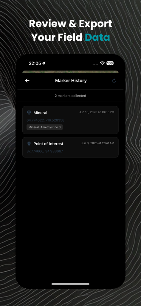
Marker history screen in the GeoKit app displaying collected field data points
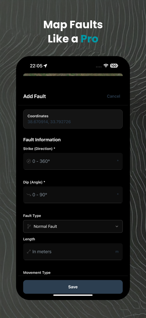
GeoKit mobile app interface for logging geological fault data with fields for strike and dip measurements
Description
Download
More Like This
Top-ranked apps in the same category

Duolingo - Language Lessons
Duolingo, Inc

Speak & Learn English: Learna
DEEP FLOW SOFTWARE SERVICES - FZCO

Toca Boca World
Toca Boca AB

驾考宝典-科一科四驾驶证考试驾考通
Wuhan Jiakaobaodian Information Service Co., Ltd.

Google Classroom
Google LLC

作业帮-中小学家长作业检查和辅导工具
Guangzhou Polar Future Culture Technology Co., Ltd

Gauth: AI Study Companion
GAUTHTECH PTE. LTD.

Nail Salon Games for Kids 2-5
Brainytrainee Ltd

HelloTalk - Language Learning
HELLOTALK FOREIGN LANGUAGE EXCHANGE LEARNING TALK CHAT APP
This page is not an official page of the app or its developer, but an independent editorial publication created for informational and commentary purposes. Unless expressly stated otherwise, neither the app nor its developer is affiliated with, endorsed by, sponsored by, authorized by, or otherwise officially connected with MWM, Apple, Google Play, the app publisher, or the app's developer, and nothing on this page implies that the app was developed using MWM's services. Any trademarks, logos, screenshots, and other content remain the property of their respective owners.