このページはアプリまたはその開発者の公式ページではなく、情報提供および論評を目的として作成された独立した編集出版物です。明示的に別段の記載がない限り、アプリおよびその開発者は、MWM、Apple、Google Play、アプリのパブリッシャー、またはアプリの開発者と提携、承認、後援、認可、またはその他の公式的な関係はなく、このページのいかなる内容も、アプリがMWMのサービスを使用して開発されたことを意味するものではありません。すべての商標、ロゴ、スクリーンショット、その他のコンテンツはそれぞれの所有者の財産です。

Air Navigation Pro
プロフェッショナルグレードの航空図、リアルタイムの航空機アラート、高度な気象レイヤーで空をマスターしましょう。離陸から着陸まで完全な状況認識を求める安全意識の高いパイロットのために設計されています。
ダウンロード
523K+ユーザー評価
評価数
200開発元
カテゴリ
Navigation対応言語
10最新バージョン
8.4.150サイズ
213.4 MBリリース日
2009年1月6日現代のパイロットのための精密フライトツール
リアルタイムの状況認識と世界中の航空データを使用して、iPadをプロフェッショナルグレードの電子フライトバッグに変えましょう。
3D合成ビジョンとTAWS
究極の状況安全のために、高解像度の3Dビューと地形認識警告システムを使用して、あらゆる地形で自信を持って飛行しましょう。
統合ライブトラフィック
ネイティブSafeSky統合を通じてリアルタイムの視覚および音声アラートを取得し、常に近くの航空機を認識できるようにします。
以下のスクリーンショットと説明は、アプリの公式ストアリスティングから直接取得されたものであり、アプリ開発者の所有物です。
アプリストア
スクリーンショット
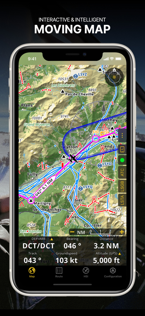
Air Navigation Proアプリのスクリーンショット、航空図とリアルタイムのフライトデータが表示されたインタラクティブな移動マップ
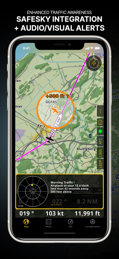
Safesky統合と視覚アラートによる航空機認識の強化を示すAir Navigation Proインターフェイス
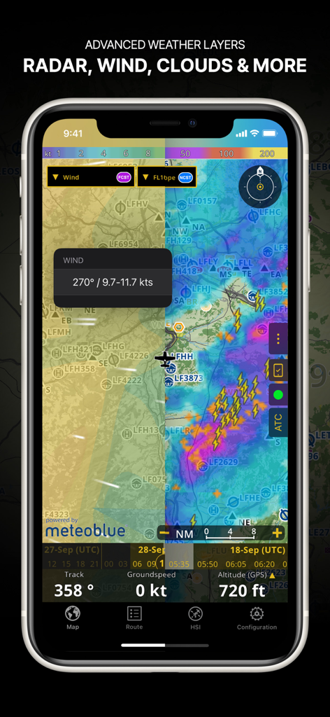
ナビゲーションマップ上のレーダー風と雲量を含む高度な気象レイヤーを示すAir Navigation Proアプリのスクリーンショット
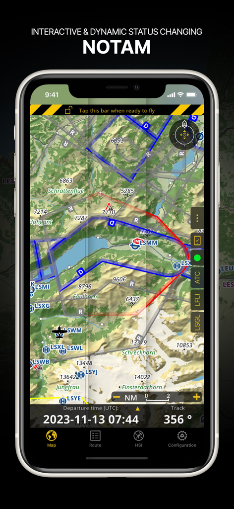
地形図上の動的なNOTAM情報が表示されたAir Navigation Proインターフェイス
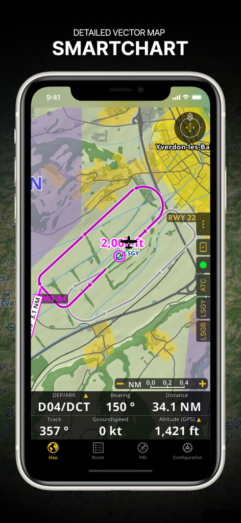
フライトルートとリアルタイムナビゲーションデータが表示された詳細なベクトルSmartChartを示すAir Navigation Proインターフェイス
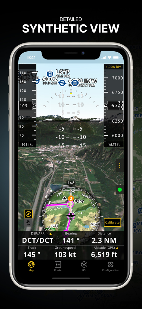
3D地形と統合されたフライト計器を備えた詳細な合成ビュー機能を表示するAir Navigation Proアプリ
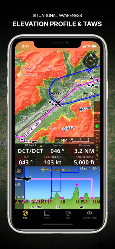
標高プロファイルと地形認識警告システムを示すAir Navigation Proのスクリーンショット
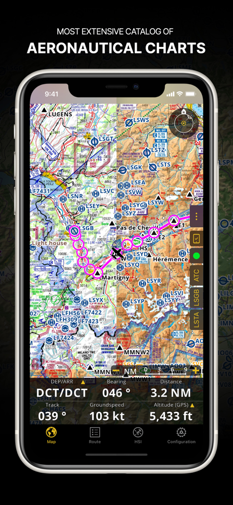
スマートフォン画面上のフライトパスとナビゲーションデータが表示された詳細な航空図を示すAir Navigation Proアプリ
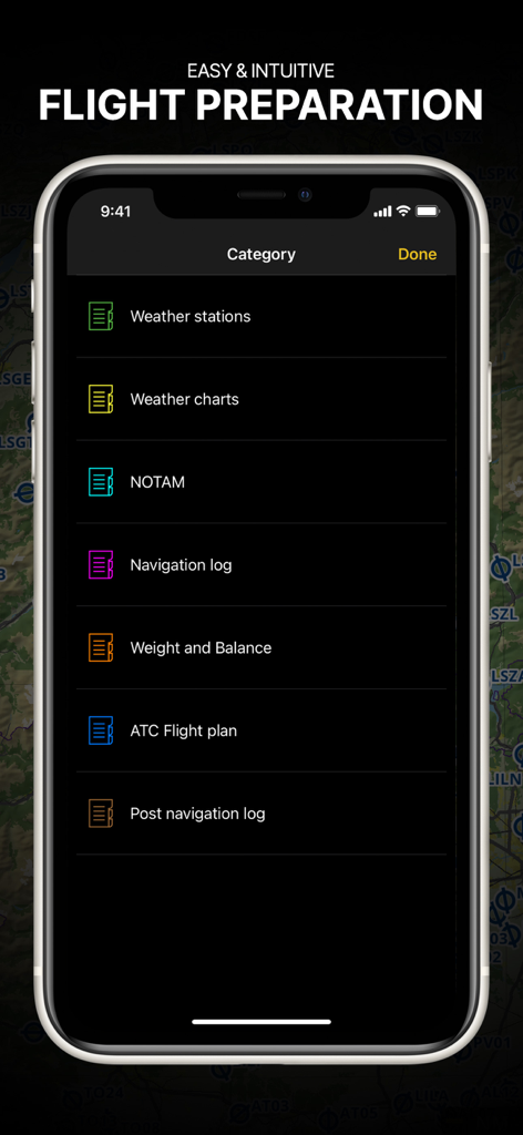
パイロット向けのブリーフィングカテゴリを備えたフライト準備メニューを示すAir Navigation Proアプリ
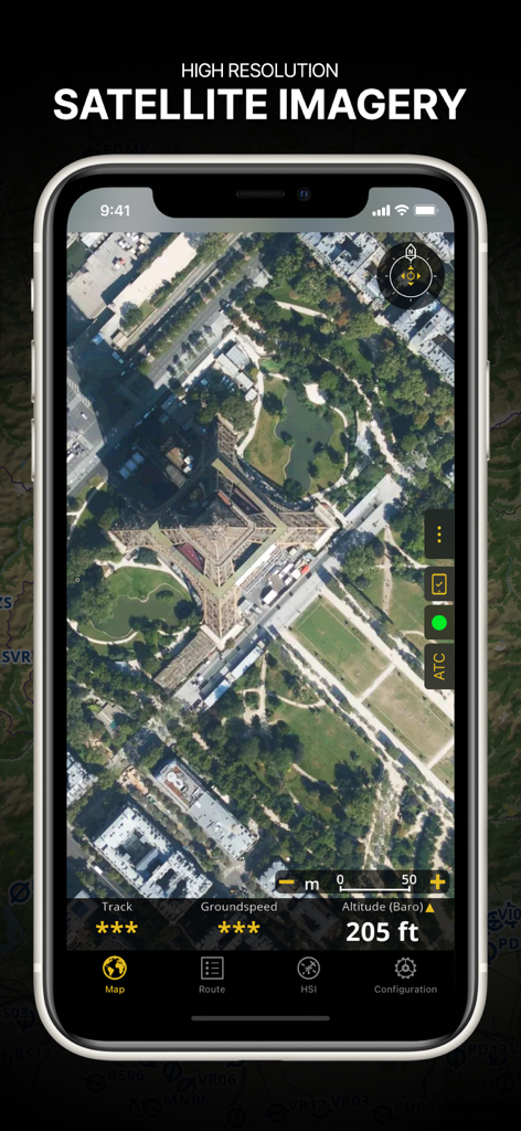
フライトデータオーバーレイを備えたエッフェル塔の高解像度衛星画像を示すAir Navigation Proアプリのスクリーンショット
説明
Download
類似アプリ
似た機能とユーザー体験を持つアプリ

Navigraph Charts
Navigraph KB

SkyDemon
Divelements Limited

Airports
Applicate Ltd

OzRunways EFB
OzRunways Pty. Ltd.

fDeck: flight instruments
Darren Yeates

Noisy Goose
Automata Solutions Ltd.

StationWeather - METAR and TAF
Oliver Puetz

Drone UAV Fly Forecast: AirMap
MONIQ TAP COMPANY LIMITED

Airmate
Myriel Aviation SA
このページはアプリまたはその開発者の公式ページではなく、情報提供および論評を目的として作成された独立した編集出版物です。明示的に別段の記載がない限り、アプリおよびその開発者は、MWM、Apple、Google Play、アプリのパブリッシャー、またはアプリの開発者と提携、承認、後援、認可、またはその他の公式的な関係はなく、このページのいかなる内容も、アプリがMWMのサービスを使用して開発されたことを意味するものではありません。すべての商標、ロゴ、スクリーンショット、その他のコンテンツはそれぞれの所有者の財産です。