このページはアプリまたはその開発者の公式ページではなく、情報提供および論評を目的として作成された独立した編集出版物です。明示的に別段の記載がない限り、アプリおよびその開発者は、MWM、Apple、Google Play、アプリのパブリッシャー、またはアプリの開発者と提携、承認、後援、認可、またはその他の公式的な関係はなく、このページのいかなる内容も、アプリがMWMのサービスを使用して開発されたことを意味するものではありません。すべての商標、ロゴ、スクリーンショット、その他のコンテンツはそれぞれの所有者の財産です。

OzRunways EFB
オーストラリアで最も信頼されている電子フライトバッグを体験してください。世界クラスのSkyVector地図、ライブ気象レーダー、そしてすべてのコックピットでの安全性と効率のために設計された包括的なオフラインチャートにアクセスできます。
ダウンロード
267K+ユーザー評価
評価数
8K+開発元
カテゴリ
Navigation対応言語
5最新バージョン
13.3.7サイズ
68.7 MBリリース日
2010年12月10日プロフェッショナルな精度で空をマスターする
OzRunways EFBは、グローバルチャートカバレッジと妥協のないオフライン信頼性を要求するパイロットのための、合理化された高性能ナビゲーションスイートを提供します。
グローバルチャート統合
SkyVectorグローバル地図と、北米、オセアニア、アフリカなどの公式航空チャートを使用して、国境を越えて自信を持って飛行しましょう。
遠隔地運用向けに構築
デッドゾーンで道に迷うことはありません。高解像度地図をダウンロードして100%オフラインで使用でき、山岳ルートや長距離フェリーフライトに最適です。
以下のスクリーンショットと説明は、アプリの公式ストアリスティングから直接取得されたものであり、アプリ開発者の所有物です。
アプリストア
スクリーンショット
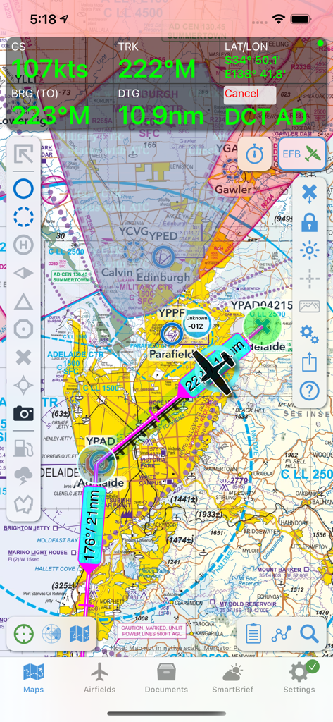
OzRunways EFBインターフェース。航空チャートとフライトテレメトリが表示された移動マップを表示。
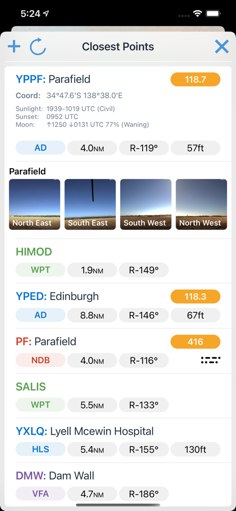
OzRunways EFBのモバイルインターフェース。最も近い航空ウェイポイントと空港を距離と方位とともに表示。
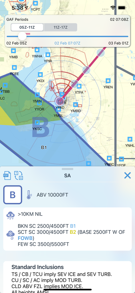
OzRunways EFBモバイルアプリ。グラフィカルなエリア予報マップと航空気象データを表示。
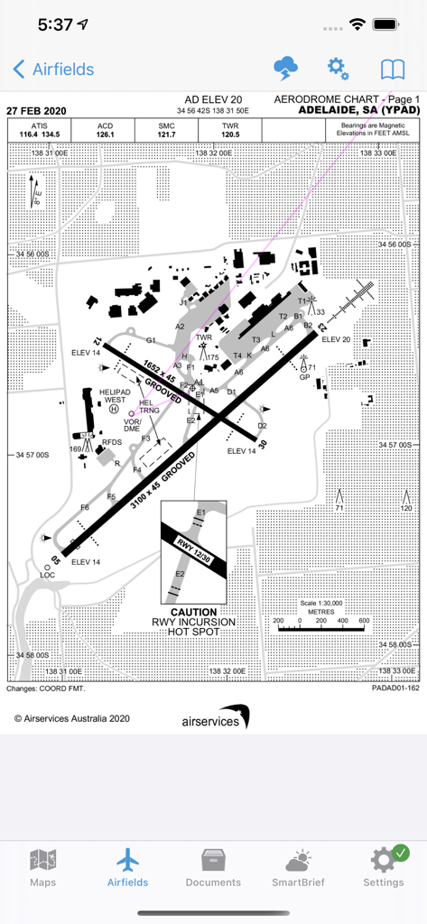
OzRunways EFBのアデレード空港の飛行場チャート。滑走路と誘導路を表示。
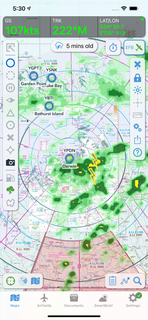
OzRunways EFBフライトナビゲーションインターフェース。オーストラリア北部の移動マップに気象レーダーと雷のオーバーレイを表示。
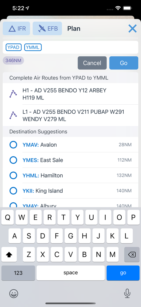
OzRunways EFBモバイルアプリインターフェース。フライトルートプランニングと目的地の提案を表示。
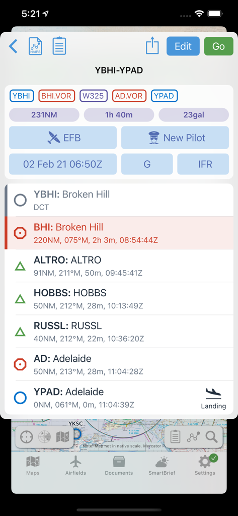
OzRunways EFBフライトプランニング画面。ブロークンヒルとアデレード間のルートウェイポイントと燃料推定値を表示。
説明
Download
類似アプリ
似た機能とユーザー体験を持つアプリ

Navigraph Charts
Navigraph KB

SkyDemon
Divelements Limited

Airports
Applicate Ltd

fDeck: flight instruments
Darren Yeates

Noisy Goose
Automata Solutions Ltd.

StationWeather - METAR and TAF
Oliver Puetz

Drone UAV Fly Forecast: AirMap
MONIQ TAP COMPANY LIMITED

Airmate
Myriel Aviation SA

AvPlan EFB
BJA Consulting Pty Ltd
このページはアプリまたはその開発者の公式ページではなく、情報提供および論評を目的として作成された独立した編集出版物です。明示的に別段の記載がない限り、アプリおよびその開発者は、MWM、Apple、Google Play、アプリのパブリッシャー、またはアプリの開発者と提携、承認、後援、認可、またはその他の公式的な関係はなく、このページのいかなる内容も、アプリがMWMのサービスを使用して開発されたことを意味するものではありません。すべての商標、ロゴ、スクリーンショット、その他のコンテンツはそれぞれの所有者の財産です。