This page is not an official page of the app or its developer, but an independent editorial publication created for informational and commentary purposes. Unless expressly stated otherwise, neither the app nor its developer is affiliated with, endorsed by, sponsored by, authorized by, or otherwise officially connected with MWM, Apple, Google Play, the app publisher, or the app's developer, and nothing on this page implies that the app was developed using MWM's services. Any trademarks, logos, screenshots, and other content remain the property of their respective owners.

Flytomap All in One HD Charts
Explore with confidence using professional-grade offline maps for seas, lakes, and national parks. Join over 200,000 captains with NOAA accuracy and real-time community insights, no cellular signal required.
Downloads
194K+User Rating
Total Ratings
100Publisher
Category
NavigationLocales
6Latest Version
6.5.11Size
127.7 MBFirst Released
Jul 8, 2010Professional Navigation for Every Horizon
Flytomap combines marine charts, lake maps, and park trails into one powerful, offline-ready tool designed for serious boaters, anglers, and outdoor enthusiasts.
Total Offline Reliability
Navigate with confidence beyond the reach of cell towers. All 500+ worldwide charts are resident on your device for 100% offline access, ensuring safety in any remote location.
Professional-Grade Accuracy
Experience the technical detail of official NOAA raster charts and advanced vector technology. Get precise depth contours, spot soundings, and buoy info identical to high-end dedicated hardware.
The following screenshots and description are sourced directly from the app's official store listing and are the property of the app developer.
App Store
Screenshots
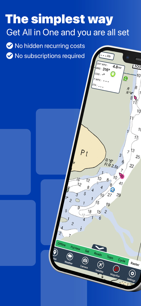
A smartphone displaying a detailed marine chart for navigation in the Flytomap app
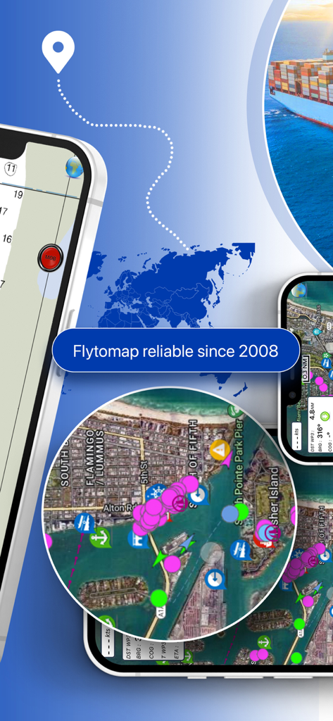
Mobile screens displaying Flytomap nautical charts and outdoor navigation tools.
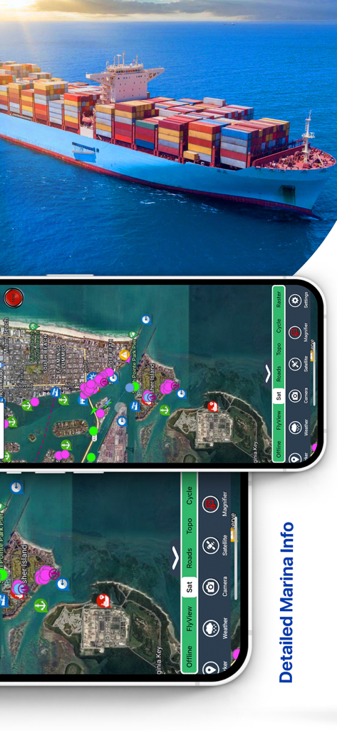
Flytomap app interface showing satellite navigation and detailed marina information
Detailed nautical map and navigation dashboard on the Flytomap mobile app
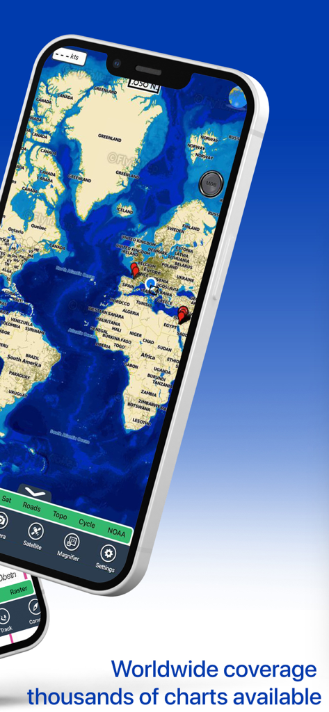
An iPhone displaying the Flytomap app with a global map and markers showing worldwide coverage of navigation charts.
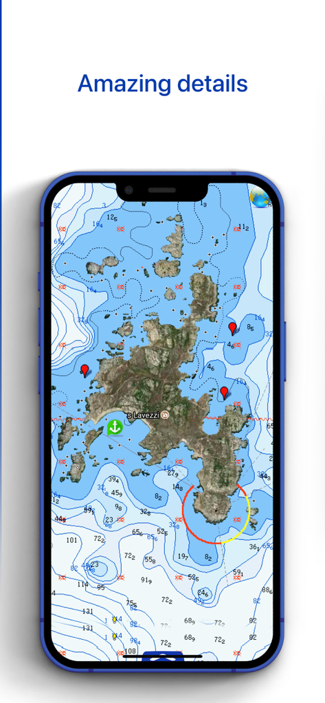
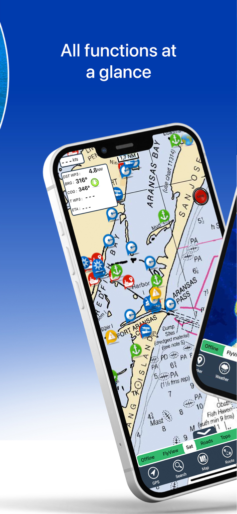
iPhone screen displaying detailed nautical charts with depth contours and markers from the Flytomap app
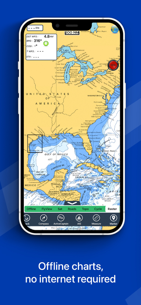
Flytomap app displaying a detailed nautical chart of North America and the Gulf of Mexico on an iPhone screen.
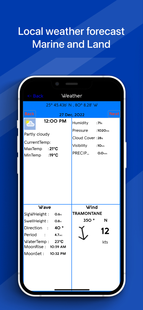
Local marine and land weather forecast screen in the Flytomap app
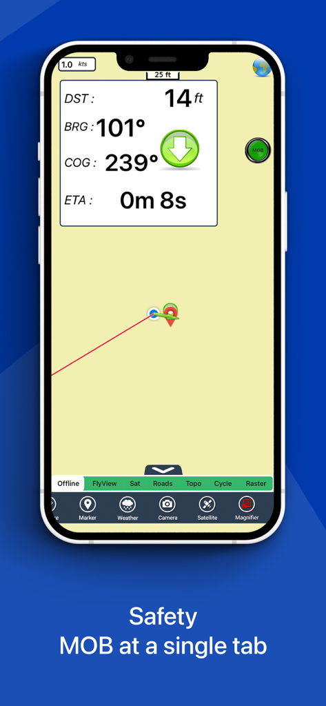
Mobile interface of Flytomap showing marine navigation metrics and a Man Overboard safety button
Description
Download
More Like This
Apps with similar features and user experience

PredictWind — Marine Forecasts
PredictWind Limited

Navily
The Navigation Family

Argo - Boating Navigation
Argo Navigation, LLC

SEAiq Pilot
Sakhalin, LLC

Maptrails
Pasi Salenius

KartenWerft NavGo 2.0
KartenWerft GmbH

MarineTraffic - Ship Tracking
MARINETRAFFIC APPLICATIONS LTD

Wavve Boating: Marine Boat GPS
Wavve Boating Inc

Savvy Navvy Boating Navigation
SAVVY NAVVY LTD
This page is not an official page of the app or its developer, but an independent editorial publication created for informational and commentary purposes. Unless expressly stated otherwise, neither the app nor its developer is affiliated with, endorsed by, sponsored by, authorized by, or otherwise officially connected with MWM, Apple, Google Play, the app publisher, or the app's developer, and nothing on this page implies that the app was developed using MWM's services. Any trademarks, logos, screenshots, and other content remain the property of their respective owners.