このページはアプリまたはその開発者の公式ページではなく、情報提供および論評を目的として作成された独立した編集出版物です。明示的に別段の記載がない限り、アプリおよびその開発者は、MWM、Apple、Google Play、アプリのパブリッシャー、またはアプリの開発者と提携、承認、後援、認可、またはその他の公式的な関係はなく、このページのいかなる内容も、アプリがMWMのサービスを使用して開発されたことを意味するものではありません。すべての商標、ロゴ、スクリーンショット、その他のコンテンツはそれぞれの所有者の財産です。

GoGoEarth - Custom map source
NASA、Maxar、Nearmapのプレミアム衛星ソースをアンロック。3D都市モデルからリアルタイム高度まで、プログレードのマッピングとバーチャル探検を指先で体験できます。
ダウンロード
427K+ユーザー評価
評価数
8K+開発元
カテゴリ
Navigation対応言語
2最新バージョン
3.2.3サイズ
155.6 MBリリース日
2022年5月11日驚くほど詳細な地球を探索
高解像度衛星画像から3D建築モデルまで、GoGoEarthは、手のひらから世界を発見するために必要なプログレードのツールを提供します。
超高精細衛星ビュー
NASAとMaxarが提供するクリスタルクリアな画像で世界を体験し、標準的なマップをはるかに超える詳細レベルを提供します。
バーチャルグローバルトラベル
HDパノラマストリートビューで200以上の地域を旅し、世界で最も有名な場所のリアルな3Dモデルを探索しましょう。
以下のスクリーンショットと説明は、アプリの公式ストアリスティングから直接取得されたものであり、アプリ開発者の所有物です。
アプリストア
スクリーンショット
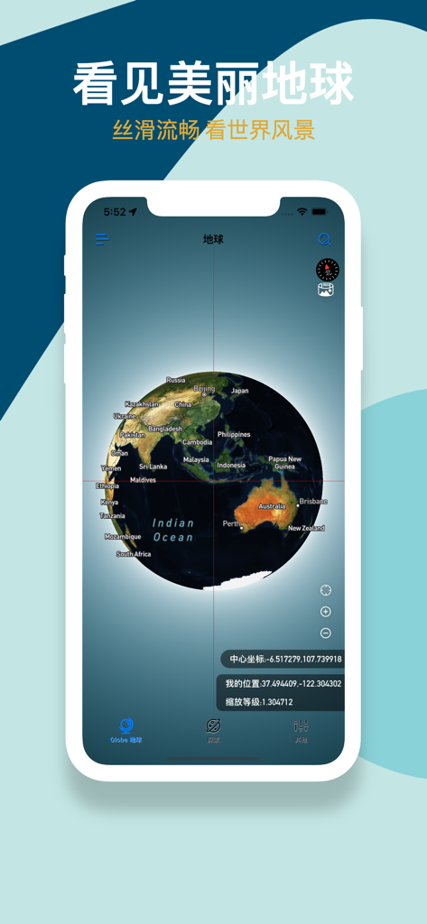
GoGoEarthアプリインターフェースに、地理ラベルと座標を持つ3D衛星グローブが表示されています
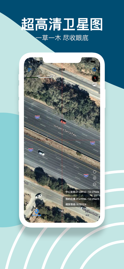
GoGoEarthアプリで、車と正確な座標が表示された高速道路の高解像度衛星画像
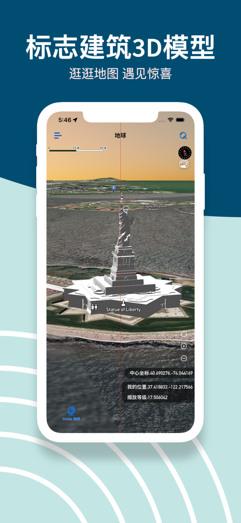
GoGoEarthアプリのスクリーンショット。衛星マップ上に自由の女神の詳細な3Dモデルが表示されています
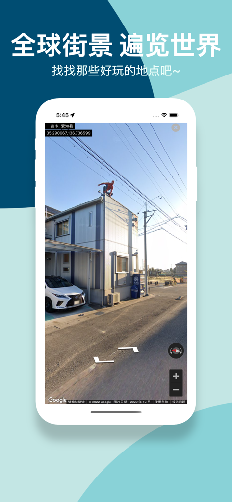
GoGoEarthアプリのスクリーンショット。日本の地域にある高解像度パノラマストリートビューが表示されています
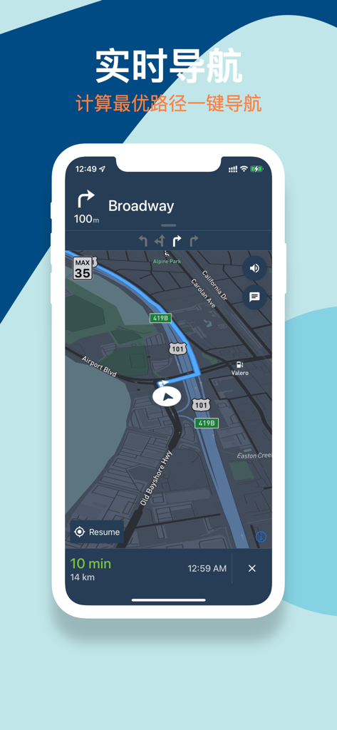
GoGoEarthモバイルアプリ。暗い衛星マップ上にルートが表示されたリアルタイムナビゲーションインターフェースが表示されています
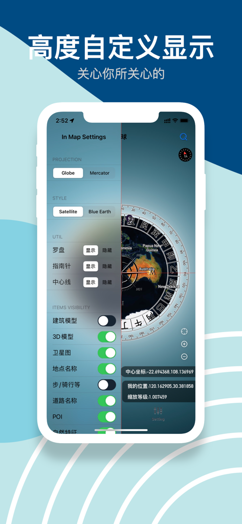
GoGoEarthアプリインターフェース。投影スタイルと3Dモデルの可視性のためのマップ設定が表示されています
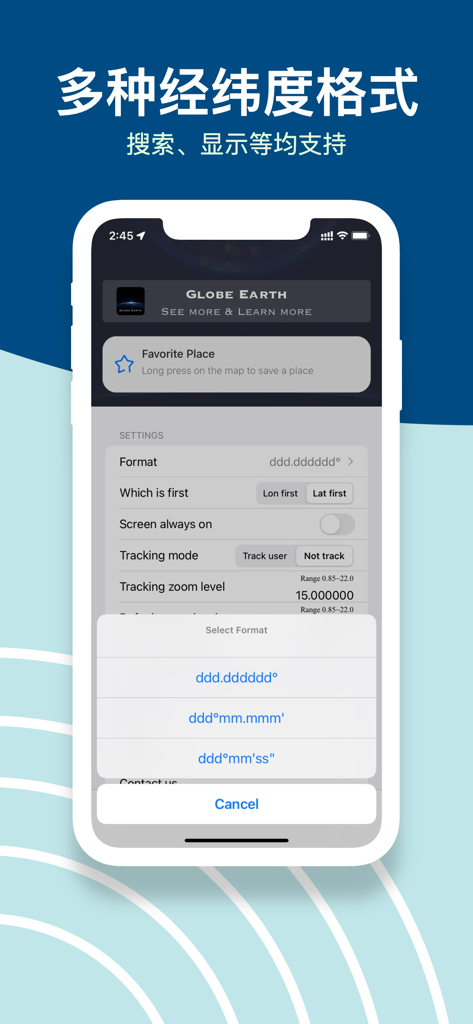
GoGoEarthアプリインターフェース。設定メニューに複数の緯度・経度座標形式オプションが表示されています
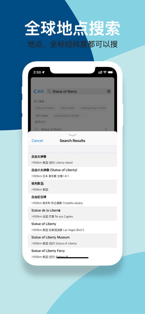
GoGoEarthアプリインターフェース。緯度・経度サポート付きの自由の女神のグローバル検索結果が表示されています
説明
Download
類似アプリ
似た機能とユーザー体験を持つアプリ

Earth Maps
FOXPOI PTE. LTD.

Satellite Map - Live Earth
慧敏 赵

Satellite Map - Earth View
ANKAGIS YAZILIM ANONIM SIRKETI

World Street 3D Panoramic Map
Beijing Zhiyue Information Technology Co., Ltd

3D Earth Map Street View
Naik Ur Rehman

Globe 3D Earth: World Map Live
Shams Alam

Street View - street view maps
国辉 满

卫星地图-高清地球探索世界
方元 朱

高清3D街景地图-地图软件手机全景版
Suzhou Caichuang Network Technology Co., Ltd.
このページはアプリまたはその開発者の公式ページではなく、情報提供および論評を目的として作成された独立した編集出版物です。明示的に別段の記載がない限り、アプリおよびその開発者は、MWM、Apple、Google Play、アプリのパブリッシャー、またはアプリの開発者と提携、承認、後援、認可、またはその他の公式的な関係はなく、このページのいかなる内容も、アプリがMWMのサービスを使用して開発されたことを意味するものではありません。すべての商標、ロゴ、スクリーンショット、その他のコンテンツはそれぞれの所有者の財産です。