このページはアプリまたはその開発者の公式ページではなく、情報提供および論評を目的として作成された独立した編集出版物です。明示的に別段の記載がない限り、アプリおよびその開発者は、MWM、Apple、Google Play、アプリのパブリッシャー、またはアプリの開発者と提携、承認、後援、認可、またはその他の公式的な関係はなく、このページのいかなる内容も、アプリがMWMのサービスを使用して開発されたことを意味するものではありません。すべての商標、ロゴ、スクリーンショット、その他のコンテンツはそれぞれの所有者の財産です。

OpenSeaMap
無料の世界中の海洋データ、港湾情報、気象レイヤーにアクセスします。レクリエーションボートコミュニティのために構築された強力なオフラインマップで、次の海岸冒険をナビゲートします。
ダウンロード
222K+ユーザー評価
評価数
300開発元
カテゴリ
Navigation対応言語
3最新バージョン
4.2サイズ
13.2 MBリリース日
2012年1月25日サブスクリプションなしのスマートな海事ナビゲーション
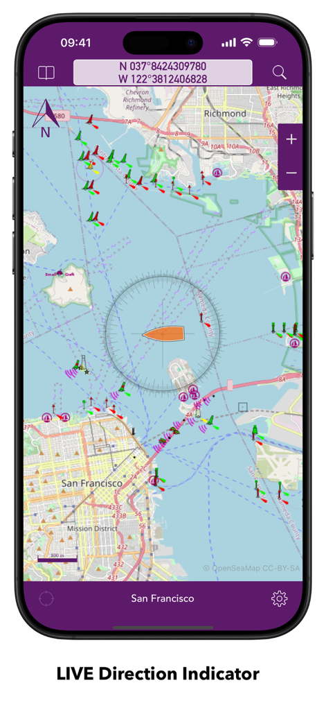
グローバルなオープンソースコミュニティに参加し、セカンダリヘルムディスプレイや海岸探検のために設計された無料の詳細な海図にアクセスします。
完全なオフライン信頼性
最大100万枚のマップタイルをデバイスにキャッシュできるため、沖合数マイルで携帯電話の信号が途切れても、自信を持ってナビゲートできます。
無料の海洋情報
OpenStreetMapプロジェクトによって提供される気象データと港湾情報を含む世界中の海図で、高額な年間料金をなくしましょう。
以下のスクリーンショットと説明は、アプリの公式ストアリスティングから直接取得されたものであり、アプリ開発者の所有物です。
アプリストア
スクリーンショット
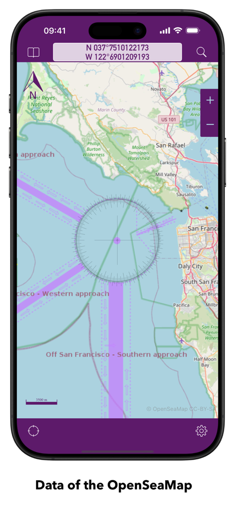
座標とナビゲーションマーキングが表示されたサンフランシスコ湾の海図を表示するOpenSeaMapアプリ
座標とナビゲーションマーキングが表示されたサンフランシスコ湾の海図を表示するOpenSeaMapアプリ
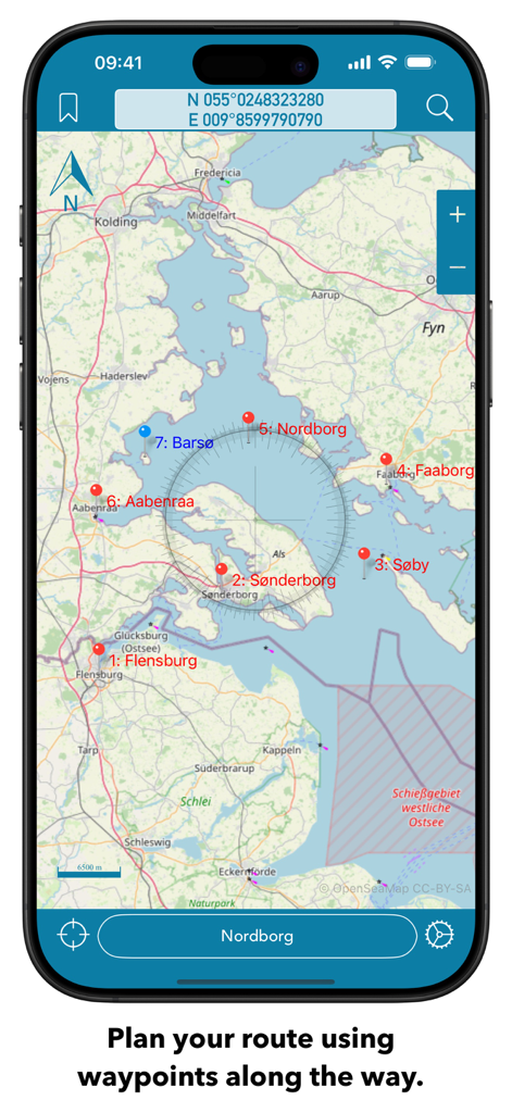
複数のウェイポイントとコンパスオーバーレイを備えたルート計画を示すスマートフォンのOpenSeaMap海事チャートインターフェイス。
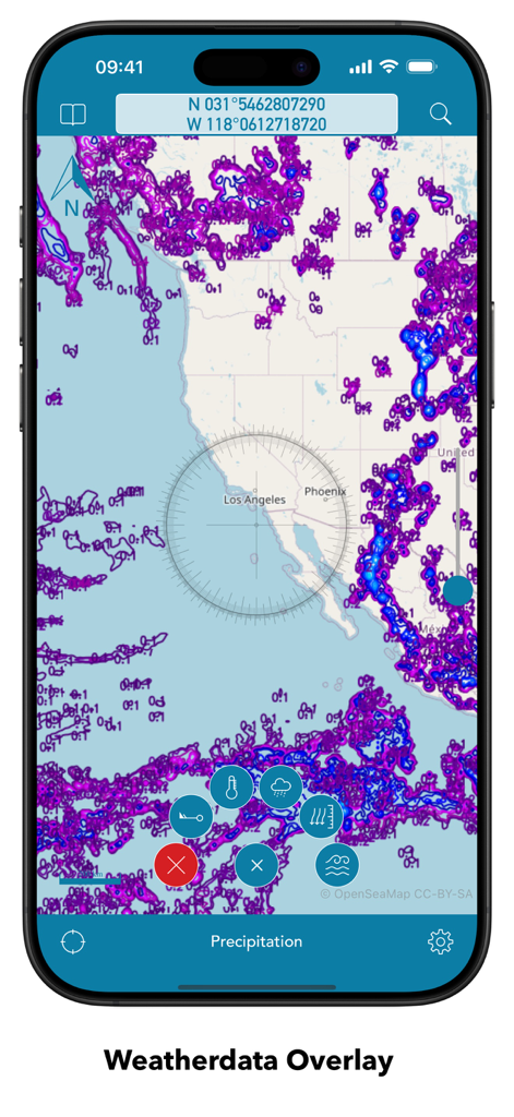
海事チャートに降水気象データオーバーレイを表示するOpenSeaMapモバイルインターフェイス。
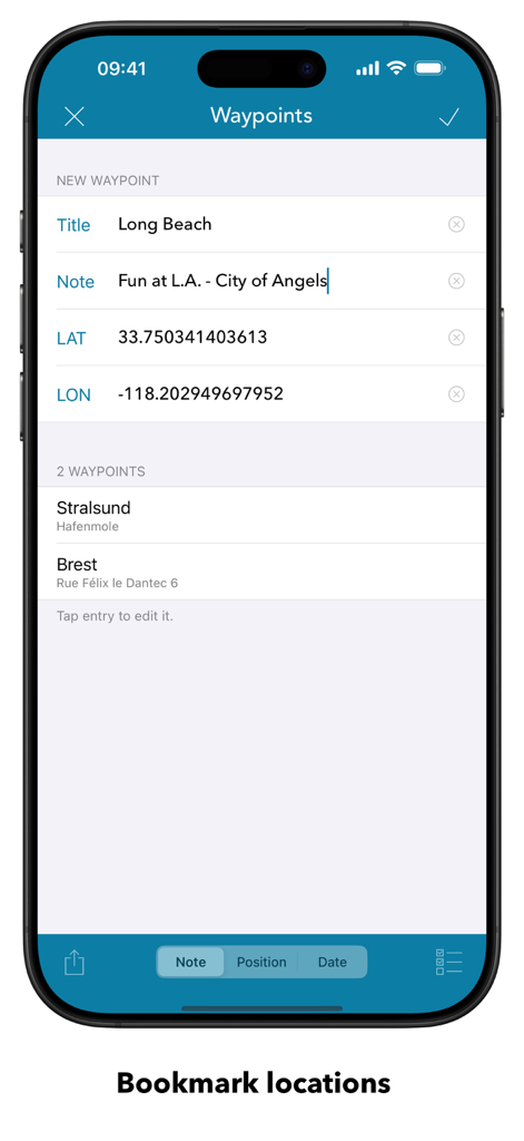
ブックマークされた海事の場所と座標入力を示すOpenSeaMapモバイルアプリのウェイポイント画面。
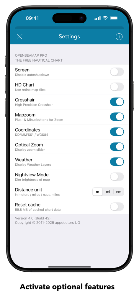
海事チャートとナビゲーション設定オプションを示すOpenSeaMap設定画面。
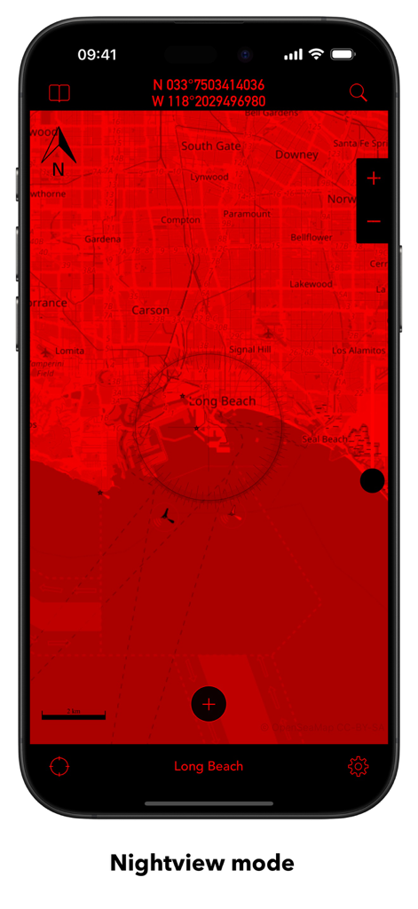
ロングビーチの赤色ナイトビューモードマップを表示するOpenSeaMapモバイルアプリインターフェイス。
説明
Download
類似アプリ
似た機能とユーザー体験を持つアプリ

PredictWind — Marine Forecasts
PredictWind Limited

Navily
The Navigation Family

Argo - Boating Navigation
Argo Navigation, LLC

SEAiq Pilot
Sakhalin, LLC

Maptrails
Pasi Salenius

KartenWerft NavGo 2.0
KartenWerft GmbH

MarineTraffic - Ship Tracking
MARINETRAFFIC APPLICATIONS LTD

Wavve Boating: Marine Boat GPS
Wavve Boating Inc

Savvy Navvy Boating Navigation
SAVVY NAVVY LTD
このページはアプリまたはその開発者の公式ページではなく、情報提供および論評を目的として作成された独立した編集出版物です。明示的に別段の記載がない限り、アプリおよびその開発者は、MWM、Apple、Google Play、アプリのパブリッシャー、またはアプリの開発者と提携、承認、後援、認可、またはその他の公式的な関係はなく、このページのいかなる内容も、アプリがMWMのサービスを使用して開発されたことを意味するものではありません。すべての商標、ロゴ、スクリーンショット、その他のコンテンツはそれぞれの所有者の財産です。