このページはアプリまたはその開発者の公式ページではなく、情報提供および論評を目的として作成された独立した編集出版物です。明示的に別段の記載がない限り、アプリおよびその開発者は、MWM、Apple、Google Play、アプリのパブリッシャー、またはアプリの開発者と提携、承認、後援、認可、またはその他の公式的な関係はなく、このページのいかなる内容も、アプリがMWMのサービスを使用して開発されたことを意味するものではありません。すべての商標、ロゴ、スクリーンショット、その他のコンテンツはそれぞれの所有者の財産です。

ShipAtlas - Ship Tracker
プロフェッショナルグレードの衛星AIS、正確な到着予定時刻推定、世界中の港の交通状況の洞察により、125,000隻以上の船舶をリアルタイムで追跡します。
ダウンロード
21K+ユーザー評価
評価数
1K+開発元
カテゴリ
Productivity対応言語
1最新バージョン
8.0.1サイズ
84.4 MBリリース日
2020年8月9日指先でプロフェッショナルな海事インテリジェンス
リアルタイムAIS追跡から高度なルート計画まで、ShipAtlasは、世界の海運および港湾活動を完全に自信を持って監視するために必要なデータ主導の洞察を提供します。
衛星 powered ライブ追跡
高解像度の衛星および地上AISデータを使用して、世界中の125,000隻以上の船舶を監視し、外洋でも船を見失うことはありません。
インテリジェントな海上ルーティング&到着予定時刻
AISの位置から世界中の任意の港への正確な航海を計画し、正確な到着時刻を計算します。特定の船速とリアルタイムの海事状況に合わせて調整されます。
以下のスクリーンショットと説明は、アプリの公式ストアリスティングから直接取得されたものであり、アプリ開発者の所有物です。
アプリストア
スクリーンショット
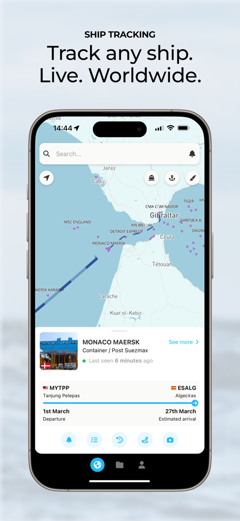
ShipAtlasモバイルアプリインターフェース、海事マップ上にライブAIS船舶追跡と船舶の詳細を表示
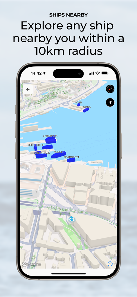
ShipAtlasアプリインターフェース、10km圏内の近くの船のマップを表示
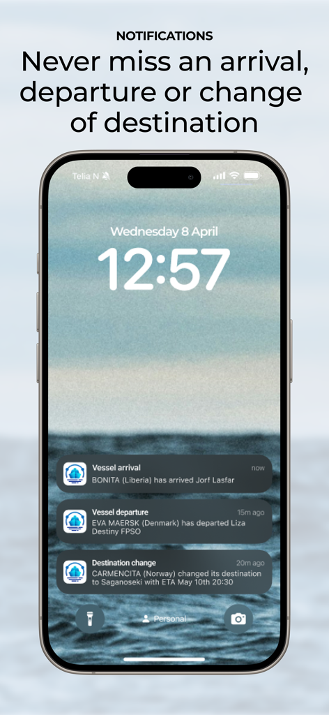
iPhoneロック画面、ShipAtlasの船舶到着・出発・目的地変更の通知を表示
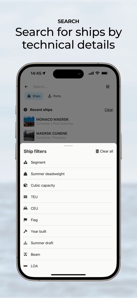
ShipAtlasアプリ画面、総重量やTEUなどの船舶の技術的な検索フィルターを表示
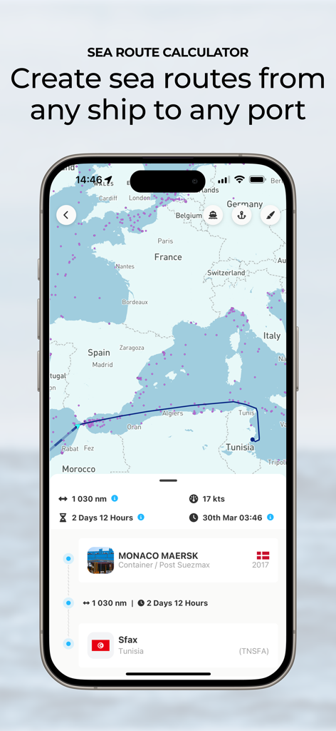
ShipAtlasアプリの海上ルート計算機、地中海から港への船の航海、到着予定時刻と距離を表示
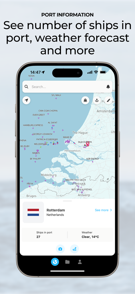
ShipAtlasアプリインターフェース、ロッテルダムのライブ港情報、船舶数、マップ上の天気予報を表示
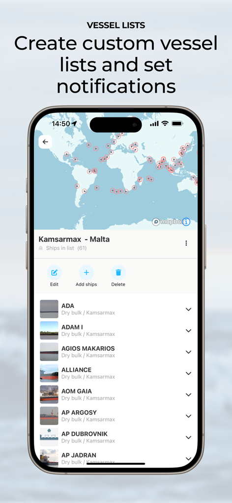
ShipAtlasアプリインターフェース、カスタム船舶リストと海事追跡通知を表示
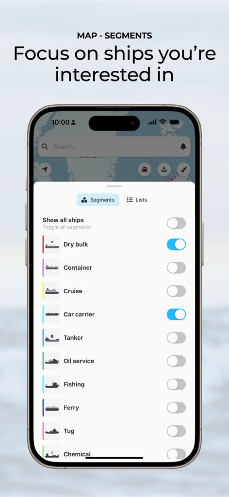
ShipAtlasインターフェース、カスタマイズされた船舶追跡のための船舶セグメントフィルターを表示
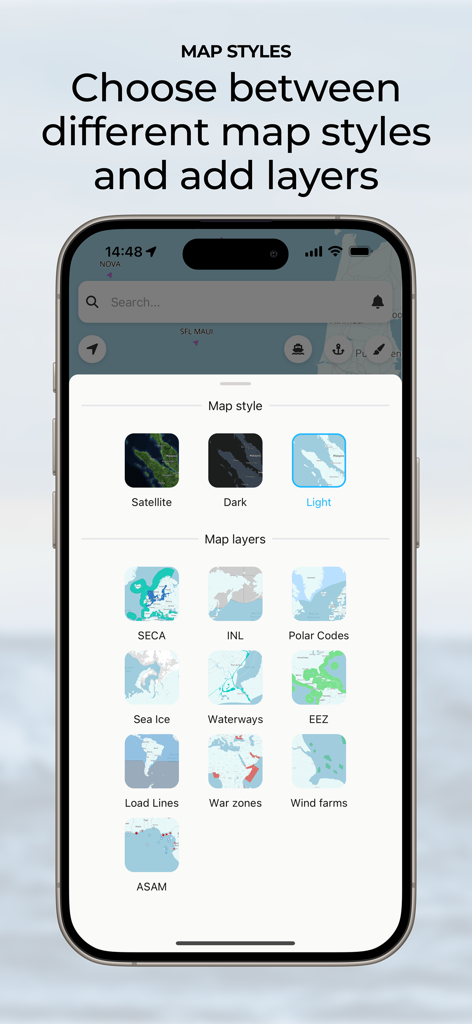
ShipAtlasアプリインターフェース、マップスタイルと海事データレイヤーを選択
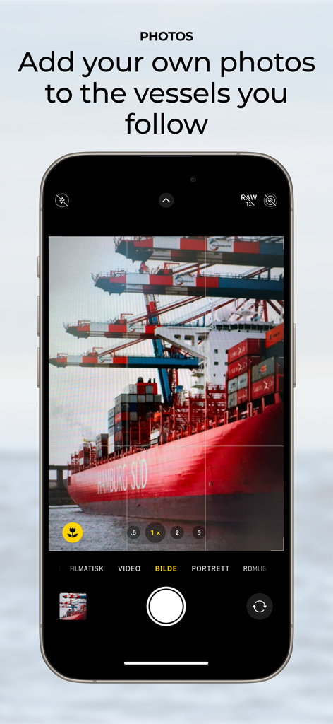
ShipAtlasアプリで追跡中の船の個人的な写真をキャプチャして追加する機能を示すスマートフォン画面
説明
Download
類似アプリ
同じカテゴリのトップランクアプリ

ChatGPT
OpenAI OpCo, LLC

Google Gemini
Google LLC

Grok
X.AI Corporation

Gmail - Email by Google
Google LLC

千问 - 阿里最强大模型官方AI助手
Shanghai Zhixin Puhui Technology Co., Ltd.

Google Drive
Google LLC

Microsoft Authenticator
Microsoft Corporation

Google Sheets
Google LLC

Google Docs
Google LLC
このページはアプリまたはその開発者の公式ページではなく、情報提供および論評を目的として作成された独立した編集出版物です。明示的に別段の記載がない限り、アプリおよびその開発者は、MWM、Apple、Google Play、アプリのパブリッシャー、またはアプリの開発者と提携、承認、後援、認可、またはその他の公式的な関係はなく、このページのいかなる内容も、アプリがMWMのサービスを使用して開発されたことを意味するものではありません。すべての商標、ロゴ、スクリーンショット、その他のコンテンツはそれぞれの所有者の財産です。