이 페이지는 앱이나 개발자의 공식 페이지가 아니며, 정보 제공 및 논평을 목적으로 작성된 독립 편집 간행물입니다. 명시적으로 달리 언급되지 않는 한, 해당 앱이나 개발자는 MWM, Apple, Google Play, 앱 퍼블리셔 또는 앱 개발자와 제휴, 보증, 후원, 승인 또는 공식적으로 연결되어 있지 않으며, 이 페이지의 어떤 내용도 해당 앱이 MWM의 서비스를 사용하여 개발되었음을 의미하지 않습니다. 모든 상표, 로고, 스크린샷 및 기타 콘텐츠는 해당 소유자의 자산입니다.

Air Navigation Pro
전문 등급 항공 차트, 실시간 교통 경고 및 고급 기상 레이어로 하늘을 마스터하세요. 이륙부터 착륙까지 완벽한 상황 인식을 요구하는 안전 의식이 있는 조종사를 위해 설계되었습니다.
다운로드
523K+사용자 평점
총 평가 수
200개발사
카테고리
Navigation지원 언어
10최신 버전
8.4.150크기
213.4 MB출시일
2009년 1월 6일현대 조종사를 위한 정밀 비행 도구
실시간 상황 인식 및 전 세계 항공 데이터를 갖춘 iPad를 전문 등급 전자 비행 가방으로 변환하세요.
3D 합성 비전 및 TAWS
궁극의 상황 안전을 위해 고해상도 3D 보기 및 지형 인식 경고 시스템을 사용하여 모든 지형에서 자신 있게 비행하세요.
통합 실시간 교통
네이티브 SafeSky 통합을 통해 실시간 시각 및 청각 경고를 받아 항상 주변 항공기에 대한 인식을 유지하세요.
다음 스크린샷과 설명은 앱의 공식 스토어 목록에서 직접 가져온 것이며 앱 개발자의 자산입니다.
앱 스토어
스크린샷
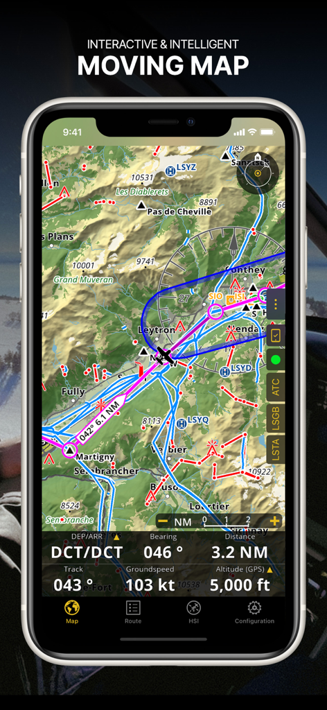
Air Navigation Pro 앱 스크린샷으로 항공 차트와 실시간 비행 데이터가 있는 대화형 이동 지도를 보여줍니다.
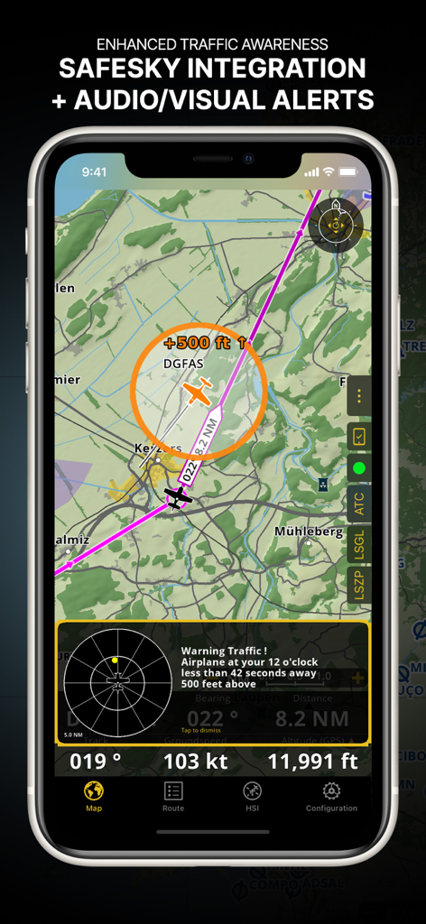
Safesky 통합 및 시각적 경고를 통해 향상된 교통 인식을 보여주는 Air Navigation Pro 인터페이스
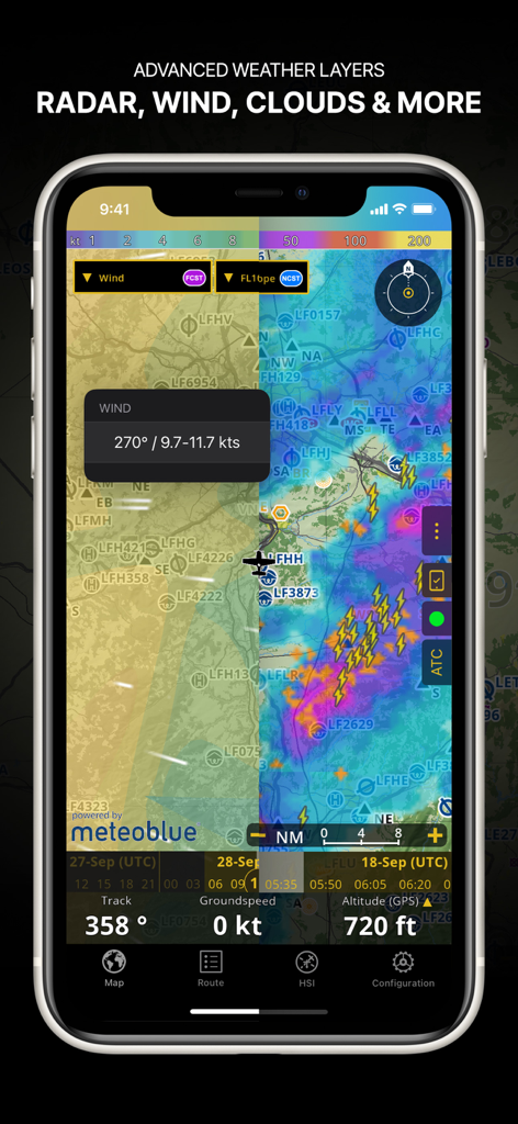
항법 지도에 레이더 바람 및 구름 덮개를 포함한 고급 날씨 레이어를 보여주는 Air Navigation Pro 앱 스크린샷
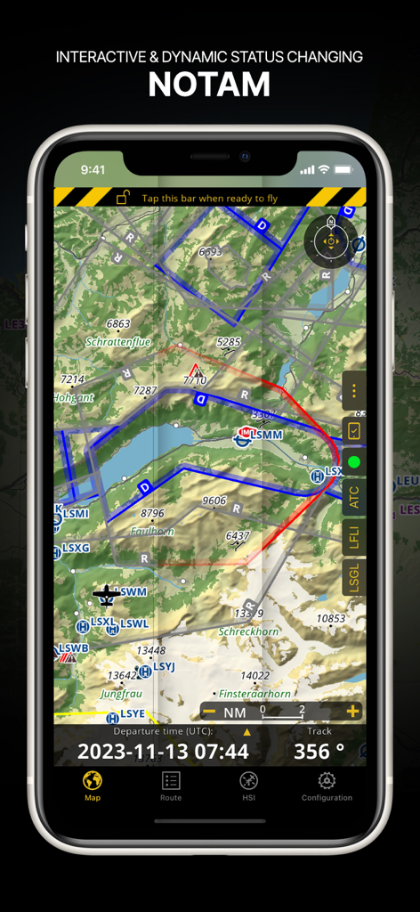
지형 항공 지도에 동적 NOTAM 정보를 표시하는 Air Navigation Pro 인터페이스
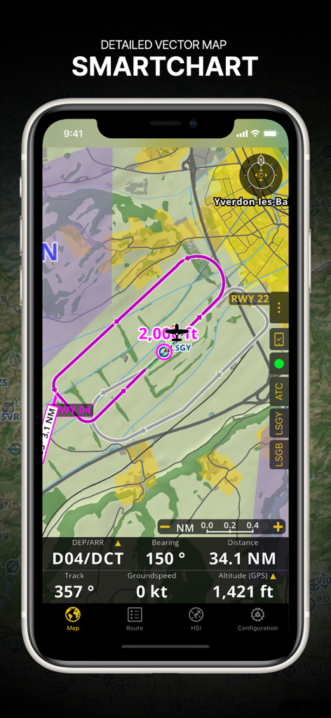
비행 경로 및 실시간 항법 데이터가 있는 상세한 벡터 SmartChart를 보여주는 Air Navigation Pro 인터페이스.
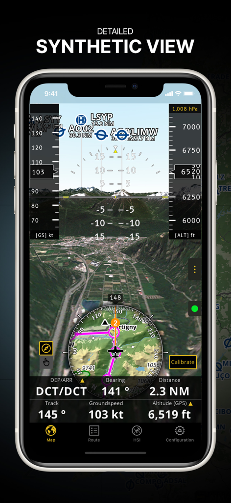
3D 지형 및 통합 비행 계측기가 있는 상세한 합성 보기를 표시하는 Air Navigation Pro 앱
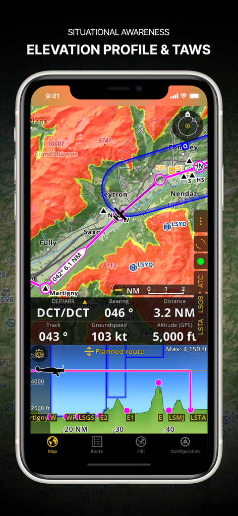
고도 프로필 및 지형 인식 경고 시스템을 보여주는 Air Navigation Pro 스크린샷.
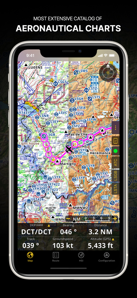
스마트폰 화면에서 비행 경로 및 항법 데이터가 있는 상세한 항공 차트를 표시하는 Air Navigation Pro 앱
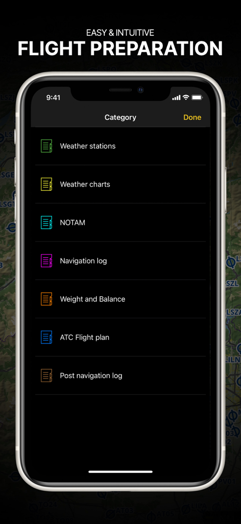
조종사를 위한 브리핑 범주가 있는 비행 준비 메뉴를 보여주는 Air Navigation Pro 앱
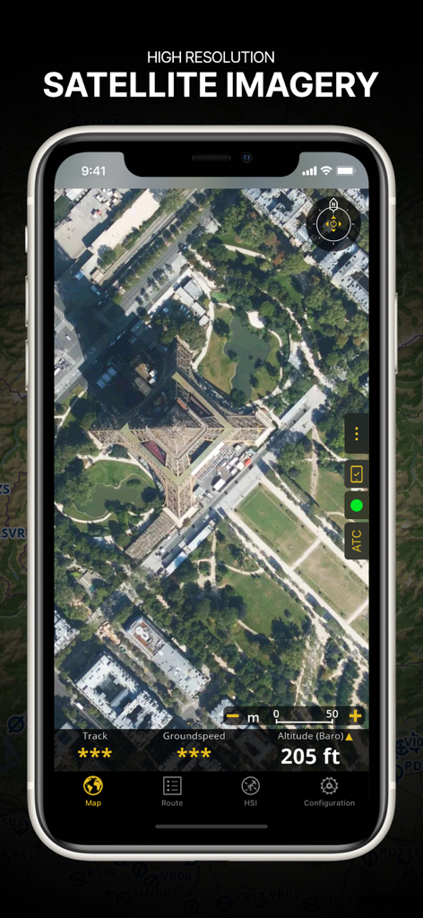
비행 데이터 오버레이가 있는 에펠탑의 고해상도 위성 이미지를 표시하는 Air Navigation Pro 앱 스크린샷
설명
Download
비슷한 앱
유사한 기능과 사용자 경험을 가진 앱

Navigraph Charts
Navigraph KB

SkyDemon
Divelements Limited

Airports
Applicate Ltd

OzRunways EFB
OzRunways Pty. Ltd.

fDeck: flight instruments
Darren Yeates

Noisy Goose
Automata Solutions Ltd.

StationWeather - METAR and TAF
Oliver Puetz

Drone UAV Fly Forecast: AirMap
MONIQ TAP COMPANY LIMITED

Airmate
Myriel Aviation SA
이 페이지는 앱이나 개발자의 공식 페이지가 아니며, 정보 제공 및 논평을 목적으로 작성된 독립 편집 간행물입니다. 명시적으로 달리 언급되지 않는 한, 해당 앱이나 개발자는 MWM, Apple, Google Play, 앱 퍼블리셔 또는 앱 개발자와 제휴, 보증, 후원, 승인 또는 공식적으로 연결되어 있지 않으며, 이 페이지의 어떤 내용도 해당 앱이 MWM의 서비스를 사용하여 개발되었음을 의미하지 않습니다. 모든 상표, 로고, 스크린샷 및 기타 콘텐츠는 해당 소유자의 자산입니다.