이 페이지는 앱이나 개발자의 공식 페이지가 아니며, 정보 제공 및 논평을 목적으로 작성된 독립 편집 간행물입니다. 명시적으로 달리 언급되지 않는 한, 해당 앱이나 개발자는 MWM, Apple, Google Play, 앱 퍼블리셔 또는 앱 개발자와 제휴, 보증, 후원, 승인 또는 공식적으로 연결되어 있지 않으며, 이 페이지의 어떤 내용도 해당 앱이 MWM의 서비스를 사용하여 개발되었음을 의미하지 않습니다. 모든 상표, 로고, 스크린샷 및 기타 콘텐츠는 해당 소유자의 자산입니다.

SityTrail
공식 USGS 지형도, 경로 이탈 안전 경고, 원활한 Apple Watch 통합으로 자신감을 가지고 탐험하세요. 데스크톱에서의 꼼꼼한 계획부터 트레일에서의 핸즈프리 내비게이션까지, SityTrail은 진정한 탐험가를 위한 최고의 도구입니다.
다운로드
167K+사용자 평점
총 평가 수
2K+개발사
카테고리
Travel지원 언어
6최신 버전
12.16.2크기
55.6 MB출시일
2011년 3월 21일전문적인 정밀도로 트레일을 마스터하세요
SityTrail은 고급 지형 매핑과 첨단 안전 기능을 결합하여 iPhone과 Apple Watch를 최고의 야외 내비게이션 시스템으로 변환합니다.
공식 USGS 지형도
고해상도 지형 데이터를 오프라인으로 이용하세요. 휴대폰 신호 없이도 가장 외딴 야생 지역을 전문가급 정확도로 탐색하세요.
능동형 경로 이탈 보호
계획된 경로에서 벗어나는 순간을 실시간 진동 알림 및 음성 안내로 알려주므로 자신감을 가지고 탐험하세요.
다음 스크린샷과 설명은 앱의 공식 스토어 목록에서 직접 가져온 것이며 앱 개발자의 자산입니다.
앱 스토어
스크린샷
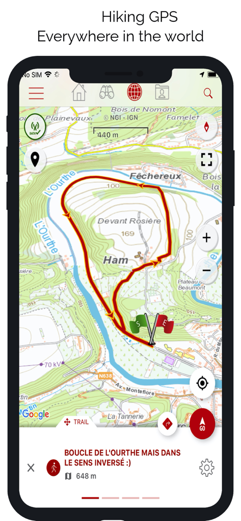
SityTrail 앱 인터페이스에 빨간색 하이킹 경로 루프가 표시된 상세 지형도가 표시됩니다.
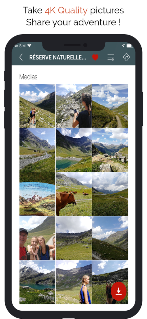
SityTrail 앱 화면에 하이킹 및 산 풍경 사진 모음이 표시됩니다.
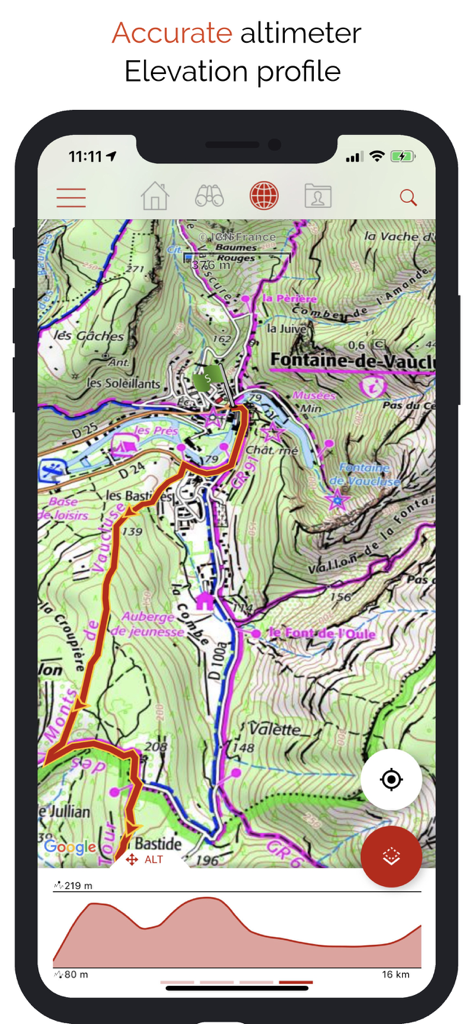
SityTrail 앱 인터페이스에 상세 지형도와 하이킹 고도 프로필 그래프가 표시됩니다.
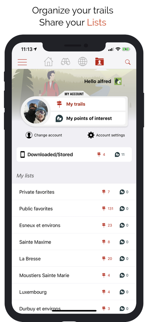
SityTrail 앱 인터페이스에 사용자 프로필 및 정리된 하이킹 경로 및 관심 지점 목록이 표시됩니다.
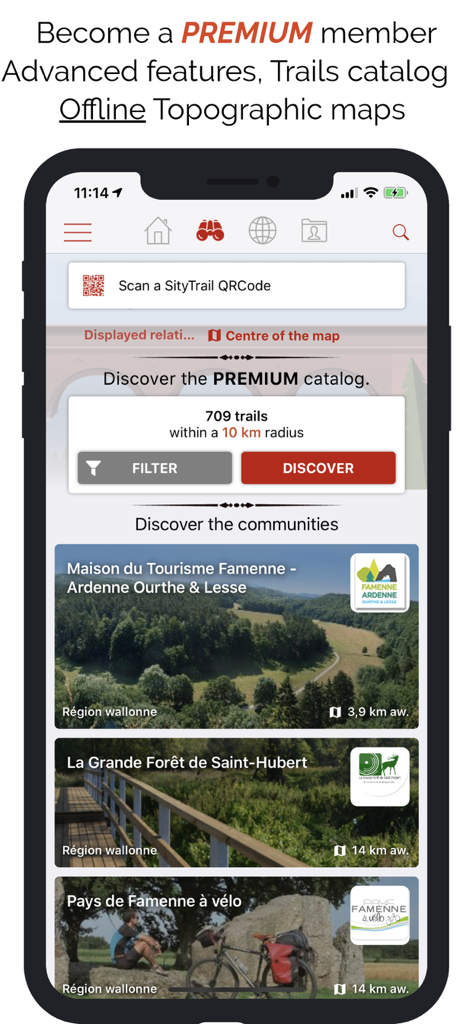
SityTrail 앱 인터페이스에 프리미엄 경로 카탈로그와 커뮤니티 큐레이션된 야외 경로가 표시됩니다.
설명
Download
비슷한 앱
유사한 기능과 사용자 경험을 가진 앱

AllTrails: Hike, Bike & Run
AllTrails, Inc.

Pedometer++
Cross Forward Consulting, LLC

Organic Maps: Offline Map
Organic Maps OU

Gaia GPS: Mobile Trail Maps
Trailbehind, INC.

Offline hiking maps: Mapy.com
Seznam.cz a.s.

Hiking Map Poland
Mapa Turystyczna sp. z o.o.

MapOut
Valnova GmbH

FarOut: Offline GPS Trail Maps
Atlas Guides DE, Inc.

Norgeskart
Norgeskart AS
이 페이지는 앱이나 개발자의 공식 페이지가 아니며, 정보 제공 및 논평을 목적으로 작성된 독립 편집 간행물입니다. 명시적으로 달리 언급되지 않는 한, 해당 앱이나 개발자는 MWM, Apple, Google Play, 앱 퍼블리셔 또는 앱 개발자와 제휴, 보증, 후원, 승인 또는 공식적으로 연결되어 있지 않으며, 이 페이지의 어떤 내용도 해당 앱이 MWM의 서비스를 사용하여 개발되었음을 의미하지 않습니다. 모든 상표, 로고, 스크린샷 및 기타 콘텐츠는 해당 소유자의 자산입니다.