This page is not an official page of the app or its developer, but an independent editorial publication created for informational and commentary purposes. Unless expressly stated otherwise, neither the app nor its developer is affiliated with, endorsed by, sponsored by, authorized by, or otherwise officially connected with MWM, Apple, Google Play, the app publisher, or the app's developer, and nothing on this page implies that the app was developed using MWM's services. Any trademarks, logos, screenshots, and other content remain the property of their respective owners.

CoMaps
Explore the world with community-powered, open-source maps. Navigate offline, discover hidden trails, and take control of your data with a not-for-profit app that never tracks you.
Downloads
55K+User Rating
Total Ratings
100Publisher
Category
NavigationLocales
44Latest Version
2026.01.08Size
134.0 MBFirst Released
Jun 28, 2025Your World, Offline and Private
Escape the grid without losing your way. CoMaps combines the power of OpenStreetMap with a strict commitment to your privacy, battery life, and independence.
Total Offline Freedom
Navigate the backcountry or international cities with zero cellular service. Download compact, detailed maps including hiking trails, contour lines, and subway layers.
Privacy Without Compromise
We don’t track, identify, or sell your data. Experience a truly ads-free navigation tool that respects your digital sovereignty and stays out of your personal business.
Frequently Asked Questions
Everything you need to know about CoMaps
Does CoMaps work without an internet connection?
Yes, CoMaps functions entirely offline. All app features are designed to work without cellular service, enabling planning and navigation abroad or in remote areas.
Does CoMaps track user data or include ads?
No, CoMaps respects user privacy. The app does not identify people, track users, collect personal information, or display any advertisements.
Is CoMaps a free application?
Yes, CoMaps is a free, open-source mapping application. It is built by a community of contributors and operates as a not-for-profit project, emphasizing transparency.
Can CoMaps provide navigation directions?
Yes, CoMaps offers navigation with voice announcements. It provides directions optimized for walking, cycling, or driving, enhancing travel planning.
What outdoor features do CoMaps maps include?
CoMaps maps feature an outdoor mode. This highlights hiking trails, campsites, water sources, peaks, and contour lines, providing essential details for outdoor activities.
Does CoMaps support Apple CarPlay?
Yes, CoMaps supports Apple CarPlay. This integration allows users to access mapping and navigation functionalities directly and safely from their vehicle's infotainment system.
Can users import and export data in CoMaps?
Yes, CoMaps supports importing and exporting bookmarks and tracks. It is compatible with common formats including KML, KMZ, and GPX for data management.
How can I find points of interest using CoMaps?
CoMaps allows users to search for points of interest. You can search by name, address, or category, such as restaurants or gas stations, directly within the app.
The following screenshots and description are sourced directly from the app's official store listing and are the property of the app developer.
App Store
Screenshots
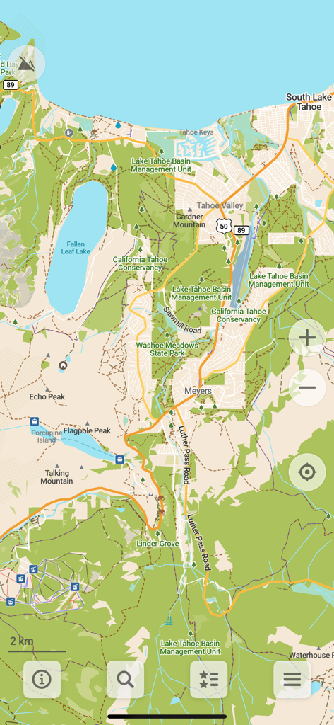
Detailed topographic map of the South Lake Tahoe area in the CoMaps app showing hiking trails and peaks.
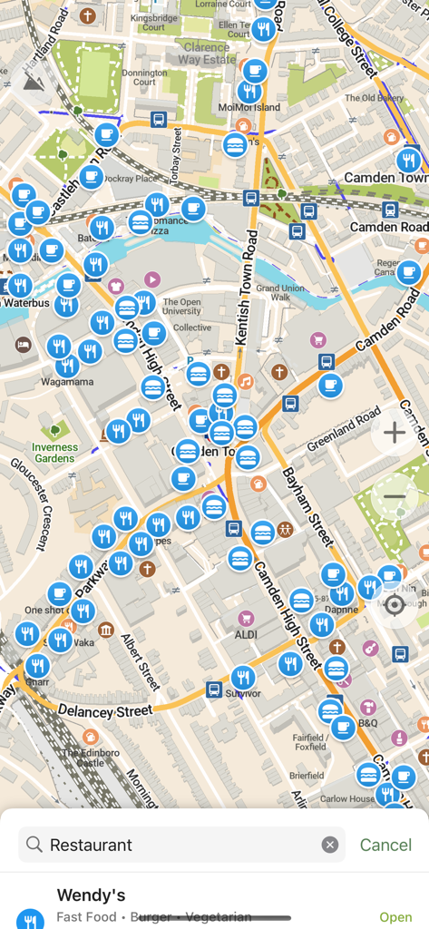
A detailed map view of a city area in the CoMaps app featuring numerous icons for restaurants, shops, and transit options with a search bar at the bottom.
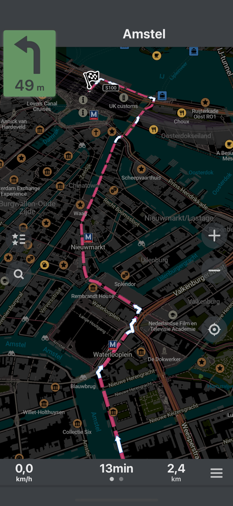
CoMaps navigation screen showing a pink route on a dark mode map of Amsterdam
Description
Download
More Like This
Apps with similar features and user experience

MAPS.ME: Offline Maps, GPS Nav
Convexity Holdings AG

GPS Navigation & Path Finder
Muhammad Asad Khan

MapFactor Navigator - GPS Maps
MAPFACTOR, s.r.o.

Guru Maps Pro & GPS Tracker
Evgen Bodunov

Offline Map Navigation
virtualmaze

Karta GPS - Offline Maps Nav
Karta Software Technologies lda

Genius Maps: GPS Navigation
Mireo d.d.

NaviMaps: 3D GPS Navigation
CE Info Systems Limited

MetroView GPS Navigation
MetroView Systems Pty Ltd
This page is not an official page of the app or its developer, but an independent editorial publication created for informational and commentary purposes. Unless expressly stated otherwise, neither the app nor its developer is affiliated with, endorsed by, sponsored by, authorized by, or otherwise officially connected with MWM, Apple, Google Play, the app publisher, or the app's developer, and nothing on this page implies that the app was developed using MWM's services. Any trademarks, logos, screenshots, and other content remain the property of their respective owners.