This page is not an official page of the app or its developer, but an independent editorial publication created for informational and commentary purposes. Unless expressly stated otherwise, neither the app nor its developer is affiliated with, endorsed by, sponsored by, authorized by, or otherwise officially connected with MWM, Apple, Google Play, the app publisher, or the app's developer, and nothing on this page implies that the app was developed using MWM's services. Any trademarks, logos, screenshots, and other content remain the property of their respective owners.

DeepStateMap
Go beyond mainstream news with precise front-line updates, NASA-backed fire data, and advanced OSINT tools used by defense professionals and analysts worldwide.
Downloads
277K+User Rating
Total Ratings
200Publisher
Category
NewsLocales
2Latest Version
2.1.1Size
26.4 MBFirst Released
Apr 27, 2023Master Battlefield Intelligence
Access the gold standard of OSINT mapping. DeepStateMap delivers granular, real-time data on troop movements, weapon ranges, and frontline shifts for the analytical observer.
Live Tactical Mapping
Monitor unit locations, airfields, and fleet movements with detailed iconography updated as events unfold on the ground.
NASA Thermal Integration
Overlay NASA FIRMS data to correlate thermal fire points with reported combat for objective, evidence-based battlefield verification.
Frequently Asked Questions
Everything you need to know about DeepStateMap
What is DeepStateMap?
DeepStateMap is an interactive online map of hostilities in Ukraine. It tracks military operations, unit locations, and movements in the Russian-Ukrainian war.
Does DeepStateMap track military operations in Ukraine?
Yes, DeepStateMap tracks military operations, unit locations, and movements in the Russian-Ukrainian war, providing real-time insights.
Can I use DeepStateMap offline?
Yes, DeepStateMap supports the possibility of caching downloaded data. This feature allows users to access map information even without an internet connection.
What territories are shown on the DeepStateMap?
DeepStateMap displays liberated, occupied, and contested territories in Ukraine. This includes areas such as Crimea, ORDLO, and Transnistria, color-coded for clarity.
Does DeepStateMap show military unit locations?
Yes, DeepStateMap displays military units, headquarters, airfields, and fleet locations. It also indicates the directions of attacks and other tactical movements.
Is there a news feed in DeepStateMap?
Yes, DeepStateMap integrates a news feed that provides regular updates on the latest developments and changes on the frontline, keeping users informed.
How can I measure distances on DeepStateMap?
Yes, DeepStateMap provides the ability to measure distances between any two points on the map. This tool helps users assess geographical ranges.
Does DeepStateMap integrate NASA Firms data for fire points?
Yes, DeepStateMap allows users to enable the display of fire points based on data from the NASA Firms system, which can be compared with the front line.
What artillery systems can DeepStateMap measure ranges for?
DeepStateMap includes a special mode to measure the range of various artillery systems, including HIMARS, M777, and CAESAR, across the entire front line.
Does DeepStateMap offer different map views?
DeepStateMap offers multiple map views, including Standard, Topo, and Satellite. Users can select their preferred map type directly from the settings menu.
Can I customize map markers in DeepStateMap?
Yes, DeepStateMap allows users to customize map markers in the settings. This includes toggling the display of NATO standards, Units, Headquarters, Airfields, and Railways.
Is a dark theme available in DeepStateMap?
Yes, DeepStateMap includes a dark theme option. Users can enable this feature within the General settings for a more comfortable viewing experience.
How frequently is DeepStateMap updated?
DeepStateMap is regularly updated with constant map changes and a frequent news feed. This ensures users have access to the latest frontline developments.
Can I create notes or highlights on DeepStateMap?
Yes, DeepStateMap provides interactive drawing tools. Users can create notes, highlight events, and organize their work directly on the map interface.
The following screenshots and description are sourced directly from the app's official store listing and are the property of the app developer.
App Store
Screenshots
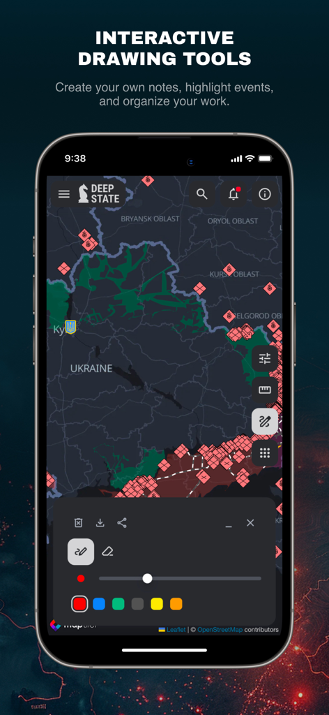
DeepStateMap app interface showing interactive drawing tools and tactical military icons on a map of Ukraine
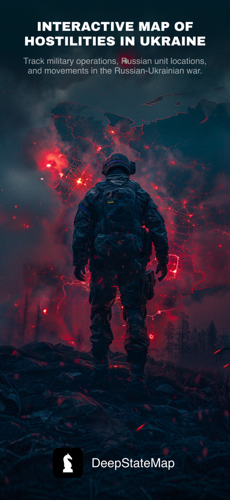
DeepStateMap interactive map tracking military operations and unit locations in Ukraine
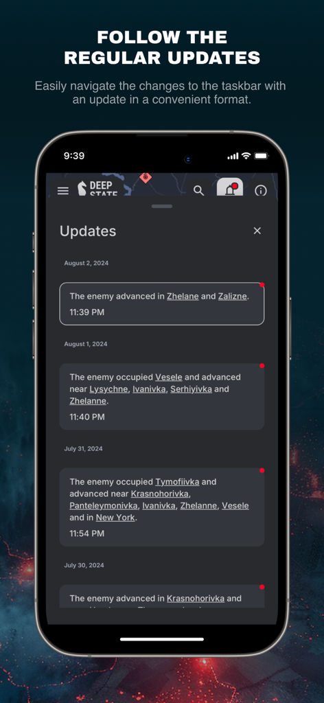
DeepStateMap app interface showing chronological military updates and front-line movement reports.
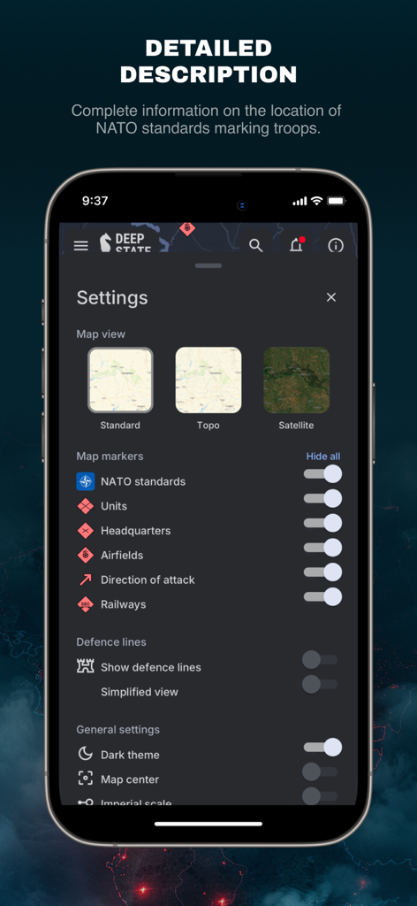
DeepStateMap settings screen showing map view options and military markers including NATO standards.
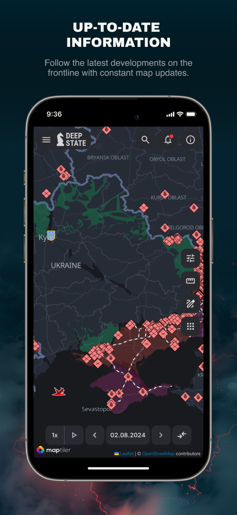
DeepStateMap interface showing a tactical military map of the Ukraine frontline with unit locations and territorial control zones
Description
Download
More Like This
Apps with similar features and user experience

MilGPS
Cascode Labs Pty Ltd

SEAiq Pilot VPP
Sakhalin, LLC

Cartograph Maps 3
Harald Meyer

新知卫星地图-路线规划,高清地图导航
Chongqing Xinzhi Space Technology Co., Ltd.

Coordinates – GPS Converter
Mapnitude Company Limited

Mgrs & Utm Map
Vahid Cataltas

Map Plus
Miocool Inc.

Compass 55. Map & GPS kit.
Kalimex-Consulting s.r.o.

Vetus Maps
Andrey Fetisov
This page is not an official page of the app or its developer, but an independent editorial publication created for informational and commentary purposes. Unless expressly stated otherwise, neither the app nor its developer is affiliated with, endorsed by, sponsored by, authorized by, or otherwise officially connected with MWM, Apple, Google Play, the app publisher, or the app's developer, and nothing on this page implies that the app was developed using MWM's services. Any trademarks, logos, screenshots, and other content remain the property of their respective owners.