This page is not an official page of the app or its developer, but an independent editorial publication created for informational and commentary purposes. Unless expressly stated otherwise, neither the app nor its developer is affiliated with, endorsed by, sponsored by, authorized by, or otherwise officially connected with MWM, Apple, Google Play, the app publisher, or the app's developer, and nothing on this page implies that the app was developed using MWM's services. Any trademarks, logos, screenshots, and other content remain the property of their respective owners.

Mgrs & Utm Map
The definitive coordinate tool for military personnel, SAR teams, and elite outdoor enthusiasts. Master your position with MGRS, UTM, and multi-satellite GNSS support in any environment.
Downloads
1M+User Rating
Total Ratings
6K+Publisher
Category
NavigationLocales
2Latest Version
3.7.0Size
50.4 MBFirst Released
Oct 27, 2018Field-Tested Precision for Critical Missions
The ultimate navigation toolkit designed for military personnel, search and rescue teams, and professional explorers who demand more than just a blue dot.
Pro-Grade Coordinate Systems
Switch instantly between MGRS, UTM, and Degrees. Built for the high-stakes land navigation accuracy required in tactical environments.
Triple-Constellation GNSS
Maximize signal reliability in canyons or heavy cover by leveraging GPS, GLONASS, and Galileo satellite systems simultaneously.
Frequently Asked Questions
Everything you need to know about Mgrs & Utm Map
What is Mgrs & Utm Map used for?
Mgrs & Utm Map is a GPS and coordinate systems helper for military personnel and outdoor activities like mountaineering, hiking, hunting, and geocaching.
Does Mgrs & Utm Map offer different map types?
Yes, Mgrs & Utm Map offers various map types including Normal, Satellite, Terrain, Hybrid, Night, and Assassin's for diverse navigation needs.
What satellite systems does Mgrs & Utm Map support?
Mgrs & Utm Map supports satellite navigation systems such as GPS, GALILEO, and GLONASS (GNSS) to provide accurate positioning.
Can Mgrs & Utm Map import and export KML files?
Yes, Mgrs & Utm Map features import and export functionality for KML files, allowing users to manage their geographic data.
Does Mgrs & Utm Map display elevation profiles?
Yes, Mgrs & Utm Map displays an elevation profile graph. This feature helps users analyze terrain changes during their outdoor activities.
Does Mgrs & Utm Map include a compass feature?
Yes, Mgrs & Utm Map includes a compass feature. It displays cardinal directions and degrees for navigation.
The following screenshots and description are sourced directly from the app's official store listing and are the property of the app developer.
App Store
Screenshots
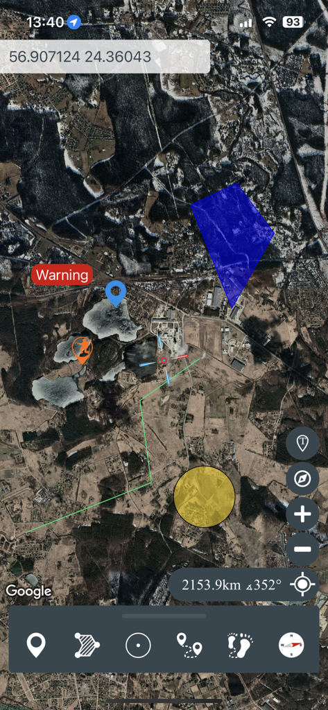
Satellite map interface in the Mgrs and Utm Map app showing coordinates and navigation markers.
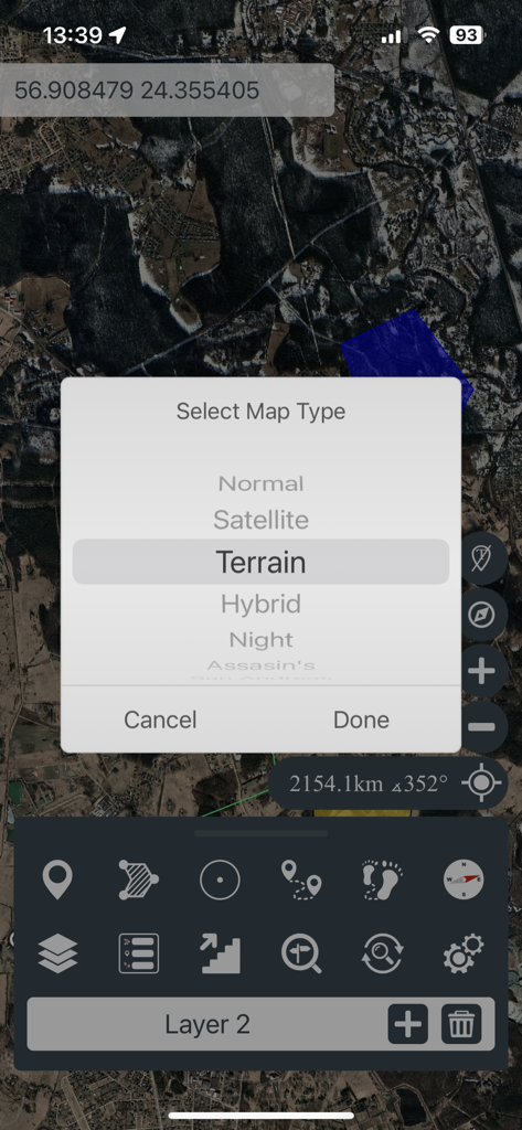
A mobile interface for Mgrs and Utm Map showing a satellite map view with a pop-up menu to select map types including Terrain and Satellite.
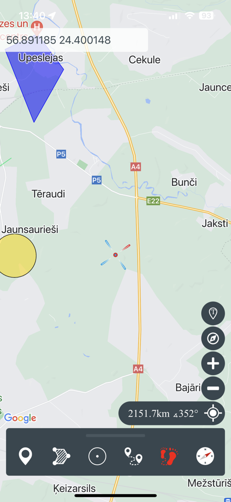
Interface of the Mgrs & Utm Map app showing a tactical navigation map with GPS coordinates and drawing tools
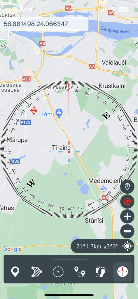
Tactical map interface with a large compass overlay and GPS coordinates
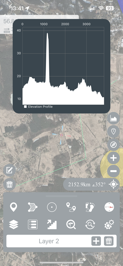
Elevation profile graph displayed over a satellite map in the Mgrs and Utm Map app.
Description
Download
More Like This
Apps with similar features and user experience

MilGPS
Cascode Labs Pty Ltd

SEAiq Pilot VPP
Sakhalin, LLC

Cartograph Maps 3
Harald Meyer

新知卫星地图-路线规划,高清地图导航
Chongqing Xinzhi Space Technology Co., Ltd.

Coordinates – GPS Converter
Mapnitude Company Limited

DeepStateMap
Heorhii Karpenko

Map Plus
Miocool Inc.

Compass 55. Map & GPS kit.
Kalimex-Consulting s.r.o.

Vetus Maps
Andrey Fetisov
This page is not an official page of the app or its developer, but an independent editorial publication created for informational and commentary purposes. Unless expressly stated otherwise, neither the app nor its developer is affiliated with, endorsed by, sponsored by, authorized by, or otherwise officially connected with MWM, Apple, Google Play, the app publisher, or the app's developer, and nothing on this page implies that the app was developed using MWM's services. Any trademarks, logos, screenshots, and other content remain the property of their respective owners.