This page is not an official page of the app or its developer, but an independent editorial publication created for informational and commentary purposes. Unless expressly stated otherwise, neither the app nor its developer is affiliated with, endorsed by, sponsored by, authorized by, or otherwise officially connected with MWM, Apple, Google Play, the app publisher, or the app's developer, and nothing on this page implies that the app was developed using MWM's services. Any trademarks, logos, screenshots, and other content remain the property of their respective owners.

DroneDeploy Flight App
Transform your DJI flights into high-resolution data. Automate missions, measure volumes, and share survey-grade maps across construction, agriculture, and inspection projects with just two taps.
Downloads
370K+User Rating
Total Ratings
14K+Publisher
Category
Photo & VideoLocales
2Latest Version
5.111.0Size
357.7 MBFirst Released
Mar 24, 2015Enterprise-Level Insights from Every Flight
Automate your data collection and transform aerial imagery into high-resolution maps, 3D models, and actionable reports tailored for your industry.
Precision Automated Flight
Plan repeatable missions and execute complex autonomous flights with two taps, ensuring consistent high-accuracy data capture every time.
Survey-Grade Measurements
Instantly calculate volumes, elevations, and surface areas to track site progress and material costs without manual labor.
The following screenshots and description are sourced directly from the app's official store listing and are the property of the app developer.
App Store
Screenshots
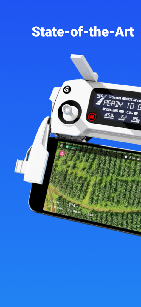
DroneDeploy app displaying an aerial field map on a smartphone attached to a drone remote controller
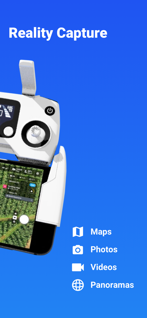
Drone remote controller and smartphone displaying reality capture features including maps photos and videos
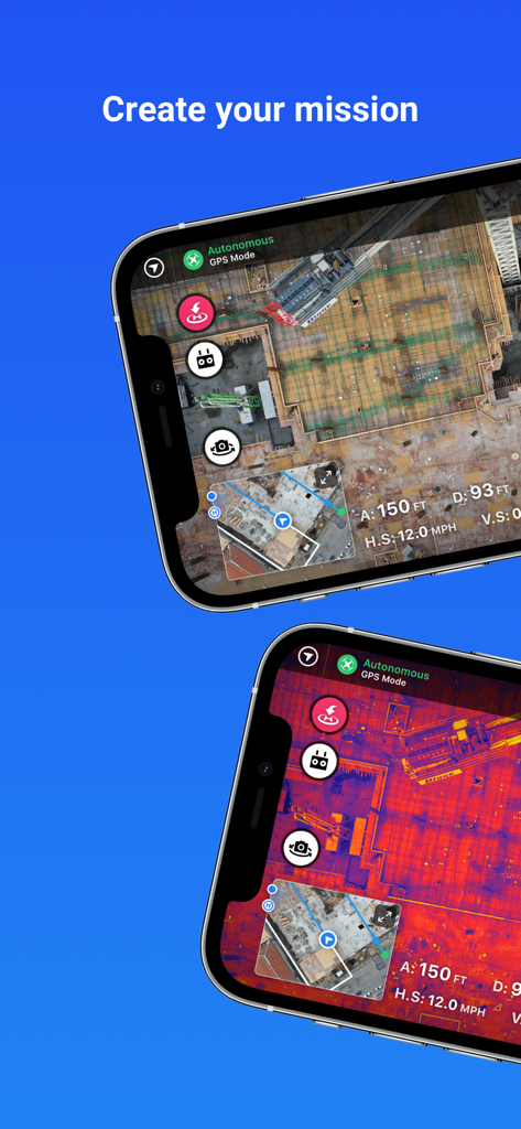
DroneDeploy app screens showing construction site mapping and thermal imaging for autonomous flight missions
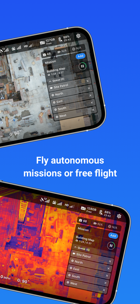
DroneDeploy app interface showing autonomous flight missions and thermal construction site mapping
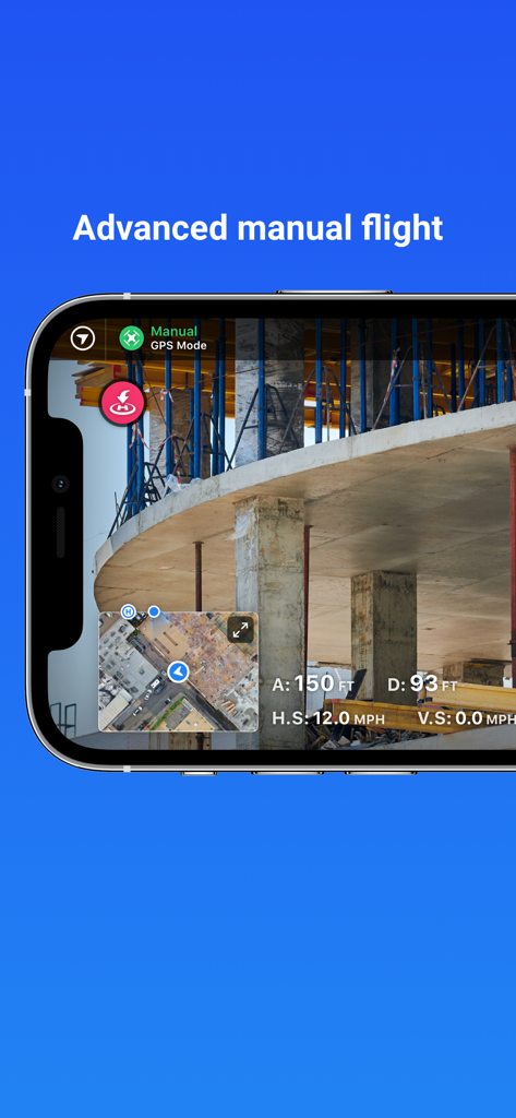
DroneDeploy app interface showcasing advanced manual flight mode with a live view of a construction site
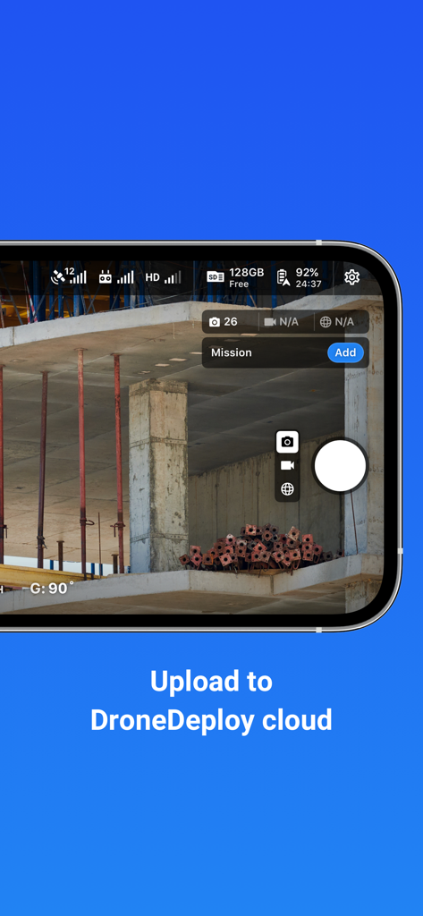
Interface of DroneDeploy app showing drone camera view of a construction site with cloud upload text
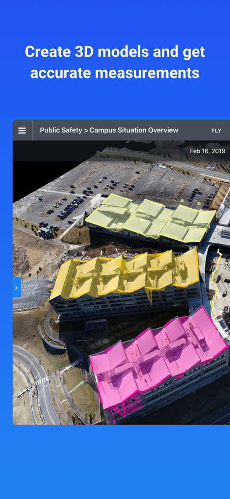
DroneDeploy interface showing a 3D building model with color coded roof segments for measurements
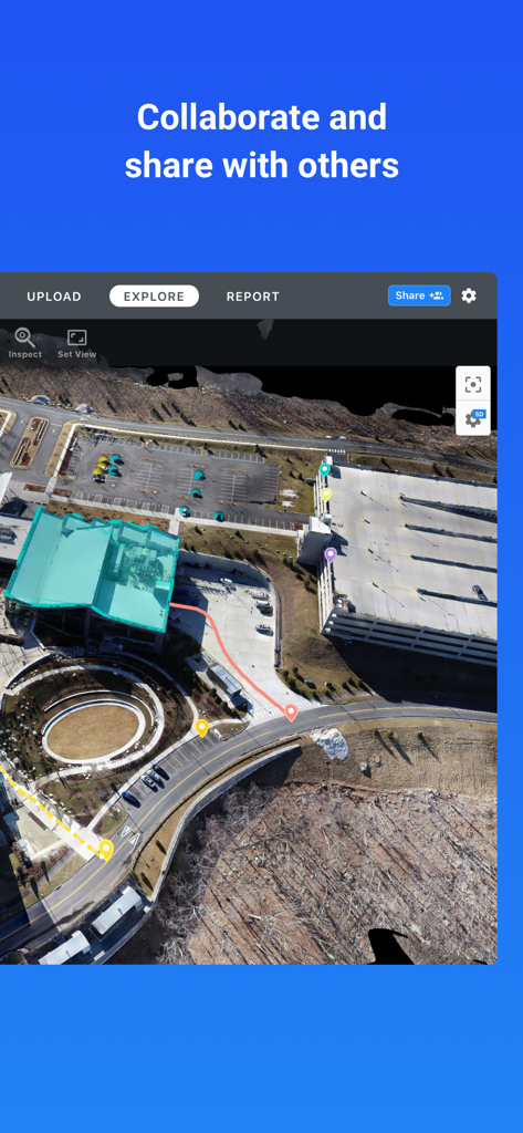
An annotated aerial drone map showing a construction site for team collaboration in the DroneDeploy app
Description
Download
More Like This
Top-ranked apps in the same category

CapCut: Photo & Video Editor
BYTEDANCE PTE. LTD.

Instagram, Inc.

YouTube
Google LLC

Canva: AI Photo & Video Editor
Canva Pty Ltd

Snapchat
Snap, Inc.

快手
Beijing Kwai Technology Co., Ltd.

Edits: Video Editor
Instagram, Inc.

Meitu- AI Photo & Video Editor
Xiamen Meitu Technology Co., Ltd.

Google Photos: Backup & Edit
Google LLC
This page is not an official page of the app or its developer, but an independent editorial publication created for informational and commentary purposes. Unless expressly stated otherwise, neither the app nor its developer is affiliated with, endorsed by, sponsored by, authorized by, or otherwise officially connected with MWM, Apple, Google Play, the app publisher, or the app's developer, and nothing on this page implies that the app was developed using MWM's services. Any trademarks, logos, screenshots, and other content remain the property of their respective owners.