This page is not an official page of the app or its developer, but an independent editorial publication created for informational and commentary purposes. Unless expressly stated otherwise, neither the app nor its developer is affiliated with, endorsed by, sponsored by, authorized by, or otherwise officially connected with MWM, Apple, Google Play, the app publisher, or the app's developer, and nothing on this page implies that the app was developed using MWM's services. Any trademarks, logos, screenshots, and other content remain the property of their respective owners.

Global Mapper Mobile
Bridge the gap between the office and the field with high-accuracy GNSS support, offline terrain display, and seamless workflow integration for engineers and surveyors.
Downloads
205K+User Rating
Total Ratings
0Publisher
Category
NavigationLocales
2Latest Version
3.1.8Size
126.3 MBFirst Released
Jun 15, 2016Optimize Your Field GIS Workflow
The professional's choice for bringing high-accuracy mapping, data collection, and spatial analysis to any remote location, seamlessly bridging the gap between office and field.
Smart Data Collection
Record points, lines, and polygons with custom attribute forms and geotagged photos to ensure high-quality data integrity directly from the field.
Reliable Offline Mapping
Access your vector, raster, and terrain layers in the most remote areas with zero cellular service, ensuring total situational awareness anywhere.
The following screenshots and description are sourced directly from the app's official store listing and are the property of the app developer.
App Store
Screenshots
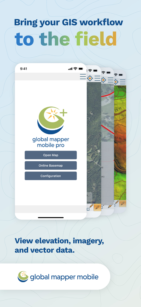
Global Mapper Mobile app screens showing GIS workflow features for field mapping and data collection
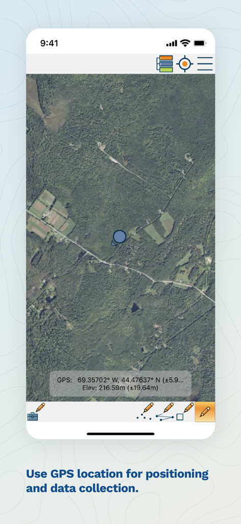
Satellite map view in Global Mapper Mobile showing GPS coordinates elevation and field data collection tools
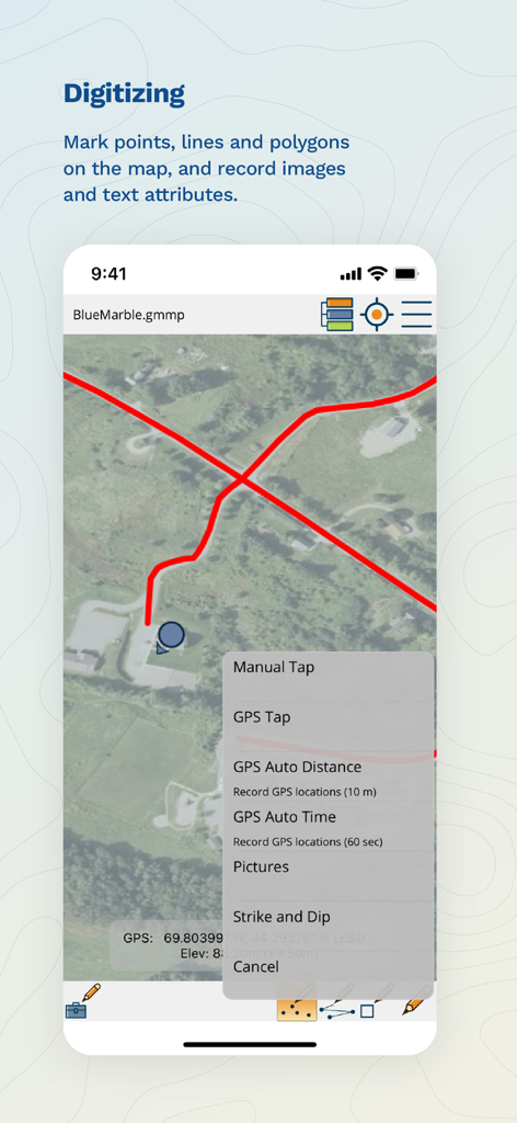
Global Mapper Mobile screen showing GIS digitizing tools for marking points lines and polygons on a map
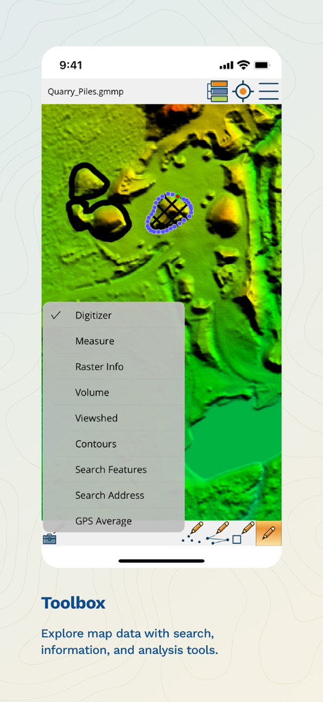
Global Mapper Mobile app showing the Toolbox menu with analysis features like volume, viewshed, and contours over a terrain map
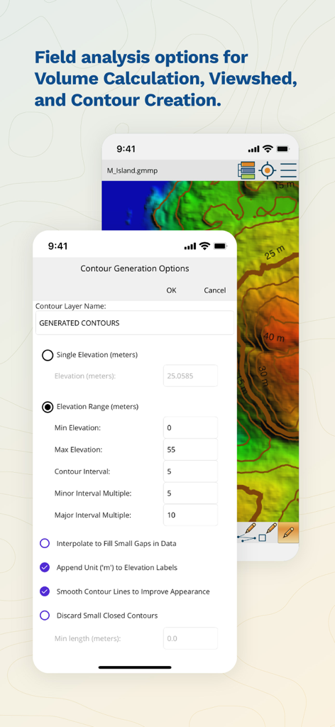
Interface of Global Mapper Mobile showing contour generation options for field analysis
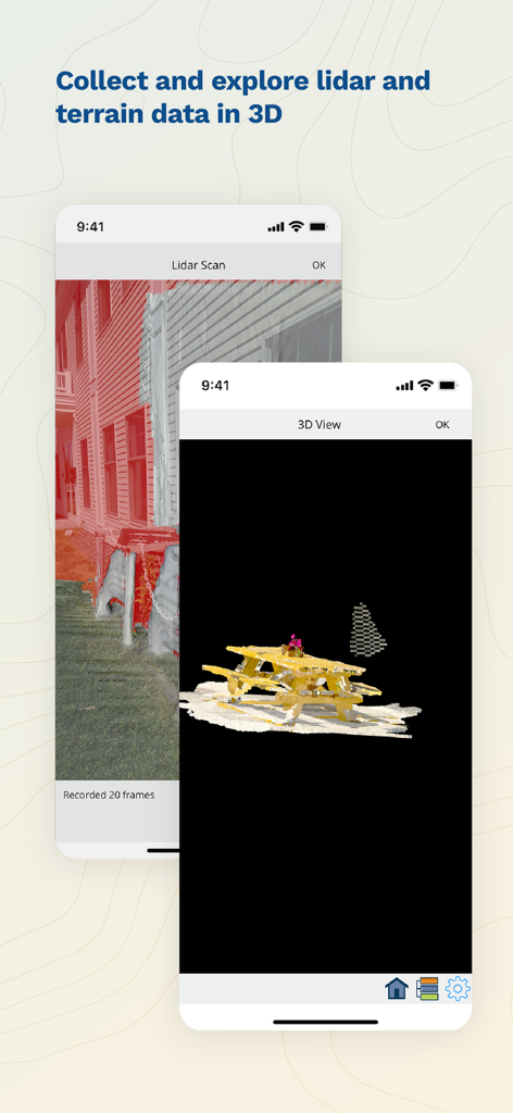
Global Mapper Mobile app interface showing a lidar scan and 3D terrain visualization on a smartphone
Description
Download
More Like This
Apps with similar features and user experience

MilGPS
Cascode Labs Pty Ltd

SEAiq Pilot VPP
Sakhalin, LLC

Cartograph Maps 3
Harald Meyer

新知卫星地图-路线规划,高清地图导航
Chongqing Xinzhi Space Technology Co., Ltd.

Coordinates – GPS Converter
Mapnitude Company Limited

Mgrs & Utm Map
Vahid Cataltas

DeepStateMap
Heorhii Karpenko

Map Plus
Miocool Inc.

Compass 55. Map & GPS kit.
Kalimex-Consulting s.r.o.
This page is not an official page of the app or its developer, but an independent editorial publication created for informational and commentary purposes. Unless expressly stated otherwise, neither the app nor its developer is affiliated with, endorsed by, sponsored by, authorized by, or otherwise officially connected with MWM, Apple, Google Play, the app publisher, or the app's developer, and nothing on this page implies that the app was developed using MWM's services. Any trademarks, logos, screenshots, and other content remain the property of their respective owners.