This page is not an official page of the app or its developer, but an independent editorial publication created for informational and commentary purposes. Unless expressly stated otherwise, neither the app nor its developer is affiliated with, endorsed by, sponsored by, authorized by, or otherwise officially connected with MWM, Apple, Google Play, the app publisher, or the app's developer, and nothing on this page implies that the app was developed using MWM's services. Any trademarks, logos, screenshots, and other content remain the property of their respective owners.

GPS Field Area Measurement
Effortlessly measure fields, plots, and boundaries with satellite accuracy. Perfect for farmers, real estate agents, and property owners to calculate acres and perimeters—even without internet.
Downloads
0User Rating
Total Ratings
0Publisher
Category
ProductivityLocales
8Latest Version
1.7Size
80.6 MBFirst Released
Jan 15, 2025Smart Tools for Precise Land Management
Transform your iPhone into a professional-grade survey tool. Measure acreage, perimeters, and distances with confidence, even in the most remote locations.
Works Anywhere, Offline
No cell service? No problem. Download maps and measure remote fields or trails without an internet connection.
Tailored for US Land Standards
Instantly calculate areas in Acres, Square Feet, or Hectares. Perfect for farming, real estate, and construction planning.
The following screenshots and description are sourced directly from the app's official store listing and are the property of the app developer.
App Store
Screenshots
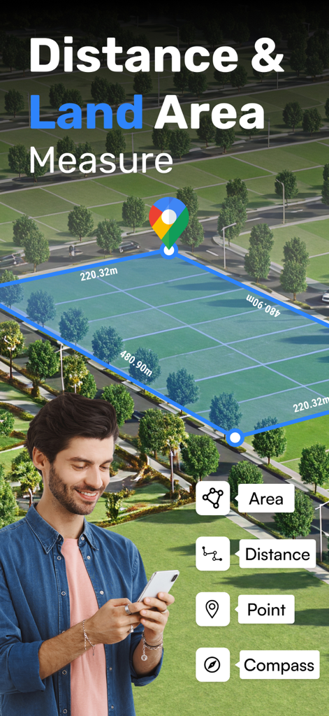
GPS app interface showing land area and distance measurement on a map
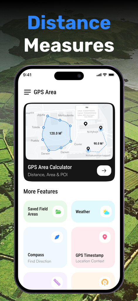
Interface of GPS Field Area Measurement app showing map tools and land surveying features
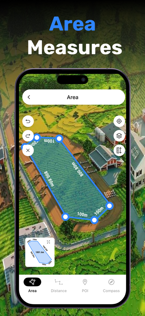
A mobile app screen showing a blue polygon overlay on a map to calculate land area and dimensions
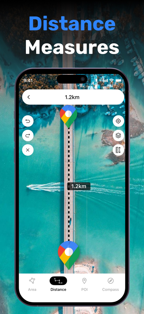
A smartphone showing the GPS Field Area Measurement app measuring a 1.2 kilometer distance on a satellite map.
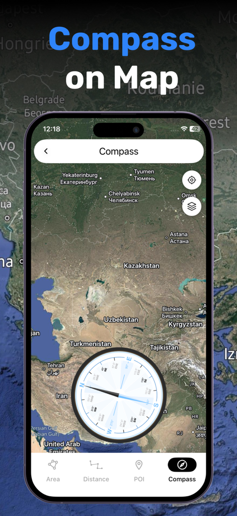
A smartphone displaying a digital compass overlay on a satellite map for land navigation and measurement
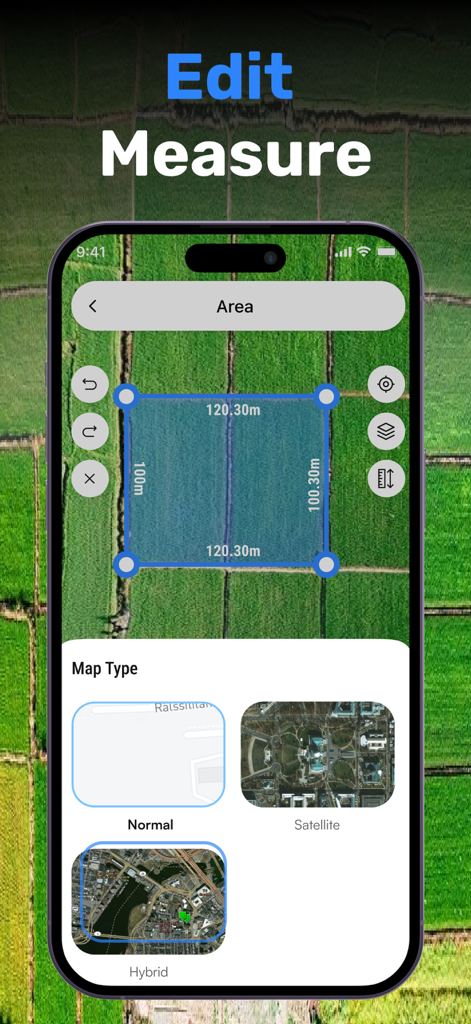
Smartphone screen showing land area measurement on a satellite map with map type options
Description
Download
More Like This
Top-ranked apps in the same category

ChatGPT
OpenAI OpCo, LLC

Google Gemini
Google LLC

Claude by Anthropic
Anthropic PBC

Gmail - Email by Google
Google LLC

千问 - 阿里最强大模型官方AI助手
Shanghai Zhixin Puhui Technology Co., Ltd.

Grok
X.AI Corporation

Google Drive
Google LLC

Microsoft Authenticator
Microsoft Corporation

Google Sheets
Google LLC
This page is not an official page of the app or its developer, but an independent editorial publication created for informational and commentary purposes. Unless expressly stated otherwise, neither the app nor its developer is affiliated with, endorsed by, sponsored by, authorized by, or otherwise officially connected with MWM, Apple, Google Play, the app publisher, or the app's developer, and nothing on this page implies that the app was developed using MWM's services. Any trademarks, logos, screenshots, and other content remain the property of their respective owners.