This page is not an official page of the app or its developer, but an independent editorial publication created for informational and commentary purposes. Unless expressly stated otherwise, neither the app nor its developer is affiliated with, endorsed by, sponsored by, authorized by, or otherwise officially connected with MWM, Apple, Google Play, the app publisher, or the app's developer, and nothing on this page implies that the app was developed using MWM's services. Any trademarks, logos, screenshots, and other content remain the property of their respective owners.

RealityMaps 3D tour planner
Visualize your next adventure with high-resolution aerial mapping and expert-verified routes. Plan technical hikes, bike trails, and ski tours with pinpoint precision using the most accurate 3D terrain data available.
Downloads
135K+User Rating
Total Ratings
1K+Publisher
Category
NavigationLocales
2Latest Version
2.0.61Size
112.8 MBFirst Released
Jul 18, 2013Navigate with Unrivaled 3D Clarity
From high-tech scouting to real-time backcountry safety, get the precision tools you need to conquer technical terrain with absolute confidence.
Immersive 3D Planning
Visualize every ridge, cliff, and trail with aerial-grade accuracy. Scout your route in a realistic 3D environment to master the terrain before your first step.
Technical Terrain Intelligence
Assess slope gradients and orientation instantly. Essential for backcountry safety, helping you identify potential hazards and navigate complex peaks like a pro.
The following screenshots and description are sourced directly from the app's official store listing and are the property of the app developer.
App Store
Screenshots
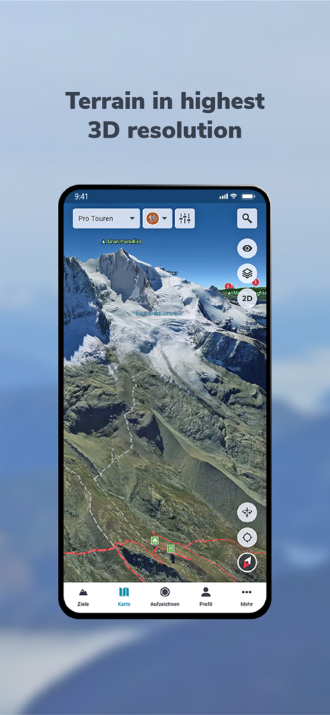
High-resolution 3D terrain map of Gran Paradiso mountain on a smartphone
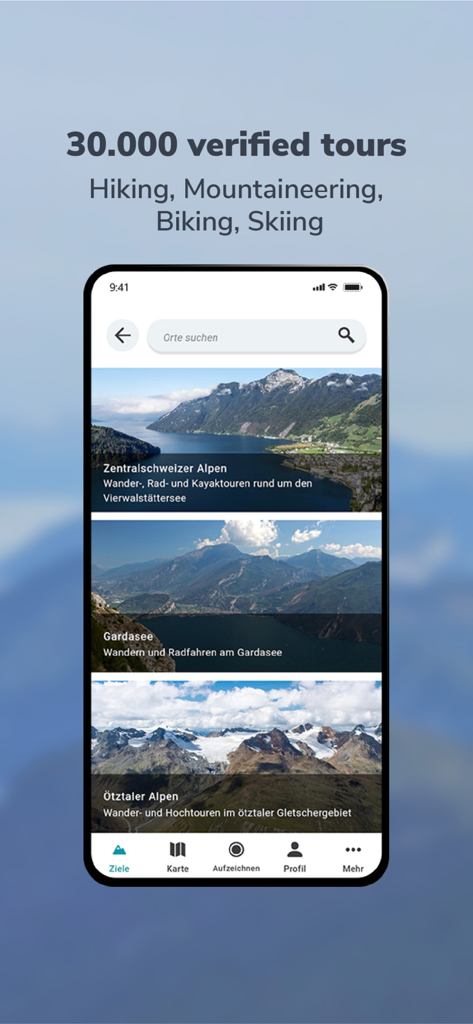
A smartphone screen displaying the RealityMaps 3D app with a selection of verified hiking and mountaineering tours in the Alps
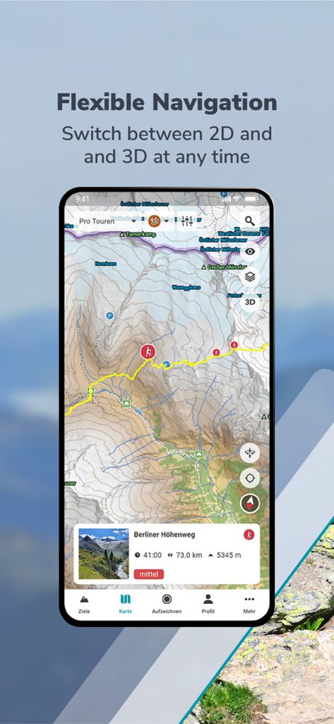
RealityMaps 3D app interface showing a 2D topographic hiking map of the Berliner Hohenweg
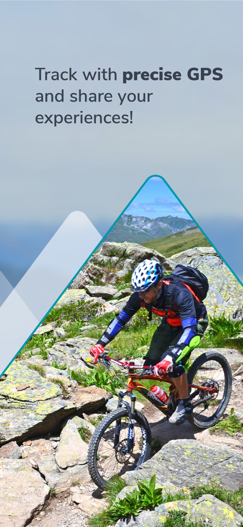
A mountain biker navigating a rocky mountain trail with precise GPS tracking
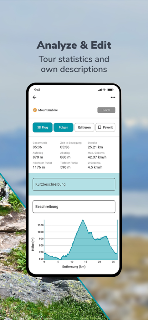
RealityMaps 3D app interface showing mountain bike tour statistics and elevation profile graph.
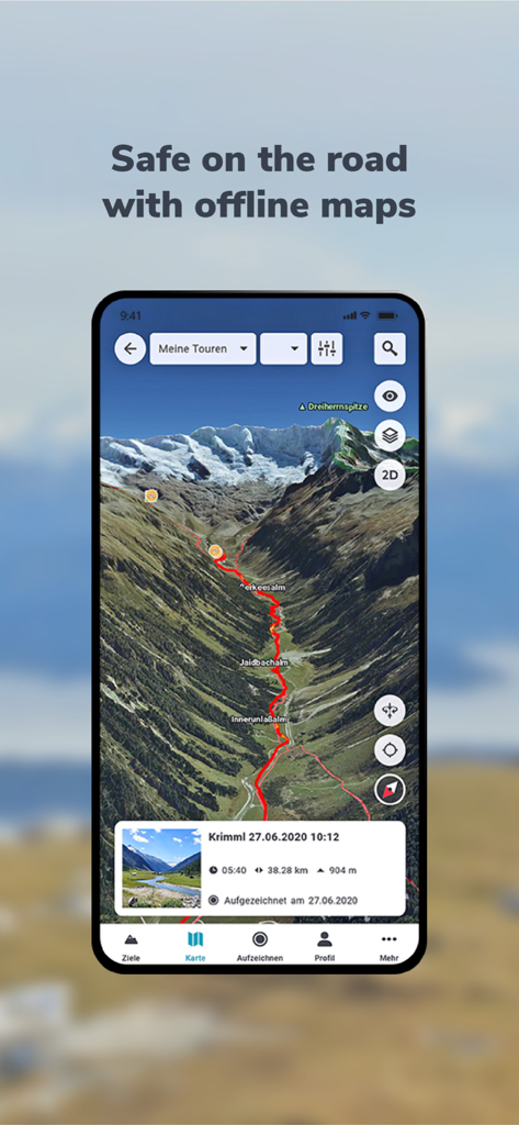
RealityMaps 3D app displaying a red hiking route on a realistic 3D mountain landscape

A high resolution 3D winter map showing a ski route on a snowy mountain peak
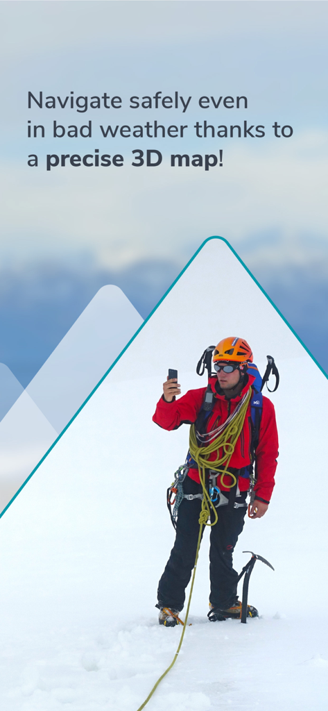
Mountain climber using 3D navigation on a snowy peak for safety
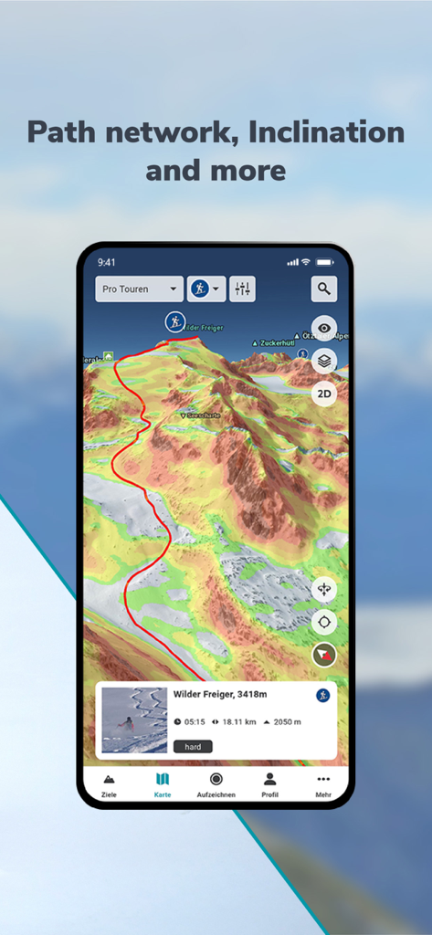
RealityMaps 3D interface showing a mountain route with color-coded slope inclination and terrain detail
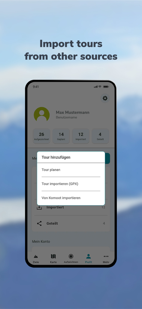
A mobile interface for RealityMaps 3D showing a menu to import hiking and biking tours from GPX files or Komoot.
Description
Download
More Like This
Apps with similar features and user experience

Saki - Connect & Share
潇泳 庄

Gaggle Paragliding, Ultralight
Viszen Pty Ltd

AvTraffic
Tailwind Software

Paragliding Tracker: Wingman
iSolid SPRL

Skida: Alpine Adventures
Mountainsnow AS

Relief Maps : backcountry gps
Batiste Vonderweidt

Spot Assist Skydiving Tool
Andrey Kan

Flyskyhy
Rene Dekker

iGlide Advanced
Logic Design
This page is not an official page of the app or its developer, but an independent editorial publication created for informational and commentary purposes. Unless expressly stated otherwise, neither the app nor its developer is affiliated with, endorsed by, sponsored by, authorized by, or otherwise officially connected with MWM, Apple, Google Play, the app publisher, or the app's developer, and nothing on this page implies that the app was developed using MWM's services. Any trademarks, logos, screenshots, and other content remain the property of their respective owners.