This page is not an official page of the app or its developer, but an independent editorial publication created for informational and commentary purposes. Unless expressly stated otherwise, neither the app nor its developer is affiliated with, endorsed by, sponsored by, authorized by, or otherwise officially connected with MWM, Apple, Google Play, the app publisher, or the app's developer, and nothing on this page implies that the app was developed using MWM's services. Any trademarks, logos, screenshots, and other content remain the property of their respective owners.

Relief Maps : backcountry gps
From the PCT to the Rockies, conquer every peak with professional-grade offline USGS maps, avalanche slope analysis, and specialized tools for ski touring, mountaineering, and paragliding.
Downloads
106K+User Rating
Total Ratings
900Publisher
Category
NavigationLocales
2Latest Version
2.5.1Size
196.9 MBFirst Released
Jan 20, 2019Engineered for the Technical Explorer
Whether you are planning a PCT thru-hike or a high-consequence ski tour, Relief Maps provides the 3D data and offline reliability to push your limits safely.
Immersive 3D Terrain Analysis
Visualize your route with high-definition 3D rendering of USGS topo maps to understand the exact topography before you step foot on the trail.
Mission-Critical Offline Maps
Download unlimited map layers for use deep in the wilderness. Stay on track with GPS navigation that works perfectly without cell service or data.
The following screenshots and description are sourced directly from the app's official store listing and are the property of the app developer.
App Store
Screenshots
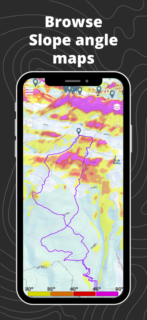
Relief Maps mobile app showing a 3D slope angle map with a tracked GPS route for backcountry safety
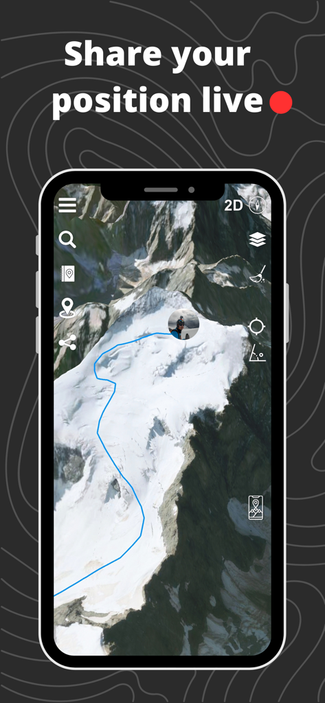
Relief Maps app interface showing a 3D mountain terrain with a blue route path and a live position indicator.
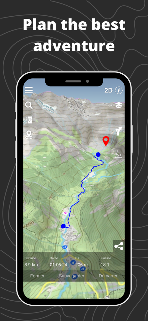
Relief Maps app showing a 3D topographic map and planned backcountry route
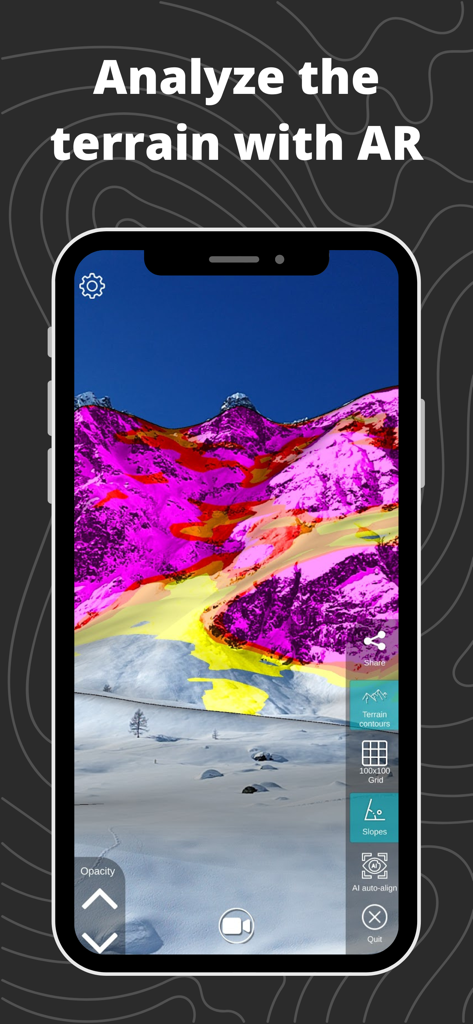
Augmented reality view of mountain slope gradients for backcountry navigation.
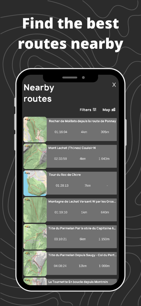
Relief Maps app interface displaying a list of nearby backcountry routes with technical data and topographic map thumbnails.
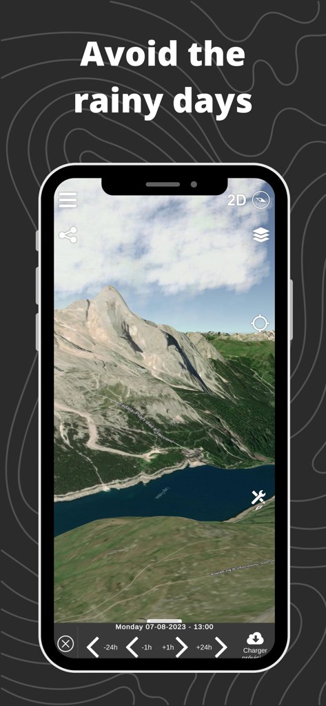
A 3D topographic mountain map on a smartphone displaying a weather forecast timeline to avoid rainy days during backcountry trips.
Description
Download
More Like This
Apps with similar features and user experience

Saki - Connect & Share
潇泳 庄

Gaggle Paragliding, Ultralight
Viszen Pty Ltd

AvTraffic
Tailwind Software

Paragliding Tracker: Wingman
iSolid SPRL

Skida: Alpine Adventures
Mountainsnow AS

RealityMaps 3D tour planner
3D RealityMaps GmbH

Spot Assist Skydiving Tool
Andrey Kan

Flyskyhy
Rene Dekker

iGlide Advanced
Logic Design
This page is not an official page of the app or its developer, but an independent editorial publication created for informational and commentary purposes. Unless expressly stated otherwise, neither the app nor its developer is affiliated with, endorsed by, sponsored by, authorized by, or otherwise officially connected with MWM, Apple, Google Play, the app publisher, or the app's developer, and nothing on this page implies that the app was developed using MWM's services. Any trademarks, logos, screenshots, and other content remain the property of their respective owners.