This page is not an official page of the app or its developer, but an independent editorial publication created for informational and commentary purposes. Unless expressly stated otherwise, neither the app nor its developer is affiliated with, endorsed by, sponsored by, authorized by, or otherwise officially connected with MWM, Apple, Google Play, the app publisher, or the app's developer, and nothing on this page implies that the app was developed using MWM's services. Any trademarks, logos, screenshots, and other content remain the property of their respective owners.

SW Maps
Empower your field work with a comprehensive mapping tool designed for professionals. Connect to external GNSS receivers, manage complex shapefiles, and collect high-accuracy geographic data effortlessly—all for free and with no ads.
Downloads
32K+User Rating
Total Ratings
0Publisher
Category
ProductivityLocales
1Latest Version
1.2.4Size
17.2 MBFirst Released
Nov 17, 2022Professional Field Data Collection
A complete, high-precision GIS toolkit designed for surveyors, engineers, and researchers who need reliable data without the enterprise price tag.
Centimeter-Level Accuracy
Connect external GNSS/RTK receivers via Bluetooth to achieve professional-grade precision directly on your mobile device.
Reliable Offline Mapping
Work anywhere by caching base maps and importing custom mbtiles or KML overlays for full functionality in remote field locations.
The following screenshots and description are sourced directly from the app's official store listing and are the property of the app developer.
App Store
Screenshots
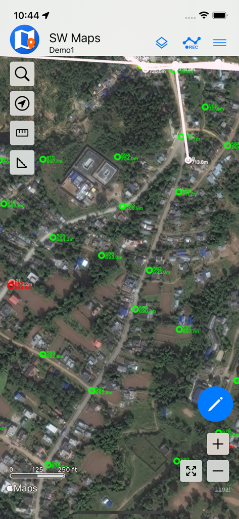
SW Maps interface displaying GIS survey points on a satellite background
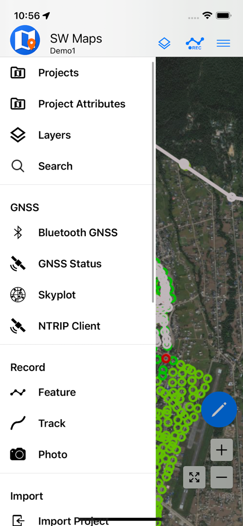
SW Maps mobile app menu showing GIS data collection and GNSS surveying options
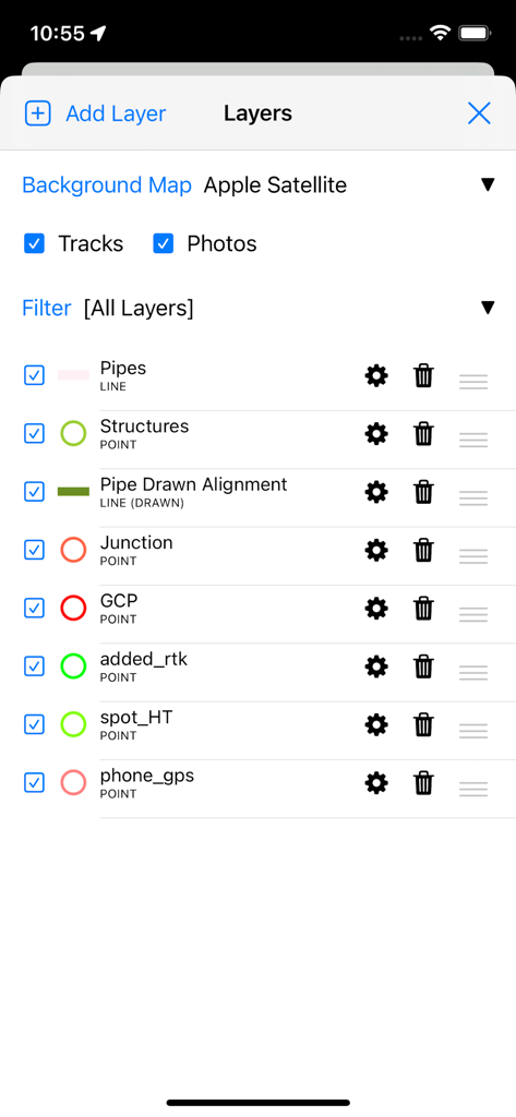
SW Maps app interface showing professional GIS data layer management for surveying and mapping
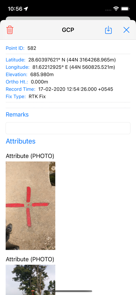
Detailed view of a ground control point in SW Maps showing coordinates and a photo of the physical survey marker
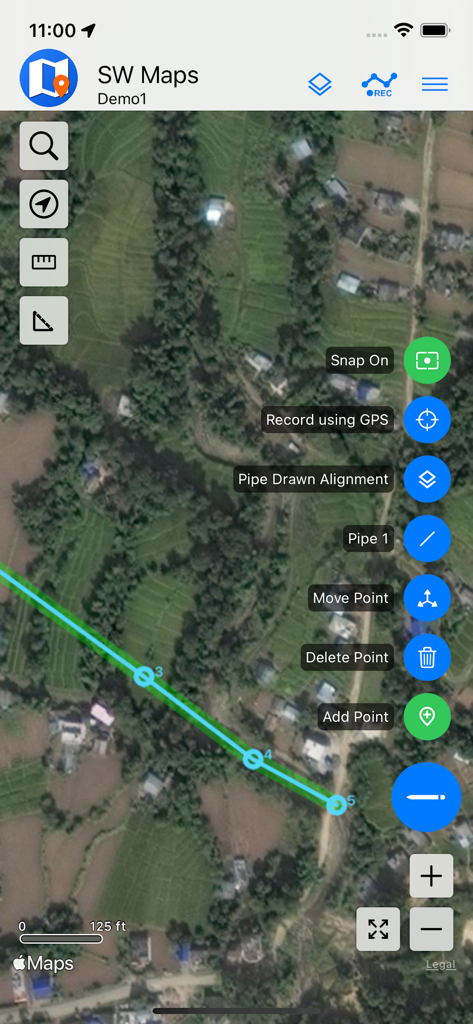
Mobile GIS mapping in SW Maps showing a pipe alignment on satellite imagery
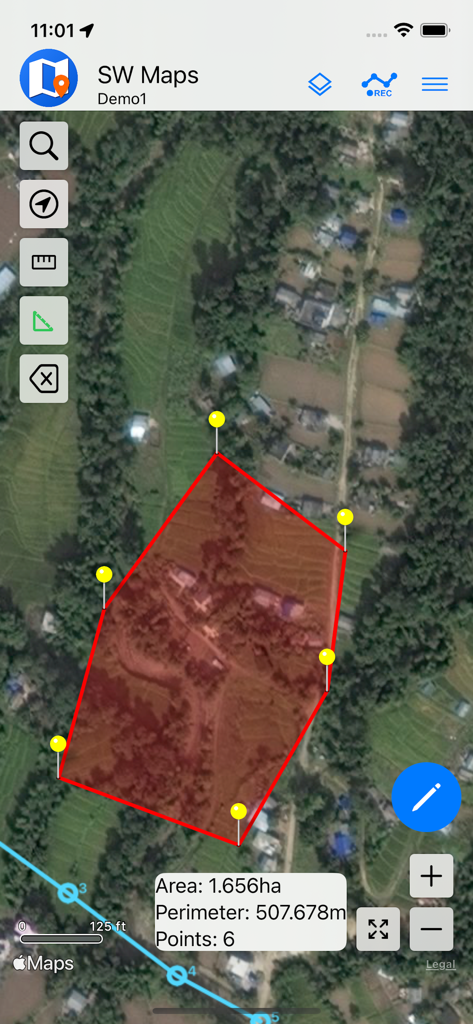
A satellite map view in the SW Maps app showing a red polygon with calculated area and perimeter for land surveying.
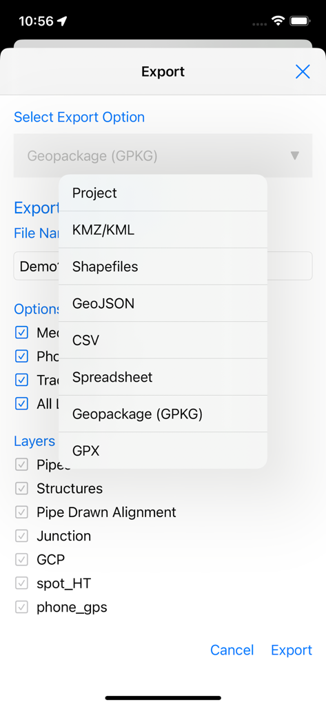
SW Maps export screen displaying a list of professional GIS file formats and layer selection options
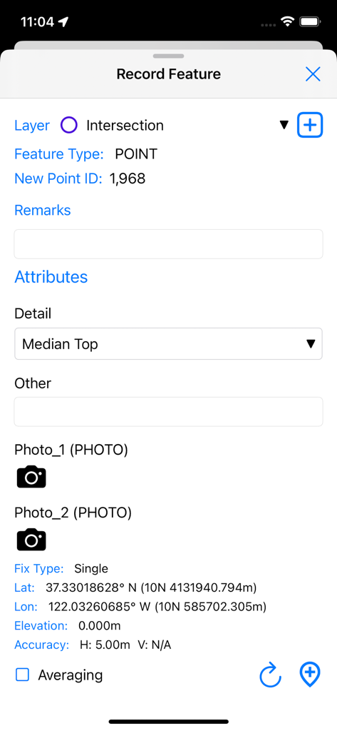
Interface for recording a new GIS point feature with GPS coordinates and custom attributes in SW Maps
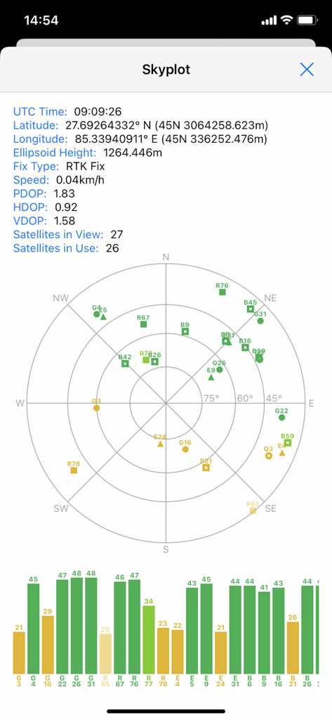
SW Maps skyplot screen displaying satellite positions and GNSS signal quality for professional mapping projects
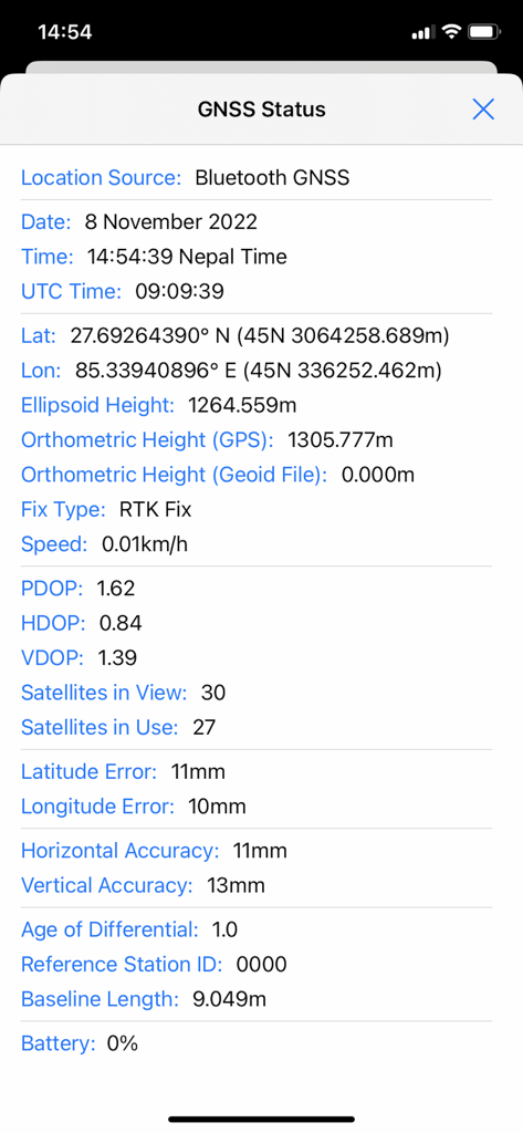
GNSS status screen in SW Maps showing high precision RTK fix and accuracy metrics
Description
Download
More Like This
Top-ranked apps in the same category

ChatGPT
OpenAI OpCo, LLC

Google Gemini
Google LLC

Grok
X.AI Corporation

Gmail - Email by Google
Google LLC

千问 - 阿里最强大模型官方AI助手
Shanghai Zhixin Puhui Technology Co., Ltd.

Google Drive
Google LLC

Microsoft Authenticator
Microsoft Corporation

Google Sheets
Google LLC

Google Docs
Google LLC
This page is not an official page of the app or its developer, but an independent editorial publication created for informational and commentary purposes. Unless expressly stated otherwise, neither the app nor its developer is affiliated with, endorsed by, sponsored by, authorized by, or otherwise officially connected with MWM, Apple, Google Play, the app publisher, or the app's developer, and nothing on this page implies that the app was developed using MWM's services. Any trademarks, logos, screenshots, and other content remain the property of their respective owners.