This page is not an official page of the app or its developer, but an independent editorial publication created for informational and commentary purposes. Unless expressly stated otherwise, neither the app nor its developer is affiliated with, endorsed by, sponsored by, authorized by, or otherwise officially connected with MWM, Apple, Google Play, the app publisher, or the app's developer, and nothing on this page implies that the app was developed using MWM's services. Any trademarks, logos, screenshots, and other content remain the property of their respective owners.

Tactical NAV
Built in combat by a veteran for the rugged demands of the field. Get 1mm accuracy, MGRS coordinates, and full offline mapping to operate with confidence in any environment.
Downloads
229K+User Rating
Total Ratings
600Publisher
Category
NavigationLocales
1Latest Version
5.0.10Size
49.3 MBFirst Released
Feb 14, 2011Built for the Mission, Proven in Combat
Empowering service members and first responders with a rugged, high-precision navigation platform designed to operate in the world's most austere environments.
Battlefield Precision
Achieve 1mm accuracy with MGRS, UTM, and BNG coordinate systems, matching the performance of official DoD hardware like the AN/PSN-13 DAGR.
Total Offline Capability
Operate with zero cellular emission. Download maps and plan missions in completely disconnected or contested environments with full tactical drawing support.
The following screenshots and description are sourced directly from the app's official store listing and are the property of the app developer.
App Store
Screenshots
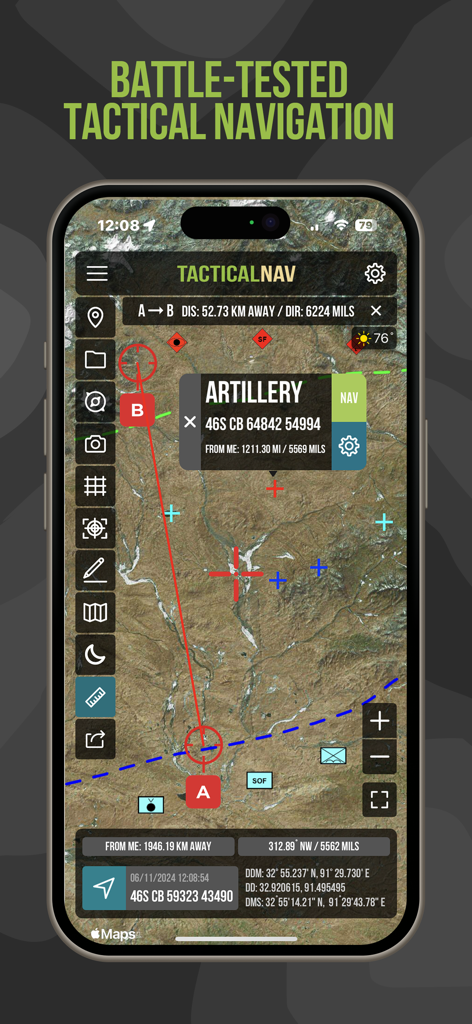
Tactical NAV app interface showing satellite map with MGRS coordinates and artillery waypoint
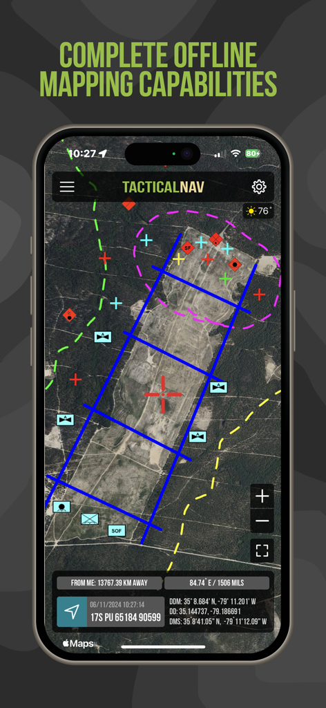
Tactical NAV app interface showing offline satellite mapping with military grid coordinates and tactical overlays
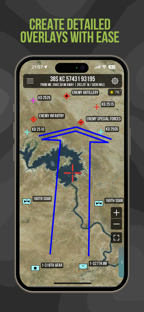
Tactical NAV app showing detailed military overlays and unit positions on a satellite map
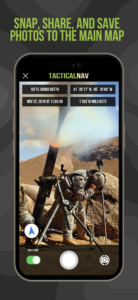
Tactical NAV app interface showing a photo of military operations with MGRS coordinates and location data overlays
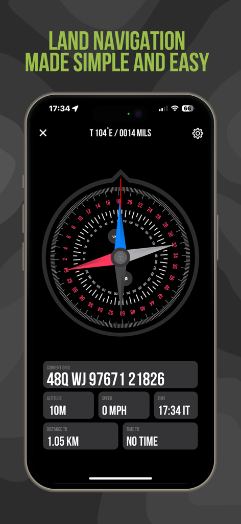
Tactical NAV land navigation screen with MGRS coordinates and digital compass
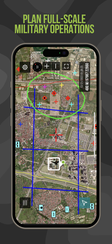
Tactical NAV app interface featuring mission planning tools and tactical map overlays
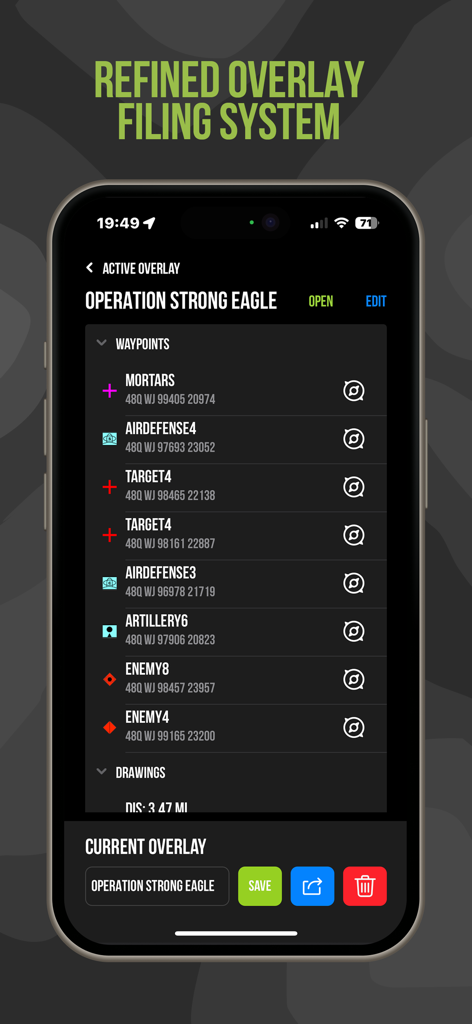
Tactical NAV app interface showing waypoint management and MGRS coordinates for mission planning
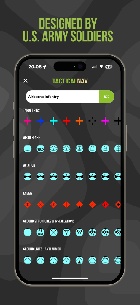
Tactical NAV app screen displaying various military symbols and icons for tactical mission planning

Tactical NAV app screen dedicated to U.S. Army fallen heroes and veteran charities

About page of the Tactical NAV app showing a personal message from its veteran creator
Description
Download
More Like This
Apps with similar features and user experience

MilGPS
Cascode Labs Pty Ltd

SEAiq Pilot VPP
Sakhalin, LLC

Cartograph Maps 3
Harald Meyer

新知卫星地图-路线规划,高清地图导航
Chongqing Xinzhi Space Technology Co., Ltd.

Coordinates – GPS Converter
Mapnitude Company Limited

Mgrs & Utm Map
Vahid Cataltas

DeepStateMap
Heorhii Karpenko

Map Plus
Miocool Inc.

Compass 55. Map & GPS kit.
Kalimex-Consulting s.r.o.
This page is not an official page of the app or its developer, but an independent editorial publication created for informational and commentary purposes. Unless expressly stated otherwise, neither the app nor its developer is affiliated with, endorsed by, sponsored by, authorized by, or otherwise officially connected with MWM, Apple, Google Play, the app publisher, or the app's developer, and nothing on this page implies that the app was developed using MWM's services. Any trademarks, logos, screenshots, and other content remain the property of their respective owners.