This page is not an official page of the app or its developer, but an independent editorial publication created for informational and commentary purposes. Unless expressly stated otherwise, neither the app nor its developer is affiliated with, endorsed by, sponsored by, authorized by, or otherwise officially connected with MWM, Apple, Google Play, the app publisher, or the app's developer, and nothing on this page implies that the app was developed using MWM's services. Any trademarks, logos, screenshots, and other content remain the property of their respective owners.

Thematics+ for Infographics
The ultimate productivity tool for educators and analysts to create, present, and share data-driven world maps—no internet or design skills required.
Downloads
0User Rating
Total Ratings
0Publisher
Category
ProductivityLocales
11Latest Version
7.10Size
27.5 MBFirst Released
Feb 14, 2013Turn Global Data into Visual Impact
Designed for educators and analysts, Thematics+ is the fastest way to create professional, presentation-ready world map infographics directly on your iPad.
Built for the Stage
Command the room with external monitor support. Mirror your iPad to a projector and see every data update reflect live for your audience.
Design in Three Simple Steps
Skip the steep learning curve. Define your data intervals, assign them to nations, and export high-resolution visuals in minutes.
The following screenshots and description are sourced directly from the app's official store listing and are the property of the app developer.
App Store
Screenshots
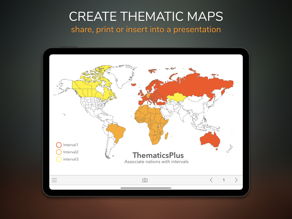
iPad displaying a thematic world map with color coded intervals for infographics and presentations
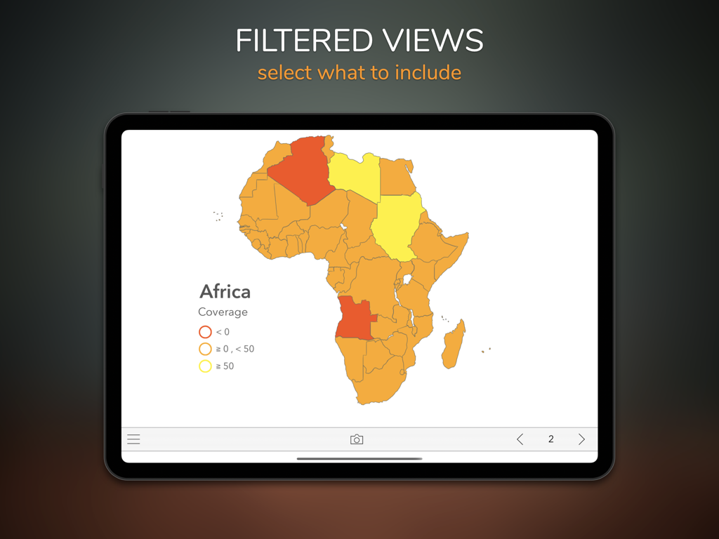
iPad display of Thematics plus app featuring a color coded thematic map of Africa with data filters
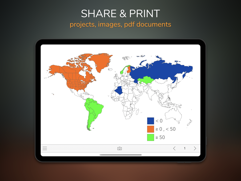
iPad screen displaying a thematic world map with a color coded legend and options to share and print as PDF or images
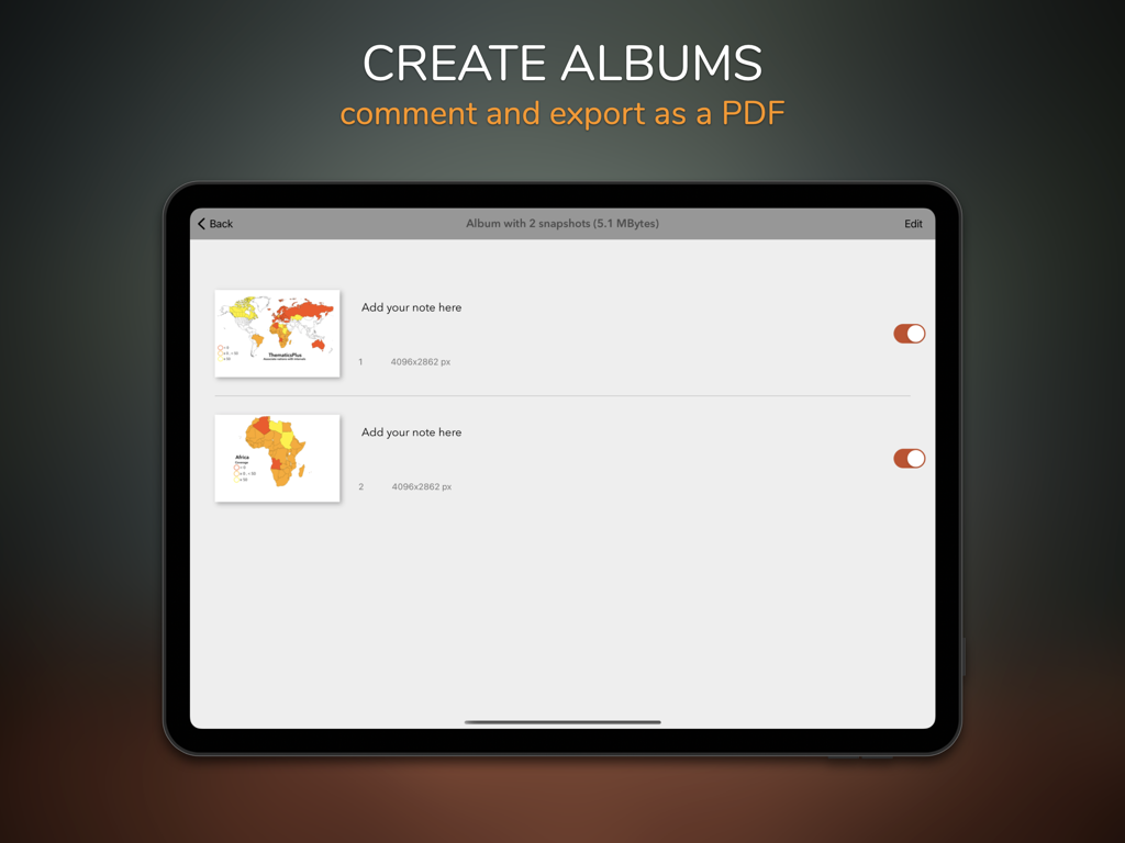
iPad screen showing how to create albums and add notes to map infographics for PDF export
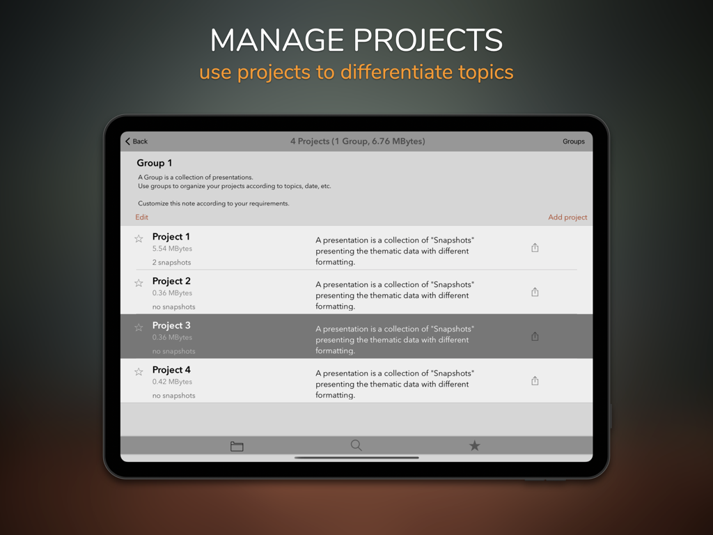
Thematics Plus app project management screen on iPad showing a list of organized infographic map projects.
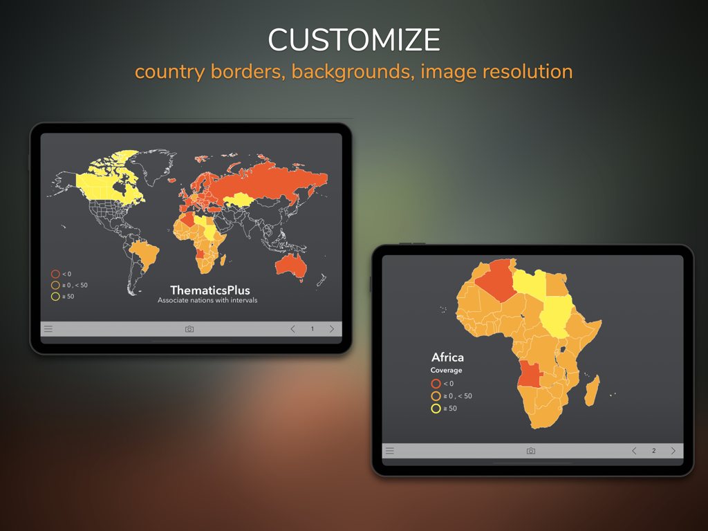
iPad screens demonstrating customization options for thematic world and Africa maps with colored data intervals
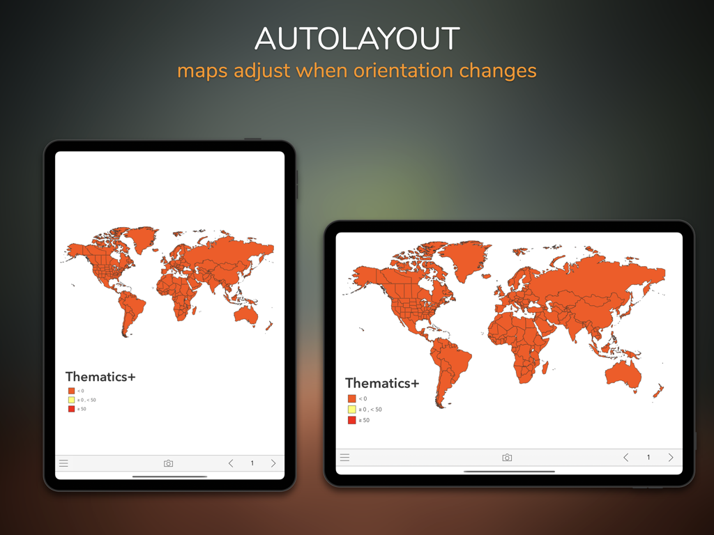
Thematics Plus app showing world map infographics adjusting between portrait and landscape modes on an iPad
Description
Download
More Like This
Top-ranked apps in the same category

ChatGPT
OpenAI OpCo, LLC

Google Gemini
Google LLC

Grok
X.AI Corporation

Gmail - Email by Google
Google LLC

千问 - 阿里最强大模型官方AI助手
Shanghai Zhixin Puhui Technology Co., Ltd.

Google Drive
Google LLC

Microsoft Authenticator
Microsoft Corporation

Claude by Anthropic
Anthropic PBC

Google Sheets
Google LLC
This page is not an official page of the app or its developer, but an independent editorial publication created for informational and commentary purposes. Unless expressly stated otherwise, neither the app nor its developer is affiliated with, endorsed by, sponsored by, authorized by, or otherwise officially connected with MWM, Apple, Google Play, the app publisher, or the app's developer, and nothing on this page implies that the app was developed using MWM's services. Any trademarks, logos, screenshots, and other content remain the property of their respective owners.