This page is not an official page of the app or its developer, but an independent editorial publication created for informational and commentary purposes. Unless expressly stated otherwise, neither the app nor its developer is affiliated with, endorsed by, sponsored by, authorized by, or otherwise officially connected with MWM, Apple, Google Play, the app publisher, or the app's developer, and nothing on this page implies that the app was developed using MWM's services. Any trademarks, logos, screenshots, and other content remain the property of their respective owners.

Vaarkaart Nederland
The definitive route planner for international cruisers. Access official bridge dimensions, real-time AIS traffic, and full offline maps to explore the Netherlands safely—without the roaming fees.
Downloads
116K+User Rating
Total Ratings
4K+Publisher
Category
NavigationLocales
1Latest Version
4.0.1Size
49.2 MBFirst Released
Dec 17, 2014Navigate the Netherlands with Total Confidence
The ultimate digital companion for international boaters, combining official Dutch nautical data with professional-grade planning tools to ensure your journey is safe, efficient, and stress-free.
Precision Route Planning
Input your vessel's specific dimensions to receive optimized routes that avoid low bridges and shallow waters, tailored specifically to your boat's draft and clearance.
Reliable Offline Navigation
Download full high-resolution charts before you leave home to navigate seamlessly without cellular data, ensuring constant access to your maps while avoiding international roaming fees.
The following screenshots and description are sourced directly from the app's official store listing and are the property of the app developer.
App Store
Screenshots
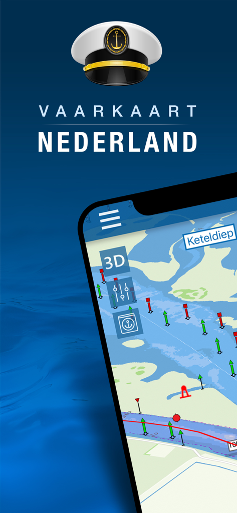
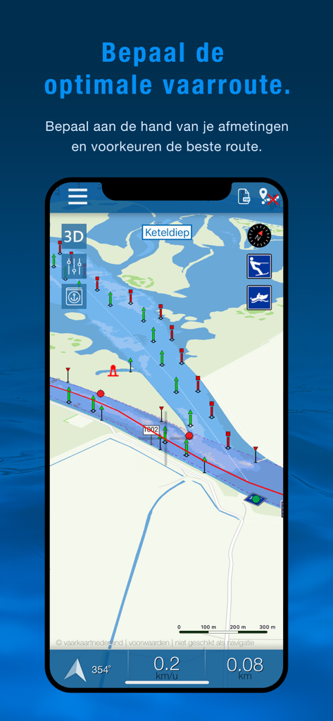
Vaarkaart Nederland app interface showing a detailed maritime navigation map of the Keteldiep area on a smartphone
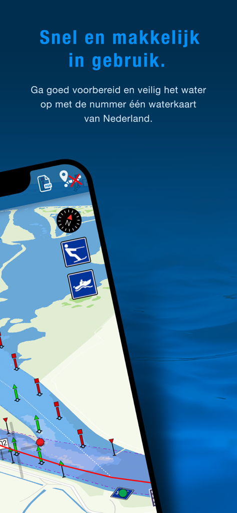
Vaarkaart Nederland mobile app showing a nautical chart for safe navigation on Dutch waterways
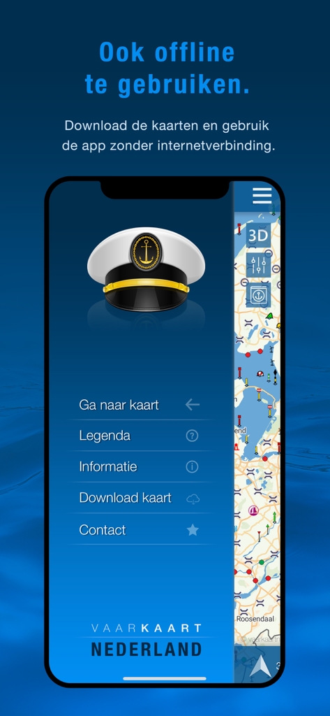
Vaarkaart Nederland app showing the navigation menu and offline maps feature for Dutch waterways.
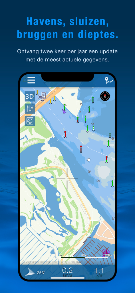
Vaarkaart Nederland app interface showing a detailed nautical chart with water depths and navigation markers.
Nautical navigation map on the Vaarkaart Nederland app showing waterways with buoys and route planning features.
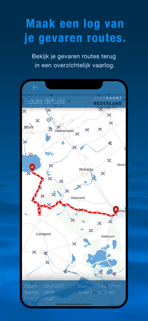
Vaarkaart Nederland app interface displaying a recorded sailing route on a detailed map of Dutch waterways
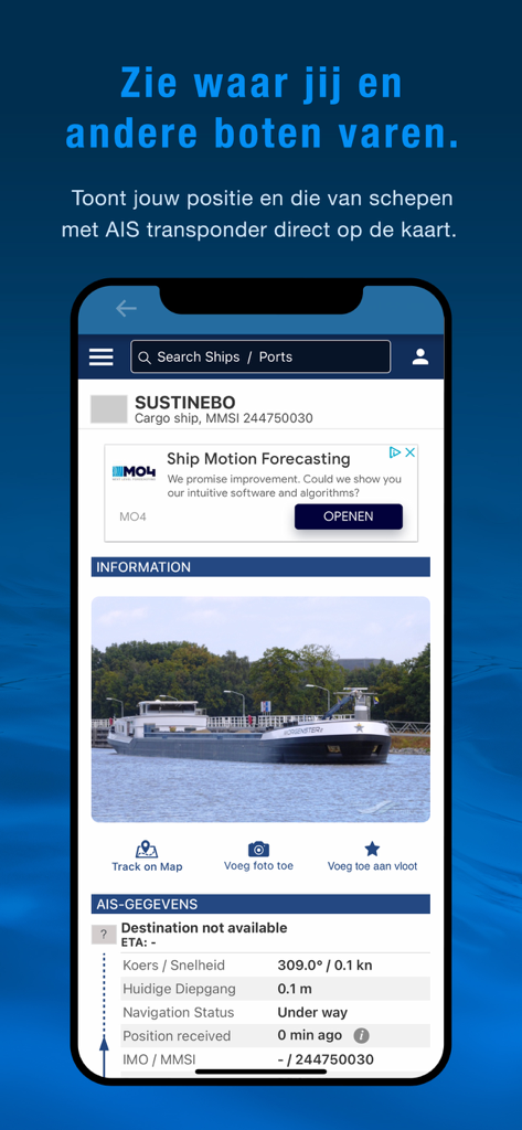
Vaarkaart Nederland app interface showing AIS tracking and vessel information for safe navigation
Description
Download
More Like This
Apps with similar features and user experience

PredictWind — Marine Forecasts
PredictWind Limited

Navily
The Navigation Family

Argo - Boating Navigation
Argo Navigation, LLC

SEAiq Pilot
Sakhalin, LLC

Maptrails
Pasi Salenius

KartenWerft NavGo 2.0
KartenWerft GmbH

MarineTraffic - Ship Tracking
MARINETRAFFIC APPLICATIONS LTD

Wavve Boating: Marine Boat GPS
Wavve Boating Inc

Savvy Navvy Boating Navigation
SAVVY NAVVY LTD
This page is not an official page of the app or its developer, but an independent editorial publication created for informational and commentary purposes. Unless expressly stated otherwise, neither the app nor its developer is affiliated with, endorsed by, sponsored by, authorized by, or otherwise officially connected with MWM, Apple, Google Play, the app publisher, or the app's developer, and nothing on this page implies that the app was developed using MWM's services. Any trademarks, logos, screenshots, and other content remain the property of their respective owners.