This page is not an official page of the app or its developer, but an independent editorial publication created for informational and commentary purposes. Unless expressly stated otherwise, neither the app nor its developer is affiliated with, endorsed by, sponsored by, authorized by, or otherwise officially connected with MWM, Apple, Google Play, the app publisher, or the app's developer, and nothing on this page implies that the app was developed using MWM's services. Any trademarks, logos, screenshots, and other content remain the property of their respective owners.

指南针-GPS经纬度海拔高度测量定位
Get real-time GPS coordinates, altitude, and speed data at your fingertips. Built for hikers, off-roaders, and outdoor explorers who demand precision and reliability in any terrain.
Downloads
0User Rating
Total Ratings
0Publisher
Category
LifestyleLocales
1Latest Version
1.6Size
13.9 MBFirst Released
Apr 22, 2024Navigate Any Terrain with Absolute Precision
A comprehensive GPS toolkit designed for hikers, off-roaders, and outdoor enthusiasts who demand professional-grade accuracy and real-time data.
High-Precision GPS Mapping
Access your exact latitude and longitude coordinates instantly to pinpoint your location on any trail or waterway with professional-grade accuracy.
Live Altitude & Weather
Track your elevation in real-time and stay prepared for changing mountain conditions with integrated weather updates tailored for your current position.
The following screenshots and description are sourced directly from the app's official store listing and are the property of the app developer.
App Store
Screenshots
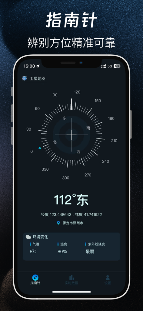
A digital compass app interface showing orientation coordinates and environmental data
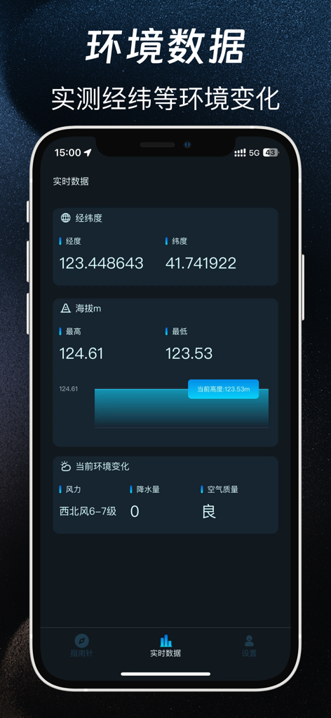
Mobile app interface displaying real-time GPS coordinates, altitude measurements, and local weather data.
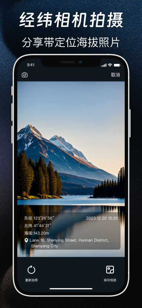
GPS camera interface showing a mountain photo with latitude longitude and altitude data overlay
Description
Download
More Like This
Top-ranked apps in the same category

Pinterest, Inc.

Alipay - Simplify Your Life
Alipay (Hangzhou) Technology Co., Ltd.

美团-美好生活小帮手
Sankuai Technology Co., Ltd.

Xiaomi Home
Beijing Xiaomi Co., Ltd

Dianping: Discover Good Places
Hanhai Information Technology (Shanghai) Co.Ltd

Tinder Dating App: Date & Chat
Tinder LLC

Lemon8 - Lifestyle Community
TIKTOK PTE. LTD.

SmartThings
Samsung Electronics Co., Ltd.

58同城-求职招聘找工作租房二手车
Beijing Chengshi Wanglin Information Technology Co., Ltd.
This page is not an official page of the app or its developer, but an independent editorial publication created for informational and commentary purposes. Unless expressly stated otherwise, neither the app nor its developer is affiliated with, endorsed by, sponsored by, authorized by, or otherwise officially connected with MWM, Apple, Google Play, the app publisher, or the app's developer, and nothing on this page implies that the app was developed using MWM's services. Any trademarks, logos, screenshots, and other content remain the property of their respective owners.