このページはアプリまたはその開発者の公式ページではなく、情報提供および論評を目的として作成された独立した編集出版物です。明示的に別段の記載がない限り、アプリおよびその開発者は、MWM、Apple、Google Play、アプリのパブリッシャー、またはアプリの開発者と提携、承認、後援、認可、またはその他の公式的な関係はなく、このページのいかなる内容も、アプリがMWMのサービスを使用して開発されたことを意味するものではありません。すべての商標、ロゴ、スクリーンショット、その他のコンテンツはそれぞれの所有者の財産です。

Hiking Map Poland
自身のルーツを再発見し、自信を持ってポーランドの公式トレイルを探索しましょう。ルート計画、オフラインマップのダウンロード、プロ仕様のGPSとApple Watch対応で進捗を追跡できます。
ダウンロード
276K+ユーザー評価
評価数
19K+開発元
カテゴリ
Travel対応言語
2最新バージョン
2.0.20サイズ
84.0 MBリリース日
2016年6月29日地元の人と同じようにポーランドの山々をマスターしましょう
タトラ、ベスキド、スデーテン山脈を巡るヘリテージ・ジャーニーのための究極のルートプランナー。精度と信頼性を求めるハイカーのために設計されています。
信頼できるオフラインナビゲーション
国際データローミング料金を回避。詳細な地形図をダウンロードし、完全に圏外の場所でも公式トレイルをナビゲートできます。
本格的なトレイルプランニング
正確な高低差プロファイルや山小屋(Schronisko)間の推定移動時間がわかる公式PTTKトレイルネットワークにアクセス。
以下のスクリーンショットと説明は、アプリの公式ストアリスティングから直接取得されたものであり、アプリ開発者の所有物です。
アプリストア
スクリーンショット
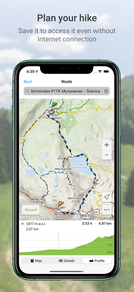
標高プロファイルと地図の詳細が表示された、タトラ山脈の計画済みトレイルルートを表示するポーランド ハイキングマップアプリのインターフェース
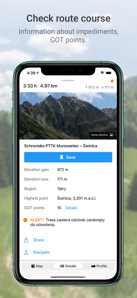
標高やGOTポイントなど、ポーランドのタトラ山脈のハイキングルートの詳細を表示するスマートフォンの画面
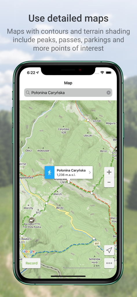
ポロニナ・カリンスカのハイキングトレイルと等高線を表示するポーランド ハイキングマップアプリの詳細な地形図
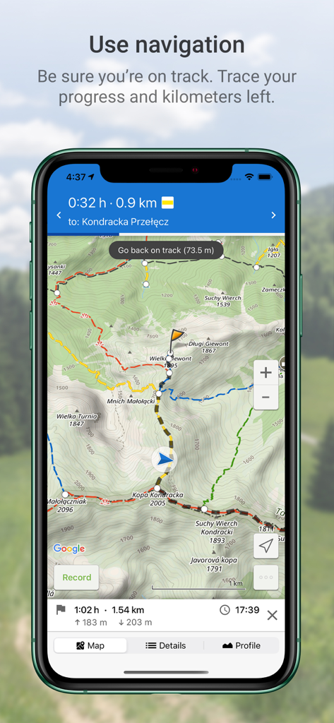
ポーランドの山々の地形図上でGPSナビゲーションを表示するモバイルアプリの画面
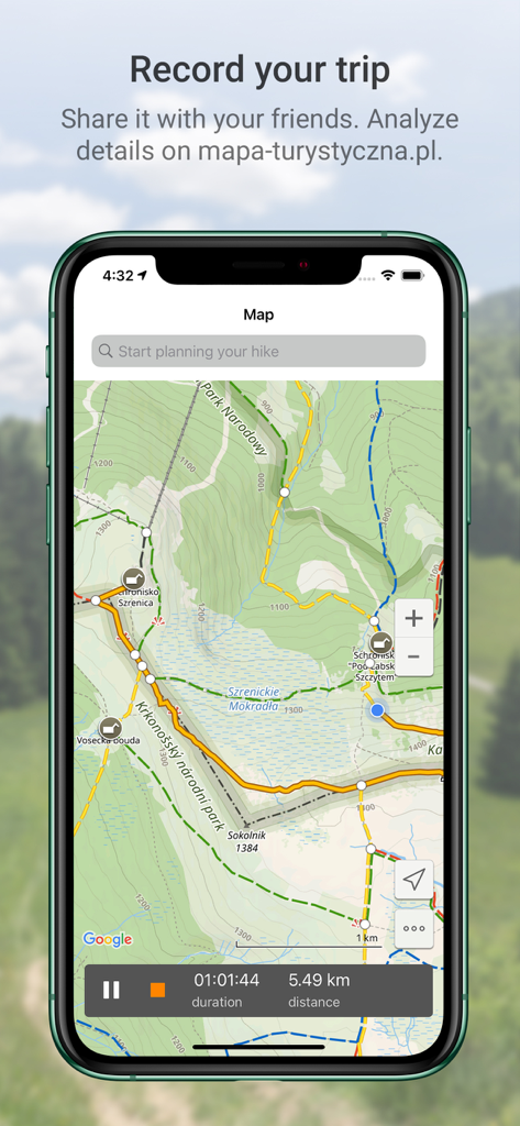
距離と時間のデータを含む、記録されたハイキングトラックを表示するポーランド ハイキングマップアプリのインターフェース
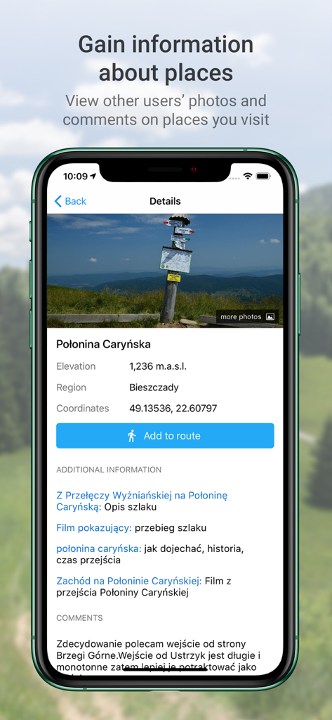
ポーランドのポロニナ・カリンスカの写真、標高、コメントを表示するハイキングアプリの詳細画面
説明
Download
類似アプリ
似た機能とユーザー体験を持つアプリ

AllTrails: Hike, Bike & Run
AllTrails, Inc.

Pedometer++
Cross Forward Consulting, LLC

Organic Maps: Offline Map
Organic Maps OU

Gaia GPS: Mobile Trail Maps
Trailbehind, INC.

Offline hiking maps: Mapy.com
Seznam.cz a.s.

MapOut
Valnova GmbH

FarOut: Offline GPS Trail Maps
Atlas Guides DE, Inc.

Norgeskart
Norgeskart AS

GPX viewer - map
Lucas den Otter
このページはアプリまたはその開発者の公式ページではなく、情報提供および論評を目的として作成された独立した編集出版物です。明示的に別段の記載がない限り、アプリおよびその開発者は、MWM、Apple、Google Play、アプリのパブリッシャー、またはアプリの開発者と提携、承認、後援、認可、またはその他の公式的な関係はなく、このページのいかなる内容も、アプリがMWMのサービスを使用して開発されたことを意味するものではありません。すべての商標、ロゴ、スクリーンショット、その他のコンテンツはそれぞれの所有者の財産です。