このページはアプリまたはその開発者の公式ページではなく、情報提供および論評を目的として作成された独立した編集出版物です。明示的に別段の記載がない限り、アプリおよびその開発者は、MWM、Apple、Google Play、アプリのパブリッシャー、またはアプリの開発者と提携、承認、後援、認可、またはその他の公式的な関係はなく、このページのいかなる内容も、アプリがMWMのサービスを使用して開発されたことを意味するものではありません。すべての商標、ロゴ、スクリーンショット、その他のコンテンツはそれぞれの所有者の財産です。

MapOut
カスタムルートを計画し、標高プロファイルを分析し、iPhoneとiPad用に設計されたエレガントな紙のようなインターフェースで、世界で最も遠隔地のトレイルをナビゲートします。セル信号不要、サブスクリプション不要—純粋な探検だけを。
ダウンロード
362K+ユーザー評価
評価数
900開発元
カテゴリ
Navigation対応言語
3最新バージョン
3.4.13サイズ
71.3 MBリリース日
2012年3月20日自立した探検家のための高精度ツール
MapOutは、従来の紙の地図の高解像度の鮮明さと、iPadおよびiPhone用のプログレードのオフラインナビゲーションおよびカスタムプランニングツールを組み合わせています。
100% オフラインでの自立
セル信号なしで、ロッキー山脈や太平洋岸北西部の遠隔地のバックカントリートレイルをナビゲートします。完全な安全のために、高解像度の地形詳細をダウンロードしてください。
直感的なルートプランニング
指またはスタイラスを使用して、マップ上に直接カスタムパスを描画します。標高プロファイルを即座に確認し、GPXファイルをインポートして、完璧な週末の遠足を計画します。
プログレードのマップの鮮明さ
パフォーマンスを重視する地図愛好家のために構築された、革新的な3Dチルトビューと正確な等高線機能を備えた、ハードウェアアクセラレーションされたミニマリストインターフェースを体験してください。
GPSとコンパス
リアルタイムのGPS追跡、コンパス、および高解像度の地形図により、どこにいても道を見失うことはありません。
GPXインポート/エクスポート
お気に入りのルートをインポートするか、MapOutで作成したルートをエクスポートして、他のアプリやデバイスと共有します。
3D 地形ビュー
3Dチルトビューで地形を視覚化し、ルートの勾配をよりよく理解します。
高解像度地形図
詳細な等高線と陰影起伏により、周囲の地形を正確に把握できます。
オフライン検索
場所、POI、およびトレイルをオフラインで検索します。
カスタマイズ可能なマップ
マップのスタイル、色、および表示するレイヤーをカスタマイズします。
iCloud 同期
すべてのデバイス間でルート、トラック、およびマップを同期します。
写真とメモ
ルートに写真やメモを追加して、旅を記録します。
詳細な統計情報
距離、時間、標高、勾配など、ルートの詳細な統計情報を確認します。
高度な設定
カスタムマップソース、距離単位、およびその他の設定を構成します。
プライバシー重視
MapOutはあなたのデータを収集しません。あなたのプライバシーは私たちの最優先事項です。
サブスクリプションなし
一度購入すれば、すべてがあなたのものです。隠れた料金やサブスクリプションはありません。
無料アップデート
すべてのアップデートは無料です。MapOutは常に進化しています。
以下のスクリーンショットと説明は、アプリの公式ストアリスティングから直接取得されたものであり、アプリ開発者の所有物です。
アプリストア
スクリーンショット
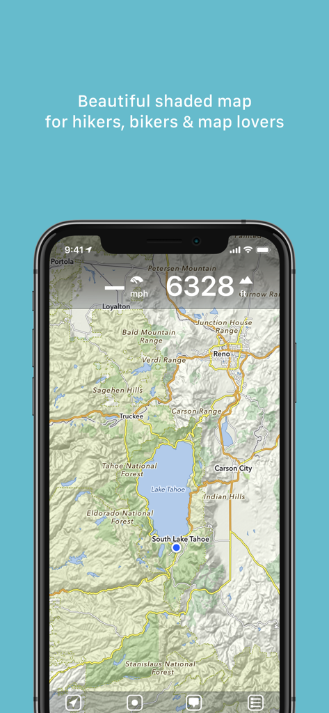
ハイカーやバイカーのためにタホ湖エリアを示すMapOutアプリのレイクタホエリアの詳細な陰影起伏地形図
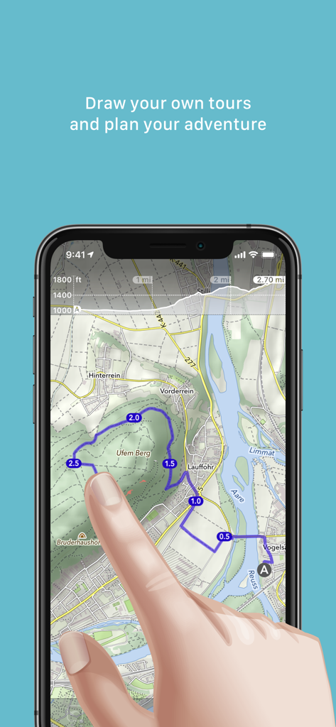
MapOutアプリ内の地形図上で指でカスタムアウトドアツアールートを描画している人の写真
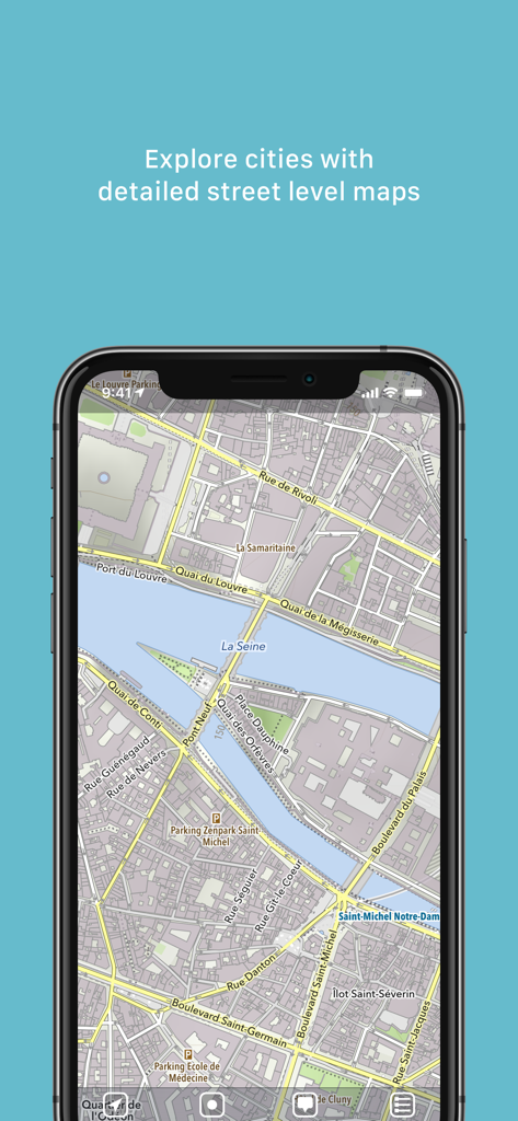
セーヌ川とランドマークのあるパリの詳細な街路図を示すスマートフォンの画面
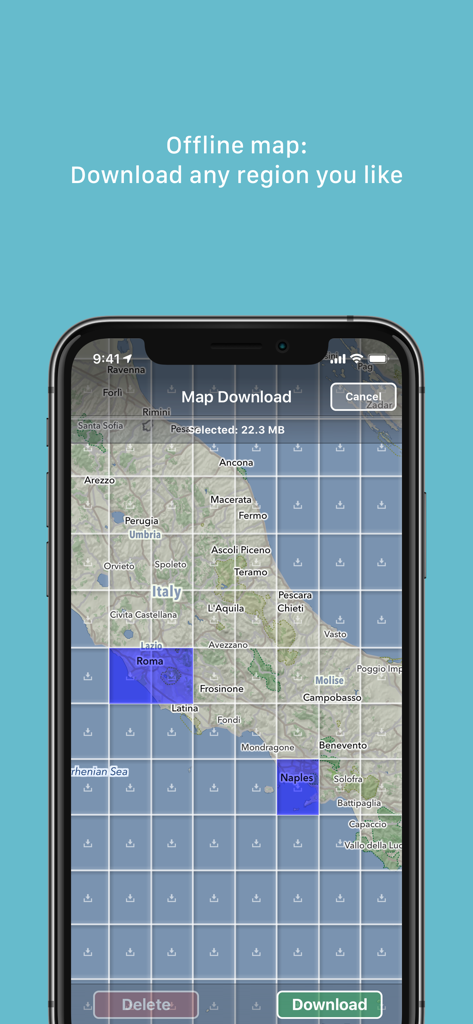
イタリアのグリッド選択を示すオフラインマップダウンロードインターフェイスを表示するMapOutアプリのスクリーンショット
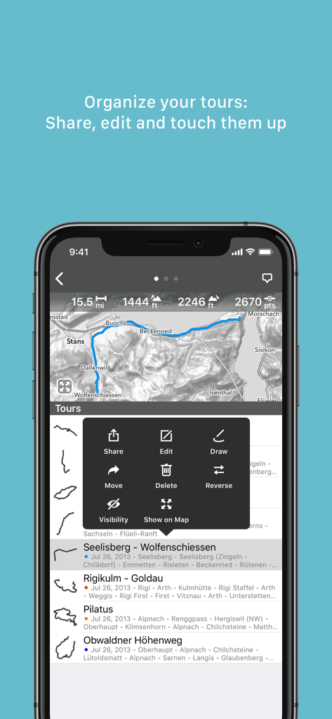
保存されたツアーのリストと、マップ上でルートを共有、編集、描画するオプションを含むメニューを表示するMapOutアプリインターフェイス
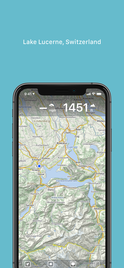
MapOutアプリのルツェルン湖スイスの地形図
説明
Download
類似アプリ
似た機能とユーザー体験を持つアプリ

AllTrails: Hike, Bike & Run
AllTrails, Inc.

Pedometer++
Cross Forward Consulting, LLC

Organic Maps: Offline Map
Organic Maps OU

Gaia GPS: Mobile Trail Maps
Trailbehind, INC.

Offline hiking maps: Mapy.com
Seznam.cz a.s.

Hiking Map Poland
Mapa Turystyczna sp. z o.o.

FarOut: Offline GPS Trail Maps
Atlas Guides DE, Inc.

Norgeskart
Norgeskart AS

GPX viewer - map
Lucas den Otter
このページはアプリまたはその開発者の公式ページではなく、情報提供および論評を目的として作成された独立した編集出版物です。明示的に別段の記載がない限り、アプリおよびその開発者は、MWM、Apple、Google Play、アプリのパブリッシャー、またはアプリの開発者と提携、承認、後援、認可、またはその他の公式的な関係はなく、このページのいかなる内容も、アプリがMWMのサービスを使用して開発されたことを意味するものではありません。すべての商標、ロゴ、スクリーンショット、その他のコンテンツはそれぞれの所有者の財産です。