このページはアプリまたはその開発者の公式ページではなく、情報提供および論評を目的として作成された独立した編集出版物です。明示的に別段の記載がない限り、アプリおよびその開発者は、MWM、Apple、Google Play、アプリのパブリッシャー、またはアプリの開発者と提携、承認、後援、認可、またはその他の公式的な関係はなく、このページのいかなる内容も、アプリがMWMのサービスを使用して開発されたことを意味するものではありません。すべての商標、ロゴ、スクリーンショット、その他のコンテンツはそれぞれの所有者の財産です。

Hikingbook: Hike, Bike & Run
精密なルート計画、3D地形プレビュー、リアルタイムのルート逸脱アラートであらゆるトレイルをマスター。Apple WatchやGarminとシームレスに同期して、あなたの冒険をデータに基づいたストーリーに変えましょう。
ダウンロード
365K+ユーザー評価
評価数
14K+開発元
カテゴリ
Health & Fitness対応言語
3最新バージョン
18.13.2サイズ
232.1 MBリリース日
2016年1月5日アウトドア体験を向上させる
3Dでのルート計画からリアルタイムアラートによる安全確保まで、Hikingbookは自然を完全に自信を持って探索するためのプロフェッショナルなツールを提供します。
パスを3Dで可視化
没入感のある3Dマッププレビューとフライオーバービデオで、到着前に地形を把握。標高の変化を直感的に理解できます。
妥協のない安全性
リアルタイムのルート逸脱音声アラートと緊急連絡先への自動位置共有により、一人でも決して孤独ではない探索を。
以下のスクリーンショットと説明は、アプリの公式ストアリスティングから直接取得されたものであり、アプリ開発者の所有物です。
アプリストア
スクリーンショット
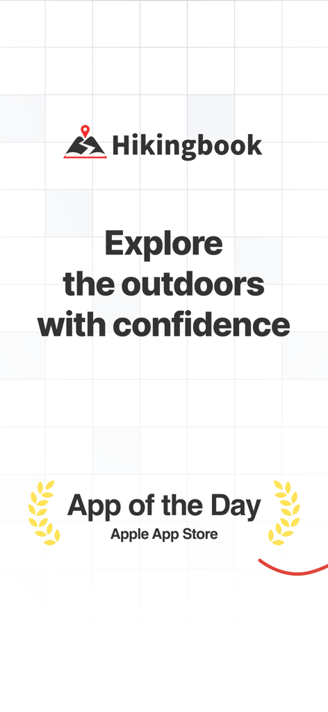
Apple App Storeの「今日のApp」アワードバッジと「自信を持ってアウトドアを探索」というスローガンが掲載された、Hikingbookアプリのプロモーション画面。
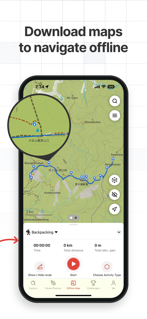
オフラインナビゲーション用にピン留めされたルートが表示された、地形図を示すHikingbookアプリのインターフェース。
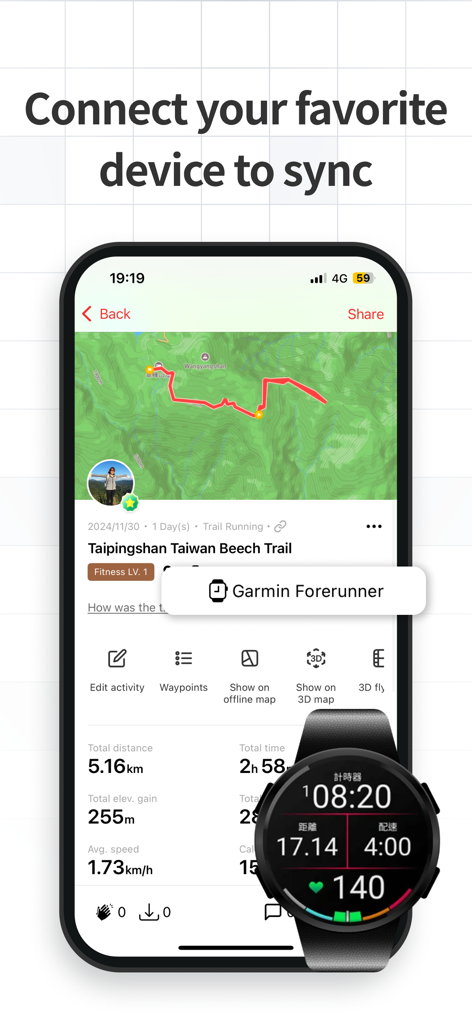
Hikingbookアプリでハイキングデータを同期しているスマートフォンとGarminスマートウォッチ。
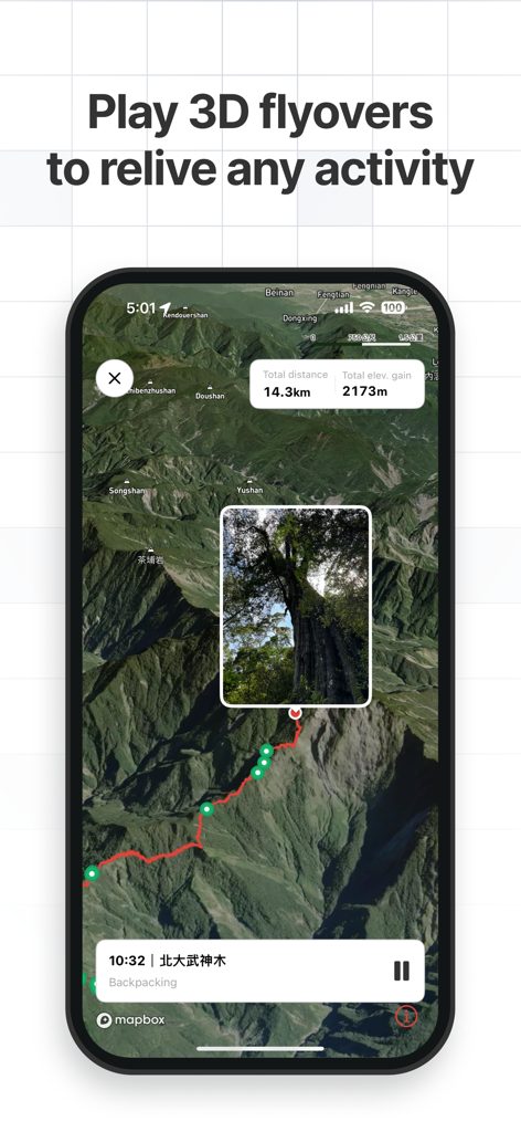
ルート統計と写真マーカーが表示された、ハイキングトレイルの3Dフライオーバーマップを示すHikingbookアプリのインターフェース。
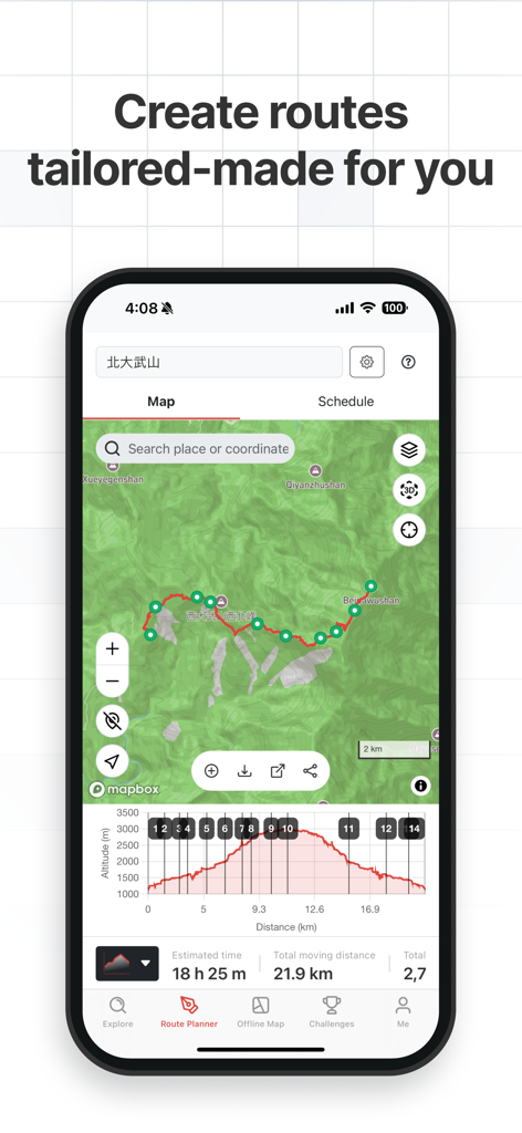
21kmのハイキングのトレイルマップと標高プロファイルを示すHikingbookアプリのルートプランナー。
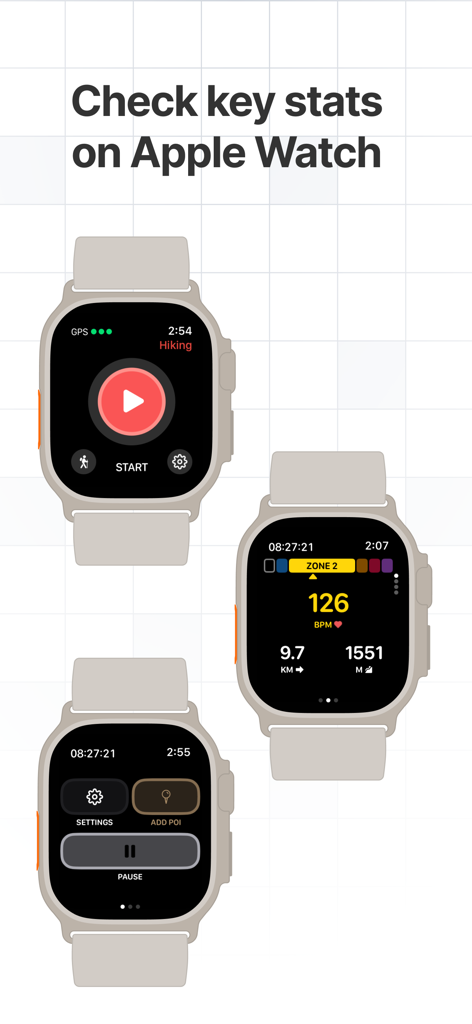
ハイキングの統計、心拍数、ナビゲーションコントロールが表示されたApple Watch上のHikingbookアプリ画面。
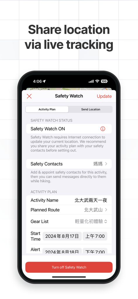
ライブ位置共有とアクティビティ計画のためのSafety Watch(セーフティウォッチ)機能が表示されたHikingbookアプリのインターフェース。
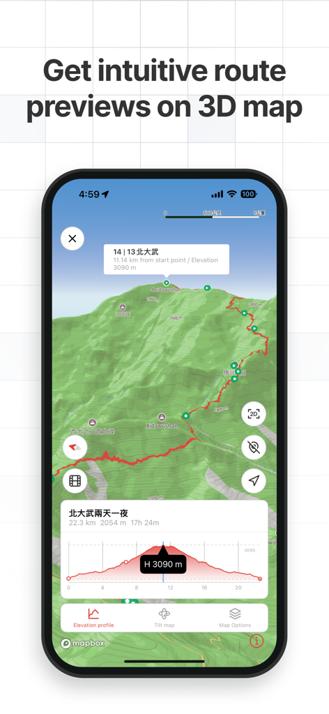
標高プロファイル付きの直感的な3Dルートプレビューが表示されたHikingbookアプリのインターフェース。
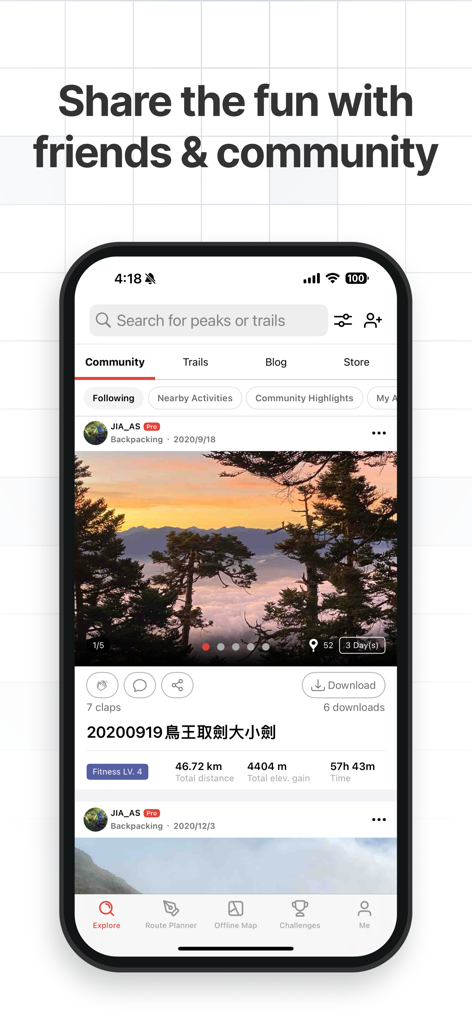
山の写真とアクティビティ指標が含まれた、コミュニティフィード内のユーザー投稿が表示されたHikingbookアプリ。
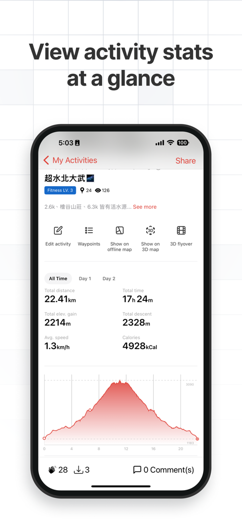
距離や標高プロファイルを含むハイキング統計を表示するアプリのインターフェース。
説明
Download
類似アプリ
似た機能とユーザー体験を持つアプリ

AllTrails: Hike, Bike & Run
AllTrails, Inc.

Pedometer++
Cross Forward Consulting, LLC

Organic Maps: Offline Map
Organic Maps OU

Gaia GPS: Mobile Trail Maps
Trailbehind, INC.

Offline hiking maps: Mapy.com
Seznam.cz a.s.

Hiking Map Poland
Mapa Turystyczna sp. z o.o.

MapOut
Valnova GmbH

FarOut: Offline GPS Trail Maps
Atlas Guides DE, Inc.

Norgeskart
Norgeskart AS
このページはアプリまたはその開発者の公式ページではなく、情報提供および論評を目的として作成された独立した編集出版物です。明示的に別段の記載がない限り、アプリおよびその開発者は、MWM、Apple、Google Play、アプリのパブリッシャー、またはアプリの開発者と提携、承認、後援、認可、またはその他の公式的な関係はなく、このページのいかなる内容も、アプリがMWMのサービスを使用して開発されたことを意味するものではありません。すべての商標、ロゴ、スクリーンショット、その他のコンテンツはそれぞれの所有者の財産です。