このページはアプリまたはその開発者の公式ページではなく、情報提供および論評を目的として作成された独立した編集出版物です。明示的に別段の記載がない限り、アプリおよびその開発者は、MWM、Apple、Google Play、アプリのパブリッシャー、またはアプリの開発者と提携、承認、後援、認可、またはその他の公式的な関係はなく、このページのいかなる内容も、アプリがMWMのサービスを使用して開発されたことを意味するものではありません。すべての商標、ロゴ、スクリーンショット、その他のコンテンツはそれぞれの所有者の財産です。

NodeMapp Hike
海外旅行者に欠かせないパートナー。オフラインGPS、音声ガイド、シームレスなApple Watch連携機能を備え、60,000kmに及ぶ絶景トレイルで自分だけのノード間ルートを計画できます。
ダウンロード
324K+ユーザー評価
評価数
11K+開発元
カテゴリ
Travel対応言語
4最新バージョン
9.0.15サイズ
78.5 MBリリース日
2016年5月31日究極のヨーロッパ・ハイキング・コンパニオン
洗練された海外旅行者のために設計されたツールで、世界で最も美しい60,000km以上のハイキングネットワークを発見しましょう。
手軽なルート計画
デスクトップで旅を計画し、簡単なQRコードでiPhoneに同期。「Surprise Me(おまかせ)」ツールを使えば、距離に基づいた旅程を即座に作成できます。
スマートウォッチ連携
ハンズフリー・ハイキングの自由を体験してください。ノードごとの音声指示に従い、Apple Watchで直接曲がり角のアラートを受け取れます。
以下のスクリーンショットと説明は、アプリの公式ストアリスティングから直接取得されたものであり、アプリ開発者の所有物です。
アプリストア
スクリーンショット
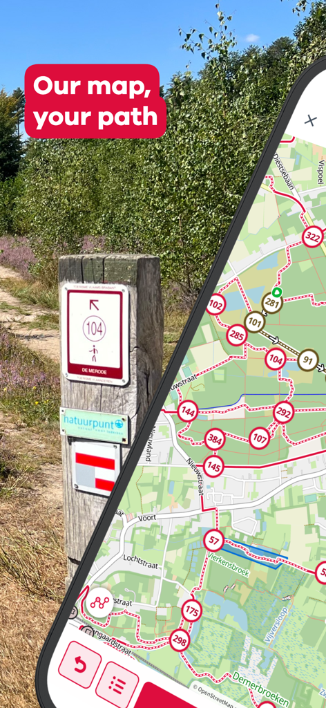
物理的なトレイル標識の隣にハイキングノードマップを表示しているスマートフォンの画面
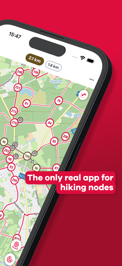
番号付きのノードと接続経路を備えた詳細なハイキングネットワークマップを表示しているNodeMapp Hikeアプリ
緑豊かな沿岸地域の番号付きノードと計画された経路を表示しているハイキングマップのモバイル画面

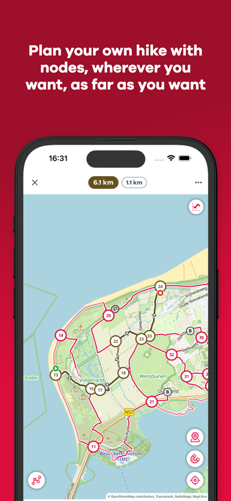
ヨーロッパの特定のハイキングルートの詳細情報と地図を表示しているNodeMapp Hikeアプリのインターフェース
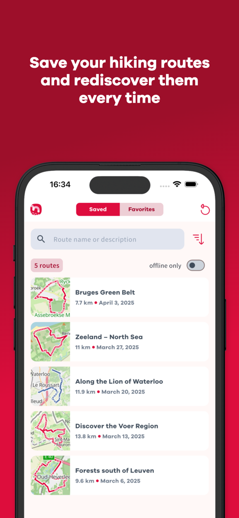
ブルージュやゼーラントを含む、NodeMapp Hikeアプリに保存されたハイキングルートのリストを表示しているiPhoneの画面
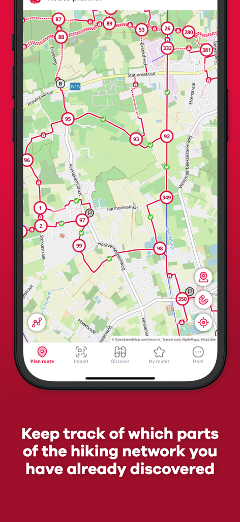
完了したハイキングセグメントを緑色のチェックマークで表示しているNodeMapp Hikeアプリのルートプランナー
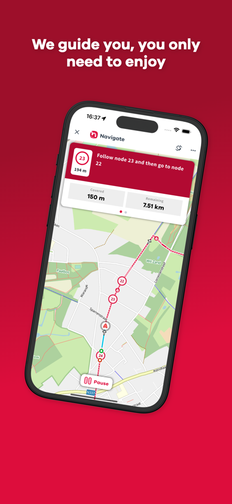
番号付きのトレイルノードと徒歩の道順が描かれた地図を表示しているNodeMapp Hikeアプリのナビゲーションインターフェース
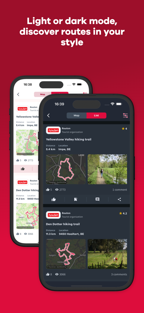
おすすめのハイキングルートのリストを表示し、ライトモードとダークモードでNodeMapp Hikeアプリを表示している2台のスマートフォン
説明
Download
類似アプリ
似た機能とユーザー体験を持つアプリ

AllTrails: Hike, Bike & Run
AllTrails, Inc.

Pedometer++
Cross Forward Consulting, LLC

Organic Maps: Offline Map
Organic Maps OU

Gaia GPS: Mobile Trail Maps
Trailbehind, INC.

Offline hiking maps: Mapy.com
Seznam.cz a.s.

Hiking Map Poland
Mapa Turystyczna sp. z o.o.

MapOut
Valnova GmbH

FarOut: Offline GPS Trail Maps
Atlas Guides DE, Inc.

Norgeskart
Norgeskart AS
このページはアプリまたはその開発者の公式ページではなく、情報提供および論評を目的として作成された独立した編集出版物です。明示的に別段の記載がない限り、アプリおよびその開発者は、MWM、Apple、Google Play、アプリのパブリッシャー、またはアプリの開発者と提携、承認、後援、認可、またはその他の公式的な関係はなく、このページのいかなる内容も、アプリがMWMのサービスを使用して開発されたことを意味するものではありません。すべての商標、ロゴ、スクリーンショット、その他のコンテンツはそれぞれの所有者の財産です。