このページはアプリまたはその開発者の公式ページではなく、情報提供および論評を目的として作成された独立した編集出版物です。明示的に別段の記載がない限り、アプリおよびその開発者は、MWM、Apple、Google Play、アプリのパブリッシャー、またはアプリの開発者と提携、承認、後援、認可、またはその他の公式的な関係はなく、このページのいかなる内容も、アプリがMWMのサービスを使用して開発されたことを意味するものではありません。すべての商標、ロゴ、スクリーンショット、その他のコンテンツはそれぞれの所有者の財産です。

OpenRunner – Bike, hike, trail
ハイカー、サイクリスト、トレイルランナーのためのエリートなルート作成ツール。高精度のマッピング、オフラインの信頼性、リアルタイムの安全追跡により、あらゆるトレイルで完全な安心感を持ってナビゲートできます。
ダウンロード
496K+ユーザー評価
評価数
8K+開発元
カテゴリ
Health & Fitness対応言語
4最新バージョン
2.9.1サイズ
89.5 MBリリース日
2017年6月2日完璧なアドベンチャーをエンジニアリング
カスタムのグラベルループの計画から人里離れたトレイルのナビゲートまで、自信を持って探索するために必要な精度と安全機能を手に入れましょう。
精密なルート設計
特定のパフォーマンス目標に合わせた、リアルタイムの獲得標高と距離の指標を使用して、あらゆるアクティビティのカスタムパスを作成します。
信頼性の高いオフラインの安全性
電波の届かない場所でのナビゲーション用に高解像度マップをダウンロードし、LiveTrackを使用して、大切な人にリアルタイムで現在地を知らせましょう。
以下のスクリーンショットと説明は、アプリの公式ストアリスティングから直接取得されたものであり、アプリ開発者の所有物です。
アプリストア
スクリーンショット
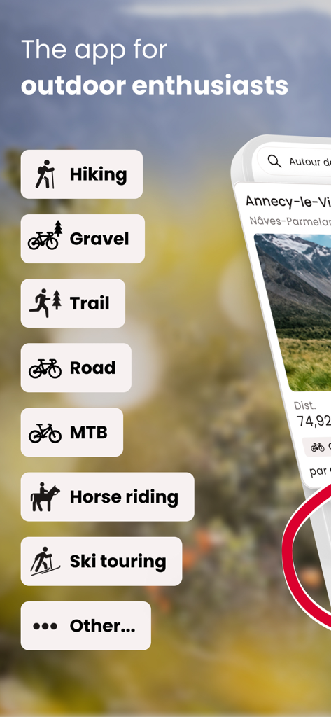
ハイキング、グラベルバイク、トレイルランニングなどのアウトドアアクティビティのリストを表示するOpenRunnerアプリのインターフェース
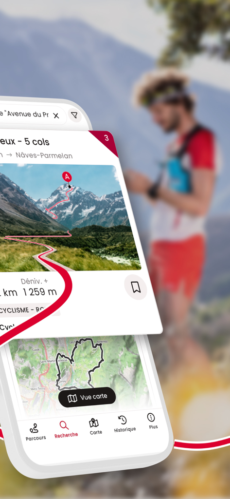
標高の詳細と地図を含む登山ルートを表示するOpenRunnerアプリのインターフェース
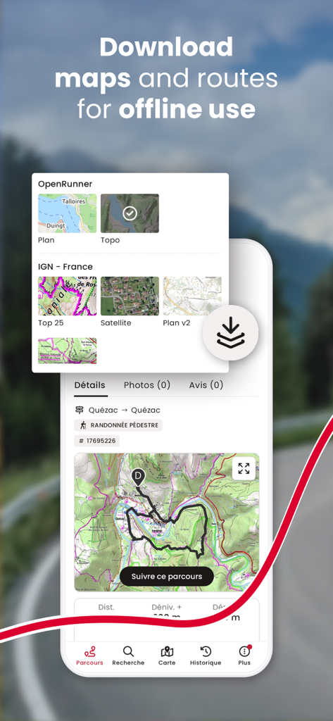
地形図やルートをオフラインで使用するためにダウンロードするオプションを表示するOpenRunnerアプリのインターフェース
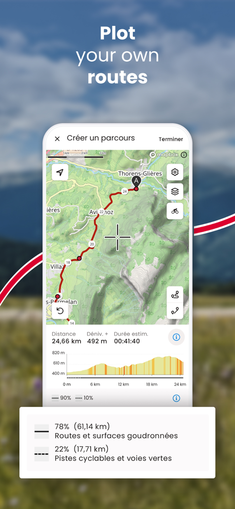
標高プロファイルと距離の統計を使用してカスタムアウトドアルートを作成するためのOpenRunnerアプリのインターフェース
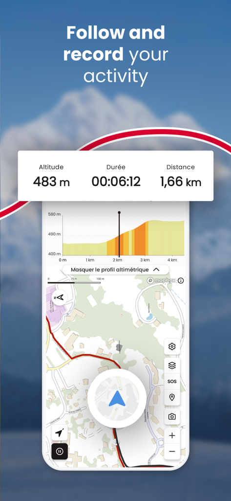
高度、時間、距離、地図を表示するライブアクティビティ追跡のOpenRunnerアプリ画面
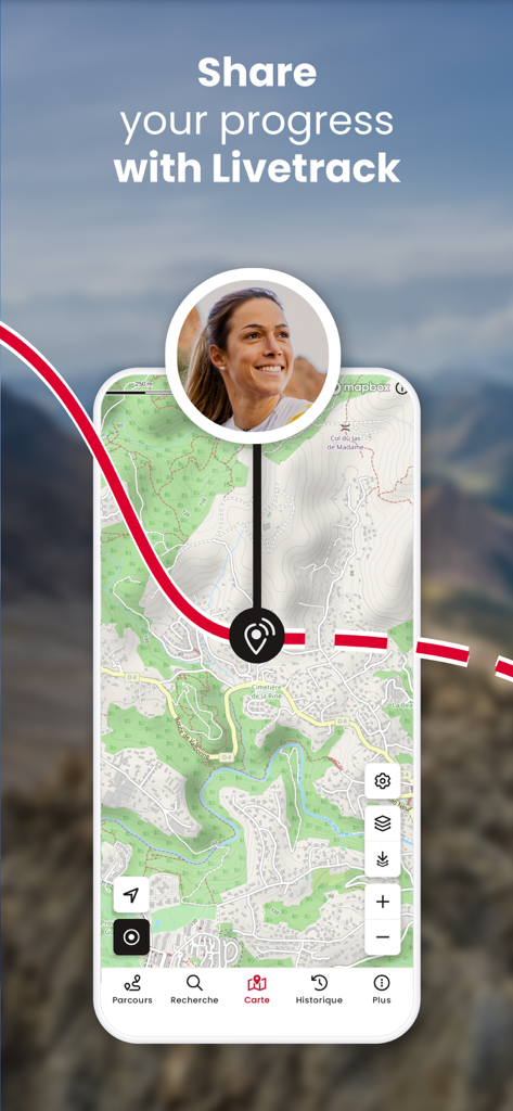
地形図上でリアルタイムの進捗状況を共有するLiveTrack機能を表示するOpenRunnerアプリ画面
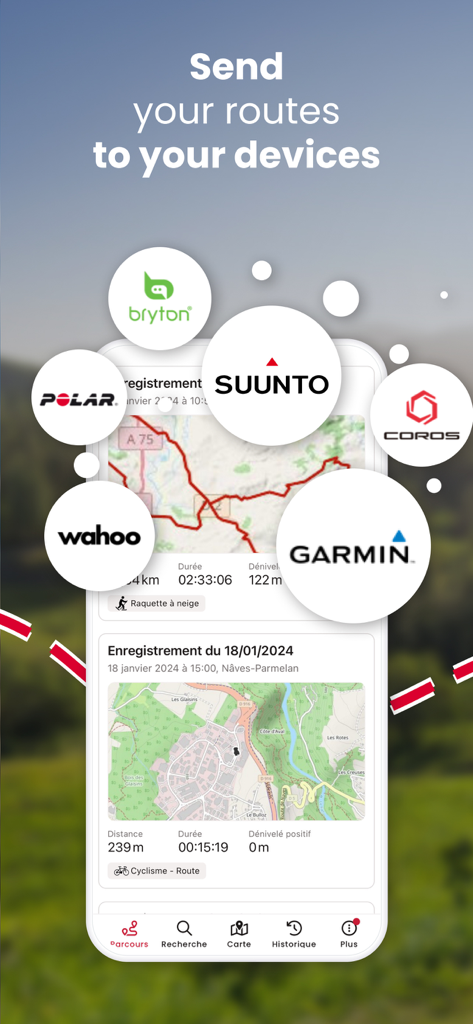
Garmin、Suunto、WahooなどのGPSブランドとのルート同期を表示するOpenRunnerアプリのインターフェース
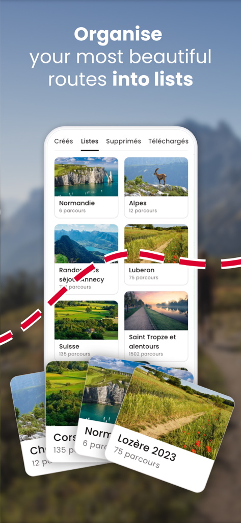
アルプスやノルマンディーなどのカスタムリストに整理されたアウトドアルートを表示するOpenRunnerのモバイルアプリインターフェース

メッセージングやソーシャルメディアのアイコンが表示された、サイクリングルートのOpenRunnerアプリのソーシャル共有機能を表示するモバイル画面
説明
Download
類似アプリ
似た機能とユーザー体験を持つアプリ

AllTrails: Hike, Bike & Run
AllTrails, Inc.

Pedometer++
Cross Forward Consulting, LLC

Organic Maps: Offline Map
Organic Maps OU

Gaia GPS: Mobile Trail Maps
Trailbehind, INC.

Offline hiking maps: Mapy.com
Seznam.cz a.s.

Hiking Map Poland
Mapa Turystyczna sp. z o.o.

MapOut
Valnova GmbH

FarOut: Offline GPS Trail Maps
Atlas Guides DE, Inc.

Norgeskart
Norgeskart AS
このページはアプリまたはその開発者の公式ページではなく、情報提供および論評を目的として作成された独立した編集出版物です。明示的に別段の記載がない限り、アプリおよびその開発者は、MWM、Apple、Google Play、アプリのパブリッシャー、またはアプリの開発者と提携、承認、後援、認可、またはその他の公式的な関係はなく、このページのいかなる内容も、アプリがMWMのサービスを使用して開発されたことを意味するものではありません。すべての商標、ロゴ、スクリーンショット、その他のコンテンツはそれぞれの所有者の財産です。