このページはアプリまたはその開発者の公式ページではなく、情報提供および論評を目的として作成された独立した編集出版物です。明示的に別段の記載がない限り、アプリおよびその開発者は、MWM、Apple、Google Play、アプリのパブリッシャー、またはアプリの開発者と提携、承認、後援、認可、またはその他の公式的な関係はなく、このページのいかなる内容も、アプリがMWMのサービスを使用して開発されたことを意味するものではありません。すべての商標、ロゴ、スクリーンショット、その他のコンテンツはそれぞれの所有者の財産です。

OruxMaps
高度なオフライン地図とプロフェッショナルGISツールで、あらゆるトレイルをマスターしましょう。登録不要、トラッキングなし、バックカントリーデータの完全なプライバシー。
ダウンロード
15K+ユーザー評価
評価数
0開発元
カテゴリ
Sports対応言語
5最新バージョン
0.0.12サイズ
115.7 MBリリース日
2025年6月18日自立した探検家のためのプロレベルナビゲーション
OruxMapsは、信号が途絶え、標準アプリが停止する場所へ行く人のために、プロフェッショナルGIS機能と完全なデータプライバシーを提供します。
絶対的なデータプライバシー
アカウント、トラッキング、強制的なクラウド同期なし。GPSデータはあなたのものであり、ローカルデバイスに安全に保存されます。
オフラインGIS&マッピング
詳細なオフライン地図、複雑な座標変換、インテリジェントなルートアラートで、圏外でもバックカントリーをナビゲート。
以下のスクリーンショットと説明は、アプリの公式ストアリスティングから直接取得されたものであり、アプリ開発者の所有物です。
アプリストア
スクリーンショット
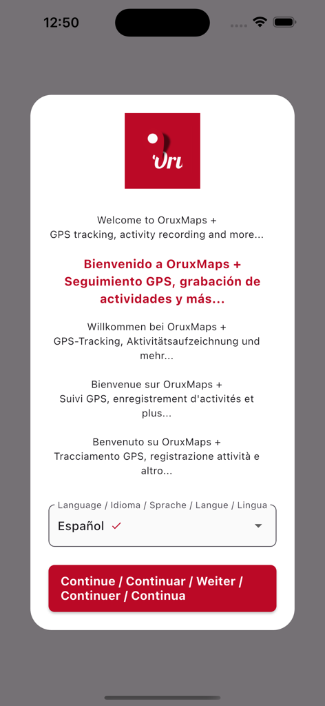
OruxMapsアプリのウェルカムスクリーン。GPSトラッキングとアクティビティ録画の言語選択オプションを表示。
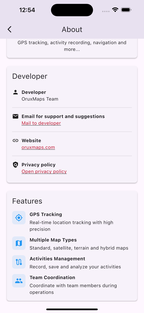
OruxMapsアプリの画面。開発者情報とGPSトラッキング、複数マップタイプなどの主要機能を表示。
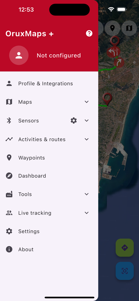
OruxMapsのサイドメニュー。衛星地図上にナビゲーションとセンサー設定を表示。
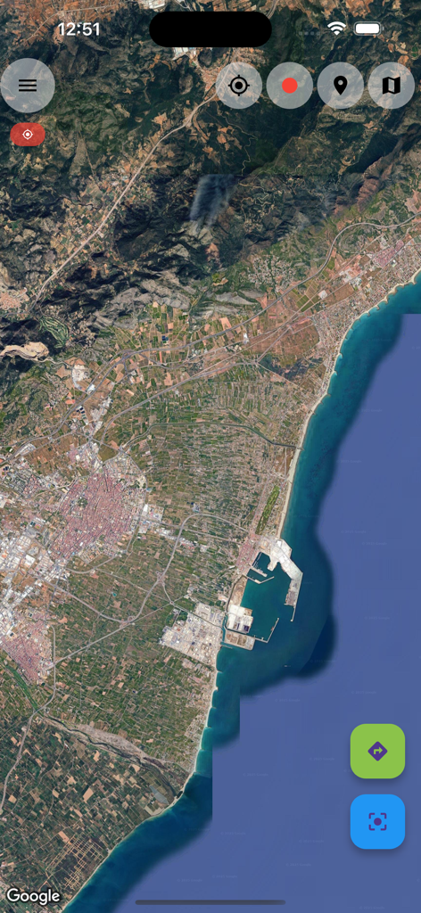
OruxMapsアプリの衛星地図ビュー。海岸地域と山々を表示。
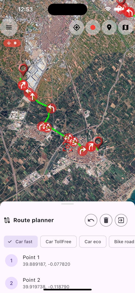
OruxMapsモバイルアプリのルートプランナー。ナビゲーションウェイポイント付きの衛星地図を表示。
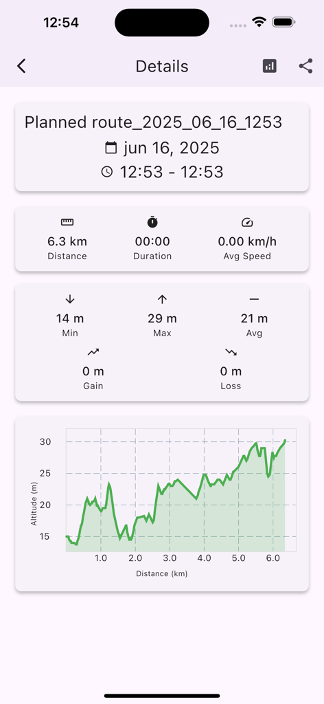
OruxMapsインターフェース。ルート統計と高度グラフを表示。
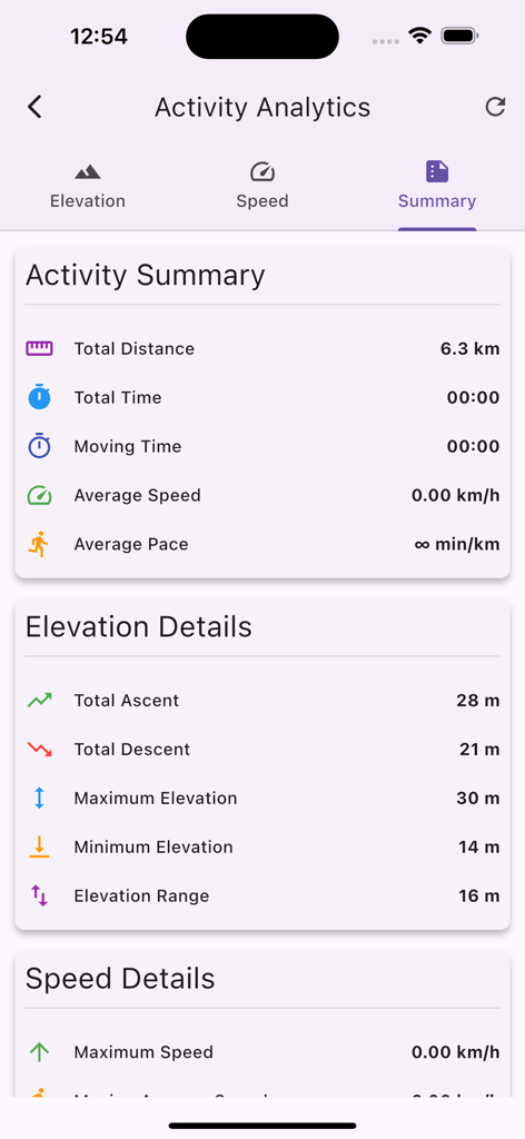
OruxMapsアクティビティアナリティクス画面。標高と距離の概要を表示。
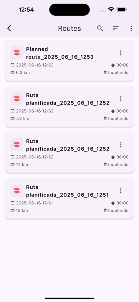
OruxMapsアプリの計画済みルートリスト。距離と日付を表示。
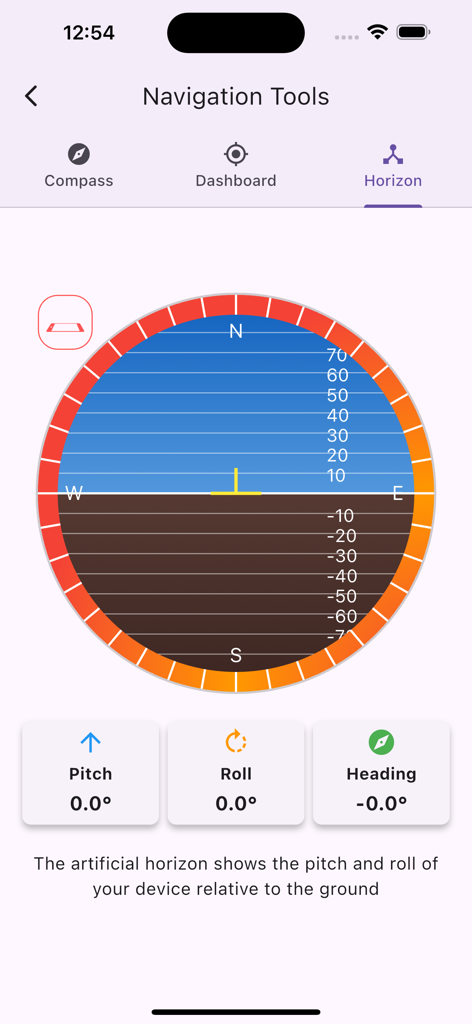
OruxMapsアプリの人工水平線インターフェース。ナビゲーション用のピッチ、ロール、ヘディングデータを表示。
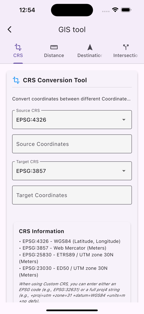
OruxMaps GISツールのインターフェース。座標参照系変換用。
説明
Download
類似アプリ
似た機能とユーザー体験を持つアプリ

AllTrails: Hike, Bike & Run
AllTrails, Inc.

Pedometer++
Cross Forward Consulting, LLC

Organic Maps: Offline Map
Organic Maps OU

Gaia GPS: Mobile Trail Maps
Trailbehind, INC.

Offline hiking maps: Mapy.com
Seznam.cz a.s.

Hiking Map Poland
Mapa Turystyczna sp. z o.o.

MapOut
Valnova GmbH

FarOut: Offline GPS Trail Maps
Atlas Guides DE, Inc.

Norgeskart
Norgeskart AS
このページはアプリまたはその開発者の公式ページではなく、情報提供および論評を目的として作成された独立した編集出版物です。明示的に別段の記載がない限り、アプリおよびその開発者は、MWM、Apple、Google Play、アプリのパブリッシャー、またはアプリの開発者と提携、承認、後援、認可、またはその他の公式的な関係はなく、このページのいかなる内容も、アプリがMWMのサービスを使用して開発されたことを意味するものではありません。すべての商標、ロゴ、スクリーンショット、その他のコンテンツはそれぞれの所有者の財産です。