이 페이지는 앱이나 개발자의 공식 페이지가 아니며, 정보 제공 및 논평을 목적으로 작성된 독립 편집 간행물입니다. 명시적으로 달리 언급되지 않는 한, 해당 앱이나 개발자는 MWM, Apple, Google Play, 앱 퍼블리셔 또는 앱 개발자와 제휴, 보증, 후원, 승인 또는 공식적으로 연결되어 있지 않으며, 이 페이지의 어떤 내용도 해당 앱이 MWM의 서비스를 사용하여 개발되었음을 의미하지 않습니다. 모든 상표, 로고, 스크린샷 및 기타 콘텐츠는 해당 소유자의 자산입니다.

GoGoEarth - Custom map source
NASA, Maxar, Nearmap의 프리미엄 위성 소스를 잠금 해제하세요. 3D 도시 모델부터 실시간 고도까지, 전문가 수준의 매핑 및 가상 탐험을 손안에서 경험하세요.
다운로드
427K+사용자 평점
총 평가 수
8K+개발사
카테고리
Navigation지원 언어
2최신 버전
3.2.3크기
155.6 MB출시일
2022년 5월 11일놀라운 디테일로 지구 탐험
고해상도 위성 이미지부터 3D 건축 모델까지, GoGoEarth는 손안에서 세상을 발견하는 데 필요한 전문가 수준의 도구를 제공합니다.
초고화질 위성 뷰
NASA와 Maxar의 크리스탈처럼 선명한 이미지를 통해 세상을 경험하세요. 일반 지도보다 훨씬 뛰어난 디테일 수준을 제공합니다.
가상 세계 관광
HD 파노라마 스트리트 뷰로 200개 이상의 지역을 여행하고 세계에서 가장 유명한 명소의 사실적인 3D 모델을 탐험하세요.
다음 스크린샷과 설명은 앱의 공식 스토어 목록에서 직접 가져온 것이며 앱 개발자의 자산입니다.
앱 스토어
스크린샷
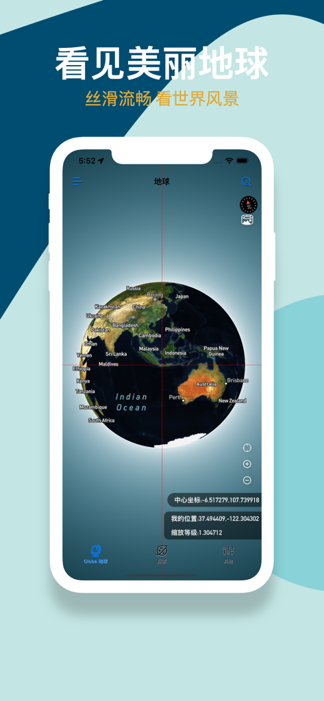
GoGoEarth 앱 인터페이스에 지리적 레이블과 좌표가 있는 3D 위성 지구가 표시됨
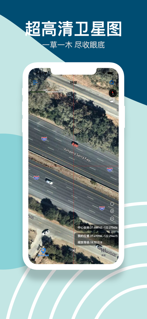
GoGoEarth 앱에서 자동차와 정확한 좌표가 있는 고화질 위성 이미지로 고속도로 표시
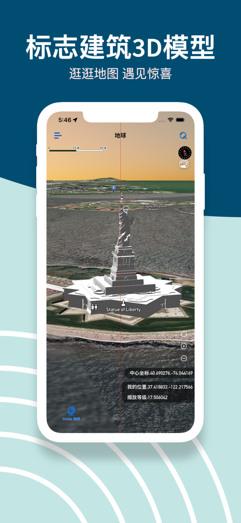
GoGoEarth 앱 스크린샷에 위성 지도 위에 자유의 여신상 상세 3D 모델이 표시됨
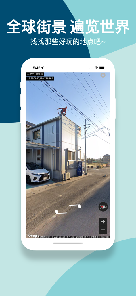
GoGoEarth 앱 스크린샷에 일본 지역의 고화질 파노라마 스트리트 뷰가 표시됨
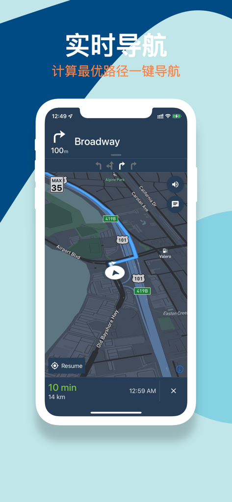
GoGoEarth 모바일 앱에 어두운 위성 지도 위에 경로가 표시된 실시간 내비게이션 인터페이스가 표시됨.
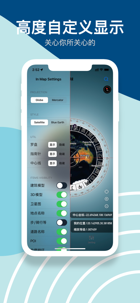
GoGoEarth 앱 인터페이스에 투영 스타일 및 3D 모델 가시성에 대한 지도 설정이 표시됨
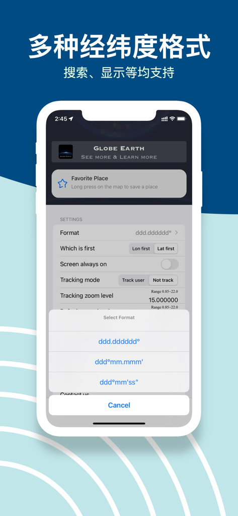
GoGoEarth 앱 인터페이스에 설정 메뉴에 여러 위도 및 경도 좌표 형식 옵션이 표시됨.
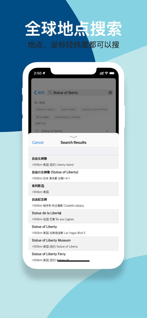
GoGoEarth 앱 인터페이스에 위도 및 경도 지원과 함께 자유의 여신상에 대한 글로벌 검색 결과가 표시됨.
설명
Download
비슷한 앱
유사한 기능과 사용자 경험을 가진 앱

Earth Maps
FOXPOI PTE. LTD.

Satellite Map - Live Earth
慧敏 赵

Satellite Map - Earth View
ANKAGIS YAZILIM ANONIM SIRKETI

World Street 3D Panoramic Map
Beijing Zhiyue Information Technology Co., Ltd

3D Earth Map Street View
Naik Ur Rehman

Globe 3D Earth: World Map Live
Shams Alam

Street View - street view maps
国辉 满

卫星地图-高清地球探索世界
方元 朱

高清3D街景地图-地图软件手机全景版
Suzhou Caichuang Network Technology Co., Ltd.
이 페이지는 앱이나 개발자의 공식 페이지가 아니며, 정보 제공 및 논평을 목적으로 작성된 독립 편집 간행물입니다. 명시적으로 달리 언급되지 않는 한, 해당 앱이나 개발자는 MWM, Apple, Google Play, 앱 퍼블리셔 또는 앱 개발자와 제휴, 보증, 후원, 승인 또는 공식적으로 연결되어 있지 않으며, 이 페이지의 어떤 내용도 해당 앱이 MWM의 서비스를 사용하여 개발되었음을 의미하지 않습니다. 모든 상표, 로고, 스크린샷 및 기타 콘텐츠는 해당 소유자의 자산입니다.