이 페이지는 앱이나 개발자의 공식 페이지가 아니며, 정보 제공 및 논평을 목적으로 작성된 독립 편집 간행물입니다. 명시적으로 달리 언급되지 않는 한, 해당 앱이나 개발자는 MWM, Apple, Google Play, 앱 퍼블리셔 또는 앱 개발자와 제휴, 보증, 후원, 승인 또는 공식적으로 연결되어 있지 않으며, 이 페이지의 어떤 내용도 해당 앱이 MWM의 서비스를 사용하여 개발되었음을 의미하지 않습니다. 모든 상표, 로고, 스크린샷 및 기타 콘텐츠는 해당 소유자의 자산입니다.

Satellite Map - Live Earth
이 앱은 세계를 당신의 발 아래 놓습니다. 지루한 지도는 잊으십시오. 이는 당신이 세계를 지배하게 합니다.
다운로드
2.5M+사용자 평점
총 평가 수
57.3K개발사
카테고리
Navigation지원 언어
2최신 버전
2.5크기
63.1 MB출시일
2020년 1월 10일세계 탐험을 위한 정밀 지리 정보 도구
앱 'Satellite Map - Live Earth' 기능 분석
최신 HD 위성 지도
이 앱은 최신 HD 위성 지도를 제공하여 사용자가 미지의 세계를 탐험하고 집에서 나가지 않고도 전 세계의 풍경을 즐길 수 있도록 합니다.
실시간 좌표 등고선 지도
이 앱은 실시간 좌표, 경도 및 위도를 표시하는 등고선 지도를 제공하여, 사용자가 정밀한 지리적 위치 데이터와 고도 정보를 파악할 수 있도록 돕습니다.
몰입형 3D 건물 지도
이 도구는 건물들의 3D 모델을 보여주는 3D 지도를 포함하여, 사용자가 더욱 몰입감 있고 현실적인 시각으로 지형과 건축물을 탐색할 수 있게 해줍니다.
상세 글로벌 평면 지도
이 도구는 전 세계 거리 정보를 상세하게 보여주는 평면 지도를 갖추고 있어, 사용자가 특정 지역의 도로망과 주요 지점을 쉽게 파악할 수 있도록 지원합니다.
자주 묻는 질문
에 대해 알아야 할 모든 것 Satellite Map - Live Earth
What is the Satellite Map - Live Earth app?
The Satellite Map - Live Earth app provides HD satellite maps, offering the latest and most complete global satellite imagery. It serves as a companion to explore the world and enjoy global scenery from home.
What types of maps are available in Satellite Map - Live Earth?
Satellite Map - Live Earth offers HD satellite maps, 3D maps displaying building models, contour maps with real-time coordinates, and flat maps showing global street information.
Does Satellite Map - Live Earth show 3D models of buildings?
Yes, Satellite Map - Live Earth includes 3D maps that specifically show 3D models of buildings. This feature enhances exploration by providing a more immersive view.
Does Satellite Map - Live Earth use background location services?
Yes, Satellite Map - Live Earth continues to use the device's location feature in the background. This ensures continuous tracking or updating of location-based data within the app.
Will Satellite Map - Live Earth reduce my phone's battery life?
Yes, Satellite Map - Live Earth's continuous use of the location feature in the background reduces battery life. Users should be aware of this impact on device power consumption.
Can I view global street information using Satellite Map - Live Earth?
Yes, Satellite Map - Live Earth provides flat maps that display global street information. This allows users to view street names and details worldwide, as seen in the app's interface.
Does Satellite Map - Live Earth provide real-time coordinates?
Yes, Satellite Map - Live Earth includes contour maps that show real-time coordinates, including longitude and latitude. This feature is useful for precise location data.
다음 스크린샷과 설명은 앱의 공식 스토어 목록에서 직접 가져온 것이며 앱 개발자의 자산입니다.
앱 스토어
스크린샷
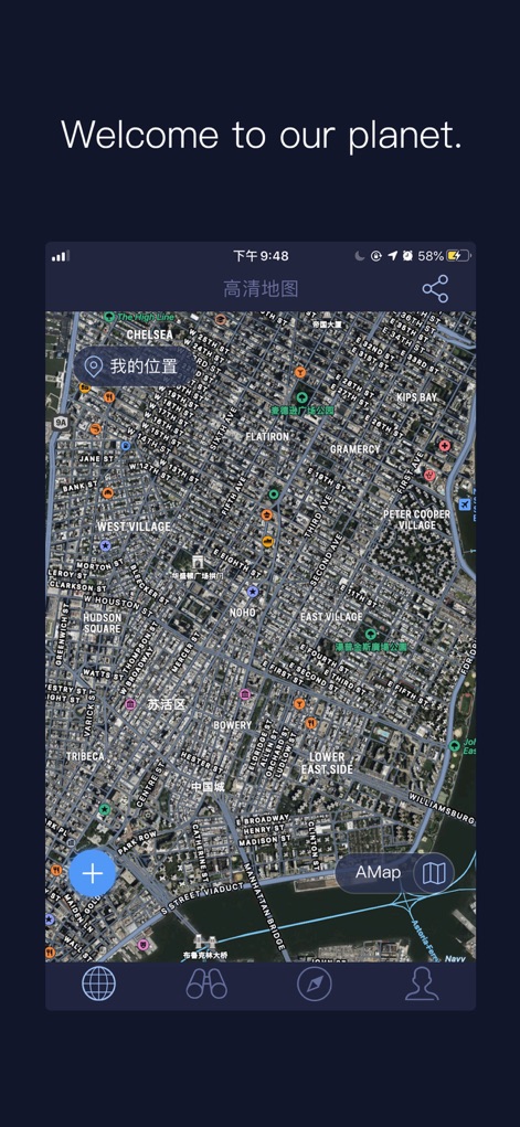
이 앱은 뉴욕 맨해튼의 상세한 위성 지도를 제공하며, 복잡하게 얽힌 거리 네트워크와 다양한 건물 구조를 선명하게 보여줍니다. 사용자는 '내 위치' 버튼으로 현재 위치를 쉽게 확인하고, 하단의 직관적인 내비게이션 바 아이콘을 통해 다양한 기능을 이용할 수 있습니다.
고화질 위성 탐험
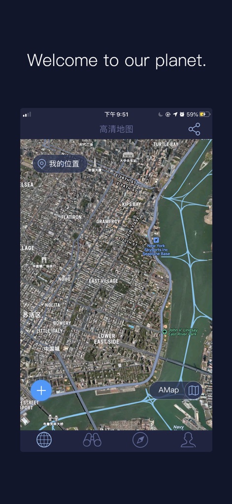
이 도구는 뉴욕시의 생생한 위성 뷰를 통해 광활한 허드슨 강과 빼곡한 도심 건물의 모습을 정밀하게 나타냅니다. 사용자는 명확하게 표시된 주요 도로와 건물 밀집 지역을 통해 주변 환경을 정확히 파악할 수 있습니다.
생생한 전경 확인
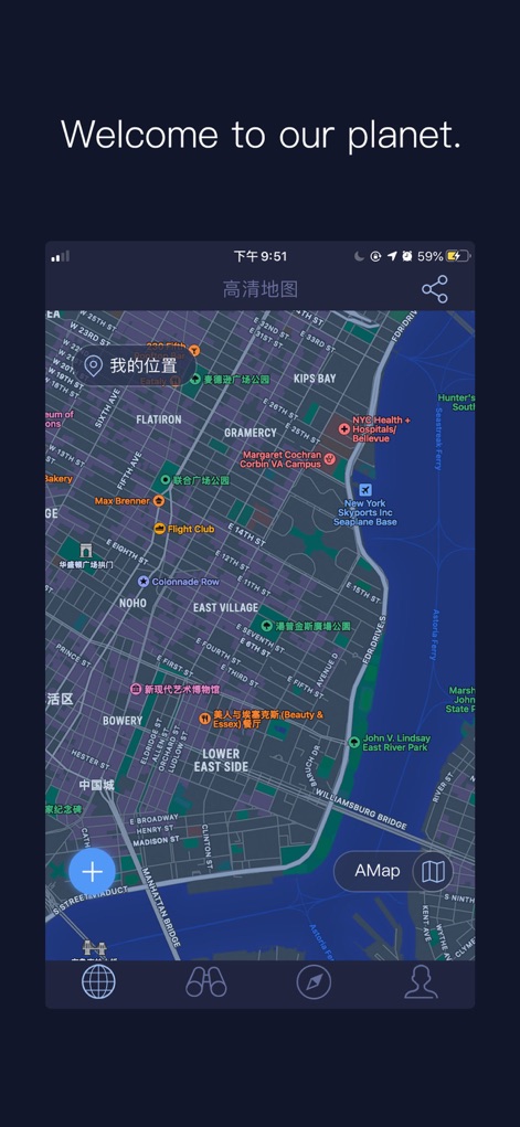
이 앱은 깔끔한 디자인의 평면 지도를 제공하여 뉴욕 맨해튼의 도시 레이아웃과 주요 도로망을 한눈에 보여줍니다. 사용자는 명확하게 구분된 지역 이름과 '병원'과 같은 주요 관심 지점들을 통해 손쉽게 목적지를 찾을 수 있습니다.
직관적인 평면 지도
설명
Download
비슷한 앱
유사한 기능과 사용자 경험을 가진 앱

Earth Maps
FOXPOI PTE. LTD.

Satellite Map - Earth View
ANKAGIS YAZILIM ANONIM SIRKETI

World Street 3D Panoramic Map
Beijing Zhiyue Information Technology Co., Ltd

3D Earth Map Street View
Naik Ur Rehman

Globe 3D Earth: World Map Live
Shams Alam

Street View - street view maps
国辉 满

卫星地图-高清地球探索世界
方元 朱

GoGoEarth - Custom map source
大靖 刘

高清3D街景地图-地图软件手机全景版
Suzhou Caichuang Network Technology Co., Ltd.
이 페이지는 앱이나 개발자의 공식 페이지가 아니며, 정보 제공 및 논평을 목적으로 작성된 독립 편집 간행물입니다. 명시적으로 달리 언급되지 않는 한, 해당 앱이나 개발자는 MWM, Apple, Google Play, 앱 퍼블리셔 또는 앱 개발자와 제휴, 보증, 후원, 승인 또는 공식적으로 연결되어 있지 않으며, 이 페이지의 어떤 내용도 해당 앱이 MWM의 서비스를 사용하여 개발되었음을 의미하지 않습니다. 모든 상표, 로고, 스크린샷 및 기타 콘텐츠는 해당 소유자의 자산입니다.