이 페이지는 앱이나 개발자의 공식 페이지가 아니며, 정보 제공 및 논평을 목적으로 작성된 독립 편집 간행물입니다. 명시적으로 달리 언급되지 않는 한, 해당 앱이나 개발자는 MWM, Apple, Google Play, 앱 퍼블리셔 또는 앱 개발자와 제휴, 보증, 후원, 승인 또는 공식적으로 연결되어 있지 않으며, 이 페이지의 어떤 내용도 해당 앱이 MWM의 서비스를 사용하여 개발되었음을 의미하지 않습니다. 모든 상표, 로고, 스크린샷 및 기타 콘텐츠는 해당 소유자의 자산입니다.

SW Maps
전문가를 위해 설계된 포괄적인 매핑 도구로 현장 업무를 강화하세요. 외부 GNSS 수신기에 연결하고, 복잡한 Shapefile을 관리하며, 센티미터 수준의 정확도로 지리 데이터를 손쉽게 수집할 수 있습니다. 모두 무료이며 광고가 없습니다.
다운로드
32K+사용자 평점
총 평가 수
0개발사
카테고리
Productivity지원 언어
1최신 버전
1.2.4크기
17.2 MB출시일
2022년 11월 17일전문 현장 데이터 수집
엔터프라이즈 가격 없이 안정적인 데이터가 필요한 측량사, 엔지니어 및 연구원을 위해 설계된 완전하고 고정밀 GIS 툴킷입니다.
센티미터 수준의 정확도
Bluetooth를 통해 외부 GNSS/RTK 수신기를 연결하여 모바일 장치에서 직접 전문가 수준의 정밀도를 달성하세요.
신뢰할 수 있는 오프라인 매핑
기본 지도를 캐싱하고 사용자 정의 mbtiles 또는 KML 오버레이를 가져와 원격 현장에서도 완벽하게 작동하여 어디서든 작업할 수 있습니다.
다음 스크린샷과 설명은 앱의 공식 스토어 목록에서 직접 가져온 것이며 앱 개발자의 자산입니다.
앱 스토어
스크린샷
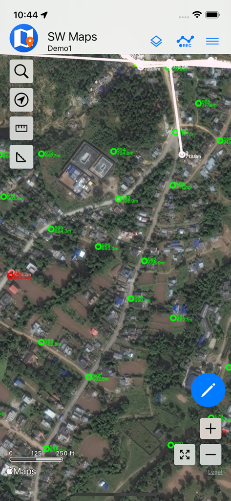
SW Maps 인터페이스가 위성 배경에 GIS 측량 포인트를 표시하고 있습니다
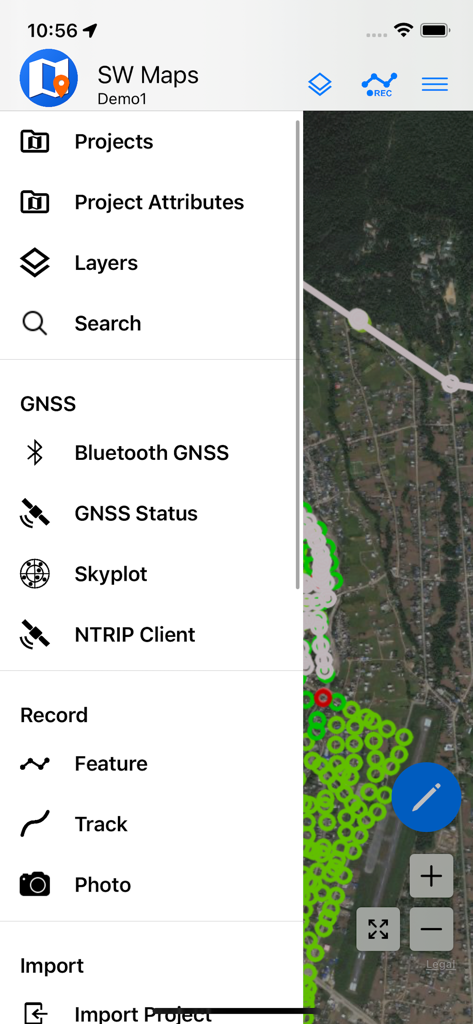
SW Maps 모바일 앱 메뉴가 GIS 데이터 수집 및 GNSS 측량 옵션을 보여주고 있습니다
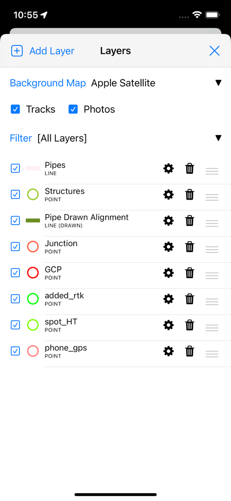
SW Maps 앱 인터페이스가 측량 및 매핑을 위한 전문 GIS 데이터 레이어 관리를 보여주고 있습니다
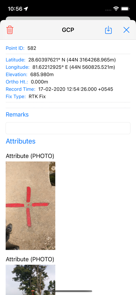
SW Maps에서 측량 지점의 상세 보기가 좌표와 실제 측량 마커 사진을 보여줍니다
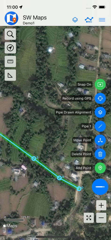
SW Maps의 모바일 GIS 매핑이 위성 영상에 파이프 정렬을 보여줍니다
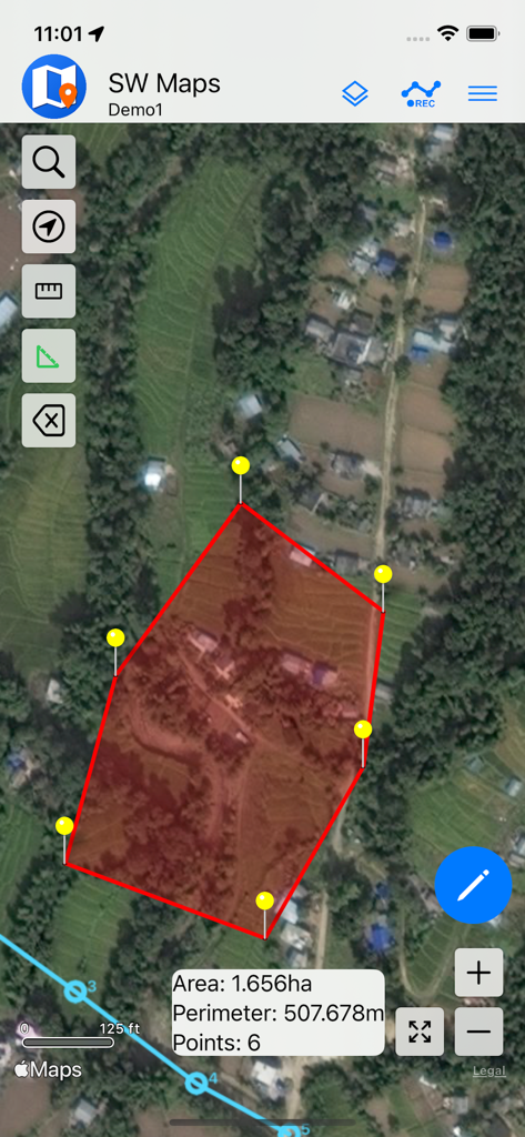
SW Maps 앱의 위성 지도 보기가 계산된 면적과 둘레를 가진 빨간색 다각형을 보여주며 토지 측량에 사용됩니다
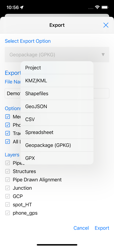
SW Maps 내보내기 화면이 전문 GIS 파일 형식 목록과 레이어 선택 옵션을 표시합니다
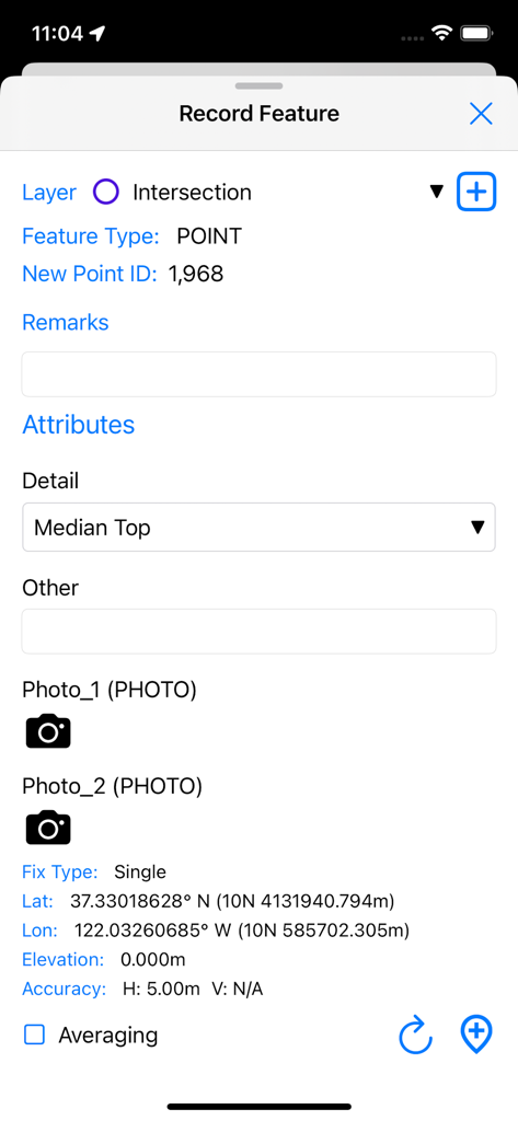
SW Maps에서 GPS 좌표와 사용자 정의 속성을 가진 새로운 GIS 포인트 기능을 기록하는 인터페이스
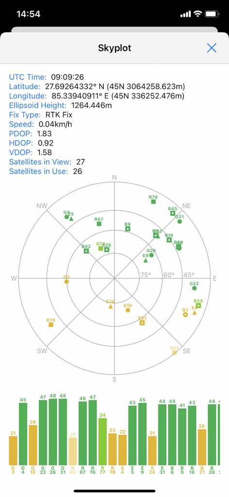
SW Maps 스카이플롯 화면이 전문 매핑 프로젝트를 위한 위성 위치 및 GNSS 신호 품질을 표시합니다
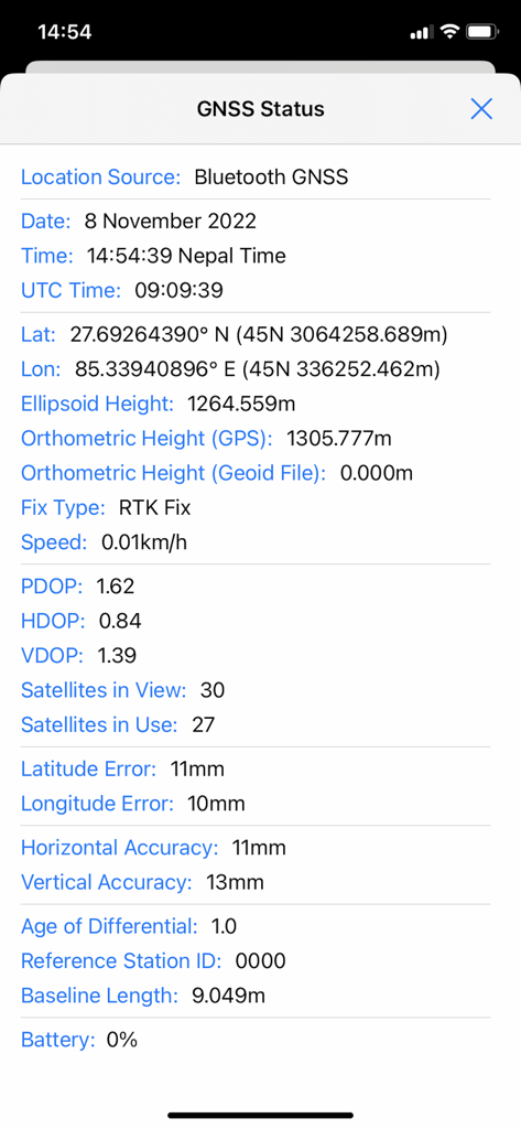
SW Maps의 GNSS 상태 화면이 고정밀 RTK 고정 및 정확도 지표를 보여줍니다
설명
Download
비슷한 앱
같은 카테고리의 상위 앱

ChatGPT
OpenAI OpCo, LLC

Google Gemini
Google LLC

Grok
X.AI Corporation

Gmail - Email by Google
Google LLC

千问 - 阿里最强大模型官方AI助手
Shanghai Zhixin Puhui Technology Co., Ltd.

Google Drive
Google LLC

Microsoft Authenticator
Microsoft Corporation

Google Sheets
Google LLC

Google Docs
Google LLC
이 페이지는 앱이나 개발자의 공식 페이지가 아니며, 정보 제공 및 논평을 목적으로 작성된 독립 편집 간행물입니다. 명시적으로 달리 언급되지 않는 한, 해당 앱이나 개발자는 MWM, Apple, Google Play, 앱 퍼블리셔 또는 앱 개발자와 제휴, 보증, 후원, 승인 또는 공식적으로 연결되어 있지 않으며, 이 페이지의 어떤 내용도 해당 앱이 MWM의 서비스를 사용하여 개발되었음을 의미하지 않습니다. 모든 상표, 로고, 스크린샷 및 기타 콘텐츠는 해당 소유자의 자산입니다.